|
Author
Colton, G.W.
Full Title
Colton's Prussia and Saxony. Published By G. W & C. B. Colton & Co. No. 172 William St. New York.
Publisher
G. W & C. B. Colton & Co.
Author
Colton, G.W.
Full Title
Colton's Germany, No. 1. (inset) Berlin and Hamburg. Published By G. W & C. B. Colton & Co. No. 172 William St. New York.
Publisher
G. W & C. B. Colton & Co.
Author
Colton, G.W.
Full Title
Colton's Germany, No. 2. Published By G. W & C. B. Colton & Co. Colton. No. 172 William St. New York.
Publisher
G. W & C. B. Colton & Co.
Author
Colton, G.W.
Full Title
Colton's Germany, No. 3. Published By G. W & C. B. Colton & Co. No. 172 William St. New York.
Publisher
G. W & C. B. Colton & Co.
Author
[Brue, Adrien Hubert, 1786-1832, Levasseur, E.]
Full Title
Carte des Iles Britanniques Anciennes. Dresse par A. Brue, Geographe. Reoue par E. Levasseur, Membre de l'Institut, Institut Geographique de Paris. Ch. Delagrave. Editeurs de la Societe de Geographie. 58 Rue des Ecoles. (inset) Illes Britanniques jusqu'a Ptolemee. Carte de Ia Germanie de la Rhetie, de Norique etc. Reoue par E. Levasseur, Membre de l'Institut. (inset) Guerres des Romains en Germanie. Atlas Universel en 67 feuilles No. 12.
Publisher
Institut Geographique de Paris
Author
[Brue, Adrien Hubert, 1786-1832, Levasseur, E.]
Full Title
Carte de l'Empire d'Allemagne Divisee en 10 Cercles avec les Possessions Allem-des et Autres de la Prusse et de l'Autriche en 1789. Dresse par A. Brue, Geographe. Reoue par E. Levasseur, Membre de l'Institut, Institut Geographique de Paris. Ch. Delagrave. Editeurs de la Societe de Geographie. 58 Rue des Ecoles. Atlas Universel en 67 feuilles No. 32.
Publisher
Institut Geographique de Paris
Author
[Brue, Adrien Hubert, 1786-1832, Levasseur, E.]
Full Title
Carte Generale de l'Europe Centrale comprenant l'Empire d'Allemagne et l;Empire Austro-Hungrois. Dresse par A. Brue, Geographe. Reoue par E. Levasseur, Membre de l'Institut, Institut Geographique de Paris. Ch. Delagrave & Cie. Editeurs de la Societe de Geographie. 58 Rue des Ecoles. Atlas Universel en 67 feuilles No. 33.
Publisher
Institut Geographique de Paris
Author
[Brue, Adrien Hubert, 1786-1832, Levasseur, E.]
Full Title
Empire Allemagne (Partie Occidentale). Dresse par A. Brue, Geographe. Reoue par E. Levasseur, Membre de l'Institut, Institut Geographique de Paris. Ch. Delagrave & Cie. Editeurs de la Societe de Geographie. 58 Rue des Ecoles. Atlas Universel en 67 feuilles No. 34.
Publisher
Institut Geographique de Paris
Author
[Brue, Adrien Hubert, 1786-1832, Levasseur, E.]
Full Title
Carte Generale de la Monarchie Prussienne. Dresse par A. Brue, Geographe. Reoue par E. Levasseur, Membre de l'Institut, Institut Geographique de Paris. Ch. Delagrave. Editeurs de la Societe de Geographie. 58 Rue des Ecoles. Atlas Universel en 67 feuilles No. 35.
Publisher
Institut Geographique de Paris
Author
Society for the Diffusion of Useful Knowledge (Great Britain)
Full Title
Germany. Deutschland I. Holstein, Hanover, Mecklenburg, the Prussian States, Saxony &c. Published under the superintendence of the Society for the Diffusion of Useful Knowledge. J. & C. Walker sculpt. London, published by Baldwin & Cradock, 47 Paternoster Row, March 1st, 1833. Printed by Russell, Penge. (London: Chapman & Hall, 1844)
Publisher
Chapman and Hall
Author
Society for the Diffusion of Useful Knowledge (Great Britain)
Full Title
Germany. Deutschland II. Eastern part of the Prussian States. Published under the superintendence of the Society for the Diffusion of Useful Knowledge. J. & C. Walker sculpt. London, published by Baldwin & Cradock, 47 Paternoster Row, Decr. 15th, 1832. Printed by E. Brain, Bartholomew Close. (London: Chapman & Hall, 1844)
Publisher
Chapman and Hall
Author
Society for the Diffusion of Useful Knowledge (Great Britain)
Full Title
Germany. Deutschland III. Baden, Wurtemberg, Bavaria, Tyrol, and Switzerland. Eastern part of the Prussian States. Published under the superintendence of the Society for the Diffusion of Useful Knowledge. J. & C. Walker sculpt. London, published by Baldwin & Cradock, 47 Paternoster Row, June 1st. 1832. (London: Chapman & Hall, 1844)
Publisher
Chapman and Hall
Author
[Andriveau-Goujon, J., Soulier, E.]
Full Title
Etats Secondaires de L'Allemagne. Atlas Elementaire Simplifie. Publie par J. Andriveau-Goujon. E. Soulier del. A Paris, chez Andriveau-Goujon, Editeur, Rue du Bac, No. 17.
Publisher
Andriveau-Goujon
Author
[Andriveau-Goujon, J., Soulier, E.]
Full Title
Monarchie Prussienne. Atlas Elementaire Simplifie. Publie par J. Andriveau-Goujon. E. Soulier del. A Paris, chez Andriveau-Goujon, Editeur, Rue du Bac, No. 17.
Publisher
Andriveau-Goujon
Author
Polish Army Topography Service
Full Title
Western Europe. Pergamon World Atlas. Pergamon Press, Ltd. & P.W.N. Poland 1967. Sluzba Topograficzna W.P.
Publisher
Pergamon Press
Author
Polish Army Topography Service
Full Title
Central Europe. Pergamon World Atlas. Pergamon Press, Ltd. & P.W.N. Poland 1967. Sluzba Topograficzna W.P.
Publisher
Pergamon Press
Author
Polish Army Topography Service
Full Title
Czechoslovakia, German Democratic Republic. Pergamon World Atlas. Pergamon Press, Ltd. & P.W.N. Poland 1967. Sluzba Topograficzna W.P.
Publisher
Pergamon Press
Author
Polish Army Topography Service
Full Title
Germany - North. Pergamon World Atlas. Pergamon Press, Ltd. & P.W.N. Poland 1964. Sluzba Topograficzna W.P.
Publisher
Pergamon Press
Author
Polish Army Topography Service
Full Title
German Democratic Republic. Pergamon World Atlas. Pergamon Press, Ltd. & P.W.N. Poland 1964. Sluzba Topograficzna W.P.
Publisher
Pergamon Press
Author
Polish Army Topography Service
Full Title
German Federal Republic. Pergamon World Atlas. Pergamon Press, Ltd. & P.W.N. Poland 1964. Sluzba Topograficzna W.P.
Publisher
Pergamon Press
Author
Polish Army Topography Service
Full Title
German Federal Republic. Pergamon World Atlas. Pergamon Press, Ltd. & P.W.N. Poland 1964. Sluzba Topograficzna W.P.
Publisher
Pergamon Press
Author
Polish Army Topography Service
Full Title
Germany - South. (inset) Munchen (Munich). Pergamon World Atlas. Pergamon Press, Ltd. & P.W.N. Poland 1964. Sluzba Topograficzna W.P.
Publisher
Pergamon Press
Author
Polish Army Topography Service
Full Title
German Federal Republic. (inset) Wilhelmshaven. Pergamon World Atlas. Pergamon Press, Ltd. & P.W.N. Poland 1964. Sluzba Topograficzna W.P.
Publisher
Pergamon Press
Author
Johnson, A.J.
Full Title
Johnson's Sweden And Norway Published by Johnson And Ward. Johnson's Denmark With Sleswick (Schleswig) & Holstein Published by Johnson And Ward.
Publisher
Johnson and Ward
Author
Johnson, A.J.
Full Title
Johnson's Prussia Published by Johnson and Ward.
Publisher
Johnson and Ward
Author
Johnson, A.J.
Full Title
Johnson's Germany Published By Johnson And Ward.
Publisher
Johnson and Ward
Author
Gray, Ormando Willis
Full Title
Gray's Atlas Map of Germany, Austria, and Switzerland. Entered ... 1874 ... Librarian of Congress at Washington. Drawn by F.A. Gray. Engraved by J.M. Atwood.
Publisher
Stedman, Brown & Lyon
Author
Rand McNally and Company
Full Title
Rand, McNally & Company's indexed atlas of the world map of Germany, western sheet. Copyright 1891, by Rand, McNally & Co. (Chicago, 1897)
Publisher
Rand McNally
Author
Rand McNally and Company
Full Title
Rand, McNally & Company's indexed atlas of the world map of Germany, eastern sheet. (with) Rhenish-Westphalian industry and mining district. (with) Berlin, Potsdam and environs. Copyright 1891, by Rand, McNally & Co. (Chicago, 1897)
Publisher
Rand McNally
Author
Mitchell, Samuel Augustus
Full Title
Germany.
Publisher
S.A. Mitchell
Author
[Union Atlas Co., Warner & Beers]
Full Title
Map of the German Empire. (Union Atlas Co., Warner & Beers, Proprietors. Lakeside Building Cor: of Clark & Adams Sts. Chicago. 1876. Entered ... 1876 by Warner & Beers ... Washington D.C.)
Publisher
Warner & Beers
Author
Finley, Anthony
Full Title
Germany. Published by A. Finley Philada. Young & Delleker Sc.
Publisher
Anthony Finley
Author
Tanner, Henry S.
Full Title
Germany. Engraved by J. & W.W. Warr. Philadelphia: Published by H.S. Tanner. (above neat line) Tanner's Universal Atlas.
Publisher
H.S. Tanner
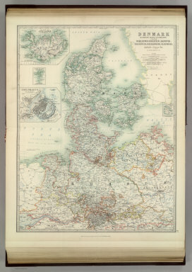
Author
Johnston, Alexander Keith
Full Title
Denmark with Northwest portion of the German Empire. ... (with) Island of Iceland. (with) Copenhagen. (with) Faroe Islands. (with) Bornholm. (with) The Elbe from Hamburg to Cuxhaven). By Keith Johnston, F.R.S.E. Keith Johnston's General Atlas. Engraved, Printed, and Published by W. & A.K. Johnston, Edinburgh & London.
Publisher
W.& A.K. Johnston
Author
Johnston, Alexander Keith
Full Title
Empire of Germany (southern portion). By Keith Johnston, F.R.S.E. Keith Johnston's General Atlas. Engraved, Printed, and Published by W. & A.K. Johnston, Edinburgh & London.
Publisher
W.& A.K. Johnston
Author
Duval, Henri
Full Title
Atlas Universel. Tableau historique et geographique du Royaume de Prusse. ... Par Henri Duval, Chevalier de la Legion d'honneur, Professeur d'histoire, de geographie, de belles-lettres, &. Paris (1834), Chez l'Auteur, rue de la Chaussee d'Antin, No.15... Johanneau, Rue du Coq. No. 8 bis. ,,, Ate. Foucher.
Publisher
L. Houbloup
Author
Duval, Henri
Full Title
Atlas Universel. Tableau historique et geographique de la Confederation Germanique. ... Par Henri Duval, Chevalier de la Legion d'honneur, Professeur d'Histoire, de Geographie, de Belles-lettres, & & &. Paris (1834), Chez l'Auteur, rue de la Chaussee d'Antin, No.15... Johanneau, Rue du Coq. No. 8 bis. ,,, Ate. Foucher.
Publisher
L. Houbloup
Author
Johnston, Alexander Keith
Full Title
Denmark with Northwest portion of the German Empire. ... (with) Island of Iceland. (with) Copenhagen. (with) Faroe Islands. (with) Bornholm. (with) The Elbe from Hamburg to Cuxhaven). By Keith Johnston, F.R.S.E. Keith Johnston's General Atlas. Engraved, Printed, and Published by W. & A.K. Johnston, Edinburgh & London.
Publisher
W.& A.K. Johnston
Author
Johnston, Alexander Keith
Full Title
Empire of Germany (southern portion). By Keith Johnston, F.R.S.E. Keith Johnston's General Atlas. Engraved, Printed, and Published by W. & A.K. Johnston, Edinburgh & London.
Publisher
W.& A.K. Johnston
Author
Johnston, Alexander Keith
Full Title
Empire of Germany (northern portion). (with) Environs of Berlin & Potsdam. The Kingdom of Prussia is Coloured Red. By Keith Johnston, F.R.S.E. Keith Johnston's General Atlas. Engraved, Printed, and Published by W. & A.K. Johnston, Edinburgh & London.
Publisher
W.& A.K. Johnston
Author
Moll, Herman, d. 1732
Full Title
Germany. Divided into circles. Agreeable to modern history. By H. Moll Geographer. (Printed and sold by T. Bowles next ye Chapter House in St. Pauls Church yard, & I. Bowles at ye Black Horse in Cornhill, 1736?)
Publisher
Thos. Bowles and John Bowles
Author
Moll, Herman, d. 1732
Full Title
The north west part of Germany. Containing ye dominions of the Electors of Brunswick, Lunenburg and Cologne, with Westphalia, and the Dutchy of Holstein, Iuliers &c. The Landgraviat of Hessen Cassel, Bishopricks of Munster & Osnabrug &c. Agreeable to modern history. By H. Moll Geographer. (Printed and sold by T. Bowles next ye Chapter House in St. Pauls Church yard, & I. Bowles at ye Black Horse in Cornhill, 1736?)
Publisher
Thos. Bowles and John Bowles
Author
Moll, Herman, d. 1732
Full Title
The N.E. part of Germany. Containing ye dominions of the Electors of Brandenburg and Saxony, the Dutchy of Meklenburg, Pomerania and Silesia &c. By H. Moll Geographer. (Printed and sold by T. Bowles next ye Chapter House in St. Pauls Church yard, & I. Bowles at ye Black Horse in Cornhill, 1736?)
Publisher
Thos. Bowles and John Bowles
Author
Moll, Herman, d. 1732
Full Title
The south west part of Germany. Containing ye dominions of ye Archbishops and Electors of Mentz & Treves; and of ye Elec: Palatine of ye Rhine; with Franconia, Swabia, Alsace and ye Dutchy of Lorrain &c. By H. Moll Geographer. (Printed and sold by T. Bowles next ye Chapter House in St. Pauls Church yard, & I. Bowles at ye Black Horse in Cornhill, 1736?)
Publisher
Thos. Bowles and John Bowles
Author
Moll, Herman, d. 1732
Full Title
The south east part of Germany. Containing ye dominions of the Elector of Bavaria, the Archbishop: of Saltzburg, and the estates of ye House of Austria, viz Bohemia, Moravia, Austria, Styria, Carinthia, Carniola, the Bishop: of Brixen, Trent, and ye County of Tirol &c. By H. Moll Geogr. (Printed and sold by T. Bowles next ye Chapter House in St. Pauls Church yard, & I. Bowles at ye Black Horse in Cornhill, 1736?)
Publisher
Thos. Bowles and John Bowles
Author
Mitchell, Samuel Augustus Jr.
Full Title
Prussia, and the German States. Copyright by S. Augustus Mitchell 1884.
Publisher
Wm. M. Bradley & Bro.
Author
Mitchell, Samuel Augustus
Full Title
A New Map of Germany. By J.H. Young. J.L. Hazzard, Sc. Entered according to Act of Congress in the year 1856 by Charles Desilver in the Clerk's office if the District Court of the Eastern District of Pennsylvania. 55.
Publisher
Charles Desilver.
Author
Delarochette, Louis Stanislas d'Arcy
Full Title
Map of the Empire of Germany, including all the states comprehended under that name: with the Kingdom of Prussia, &c. (Northern section). By L. Delarochette. (T. Kitchin, sculpt.) London, printed for Robt. Sayer, Map & Print Seller, opposite Fetter Lane in Fleet Street, (1790?)
Publisher
Robert Sayer
Author
Delarochette, Louis Stanislas d'Arcy
Full Title
(Map of the Empire of Germany, including all the states comprehended under that name: with the Kingdom of Prussia, &c. Southern section. By L. Delarochette). T. Kitchin, sculpt. (London, printed for Robt. Sayer, Map & Print Seller, opposite Fetter Lane in Fleet Street, 1790?)
Publisher
Robert Sayer
|