|
Author
Servoss, R. D.
Full Title
Section 8. Showing from Kensico northward to Mount Kisco, and from Pleasantville eastward to Bedford. Copyright 1895, by R.D. Servoss.
Publisher
R.D. Servoss.
Author
Servoss, R. D.
Full Title
Section 9. Showing from Darien, Conn. northward to Trinity Lake, and Stanwich, Conn. eastward to Wilton, Conn. Copyright 1895, by R.D. Servoss.
Publisher
R.D. Servoss.
Author
Servoss, R. D.
Full Title
Section 10. Showing from Croton Landing northward to county line, and eastward to Yorktown. Copyright 1895, by R.D. Servoss.
Publisher
R.D. Servoss.
Author
Servoss, R. D.
Full Title
Section 11. Showing from Mount Kisco northward to county line, and from Yorktown eastward to Cross River. Copyright 1895, by R.D. Servoss.
Publisher
R.D. Servoss.
Author
Servoss, R. D.
Full Title
Section 12. Showing from Trinity Lake northward to Ridgebury, Conn., and from Cross River eastward to Bethel, Conn. Copyright 1895, by R.D. Servoss.
Publisher
R.D. Servoss.
Author
Servoss, R. D.
Full Title
Key map, showing the area covered by each sectional map (Servoss' sectional road map of Westchester County, New York with part of Fairfield County, Conn. 1902)
Publisher
Isaac H. Blanchard Co.
Author
Servoss, R. D.
Full Title
Section 1. Showing the vicinity of New York City as far northward as High Bridge. (1902)
Publisher
Isaac H. Blanchard Co.
Author
Servoss, R. D.
Full Title
Section 2. Showing from Harlem northward to Yonkers, and eastward to Pelham Manor. (1902)
Publisher
Isaac H. Blanchard Co.
Author
Servoss, R. D.
Full Title
Section 3. Showing from Fort Schuyler northward to Orienta, and eastward to Glen Cove, L.I. (1902)
Publisher
Isaac H. Blanchard Co.
Author
Servoss, R. D.
Full Title
Section 4. Showing from Yonkers northward to Tarrytown, and eastward to Hartsdale. (1902)
Publisher
Isaac H. Blanchard Co.
Author
Thompson, Thos. H.
Full Title
Map of the state of California, compiled expressly for Thos. H. Thompson, publisher, Tulare, Cal. Issued with the Tulare County atlas. Lith. Britton & Rey, S.F. (1892)
Publisher
T.H. Thompson
Author
Thompson, Thos. H.
Full Title
Map of Tulare County, California. 1892. Thos. H. Thompson, Tulare, Cal.
Publisher
T.H. Thompson
Full Title
Township 15 South, Range 25 East, Tulare Co., California. (Compiled, drawn and published by Thos. H. Thompson, Tulare, Cal., 1892)
Publisher
T.H. Thompson
Full Title
Township 15 South, Range 26 East, Tulare Co., California. (Compiled, drawn and published by Thos. H. Thompson, Tulare, Cal., 1892)
Publisher
T.H. Thompson
Full Title
Township 15 South, Range 27 East, Tulare Co., California. (Compiled, drawn and published by Thos. H. Thompson, Tulare, Cal., 1892)
Publisher
T.H. Thompson
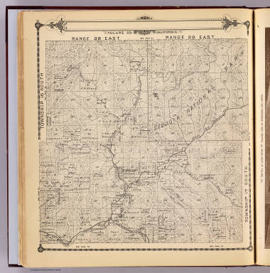
Full Title
Township 15 South, Township 14 South, Range 28 East, Range 29 East, Tulare Co., California. (Compiled, drawn and published by Thos. H. Thompson, Tulare, Cal., 1892)
Publisher
T.H. Thompson
Full Title
Township 15 South, Township 14 South, Range 30 East, Range 31 East, Tulare Co., California. (Compiled, drawn and published by Thos. H. Thompson, Tulare, Cal., 1892)
Publisher
T.H. Thompson
Full Title
Township 17 South ... Township 14 South, Range 32 East ... Range 35 East, Tulare Co., California. (with) Map of Lucerne Colony, Tulare County ... (Compiled, drawn and published by Thos. H. Thompson, Tulare, Cal., 1892)
Publisher
T.H. Thompson
Full Title
Township 16 South, Range 22 East, Tulare Co., California. (with) Map of Mt. Whitney Colony ... (with) Map of Level Orchard Land Colony ... (with) Map of Mack's Addition to Orosi Colony ... (Compiled, drawn and published by Thos. H. Thompson, Tulare, Cal., 1892)
Publisher
T.H. Thompson
Full Title
Township 16 South, Range 23 East, Tulare Co., California. (Compiled, drawn and published by Thos. H. Thompson, Tulare, Cal., 1892)
Publisher
T.H. Thompson
Full Title
Township 16 South, Range 24 East, Tulare Co., California. (Compiled, drawn and published by Thos. H. Thompson, Tulare, Cal., 1892)
Publisher
T.H. Thompson
Full Title
Map of the town of Monson, Tulare County. (with) Map of Lindsay, Tulare County. (with) Map of Zumwalt's subdivision ... (with) Map of Galicia Vineyard ... (Compiled, drawn and published by Thos. H. Thompson, Tulare, Cal., 1892)
Publisher
T.H. Thompson
Full Title
Township 16 South, Range 25 East, Tulare Co., California. (Compiled, drawn and published by Thos. H. Thompson, Tulare, Cal., 1892)
Publisher
T.H. Thompson
Full Title
Township 16 South, Range 26 East, Tulare Co., California. (Compiled, drawn and published by Thos. H. Thompson, Tulare, Cal., 1892)
Publisher
T.H. Thompson
Full Title
Township 16 South, Range 27 East, Tulare Co., California. (Compiled, drawn and published by Thos. H. Thompson, Tulare, Cal., 1892)
Publisher
T.H. Thompson
Full Title
Township 16 South, Township 17 South, Range 28 East, Range 29 East, Tulare Co., California. (Compiled, drawn and published by Thos. H. Thompson, Tulare, Cal., 1892)
Publisher
T.H. Thompson
Full Title
Township 16 South, Township 17 South, Range 30 East, Range 31 East, Tulare Co., California. (Compiled, drawn and published by Thos. H. Thompson, Tulare, Cal., 1892)
Publisher
T.H. Thompson
Full Title
Township 17 South, Range 21 East, Tulare Co., California. (with) Map of Vina Colony ... (with) Map of Oakview Colony ... (with) Map of Holliday Addition ... (with) Map of Sciarone Subdivision ... (all) Tulare County. (Compiled, drawn and published by Thos. H. Thompson, Tulare, Cal., 1892)
Publisher
T.H. Thompson
Full Title
Township 17 South, Range 22 East, Tulare Co., California. (Compiled, drawn and published by Thos. H. Thompson, Tulare, Cal. 1892)
Publisher
T.H. Thompson
Full Title
Township 17 South, Range 23 East, Tulare Co., California. (Compiled, drawn and published by Thos. H. Thompson, Tulare, Cal. 1892)
Publisher
T.H. Thompson
Full Title
Map of Traver, Tulare County. (with) Map of Coe Colony, Tulare Co. (with) Map of Kitchener Colony, Tulare County. (with) Map of Traver Colony, Tulare County. (1892)
Publisher
T.H. Thompson
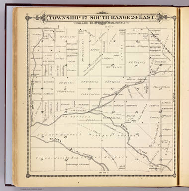
Full Title
Township 17 South, Range 24 East, Tulare Co., California. (Compiled, drawn and published by Thos. H. Thompson, Tulare, Cal. 1892)
Publisher
T.H. Thompson
Full Title
Township 17 South, Range 25 East, Tulare Co., California. (Compiled, drawn and published by Thos. H. Thompson, Tulare, Cal. 1892)
Publisher
T.H. Thompson
Full Title
Township 17 South, Range 26 East, Tulare Co., California. (Compiled, drawn and published by Thos. H. Thompson, Tulare, Cal. 1892)
Publisher
T.H. Thompson
Full Title
Township 17 South, Range 27 East, Tulare Co., California. (Compiled, drawn and published by Thos. H. Thompson, Tulare, Cal. 1892)
Publisher
T.H. Thompson
Author
Servoss, R. D.
Full Title
Section 5. Showing from Larchmont northward to Kensico Station, and from Hartsdale eastward to Greenwich, Conn. (1902)
Publisher
Isaac H. Blanchard Co.
Author
Servoss, R. D.
Full Title
Section 6. Showing from Long Id. Sound northward to Talmadge Hill, and from Cos Cob eastward to South Norwalk. (1902)
Publisher
Isaac H. Blanchard Co.
Author
Servoss, R. D.
Full Title
Section 7. Showing from Tarrytown northward to Oscawana, and eastward to Merritt's Corners. (1902)
Publisher
Isaac H. Blanchard Co.
Author
Servoss, R. D.
Full Title
Section 8. Showing from Kensico northward to Mount Kisco, and from Pleasantville eastward to Bedford. (1902)
Publisher
Isaac H. Blanchard Co.
Author
Servoss, R. D.
Full Title
Section 9. Showing from Darien, Conn. northward to Trinity Lake, and Stanwich, Conn. eastward to Wilton, Conn. (1902)
Publisher
Isaac H. Blanchard Co.
Author
Servoss, R. D.
Full Title
Section 10. Showing from Croton Landing northward to county line, and eastward to Yorktown. (1902)
Publisher
Isaac H. Blanchard Co.
Author
Servoss, R. D.
Full Title
Section 11. Showing from Mount Kisco northward to county line, and from Yorktown eastward to Cross River. (1902)
Publisher
Isaac H. Blanchard Co.
Author
Servoss, R. D.
Full Title
Section 12. Showing from Trinity Lake northward to Ridgebury, Conn., and from Cross River eastward to Bethel, Conn.. (1902)
Publisher
Isaac H. Blanchard Co.
Author
Ogle, George A. & Co.
Full Title
Outline Map of Dawson County, Nebraska.
Publisher
Geo. A. Ogle & Co.
Author
Ogle, George A. & Co.
Full Title
Township 9 N. & Part of Township 8 N. Range XIX W. Willow Island. Overton. Sumner.
Publisher
Geo. A. Ogle & Co.
Author
Ogle, George A. & Co.
Full Title
Township 9 N. & Part of Township 8 N. Range XX W.
Publisher
Geo. A. Ogle & Co.
Author
Ogle, George A. & Co.
Full Title
Map of Township 9 N. Range XXI W.
Publisher
Geo. A. Ogle & Co.
Author
Ogle, George A. & Co.
Full Title
Township 9 N. Range XXII W.
Publisher
Geo. A. Ogle & Co.
Author
Ogle, George A. & Co.
Full Title
Township 9 N. Range XXIII W.
Publisher
Geo. A. Ogle & Co.
|