|
Full Title
(Carte de France levee par ordre du Roy). No. 107 (Aire - Orthez. 1771)
Publisher
Carte de la France Directeures
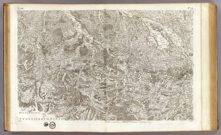
Full Title
(Carte de France levee par ordre du Roy). No. 108 (Pau - Bearn). Aldring sculp. Bourgoin scrip. (1771)
Publisher
Carte de la France Directeures
Full Title
(Carte de France levee par ordre du Roy). No. 108+ (Cauterets. 1781)
Publisher
Carte de la France Directeures
Full Title
(Carte de France levee par ordre du Roy). No. 109 (Montmedy - Longwy - Bouillon. 1766)
Publisher
Carte de la France Directeures
Full Title
(Carte de France levee par ordre du Roy). No. 109+ (Saint-Hubert. 1759)
Publisher
Carte de la France Directeures
Full Title
(Carte de France levee par ordre du Roy). No. 110 (Verdun). J. Seguin, Ingr. du Roy, 1760.
Publisher
Carte de la France Directeures
Full Title
(Carte de France levee par ordre du Roy). No. 111 (Toul). J. Seguin, Ingr. Geogrph. du Roy, fecit 1759.
Publisher
Carte de la France Directeures
Author
[Johnston, Alexander Keith, 1804-1871, Rogers, Henry Darwin]
Full Title
Mexico. Southern States. By Prof. H.D. Rogers & A. Keith Johnston, F.R.S.E. Entered in Sta. Hall. London ... & according to an act of Congress ... 1857, by H.D. Rogers ... Massachusetts. London, John Murray, Albemarle Street, Edinburgh, W. & A.K. Johnston. Engraved by W. & A.K. Johnston, Edinburgh.
Publisher
Edward Stanford
Full Title
North America. (London: Published by Simpkin & Marshall -- and Thomas Wardle, Philadelphia. 1832)
Publisher
[Simpkin & Marshall, Thomas Wardle]
Author
[Hinton, Isaac Taylor, 1799-1847, Simpkin & Marshall]
Full Title
A geological map of the United States. Engraved & printed by Fenner Sears & Co. London: Published March 15, 1832 by I.T. Hinton & Simpkin & Marshall.
Publisher
[Simpkin & Marshall, Thomas Wardle]
Author
[Hinton, Isaac Taylor, 1799-1847, Simpkin & Marshall]
Full Title
Map of the United States of America, and Nova Scotia &c. &c. London, published Feb. 1, 1832 by I.T. Hinton & Simpkin & Marshall. Engraved & printed by Fenner Sears & Co. -- and Thomas Wardle, Philadelphia. (1832)
Publisher
[Simpkin & Marshall, Thomas Wardle]
Author
[Hinton, Isaac Taylor, 1799-1847, Simpkin & Marshall]
Full Title
Geological sections of the United States. Engraved & printed by Fenner Sears & Co. (London: Published March 15, 1832 by I.T. Hinton & Simpkin & Marshall).
Publisher
[Simpkin & Marshall, Thomas Wardle]
Author
[Hinton, Isaac Taylor, 1799-1847, Simpkin & Marshall]
Full Title
New England and New York in 1697. From the "Magnalia americana." London: Published Nov. 1, 1830 by I.T. Hinton & Simpkin & Marshall. Engraved & printed by Fenner Sears & Co. (1832)
Publisher
[Simpkin & Marshall, Thomas Wardle]
Author
[Hinton, Isaac Taylor, 1799-1847, Simpkin & Marshall]
Full Title
Map of the state of New York, with part of Upper Canada. (with) New York (City). London: Published April 1, 1831 by I.T. Hinton and Simpkin and Marshall. Engraved and printed by Fenner Sears & Co. (1832)
Publisher
[Simpkin & Marshall, Thomas Wardle]
Author
[Hinton, Isaac Taylor, 1799-1847, Simpkin & Marshall]
Full Title
Map of the states of Kentucky and Tennessee. London, published June 1, 1831, by I.T. Hinton and Simpkin & Marshall. Engraved & printed by Fenner Sears & Co. (1832)
Publisher
[Simpkin & Marshall, Thomas Wardle]
Author
[Hinton, Isaac Taylor, 1799-1847, Simpkin & Marshall]
Full Title
Map of the states of Indiana and Ohio, with part of Michigan Territory. (with) Plan of Cincinnati. London, published June 1 by I.T. Hinton & Simpkin & Marshall. Engraved & printed by Fenner Sears & Co. (1832)
Publisher
[Simpkin & Marshall, Thomas Wardle]
Author
[Hinton, Isaac Taylor, 1799-1847, Simpkin & Marshall]
Full Title
Map of the states of North & South Carolina. (with) Plan of Charleston. London, published June 1 by I.T. Hinton & Simpkin & Marshall. Engraved & printed by Fenner Sears & Co. (1832)
Publisher
[Simpkin & Marshall, Thomas Wardle]
Author
[Hinton, Isaac Taylor, 1799-1847, Simpkin & Marshall]
Full Title
Map of the states of Virginia and Maryland. (with) Plan of Washington and Georgetown. London, published Sept. 1, 1831, by I.T. Hinton & Simpkin & Marshall. Engraved & printed by Fenner Sears & Co. (1832)
Publisher
[Simpkin & Marshall, Thomas Wardle]
Author
[Hinton, Isaac Taylor, 1799-1847, Simpkin & Marshall]
Full Title
Map of the states of Massachusetts and Connecticut, and Rhode Island. (with) Plan of Boston &c. London, published Feb. 1, 1832 by I.T. Hinton & Simpkin & Marshall. Engraved & printed by Fenner Sears & Co. (1832)
Publisher
[Simpkin & Marshall, Thomas Wardle]
Author
[Hinton, Isaac Taylor, 1799-1847, Simpkin & Marshall]
Full Title
Map of the states of Pennsylvania and New Jersey. (with) Plan of Philadelphia. London, published March 15, 1832 by I.T. Hinton & Simpkin & Marshall. Engraved & printed by Fenner Sears & Co. (1832)
Publisher
[Simpkin & Marshall, Thomas Wardle]
Author
[Hinton, Isaac Taylor, 1799-1847, Simpkin & Marshall]
Full Title
Map of the states of Mississippi, Louisiana and the Arkansas Territory. London, published April 1, 1832 by I.T. Hinton & Simpkin & Marshall. Engraved, printed by Fenner Sears & Co. (1832)
Publisher
[Simpkin & Marshall, Thomas Wardle]
Author
[Hinton, Isaac Taylor, 1799-1847, Simpkin & Marshall]
Full Title
Map of the states of Missouri and Illinois. London, published ... 1832, by I.T. Hinton & Simpkin & Marshall. Engraved & printed by Fenner Sears & Co. (1832)
Publisher
[Simpkin & Marshall, Thomas Wardle]
Author
[Hinton, Isaac Taylor, 1799-1847, Simpkin & Marshall]
Full Title
Map of Maine, New Hampshire and Vermont. London, published April 15, 1832 by I.T. Hinton & Simpkin & Marshall. Engraved & printed by Fenner Sears & Co. (1832)
Publisher
[Simpkin & Marshall, Thomas Wardle]
Author
[Hinton, Isaac Taylor, 1799-1847, Simpkin & Marshall]
Full Title
Map of the states of Alabama and Georgia. (with) Plan of Savannah. London, published Oct. 15, 1831 by I.T. Hinton & Simpkin & Marshall. Engraved & printed by Fenner Sears & Co. (1832)
Publisher
[Simpkin & Marshall, Thomas Wardle]
Author
[Hinton, Isaac Taylor, 1799-1847, Simpkin & Marshall]
Full Title
Map of the state of Florida. London, published April 1, 1832 by I.T. Hinton & Simpkin & Marshall. Engraved & printed by Fenner Sears & Co. (1832)
Publisher
[Simpkin & Marshall, Thomas Wardle]
Author
[Johnston, Alexander Keith, 1804-1871, Rogers, Henry Darwin]
Full Title
Central America. States Of Yucatan Guatemala, S. Salvador, & Honduras, with the British Colony of Belize. By Prof. H.D. Rogers & A. Keith Johnston, F.R.S.E. Entered in Sta. Hall. London ... & according to an act of Congress ... 1857, by H.D. Rogers ... Massachusetts. London, John Murray, Albemarle Street, Edinburgh, W. & A.K. Johnston. Engraved by W. & A.K. Johnston, Edinburgh.
Publisher
Edward Stanford
Author
[Johnston, Alexander Keith, 1804-1871, Rogers, Henry Darwin]
Full Title
Central America. States Of Nicaragua, & Costa Rica, with part of The Republic Of New Granada. By Prof. H.D. Rogers & A. Keith Johnston, F.R.S.E. Entered in Sta. Hall. London ... & according to an act of Congress ... 1857, by H.D. Rogers ... Massachusetts. London, John Murray, Albemarle Street, Edinburgh, W. & A.K. Johnston. Engraved by W. & A.K. Johnston, Edinburgh.
Publisher
Edward Stanford
Author
[Johnston, Alexander Keith, 1804-1871, Rogers, Henry Darwin]
Full Title
West Indies. Island Of Cuba, (Spanish) Jamaica, (British). By Prof. H.D. Rogers & A. Keith Johnston, F.R.S.E. Entered in Sta. Hall. London ... & according to an act of Congress ... 1857, by H.D. Rogers ... Massachusetts. London, John Murray, Albemarle Street, Edinburgh, W. & A.K. Johnston. Engraved by W. & A.K. Johnston, Edinburgh.
Publisher
Edward Stanford
Author
[Johnston, Alexander Keith, 1804-1871, Rogers, Henry Darwin]
Full Title
Quebec and its Environs (with) Montreal. Entered in Sta. Hall. London ... & according to an act of Congress ... 1857, by H.D. Rogers ... Massachusetts. London, John Murray, Albemarle Street, Edinburgh, W. & A.K. Johnston. Engraved by W. & A.K. Johnston, Edinburgh.
Publisher
Edward Stanford
Author
[Johnston, Alexander Keith, 1804-1871, Rogers, Henry Darwin]
Full Title
New York and its Environs. London ... & according to an act of Congress ... 1857, by H.D. Rogers ... Massachusetts. London, John Murray, Albemarle Street, Edinburgh, W. & A.K. Johnston. Engraved by W. & A.K. Johnston, Edinburgh.
Publisher
Edward Stanford
Author
[Johnston, Alexander Keith, 1804-1871, Rogers, Henry Darwin]
Full Title
Philadelphia & Vicinity. Boston and its Environs. London ... & according to an act of Congress ... 1857, by H.D. Rogers ... Massachusetts. London, John Murray, Albemarle Street, Edinburgh, W. & A.K. Johnston. Engraved by W. & A.K. Johnston, Edinburgh.
Publisher
Edward Stanford
Author
[Johnston, Alexander Keith, 1804-1871, Rogers, Henry Darwin]
Full Title
Cincinnati & Vicinity. Louisville Jeffersonville & Vicinity. London ... & according to an act of Congress ... 1857, by H.D. Rogers ... Massachusetts. London, John Murray, Albemarle Street, Edinburgh, W. & A.K. Johnston. Engraved by W. & A.K. Johnston, Edinburgh.
Publisher
Edward Stanford
Author
[Johnston, Alexander Keith, 1804-1871, Rogers, Henry Darwin]
Full Title
New Orleans. San Francisco. London ... & according to an act of Congress ... 1857, by H.D. Rogers ... Massachusetts. London, John Murray, Albemarle Street, Edinburgh, W. & A.K. Johnston. Engraved by W. & A.K. Johnston, Edinburgh.
Publisher
Edward Stanford
Author
Wheeler, G.M.
Full Title
Part Of South-Eastern Idaho, Atlas Sheet No. 32(D). Issued June 30, 1879. Weyss, Lang & Herman Del. Expedition of 1877, Under the Command of 1st Lieut. Geo. M. Wheeler, Corps of Engineers, U.S. Army. U.S. Geographical Surveys West Of The 100th Meridian.
Publisher
U.S.
Author
Wheeler, G.M.
Full Title
Land Classification Map Of Part Of South-Eastern Idaho, Atlas Sheet No. 32(D). Issued June 30, 1879. Weyss, Lang & Herman Del. Expedition of 1877, Under the Command of 1st Lieut. Geo. M. Wheeler, Corps of Engineers, U.S. Army. U.S. Geographical Surveys West Of The 100th Meridian.
Publisher
U.S.
Author
Wheeler, G.M.
Full Title
Parts Of N.E. California, N.W. Nevada And Southern Oregon. Atlas Sheet No. 38 B. Issued June 30th, 1882. Weyss, Rock and Karl, Del. Expeditions of 1877 & 1878 Under the Command of 1st Lieut. Geo. M. Wheeler, Corps of Engineers, U.S. Army. U.S. Geographical Surveys West Of The 100th Meridian.
Publisher
U.S.
Author
Wheeler, G.M.
Full Title
Parts Of N.E. California & N.W. Nevada, Atlas Sheet No. 38(D.). Issued Nov 15th, 1880. Herman, Franke, and Rock, Del. Expedition of 1877 Under the Command of 1st Lieut. Geo. M. Wheeler, Corps of Engineers, U.S. Army. 1st. Lieut. T.W. Symons, Corps of Engineers U.S. Army. Executive Officer & Field Astronomer. J.C. Spiller, Topographical Assistant. U.S. Geographical Surveys West Of The 100th Meridian.
Publisher
U.S.
Author
Wheeler, G.M.
Full Title
Land Classification Map Of Parts Of N.E. California & N.W. Nevada, Atlas Sheet No. 38(D.). Issued Nov 15th, 1880. Herman, Franke, and Rock, Del. Expedition of 1877 Under the Command of 1st Lieut. Geo. M. Wheeler, Corps of Engineers, U.S. Army. U.S. Geographical Surveys West Of The 100th Meridian.
Publisher
U.S.
Author
Wheeler, G.M.
Full Title
Parts Of Southern Idaho & Northern Utah, Atlas Sheet No. 41(A.). Issued June 30, 1880. Weyss, Lang & Herman Del. Expedition of 1877 Under the Command of 1st Lieut. Geo. M. Wheeler, Corps of Engineers, U.S. Army. 1st Lieut. Rogers Birnie 13th Infantry, U.S. Army. Executive Officer & Field Astronomer. J.W. Ward, Alfred Downing, Topographical Assistants. U.S. Geographical Surveys West Of The 100th Meridian.
Publisher
U.S.
Author
Cram, George Franklin
Full Title
Cram's Rail Road & Township Map of Kansas. Published by Geo. F. Cram. Proprietor of the Western Map Depot. 66, Lake St. Chicago Ills. 1875.
Publisher
Cram Atlas Company
Author
Cram, George Franklin
Full Title
Cram's Rail Road & Township Map of Nebraska. Published by Geo. F. Cram. Proprietor of the Western Map Depot. 66, Lake St. Chicago Ills. 1875.
Publisher
Cram Atlas Company
Author
Cram, George Franklin
Full Title
Cram's Rail Road & Township Map of Minnesota. Published by Geo. F. Cram. Proprietor of the Western Map Depot. 66, Lake St. Chicago Ills. 1875.
Publisher
Cram Atlas Company
Author
Cram, George Franklin
Full Title
Cram's Rail Road & Township Map of Dakota. Published by Geo. F. Cram. Proprietor of the Western Map Depot. 66, Lake St. Chicago Ills. 1875.
Publisher
Cram Atlas Company
Author
Cram, George Franklin
Full Title
Cram's Rail Road & Township Map of Arkansas. Published by Geo. F. Cram. Proprietor of the Western Map Depot. 66, Lake St. Chicago Ills. 1875.
Publisher
Cram Atlas Company
Author
Cram, George Franklin
Full Title
Cram's Rail Road & Township Map of Louisiana. Published by Geo. F. Cram. Proprietor of the Western Map Depot. 66, Lake St. Chicago Ills. 1875.
Publisher
Cram Atlas Company
Author
Cram, George Franklin
Full Title
Cram's Rail Road & Township Map of Texas. Published by Geo. F. Cram. Proprietor of the Western Map Depot. 66, Lake St. Chicago Ills. 1875.
Publisher
Cram Atlas Company
Author
Cram, George Franklin
Full Title
Cram's Rail Road & Township Map of Idaho. Published by Geo. F. Cram. Proprietor of the Western Map Depot. 66, Lake St. Chicago Ills. 1875.
Publisher
Cram Atlas Company
Author
Wheeler, G.M.
Full Title
Parts Of Southern Idaho & Northern Utah, Atlas Sheet No. 41(A.). Issued June 30, 1880. Weyss, Lang & Herman Del. Expedition of 1877 Under the Command of 1st Lieut. Geo. M. Wheeler, Corps of Engineers, U.S. Army. U.S. Geographical Surveys West Of The 100th Meridian.
Publisher
U.S.
Author
Wheeler, G.M.
Full Title
North-Eastern Utah & South-Eastern Idaho, Atlas Sheet No. 41(B). Issued June 30, 1878. Weyss, Lang & Herman Del. Expedition of 1877; Under the Command of 1st Lieut. Geo. M. Wheeler, Corps of Engineers, U.S. Army. 1st. Lieut. S.E. Tillman and 2nd. Lieut. Willard Young, Corps of Engr's. Executive Officers, & Field Astronomers. G. Thompson, Topographical Assistant. U.S. Geographical Surveys West Of The 100th Meridian.
Publisher
U.S.
Author
Wheeler, G.M.
Full Title
Land Classification Map Of North-Eastern Utah & South-Eastern Idaho, Atlas Sheet No. 41(B). Issued June 30, 1878. Weyss, Lang & Herman Del. Expedition of 1877; Under the Command of 1st Lieut. Geo. M. Wheeler, Corps of Engineers, U.S. Army. U.S. Geographical Surveys West Of The 100th Meridian.
Publisher
U.S.
|