Search Results:

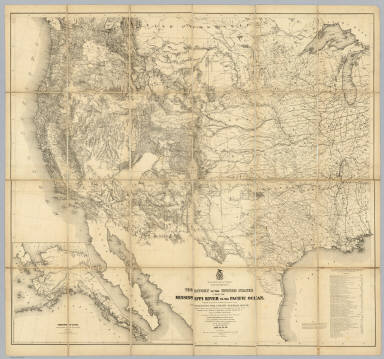
1869 Map Of The Route Of The Southern Contine … Separate Map Map Of The Route Of The Southern Contine … |

1869 Map Of The Route Of The Southern Contine … Separate Map Map Of The Route Of The Southern Contine … |

1892 Cover: California, Texas, Mexico and Ari … Timetable Map (Covers to:) California, Texas, Mexico A … |

1892 California, Texas, Mexico and Arizona So … Timetable Map California, Texas, Mexico And Arizona So … |

1892 Railway, steamship lines, Southern Pacif … Timetable Map Correct map of the railway & steamship l … |

1877 Trans-Continental Map Of The Pacific R.R … Separate Map Williams' New Trans-Continental Map Of T … |

1883 Denver and Rio Grande Railroad System Separate Map (Denver and Rio Grande Railroad System). … |

1883 Denver and Rio Grande Railroad System Separate Map Denver and Rio Grande Railroad System. D … |

1861 Profiles, main routes surveyed 1855. Exploration Book Profiles of the main routes surveyed, co … |

1861 Profiles, 1 Ft. Bridger-Ft. Reading, 2 W … Exploration Book Profiles from Explorations and Surveys m … |

1861 Profile Ft. Smith, Ark.-Martinez, Calif. Exploration Book General profile from Fort Smith, Arkansa … |

1861 Profiles San Francisco Bay-Los Angeles & … Exploration Book Profiles from San Francisco Bay to Los A … |

1861 Cover: Reports of Explorations and Surve … Exploration Book (Covers to) Reports of Explorations and … |

1861 Contents: Reports of explorations and su … Exploration Book (Contents Page to) Reports of Exploratio … |

1861 Title Page: Memoir to accompany the Map … Exploration Book (Title Page to) Memoir to accompany the … |

1861 Contents: Memoir to accompany the Map of … Exploration Book (Contents Page to) Memoir to accompany t … |

1861 Contents: Topographical maps, profiles, … Exploration Book (Contents Page to) Topographical maps, p … |

1861 Contents: Topographical maps, profiles, … Exploration Book (Contents Page to) Topographical maps, p … |

1876 Cover: Watson's Pacific States, New coun … Pocket Map (Covers to) Watson's New County and Rail … |

1876 Watson's New County and Railroad Map of … Pocket Map Watson's New County and Railroad Map of … |

1870 Covers: Pacific Rail Road Route Pocket Map (Covers to) Map Of The Pacific Rail Road … |

1870 Pacific Rail Road Route Pocket Map Map Of The Pacific Rail Road Route From … |

1867 Map Of The Territory Of The United State … Case Map Map Of The Territory Of The United State … |
1868 Territory Of The United States From The … Case Map Territory Of The United States From The … |

1861 Title Page: Reports, explorations and su … Exploration Book (Title Page to) Reports of Explorations … |

1861 Title Page: Topographical maps, profiles … Exploration Book (Title Page to) Topographical maps, prof … |

1871 Map Of The Country Tributary To The Nort … Separate Map Map Of The Country Tributary To The Nort … |

1869 Map of the Union Pacific Rail Road Separate Map Map of the Union Pacific Rail Road Surve … |

1883 U.S. Western. World Atlas United States of North America, and part … |

1879 Map of the Northern Pacific Railroad and … Timetable Map Map of the Northern Pacific Railroad and … |

1879 Cover: Black Hills, Montana, Upper Misso … Timetable Map (Covers to) Black Hills, Montana, Upper … |

1879 Text Page: Black Hills, Montana, Upper M … Timetable Map (Text Page to) Black Hills, Montana, Upp … |

1892 Great No. RR line. Timetable Map Great Northern Railway line and connecti … |

1892 Cover: Red River Thal, Minn.-N.D. Timetable Map (Covers to) Das Red River Thal in Minnes … |

1892 Text Page: Red River Thal, Minn.-N.D. Timetable Map (Text Page to) Das Red River Thal in Min … |

1887 St. Paul, Minneapolis & Manitoba Ry. Timetable Map St. Paul, Minneapolis & Manitoba Ry. Man … |

1887 Cover: St. Paul, Minneapolis & Manitoba … Timetable Map (Covers to) St. Paul, Minneapolis & Mani … |

1887 Text Page: St. Paul, Minneapolis & Manit … Timetable Map (Text Page to) St. Paul, Minneapolis & M … |

1888 Land grant W. Wash. & N. Oregon. Pocket Map Map showing land grant of the Northern P … |

1888 Cover: Land grant W. Wash. & N. Oregon. Pocket Map (Covers to) Map showing land grant of th … |

1888 Text Page: Land grant W. Wash. & N. Oreg … Pocket Map (Text Page to) Map showing land grant of … |

1887 Map N.P.R.R. Timetable Map The Yellowstone Park and dining car rout … |

1887 Cover: No. Pacific R.R. Timetable Map (Covers to) The Northern Pacific R.R. Th … |

1887 Text Page: No. Pacific R.R. Timetable Map (Text Page to) The Northern Pacific R.R. … |

1901 Yellowstone Natl. Park. Pocket Map Burlington Route - Northern Pacific Rail … |

1901 Cover: Yellowstone Natl. Park. Pocket Map (Covers to) Burlington Route - Northern … |

1901 Text Page: Yellowstone Natl. Park. Pocket Map (Text Page to) Burlington Route - Northe … |

1898 Text Page: Yellowstone National Park. Timetable Map (Text Page to) The Yellowstone National … |

1904 Santa Fe. Timetable Map Santa Fe. Poole Bros., Chicago. |

1904 Cover: AT&SF Railway, connecting lines. Timetable Map (Covers to) Santa Fe. The Atchison, Tope … |