Who What Where WhenREMOVE |
Author
Johnson, A.J.
Full Title
Johnson's Georgetown and the City of Washington, the Capital of the United States of America. By Johnson and Ward.
Publisher
Johnson and Ward
Author
Johnson, A.J.
Full Title
Johnson's Delaware and Maryland By Johnson and Ward. (inset) District of Columbia.
Publisher
Johnson and Ward
Author
Johnson, A.J.
Full Title
Johnson's Indiana, Published By Johnson and Ward.
Publisher
Johnson and Ward
Author
Johnson, A.J.
Full Title
Johnson's Germany Published By Johnson And Ward.
Publisher
Johnson and Ward
Author
Johnson, A.J.
Full Title
Johnson's Switzerland By Johnson And Ward.
Publisher
Johnson and Ward
Author
Johnson, A.J.
Full Title
Johnson's Palestine By Johnson And Ward. (inset) Jerusalem. Vignette of Damascus.
Publisher
Johnson and Ward
Author
Johnson, A.J.
Full Title
Johnson's China By Johnson And Ward. (insets): Harbor Island of Amoy, and Map of Canton and Adjacent Islands.
Publisher
Johnson and Ward
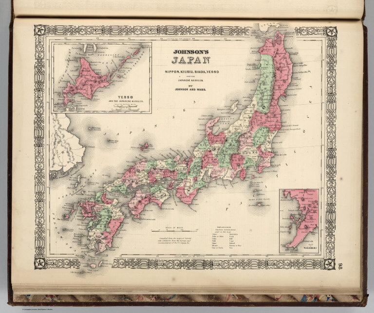
Author
Johnson, A.J.
Full Title
Johnson's Japan, Nippon, Kiusiu, Sikok, Yesso and the Japanese Kuriles. By Johnson And Ward. (insets): Yesso and the Japanese Kuriles, Bay of Nagasaki.
Publisher
Johnson and Ward
Author
Mitchell, Samuel Augustus
Full Title
Map Of Oregon, Washington, And Part Of British Columbia. 36. Entered ... 1860, by S. Augustus Mitchell, Jr. ... Pennsylvania.
Publisher
S.A. Mitchell, Jr.
Author
Johnson, A.J.
Full Title
Johnson's Africa Published By Johnson And Ward. (insets): Map of Liberia, Delta of the Nile, Map of Cape Colony, Cape Verde Islands, and St. Helena.
Publisher
Johnson and Ward
Author
Johnson, A.J.
Full Title
Johnson's Australia By Johnson And Ward.
Publisher
Johnson and Ward
Author
Johnson, A.J.
Full Title
Johnson's Roman Empire, Imperium Romanorum Latissime Patens By Johnson And Ward. (insets): No. 104 Graecia. No. 105 Italia.
Publisher
Johnson and Ward
Author
Mitchell, Samuel Augustus
Full Title
County Map Of California. 37. (with) two inset maps: Map Of The Settlements in the Great Salt Lake Country. Utah. 38. San Francisco Bay and Vicinity. 39. Entered ... 1860, by S. Augustus Mitchell, Jr. ... Pennsylvania.
Publisher
S.A. Mitchell, Jr.
Author
Mitchell, Samuel Augustus
Full Title
Map Of Mexico, Central America, And The West Indies. 40. Constructed & Engraved by W. Williams Philadelphia. (with) four inset maps: Map of the Island of Cuba. 41. ... Island of Jamaica. 42. ... Bermuda Islands. 43. ... Panama Railroad. 44. Entered ... 1860, by S. Augustus Mitchell, Jr. ... Pennsylvania.
Publisher
S.A. Mitchell, Jr.
Author
Rand McNally and Company
Full Title
The population of the world, 1890. Rand, McNally & Co.'s miniature map of the world showing density of population, 1890. Area and population of foreign countries, compared with the United States, 1890. Indexed atlas of the world. (Engraved, printed and published by Rand, McNally & Company, Chicago and New York, U.S.A., 1897)
Publisher
Rand McNally
Author
Rand McNally and Company
Full Title
Rand, McNally & Co.'s. indexed atlas of the world map of the world on Mercator's projection. Showing the direction of the ocean currents. Copyright `895, by Rand, McNally & Co. ... Engravers, Chicago. (1897)
Publisher
Rand McNally
Author
Rand McNally and Company
Full Title
Rand, McNally & Company's indexed atlas of the world Western Hemisphere, Eastern Hemisphere. Rand McNally & Co.'s New map of the Western ... Eastern Hemisphere. Copyright 1892 by Rand, McNally & Co. ... Engravers, Chicago. (1897)
Publisher
Rand McNally
Author
Rand McNally and Company
Full Title
Rand, McNally & Company's indexed atlas of the world map of North Polar Regions. Copyright 1892, by Rand, McNally & Co. (Chicago. 1897)
Publisher
Rand McNally
Author
Gray, Ormando Willis
Full Title
Mountains & Rivers.
Publisher
Stedman, Brown & Lyon
Author
[Blodget, Lorin, Gray, Ormando Willis]
Full Title
Gray's Atlas Climatological Map of the United States Showing the Average Temperature, Amount of Rain Fall &c. by Loren Blodget, 1873.
Publisher
Stedman, Brown & Lyon
Author
[Gray, Ormando Willis, Porter, Thomas C.]
Full Title
Map of the United States Showing the Principal Botanical Divisions, by Thomas C. Porter, A.M., Professor of Botany in Lafayette College, Easton, Pa.
Publisher
Stedman, Brown & Lyon
Author
[Cope, Edward D., Gray, Ormando Willis]
Full Title
Map of the United States Showing the Principal Zoological Divisions, by Professor Edward D. Cope, A.M., Secretary of Academy of Natural Sciences, Philadephia.
Publisher
Stedman, Brown & Lyon
Author
Gray, Ormando Willis
Full Title
Gray's Atlas Map of the United States Showing the Principal Geological Formations by Cha's. H. Hitchcock, Ph.D.,Professor of Geology in Dartmouth College.
Publisher
Stedman, Brown & Lyon
Author
Rand McNally and Company
Full Title
Rand, McNally & Company's indexed atlas of the world map of Europe. Copyright 1891, by Rand, McNally & Co. ... Engravers, Chicago. (1897)
Publisher
Rand McNally
Author
Mitchell, Samuel Augustus
Full Title
Map Of South America, Showing Its Political Divisions. 45. Constructed & Engraved by W. Williams Philadelphia. (with) inset Map Showing The Proposed Atrato-Inter-Oceanic Canal Routes, for Connecting the Atlantic and Pacific Oceans. 46. Entered ... 1860, by S. Augustus Mitchell, Jr. ... Pennsylvania.
Publisher
S.A. Mitchell, Jr.
Author
Gray, Ormando Willis
Full Title
Western Hemisphere. Eastern Hemisphere.
Publisher
Stedman, Brown & Lyon
Author
Gray, Ormando Willis
Full Title
Gray's Atlas Map of Asia.
Publisher
Stedman, Brown & Lyon
Author
Gray, Ormando Willis
Full Title
Gray's Atlas Map of Oceanica, 1873.
Publisher
Stedman, Brown & Lyon
Author
Rand McNally and Company
Full Title
Rand, McNally & Company's indexed atlas of the world map of England and Wales. (with) London and environs. Copyright 1892, by Rand, McNally & Co. ... (Chicago, 1897)
Publisher
Rand McNally
Author
Gray, Ormando Willis
Full Title
Gray's Atlas Map of Africa, 1873.
Publisher
Stedman, Brown & Lyon
Author
Gray, Ormando Willis
Full Title
Gray's Atlas Map of Europe.
Publisher
Stedman, Brown & Lyon
Author
Gray, Ormando Willis
Full Title
Gray's Atlas Map of Great Britain and Ireland.
Publisher
Stedman, Brown & Lyon
Author
Rand McNally and Company
Full Title
Rand, McNally & Company's indexed atlas of the world map of Scotland. Copyright 1891, by Rand, McNally & Co. ... (Chicago, 1897)
Publisher
Rand McNally
Author
Gray, Ormando Willis
Full Title
Gray's Atlas Map of Germany, Austria, and Switzerland. Entered ... 1874 ... Librarian of Congress at Washington. Drawn by F.A. Gray. Engraved by J.M. Atwood.
Publisher
Stedman, Brown & Lyon
Author
Gray, Ormando Willis
Full Title
Gray's Atlas Map of South America.
Publisher
Stedman, Brown & Lyon
Author
Rand McNally and Company
Full Title
Rand, McNally & Company's indexed atlas of the world map of Ireland. Copyright 1892, by Rand, McNally & Co. ... (Chicago, 1897)
Publisher
Rand McNally
Author
Gray, Ormando Willis
Full Title
Gray's Atlas Map of North America.
Publisher
Stedman, Brown & Lyon
Author
Gray, Ormando Willis
Full Title
Central America. West Indies. (inset) Isthmus of Panama. (inset) City & Harbor of Havana.
Publisher
Stedman, Brown & Lyon
Author
Gray, Ormando Willis
Full Title
Gray's Atlas Map of Mexico. (inset) Territory and Isthmus of Tehuantepec.
Publisher
Stedman, Brown & Lyon
Author
Gray, Ormando Willis
Full Title
Grays Atlas Map of Washington.
Publisher
Stedman, Brown & Lyon
Author
Rand McNally and Company
Full Title
Rand, McNally & Company's indexed atlas of the world map of Spain and Portugal. Copyright 1892, by Rand, McNally & Co. ... Engravers, Chicago, (1897)
Publisher
Rand McNally
Author
Gray, Ormando Willis
Full Title
Gray's Atlas Map of the United States of America, 1873. (inset) Alaska.
Publisher
Stedman, Brown & Lyon
Author
Gray, Ormando Willis
Full Title
Gray's Atlas Map of Maine. New Hampshire.
Publisher
Stedman, Brown & Lyon
Author
Gray, Ormando Willis
Full Title
Gray's Atlas Map of Vermont.
Publisher
Stedman, Brown & Lyon
Author
Gray, Ormando Willis
Full Title
Gray's Atlas Map of Massachusetts and Rhode Island. (inset) Vicinity of Boston.
Publisher
Stedman, Brown & Lyon
Author
Rand McNally and Company
Full Title
Rand, McNally & Company's indexed atlas of the world map of France. Copyright 1892, by Rand, McNally & Co. (Chicago, 1897)
Publisher
Rand McNally
Author
Gray, Ormando Willis
Full Title
Map of the Compact Portions of Boston and Adjacent Cities.
Publisher
Stedman, Brown & Lyon
Author
Gray, Ormando Willis
Full Title
Gray's Atlas Map of Connecticut with Portions of New York and Rhode Island.
Publisher
Stedman, Brown & Lyon
Author
Gray, Ormando Willis
Full Title
Gray's Atlas Map of New York. (insets for:) Oswego, Buffalo, Rochester, Syracuse, Albany, Troy, and Vicinity of New York.
Publisher
Stedman, Brown & Lyon
|