Who What Where WhenREMOVEWHEREShow More |
Full Title
Plat no. 42 (San Francisco. (Compiled and published by Wm. P. Humphreys & Co., A.B. Holcombe, W.C. Kewen. Eng. by Worley & Bracher ... Phila, Pa. Printed by F. Bourquin ... Phila, Pa. 1876.)
Publisher
W. Humphreys
Full Title
Plat no. 43 (San Francisco. (Compiled and published by Wm. P. Humphreys & Co., A.B. Holcombe, W.C. Kewen. Eng. by Worley & Bracher ... Phila, Pa. Printed by F. Bourquin ... Phila, Pa. 1876.)
Publisher
W. Humphreys
Full Title
Plat no. 44 (San Francisco. (Compiled and published by Wm. P. Humphreys & Co., A.B. Holcombe, W.C. Kewen. Eng. by Worley & Bracher ... Phila, Pa. Printed by F. Bourquin ... Phila, Pa. 1876.)
Publisher
W. Humphreys
Full Title
Plat no. 45 (San Francisco. (Compiled and published by Wm. P. Humphreys & Co., A.B. Holcombe, W.C. Kewen. Eng. by Worley & Bracher ... Phila, Pa. Printed by F. Bourquin ... Phila, Pa. 1876.)
Publisher
W. Humphreys
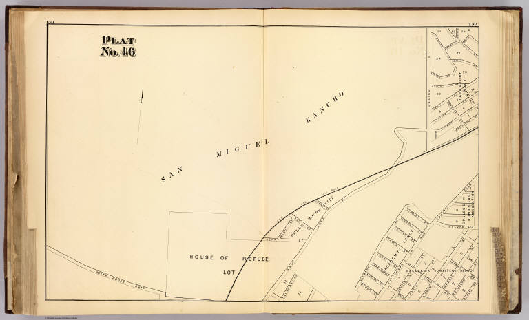
Full Title
Plat no. 46 (San Francisco. (Compiled and published by Wm. P. Humphreys & Co., A.B. Holcombe, W.C. Kewen. Eng. by Worley & Bracher ... Phila, Pa. Printed by F. Bourquin ... Phila, Pa. 1876.)
Publisher
W. Humphreys
Full Title
Plat no. 47 (San Francisco. (Compiled and published by Wm. P. Humphreys & Co., A.B. Holcombe, W.C. Kewen. Eng. by Worley & Bracher ... Phila, Pa. Printed by F. Bourquin ... Phila, Pa. 1876.)
Publisher
W. Humphreys
Full Title
Plat no. 48 (San Francisco. (Compiled and published by Wm. P. Humphreys & Co., A.B. Holcombe, W.C. Kewen. Eng. by Worley & Bracher ... Phila, Pa. Printed by F. Bourquin ... Phila, Pa. 1876.)
Publisher
W. Humphreys
Full Title
Plat no. 49 (San Francisco. (Compiled and published by Wm. P. Humphreys & Co., A.B. Holcombe, W.C. Kewen. Eng. by Worley & Bracher ... Phila, Pa. Printed by F. Bourquin ... Phila, Pa. 1876.)
Publisher
W. Humphreys
Author
Mitchell, Samuel Augustus
Full Title
A New Map of the States of California, the Territories of Oregon, Washington, Utah & New Mexico. Published By Charles Desilver, No. 714 Chesnut Street, Philadelphia. Entered according to Act of Congress in the year 1859 by Charles Desilver in the Clerk's office if the District Court of the Eastern District of Pennsylvania. 37.
Publisher
Charles Desilver.
Full Title
Plat no. 50 (San Francisco. (Compiled and published by Wm. P. Humphreys & Co., A.B. Holcombe, W.C. Kewen. Eng. by Worley & Bracher ... Phila, Pa. Printed by F. Bourquin ... Phila, Pa. 1876.)
Publisher
W. Humphreys
Full Title
Plat no. 51 (San Francisco. (Compiled and published by Wm. P. Humphreys & Co., A.B. Holcombe, W.C. Kewen. Eng. by Worley & Bracher ... Phila, Pa. Printed by F. Bourquin ... Phila, Pa. 1876.)
Publisher
W. Humphreys
Full Title
Plat no. 52 (San Francisco. (Compiled and published by Wm. P. Humphreys & Co., A.B. Holcombe, W.C. Kewen. Eng. by Worley & Bracher ... Phila, Pa. Printed by F. Bourquin ... Phila, Pa. 1876.)
Publisher
W. Humphreys
Full Title
Plat no. 53 (San Francisco. (Compiled and published by Wm. P. Humphreys & Co., A.B. Holcombe, W.C. Kewen. Eng. by Worley & Bracher ... Phila, Pa. Printed by F. Bourquin ... Phila, Pa. 1876.)
Publisher
W. Humphreys
Full Title
Plat no. 54. Plat no. 55 (San Francisco. (Compiled and published by Wm. P. Humphreys & Co., A.B. Holcombe, W.C. Kewen. Eng. by Worley & Bracher ... Phila, Pa. Printed by F. Bourquin ... Phila, Pa. 1876.)
Publisher
W. Humphreys
Full Title
Plat no. 56 (San Francisco. (Compiled and published by Wm. P. Humphreys & Co., A.B. Holcombe, W.C. Kewen. Eng. by Worley & Bracher ... Phila, Pa. Printed by F. Bourquin ... Phila, Pa. 1876.)
Publisher
W. Humphreys
Full Title
Plat no. 57 (San Francisco. (Compiled and published by Wm. P. Humphreys & Co., A.B. Holcombe, W.C. Kewen. Eng. by Worley & Bracher ... Phila, Pa. Printed by F. Bourquin ... Phila, Pa. 1876.)
Publisher
W. Humphreys
Full Title
Plat no. 58 (San Francisco. (Compiled and published by Wm. P. Humphreys & Co., A.B. Holcombe, W.C. Kewen. Eng. by Worley & Bracher ... Phila, Pa. Printed by F. Bourquin ... Phila, Pa. 1876.)
Publisher
W. Humphreys
Full Title
Plat no. 59 (San Francisco. (Compiled and published by Wm. P. Humphreys & Co., A.B. Holcombe, W.C. Kewen. Eng. by Worley & Bracher ... Phila, Pa. Printed by F. Bourquin ... Phila, Pa. 1876.)
Publisher
W. Humphreys
Full Title
Plat no. 60 (San Francisco. (Compiled and published by Wm. P. Humphreys & Co., A.B. Holcombe, W.C. Kewen. Eng. by Worley & Bracher ... Phila, Pa. Printed by F. Bourquin ... Phila, Pa. 1876.)
Publisher
W. Humphreys
Full Title
Plat no. 61 (San Francisco. (Compiled and published by Wm. P. Humphreys & Co., A.B. Holcombe, W.C. Kewen. Eng. by Worley & Bracher ... Phila, Pa. Printed by F. Bourquin ... Phila, Pa. 1876.)
Publisher
W. Humphreys
Full Title
Plat no. 62 (San Francisco. (Compiled and published by Wm. P. Humphreys & Co., A.B. Holcombe, W.C. Kewen. Eng. by Worley & Bracher ... Phila, Pa. Printed by F. Bourquin ... Phila, Pa. 1876.)
Publisher
W. Humphreys
Full Title
Plat no. 63 (San Francisco. (Compiled and published by Wm. P. Humphreys & Co., A.B. Holcombe, W.C. Kewen. Eng. by Worley & Bracher ... Phila, Pa. Printed by F. Bourquin ... Phila, Pa. 1876.)
Publisher
W. Humphreys
Author
William P. Humphreys & Co.
Full Title
(Covers to) Atlas of the city and county of San Francisco from actual surveys and official records. Compiled and published by Wm. P. Humphreys & Co., A.B. Holcombe, W.C. Kewen. Eng. by Worley & Bracher ... Phila, Pa. Printed by F. Bourquin ... Phila, Pa. 1876.
Publisher
W. Humphreys
Author
William P. Humphreys & Co.
Full Title
(Contents to) Atlas of the city and county of San Francisco from actual surveys and official records. Compiled and published by Wm. P. Humphreys & Co., A.B. Holcombe, W.C. Kewen. Eng. by Worley & Bracher ... Phila, Pa. Printed by F. Bourquin ... Phila, Pa. 1876.
Publisher
W. Humphreys
Author
[Rand McNally and Company, State Farm Insurance Companies Travel Bureau]
Full Title
Rand McNally Road map, California. Copyright by Rand McNally & Company, Chicago, Ill. Lithographed in the U.S.A. (to accompany) State Farm Road Atlas: United States, Canada, Mexico,Central and South America. Copyright 1940 by Rand McNally & Company, Chicago, Ill.
Publisher
State Farm Insurance Companies Travel Bureau
Author
Stieler, Adolf
Full Title
Die Vereinigten Staaten Von Nord-Amerika In 6 Blattern Im Maassstabe Von 1:3.700.000. Von A. Petermann. Bl. 4. Bearbeitet v. H. Habenicht. Gest v. Eberhardt, Kuhn, Metzeroth & Weiler. Gotha: Justus Perthes. 1873.
Publisher
Justus Perthes
Author
[Geographisches Institut (Weimar, Germany), Kiepert, Heinrich, 1818-1899]
Full Title
Mexico, Texas und Californien. (with) Die Republiken von Central-America im Maasstab der Hauptkarte. (with) Haupt-Gold-District in Californien im doppelten maastab der Hauptkarte... (with) Plateau von Mexico ... Bearbeitet und gezeichnet von H. Kiepert. Situation und Schrift gestochen von K. Madel, Terrain von C. Jungmann. Weimar, Verlag des Geographischen Instituts, 1855.
Publisher
Weimar Geo Inst.
Author
Smith, F. E. (Frank Enos)
Full Title
Official map of Madera County, California 1914. Compiled from official records and surveys. Published by F.E. Smith, Co. Surveyor. Drawn by Irving Bacon, Deputy. Approved and declared the Official map of Madera County by order of the Board of Supervisors ... Copyright by F.E. Smith, 1914. Britton & Rey Lithographers Inc., S.F. (inset) City of Madera.
Publisher
F.E. Smith, County Surveyor
Author
Smith, F. E. (Frank Enos)
Full Title
(Covers to) Official map of Madera County, California 1914. Compiled from official records and surveys. Published by F.E. Smith, Co. Surveyor. Drawn by Irving Bacon, Deputy. Approved and declared the Official map of Madera County by order of the Board of Supervisors ... Copyright by F.E. Smith, 1914. Britton & Rey Lithographers Inc., S.F.
Publisher
F.E. Smith, County Surveyor
Author
Green, Abbott M.
Full Title
Official map of Modoc County, California. Compiled & drawn by A.M. Green, Civil Engineer. 1911. Approved, July 6th 1911 ...
Publisher
Abbott M. Green
Author
Green, Abbott M.
Full Title
(Covers to) Official map of Modoc County, California. Compiled & drawn by A.M. Green, Civil Engineer. 1911. Approved, July 6th 1911 ...
Publisher
Abbott M. Green
Author
[C.F. Weber & Co., Punnett Brothers]
Full Title
(Weber's Map of Yolo County, California showing towns, steam and electric railroads, wagon and automobile roads, township and section lines, rivers, creeks, reclamation and irrigation districts, etc. Compiled from the latest official and private sources.) Published by C.F. Weber & Co., San Francisco, Los Angeles. Copyright 1914 by Punnett Brothers.
Publisher
C.F. Weber
Author
[C.F. Weber & Co., Punnett Brothers]
Full Title
(Covers to) Weber's Map of Yolo County, California showing towns, steam and electric railroads, wagon and automobile roads, township and section lines, rivers, creeks, reclamation and irrigation districts, etc. Compiled from the latest official and private sources. Published by C.F. Weber & Co., San Francisco, Los Angeles. Copyright 1914 by Punnett Brothers.
Publisher
C.F. Weber
Author
Mitchell, Samuel Augustus
Full Title
Oregon and Upper California. Published by S. Augustus Mitchell, N.E. corner of Market & Seventh Streets. Philadelphia. 1848. Entered according to Act of Congress in the year 1845 by H.N. Burroughs in the ... District Court of the eastern district of Pennsylvania.
Publisher
S.A. Mitchell
Full Title
Map of the state of California, the territories of Oregon & Utah, and the chief part of New Mexico. Entered according to Act of Congress in the year 1845 by H.N. Burroughs in the ... District Court of the eastern district of Pennsylvania. (1850)
Publisher
Thomas, Cowperthwait & Co.
Author
[C.H. Street & Co., Immigration Association of California]
Full Title
Map of the state of California, compiled expressly for C.H. Street & Co., successors to the Immigration Association of California, 415 Montgomery St., San Francisco ... Lith. Britton & Rey, S.F. (1886?)
Publisher
Britton & Rey
Author
[C.H. Street & Co., Immigration Association of California]
Full Title
(Covers to) Map of the state of California, compiled expressly for C.H. Street & Co., successors to the Immigration Association of California, 415 Montgomery St., San Francisco ... Lith. Britton & Rey, S.F. (1886?)
Publisher
Britton & Rey
Author
[C.H. Street & Co., Immigration Association of California]
Full Title
(Text Page to) Map of the state of California, compiled expressly for C.H. Street & Co., successors to the Immigration Association of California, 415 Montgomery St., San Francisco ... Lith. Britton & Rey, S.F. (1886?)
Publisher
Britton & Rey
Author
[Hill Publishing Company, Hill, E. F.]
Full Title
Map of Los Angeles, California. Copyright, by E.F. Hill. (inset map) City of Inglewood.
Publisher
Hill Publishing Co.
Author
[Hill Publishing Company, Hill, E. F.]
Full Title
Map of Eagle Rock with sections of Annandale and Glendale. Copyright 1927, E.F. Hill. Map of San Fernando addition to the city of Los Angeles. Hill's map of South Los Angeles and Harbor District. Hill's map of North Hollywood, formerly Lankershim. Hill's map of Glendale. Outline map showing annexations to the city of Los Angeles. Street map of Burbank.
Publisher
Hill Publishing Co.
Author
[Hill Publishing Company, Hill, E. F.]
Full Title
(Covers to) Map of Los Angeles, California. Copyright, by E.F. Hill.
Publisher
Hill Publishing Co.
Author
[Central Pacific Railroad Company, Union Pacific Railroad Company]
Full Title
(Covers to) The only great through all rail route is the Union and Central Pacific R.R. line via Omaha ... Rand, McNally & Co., Printers Engravers, etc., 108 West Randolph St., Chicago ... Through time table, in effect January 1, 1872.
Publisher
Rand McNally & Co.
Author
[Central Pacific Railroad Company, Union Pacific Railroad Company]
Full Title
(Text Page to) The only great through all rail route is the Union and Central Pacific R.R. line via Omaha ... Rand, McNally & Co., Printers Engravers, etc., 108 West Randolph St., Chicago ... Through time table, in effect January 1, 1872. (with) Map of rail & stage route to Big Tree Groves and Yosemite. (with) New mining map of Utah compiled from U.S. Govt. Surveys ... Nat. Railway Public Co., Philadelphia.
Publisher
Rand McNally & Co.
Author
[Central Pacific Railroad Company, Union Pacific Railroad Company]
Full Title
(Text Page to) The only great through all rail route is the Union and Central Pacific R.R. line via Omaha ... Rand, McNally & Co., Printers Engravers, etc., 108 West Randolph St., Chicago ... Through time table, in effect January 1, 1872.
Publisher
Rand McNally & Co.
Author
Goos, Pieter
Full Title
Paskaerte van Nova Granada, en t'Eylandt California. t'Amersterdam by Pieter Goos op't Waater inde Vergulde Zeepiegel, Ao 1666.
Publisher
Pieter Goos
Full Title
A new map of the state of California, the territories of Oregon, Washington, Utah and New Mexico. Published by Charles Desilver, no. 251 Market Street, Philadelphia. Entered according to Act of Congress in the year 1856 by Charles Desilver in the ... District Court of the eastern district of Pennsylvania. (1858)
Publisher
Charles Desilver
Author
[Gibbes, C.D., Holt, Warren]
Full Title
Map of the States of California and Nevada. Carefully Compiled from the Latest Authentic Sources. California by Julius H. Von Schmidt, Arthur W. Keddie, and C.D. Gibbes, C.E.'s. Nevada by Chas. Drayton Gibbes C.E. Comprising Information obtained from the U.S. Coast and Land Surveys; State Geological Surveys, By Prof. J.D. Whitney; Railroad Surveys And The Results of Explorations Made By Brevet Lieut. Col. R.S. Williamson, U.S.A., Henry DeGroot, C.D. Gibbes, And Others. Entered ... 1876 by Warren Holt ... California.
Publisher
Warren Holt
Full Title
A new map of the state of California, the territories of Oregon, Washington, Utah and New Mexico. Published by Charles Desilver, no. 251 Market Street, Philadelphia. Entered according to Act of Congress in the year 1856 by Charles Desilver in the ... District Court of the eastern district of Pennsylvania. (1858)
Publisher
Cushings & Bailey
Author
[Ringgold, Cadwalader, 1802-1867, Stuart, F. D. (Fred. D.)]
Full Title
Chart of the Bay of San Pablo Straits Of Carquines and part of the Bay of San Francisco California By Cadwalader Ringgold Commander, U.S. Navy. Assisted by Simon F. Blunt, Lieut. U.S.N. 1850. Projected, Constructed & Drawn by Fred. D. Stuart, Hydrographer, late of the U.S. Ex.Ex. Assisted by A.H. Campbell, Civil Engineer. Entered ... 1851, by Cadwalader Ringgold ... District of Columbia. C.B. Graham, Lithr. Washington, D.C.
Publisher
Jno. T. Towers
Author
[Dougal, William H., 1822-1895, Ringgold, Cadwalader, 1802-1867]
Full Title
View of San Francisco from Yerba Buena Island. W.H. Dougal. (Washington: printed by Jno. T. Towers, 1852)
Publisher
Jno. T. Towers
|