Who What Where WhenREMOVE |
Author
Hunt, Marianne
Full Title
(Europe). (to accompany) Cours de Geographie. Institution de Mme. Butler. Saint-Omer. Marianne Hunt. 1844.
Publisher
Manuscript. Saint-Omer
Author
Hunt, Marianne
Full Title
(Text Page to) Europe Politique. (to accompany) Cours de Geographie. Institution de Mme. Butler. Saint-Omer. Marianne Hunt. 1844.
Publisher
Manuscript. Saint-Omer
Author
Hunt, Marianne
Full Title
(Text Page to) Europe Politique. (to accompany) Cours de Geographie. Institution de Mme. Butler. Saint-Omer. Marianne Hunt. 1844.
Publisher
Manuscript. Saint-Omer
Author
Bowen, Emanuel
Full Title
A new & accurate map of Germany, divided into its circles & drawn from the most approv'd maps &c. and regulated by astronoml. observatns. By Emanl. Bowen. (London: Printed for William Innys, Richard Ware, Aaron Ward, J. and P. Knapton, John Clarke, T. Longman and T. Shewell, Thomas Osborne, Henry Whitridge ... M.DCC.XLVII)
Publisher
William Innys [et al.]
Author
Bowen, Emanuel
Full Title
A new & accurate map of the South East part of Germany, containing the Electorate of Bavaria, A.Bp. of Saltzburg, K. of Bohemia, with the Queen of Hungary's hereditary dominions of Austria, Moravia, Styria, Carinthia, Carniola, Trent, Tirol. &c. Drawn from the best authorities & most approv'd maps, & regulated by astronomical observations. By Emanl. Bowen. (London: Printed for William Innys, Richard Ware, Aaron Ward, J. and P. Knapton, John Clarke, T. Longman and T. Shewell, Thomas Osborne, Henry Whitridge ... M.DCC.XLVII)
Publisher
William Innys [et al.]
Author
Delamarche, Felix.
Full Title
L'Empire Romai et les Barbares du Nord au IVeme Siecle ...1843.
Publisher
F. Delamarche
Author
Delamarche, Felix.
Full Title
Carte de L'Europe etats Barbares au VI eme Siecle ... 1843. (inset) Peuples Barbares.
Publisher
F. Delamarche
Author
Delamarche, Felix.
Full Title
Carte de L'Empire Carlovingien et des Empires Arabes ... 1843. (inset) Partage de L'Empire Carlovingies.
Publisher
F. Delamarche
Author
Delamarche, Felix.
Full Title
Carte de l'Europe ... 1845.
Publisher
F. Delamarche
Author
Arrowsmith, Aaron Jr.
Full Title
Europe. Europa, Cum Insulis et Regionibus intra Paludem Maeotida et Mare Hyrcanum silis. London, Published Jany. 2, 1828 by A. Arrowsmith Hydrographer to His Majesty, No. 10, Soho Square.
Publisher
A. Arrowsmith
Author
Cartee, Cornelius S.
Full Title
Map of Europe. Designed To Accompany Cartee's "Elements Of Physical Geography. Engraved by G.W. Boynton. Entered ... 1856, by Hickling, Swan, And Brown ... Massachusetts. (to accompany) A School Atlas Of Physical Geography ... By Cornelius S. Cartee, A.M. M DCCC LVI.
Publisher
Hickling, Swan, and Brown
Author
[Dower, John, Higgins, W.M.]
Full Title
Europe.
Publisher
[W.S. Orr, Chambers, W. & R.]
Author
[Dower, John, Higgins, W.M.]
Full Title
(Text Page) Europe.
Publisher
[W.S. Orr, Chambers, W. & R.]
Author
Stein, C.G.D.
Full Title
Europa. Herausgegeben von J.C. Hintichs Buchhandler in Leipzig, 1826. Schrift gest. v. Leutemann. (to accompany) Neuer Atlas Der Ganzen Welt.
Publisher
J.C. Hinrichs
Author
[Bradford, Thomas G., Goodrich, S.G.]
Full Title
Europe. Engraved by G.W. Boynton. Entered ... 184 by S.G. Goodrich ... Massachusetts.
Publisher
C.D. Strong
Author
[Bradford, Thomas G., Goodrich, S.G.]
Full Title
Western Europe including The British Islands, France, Spain, Portugal, Holland, Belgium, Denmark. Engraved by G.W. Boynton. Entered ... 184 by S.G. Goodrich ... Massachusetts.
Publisher
C.D. Strong
Author
[Bradford, Thomas G., Goodrich, S.G.]
Full Title
Southern & Middle Europe, including Germany, Austria, Prussia, Switzerland, Italy, Greece, Turkey. Engraved by G.W. Boynton. Entered ... 184 by S.G. Goodrich ... Massachusetts.
Publisher
C.D. Strong
Author
Arrowsmith, John
Full Title
Europe, By J. Arrowsmith. (Map) 3. London, Pubd. 15 Feby. 1842, by J. Arrowsmith, 10 Soho Square.
Publisher
John Arrowsmith
Full Title
Europe. Published by Lincoln & Edmands, Boston, (1819)
Publisher
Lincoln & Edmands
Full Title
Europe. H. Morse Sc. Published by Lincoln & Edmands, Boston. (1832)
Publisher
Lincoln & Edmands
Full Title
Europe. Philad., Published by M. Carey & Son, 1820. (1825)
Publisher
Carey & Lea
Author
Cornell, S. S. (Sarah S.)
Full Title
Europe. Designed to accompany Cornell's High school geography. Entered ... 1855, by S.S. Cornell ... Southern District of New York. New York: D. Appleton & Co., 443 & 445 Broadway. (1864)
Publisher
Appleton & Co.
Author
Cornell, S. S. (Sarah S.)
Full Title
Western, Central & Southern continental Europe. Designed to accompany Cornell's High school geography. Entered ... 1855, by S.S. Cornell ... Southern District of New York. New York: D. Appleton & Co., 443 & 445 Broadway. (1864)
Publisher
Appleton & Co.
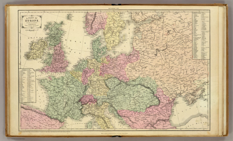
Author
Cornell, S. S. (Sarah S.)
Full Title
A part of Europe. Designed to accompany Cornell's High school geography. Entered ... 1856, by S.S. Cornell ... Southern District of New York. New York: D. Appleton & Co., 443 & 445 Broadway. (1864)
Publisher
Appleton & Co.
Author
[Fitch, George W., Jamison, Joseph]
Full Title
Europe. Drawn by (to be filled in. By George W. Fitch. New York: Sheldon, Blakeman and Company, 115 Nassau Street. Entered ... 1850, by Huntington and Savage ... New York)
Publisher
Blakeman, Sheldon & Co.
Author
Fitch, George W.
Full Title
Southern Europe. Drawn by (to be filled in. By George W. Fitch. New York: Sheldon, Blakeman and Company, 115 Nassau Street. Entered ... 1850, by Huntington and Savage ... New York)
Publisher
Blakeman, Sheldon & Co.
Author
[Gaultier, abbe (Aloisius Edouard Camille), 1746?-1818, Wauthier, J. M.]
Full Title
A plain map or emblematic chart for the geographical game of Europe, according to the method of the Abbe Gaultier. By Mr. Wauthier, his pupil, 1797.
Publisher
Harris and Son
Author
[Gaultier, abbe (Aloisius Edouard Camille), 1746?-1818, Wauthier, J. M.]
Full Title
A map of Europe, according to the method of the Abbe Gaultier by Mr. Wauthier, his pupil, 1799. Hewitt sc.
Publisher
Harris and Son
Author
[Gaultier, abbe (Aloisius Edouard Camille), 1746?-1818, Wauthier, J. M.]
Full Title
An outline map of the central part of Europe, according to the method of the Abbe Gaultier, by Mr. Wauthier, his pupil. (1821)
Publisher
Harris and Son
Author
[Gaultier, abbe (Aloisius Edouard Camille), 1746?-1818, Wauthier, J. M.]
Full Title
A plain map of the central part of Europe, according to the method of the Abbe Gaultier, by Mr. Wauthier, his pupil. 1799.
Publisher
Harris and Son
Full Title
Europe. J.H. Young Sc. (Philadelphia: John Grigg, No. 9 North Fourth Street. 1830)
Publisher
John Grigg
Full Title
Orbis Romani pars orientalis. W. Sim, Sc., New York. (1814?)
Publisher
R. M'Dermut
Full Title
L'Europe suivant ses nouvelles divisions. (A Paris, chez Delamarche, Geogr., ca. 1800)
Publisher
C.F. Delamarche
Full Title
Europe. Engraved for Morse's School geography. (Published by Richardson & Lord. Sold also by Collins & Hannay, New-York, 1828)
Publisher
Richardson & Lord
Full Title
Africa. J.W. Barber sc. (with) Outline of British Isles. (with) Outline of Europe. (Published by Richardson & Lord. Sold also by Collins & Hannay, New-York, 1828)
Publisher
Richardson & Lord
Author
Thomson, John
Full Title
Europe. J. & G. Menzies sculpt. (1817)
Publisher
[Baldwin, Cradock, and Joy, John Cumming, John Thomson]
Author
Thomson, John
Full Title
A map of Europe with the political divisions after the Peace of Paris and Congress of Vienna. Drawn & engraved for Thomson's New general atlas, 1816.
Publisher
[Baldwin, Cradock, and Joy, John Cumming, John Thomson]
Author
Thomson, John
Full Title
Europe after the Congress of Vienna. Neele sculpt., 352 Strand, London. Drawn & engraved for Thomson's New general atlas, 1816.
Publisher
[Baldwin, Cradock, and Joy, John Cumming, John Thomson]
Author
Thomson, John
Full Title
(Composite of) Europe after the Congress of Vienna. Neele sculpt., 352 Strand, London. Drawn & engraved for Thomson's New general atlas, 1816.
Publisher
[Baldwin, Cradock, and Joy, John Cumming, John Thomson]
Author
Lisle, Guillaume de, 1675-1726
Full Title
Carte d'Europe dressee pour l'usage de Roy sur les itineraires anciens et modernes et sur les routiers de mer assujetis aux observations astronomiques par G. Delisle Premier Geographe de S.M. de l'Academie Royale des Sciences. A Paris, chez l'Auteur Quay de l'Horloge avec Privilege, May 1724.
Publisher
Guillaume DeLisle, Quai de l'Horloge
Author
Lisle, Guillaume de, 1675-1726
Full Title
Les Isles Britanniques ou sont le Rme. d'Angleterre tire de Sped, celuy d'Ecosse tire de Th. Pont &c., et celuy d'Irelande tire de Petti. Le tout rectifie par diverses observations Par G. De l'Isle geographe de l'Academie Royale des Sciences. A Paris, chez l'Auteur sur le Quai de l'Horloge a l'Aigle d'Or. Avec Privilege du Roy pour 20 ans. Grave par J.B. Liebaux.
Publisher
Guillaume DeLisle, Quai de l'Horloge a l'Aigle d'Or
Author
Lisle, Guillaume de, 1675-1726
Full Title
Carte des Courones du Nord. (Northern section). Dediee au tres puissant et tres invincible Prince Charles XII, Roy de Suede, des Gots et des Vandales, Grand Duc de Finlande &c, &c, &c. Par son tres humble et tres obeissant serviteur Guillaume De l'Isle de l'Academie Rle. des Sciences, 1706. A Paris, chez l'Auteur sur le Quai de l'Orloge a avec Privilege du Roy. Grave par Liebaux le fils.
Publisher
Guillaume DeLisle, Quai de l'Horloge
Author
Lisle, Guillaume de, 1675-1726
Full Title
(Carte des Courones du Nord. (Southern section). Dediee au tres puissant et tres invincible Prince Charles XII, Roy de Suede, des Gots et des Vandales, Grand Duc de Finlande &c, &c, &c. Par son tres humble et tres obeissant serviteur Guillaume De l'Isle de l'Academie Rle. des Sciences, 1706. A Paris, chez l'Auteur sur le Quai de l'Orloge a avec Privilege du Roy). Grave par Liebaux le fils.
Publisher
Guillaume DeLisle, Quai de l'Horloge
Author
Lisle, Guillaume de, 1675-1726
Full Title
(Composite of) Carte des Courones du Nord. Dediee au tres puissant et tres invincible Prince Charles XII, Roy de Suede, des Gots et des Vandales, Grand Duc de Finlande &c, &c, &c. Par son tres humble et tres obeissant serviteur Guillaume De l'Isle de l'Academie Rle. des Sciences, 1706. A Paris, chez l'Auteur sur le Quai de l'Orloge a avec Privilege du Roy. Grave par Liebaux le fils.
Publisher
Guillaume DeLisle, Quai de l'Horloge
Author
[White, M. Wood, Young, James H.]
Full Title
Map of the Roman Empire at the period of its greatest extent. About the year A.D. 107. Engraved to illustrate Mitchell's ancient geography. (with) Map of Britannia Romanorum of Roman Britain. (with) Map of northern and central Syria. Drawn & engraved by J.H. Young. Entered according to Act of Congress in the year 1844 by S. Augustus Mitchell in the ... District Court of the eastern district of Pennsylvania. (1873)
Publisher
M.W. White
Author
Lisle, Guillaume de, 1675-1726
Full Title
Carte de Moscovie. (Northern section). Dressee par Guillaume De l'Isle de l'Academie royale des Sciences a Son Excellence Monseigneur Andre Artemonides de Matueof Ministre d'Etat de sa Majeste Csarienne l'Empereur des Russes, son Lieutenant gnal. en la Principaute de Jaroslavie ... Par son tres humble et tres obeisst. Serviteur De l'Isle. A Paris, chez l'Auteur sur le Quai de l'Horologe, avec Privilege, 1706. (Grave par Liebaux le fils)
Publisher
Guillaume DeLisle, Quai de l'Horloge
Author
Lisle, Guillaume de, 1675-1726
Full Title
(Carte de Moscovie. Southern section. Dressee par Guillaume De l'Isle de l'Academie royale des Sciences a Son Excellence Monseigneur Andre Artemonides de Matueof Ministre d'Etat de sa Majeste Csarienne l'Empereur des Russes, son Lieutenant gnal. en la Principaute de Jaroslavie ... Par son tres humble et tres obeisst. Serviteur De l'Isle. A Paris, chez l'Auteur sur le Quai de l'Horologe, avec Privilege, 1706). Grave par Liebaux le fils.
Publisher
Guillaume DeLisle, Quai de l'Horloge
Author
Lisle, Guillaume de, 1675-1726
Full Title
(Composite of) Carte de Moscovie. Dressee par Guillaume De l'Isle de l'Academie royale des Sciences a Son Excellence Monseigneur Andre Artemonides de Matueof Ministre d'Etat de sa Majeste Csarienne l'Empereur des Russes, son Lieutenant gnal. en la Principaute de Jaroslavie ... Par son tres humble et tres obeisst. Serviteur De l'Isle. A Paris, chez l'Auteur sur le Quai de l'Horologe, avec Privilege, 1706. Grave par Liebaux le fils.
Publisher
Guillaume DeLisle, Quai de l'Horloge
Author
Huntington, Francis Junius, 1802-1878
Full Title
Europe. Entered ... 12th day of Augut 1830 by F.J. Huntington ... Connecticut.
Publisher
F.J. Huntington
|