Who What Where WhenREMOVEWHATShow More |
Author
[Morse, Sidney E., Breese, S.]
Full Title
Maine. (to accompany) Supplement To The New-York Observer. The Cerographic Atlas Of The United States. By Sidney E. Morse, A.M. And Samuel Breese, A.M. New-York: Published By Sidney E. Morse & Co. 1842. [Entered ... 1841, by Sidney E. Morse and Samuel Breese ... New-York.]
Publisher
Sidney E. Morse & Co.
Author
Gray, O.W.
Full Title
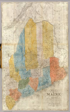
Gray's Atlas Map of Maine.
Publisher
Stedman, Brown & Lyon
Author
Finley, Anthony
Full Title
Map of Maine, New Hampshire, and Vermont, Compliled from the Latest Authorities.
Publisher
Anthony Finley
Author
[Colton, J.H., Gray, O.W.]
Full Title
Maine. Entered ... 1855 by J.H. Colton & Co. ....
Publisher
Stedman & Brown
Author
Cram, George Franklin
Full Title
Cram's Rail Road & County Map of New England.
Publisher
George F. Cram
Author
Appleton, D. & Co.
Full Title
Map of Maine. Copyright 1891 by Matthews-Northrup Co. ... Buffalo, New York. (inset) City of Portland and vicinity. (to accompany) The Library Atlas Of Modern Geography ... New York, D. Appleton And Company 1892. (on upper margin) Maine. 68.
Publisher
D. Appleton & Co.
Author
[Rand McNally and Company, State Farm Insurance Companies Travel Bureau]
Full Title
Rand McNally Road map: Maine, New Hampshire, Vermont. Copyright by Rand McNally & Company, Chicago, Ill. Lithorgaphed in the U.S.A. U.3633. (to accompany) State Farm road atlas : United States, Canada, Mexico. (inset) Northeastern Maine.
Publisher
State Farm Insurance Companies Travel Bureau
Author
[Taylor, Frank J., White, Ruth Taylor]
Full Title
Maine.
Publisher
Little, Brown, and Company
Author
[Morse, Sidney E., Breese, Samuel]
Full Title
Maine. (By Sidney E. Morse and Samuel Breese. New York: Published by Harper & Brothers, 1845). (to accompany) Morse's Cerographic Maps. No. IX.
Publisher
Harper and Brothers
Author
Mitchell, Samuel Augustus
Full Title
A New Map of Maine. Published By S. Augustus Mitchell, N.E. corner of Market & 7th Street Philada., 1846. Entered ... 1846 by H.N. Burroughs ... Pennsylvania.
Publisher
S.A. Mitchell
Author
Greenleaf, Moses, 1777-1834
Full Title
Map Of The State Of Maine With The Province Of New Brunswick By Moses Greenleaf. Engraved by J.H. Young & F. Dankworth, Philadelphia. Third Edition. Carefully revised and corrected from the latest official authorities. Jany. 1844. Entered ... 29th day of February 1828 by Moses Greenleaf ... Maine. (inset map of Nova Scotia and Gulf of St. Lawrence).
Publisher
Young, J.H.; Dankworth, E.
Author
[Chace, J., Walling, H. F.]
Full Title
Map Of The State Of Maine. From Surveys made by the United States Coast Survey, from the British and American Boundary Commissioners Survey, from the State Land Surveys, the New Brunswick Provincial Surveys, and from Actual Surveys by H.F. Walling & J. Chace Jr. ... H.F. Walling. Published By J. Chace Jr. & Co. 55 Exchange St. Portland. 1862. M. Clemens, T.W. Baker, Assistant Draughtsmen. W. Hatfield, Engraver, 132 Nassau St. J. Chace Jr., Sanborn & Carter, 55 Exchange St. Portland. Bailey & Noyes, 56 & 58 Exch. St. Portland. Entered ... by H.F. Walling & J. Chace Jr. ... New York. (inset) Map Of The United States Of America By H.F. Walling, 1861. Engraved by D. Griffing Johnson, N. York. (with 28 smaller inset maps).
Publisher
J. Chace Jr. & Co.
Author
Greenleaf, Moses, 1777-1834
Full Title
Map Of The State Of Maine With The Province Of New Brunswick By Moses Greenleaf. Engraved by J.H. Young & F. Dankworth, Philadelphia. Third Edition. Carefully revised and corrected from the latest official authorities. Jany. 1844. Entered ... 29th day of February 1828 by Moses Greenleaf ... Maine. (inset) Map of Nova Scotia and Gulf of St. Lawrence.
Publisher
Young, J.H.; Dankworth, E.
Author
Eldridge, George
Full Title
Eldridge's Chart From Cape Cod To Belle Isle, Including the Bay of Fundy, Gulf of St. Lawrence and Banks of Newfoundland ... From the latest surveys by the United States, Admiralty, French Marine & George Eldridge. 1866. Published by E.W. Carpenter. Geo. Eldridge, Hydrographer. Sold by S. Thaxter & Son. 125 State St. Boston. Entered ... 1864 ... Massachusetts. G.W. Boynton Sc. (with) seven insets listed in Notes.
Publisher
E.W. Carpenter
Author
Rand McNally and Company
Full Title
Rand, McNally & Co.'s New Shippers' Railroad Map of the United States. Scale: 8 miles to one inch. Showing all railroads, each in a separate color, and all railroad stations in large, plain type. This is the Montreal section, only, of the above-named map. (Below the neatline) Rand, McNally & Co.'s New Shippers' Railroad Map of the United States, Copyright, 1888 by Rand, McNally & Co. Copyright, 1891 by Rand, McNally & Co.
Publisher
Rand McNally & Co.
Author
Rand McNally and Company
Full Title
(Covers to) Rand, McNally & Co.'s New Shippers' Railroad Map of the United States. Scale: 8 miles to one inch. Showing all railroads, each in a separate color, and all railroad stations in large, plain type. This is the Montreal section, only, of the above-named map. (Below the neatline) Rand, McNally & Co.'s New Shippers' Railroad Map of the United States, Copyright, 1888 by Rand, McNally & Co. Copyright, 1891 by Rand, McNally & Co.
Publisher
Rand McNally & Co.
Author
Colton, J. H.
Full Title
Maine. 1853. Published By J.H. Colton. No. 86 Cedar St. New York. Entered ... 1853, by J.H. Colton ... New York.
Publisher
J.H. Colton
Author
Colton, J. H.
Full Title
(Covers to) Maine. 1853. Published By J.H. Colton. No. 86 Cedar St. New York. Entered ... 1853, by J.H. Colton ... New York.
Publisher
J.H. Colton
Author
Desilver, Charles
Full Title
(Covers to) A New Map of Maine. Published By Charles DeSilver No. 251 Market Street Philadelphia. 1857. Entered ... 1856 by Charles Desilver ... Pennsylvania.
Publisher
Charles Desilver
Author
Desilver, Charles
Full Title
A New Map of Maine. Published By Charles DeSilver No. 251 Market Street Philadelphia. 1857. Entered ... 1856 by Charles Desilver ... Pennsylvania.
Publisher
Charles Desilver
Author
[Carey, Mathew, Lewis, Samuel]
Full Title
The Province of Maine, From the best Authorities by Samuel Lewis, 1794. (above neat line) Engraved for Carey's American Edition of Guthrie's Geography improved.
Publisher
Mathew Carey
Author
American Telephone and Telegraph Company
Full Title
(Covers to) Lines And Metallic Circuit Connections. American Telephone and Telegraph Company. 15 Dey St., New York September 1898. (inset) Maine.
Publisher
No Publisher
Author
American Telephone and Telegraph Company
Full Title
Lines And Metallic Circuit Connections. American Telephone and Telegraph Company. 15 Dey St., New York September 1898. (inset) Maine.
Publisher
No Publisher
Author
Anson, W.
Full Title
(Covers to) Map Of Maine Constructed from the most Correct Surveys With Sectional Distances and Elevations or Level, of the St. Croix River from Calais Bridge. Deduced from the States Survey, Made by W. Anson, Civil Engineer, In 1836. Engraved & Published by by S.H. Colesworthy, Portland. 1843. Revised Edition.
Publisher
S.H. Colesworthy
Author
Anson, W.
Full Title
Map Of Maine Constructed from the most Correct Surveys With Sectional Distances and Elevations or Level, of the St. Croix River from Calais Bridge. Deduced from the States Survey, Made by W. Anson, Civil Engineer, In 1836. Engraved & Published by by S.H. Colesworthy, Portland. 1843. Revised Edition.
Publisher
S.H. Colesworthy
Author
Arbuckle Bros.
Full Title
South Carolina, Wisconsin, Maine, Michigan. Copyright 1889 Arbuckle Bros. N.Y.
Publisher
Arbuckle Bros.
Author
Mitchell, Samuel Augustus
Full Title
Map of Maine, New Hampshire And Vermont, Compiled From The Latest Authorities. Published by S. Augustus Mitchell Philadelphia. 1831. J.H. Young Sc. (inset) North Part of Maine.
Publisher
S.A. Mitchell
Author
Mitchell, Samuel Augustus
Full Title
County Map Of The State Of Maine. 11. (with) inset map Portland Har. And Vicinity. 12. Entered ... 1860, by S. Augustus Mitchell, Jr. ... Pennsylvania.
Publisher
S.A. Mitchell, Jr.
Author
USSR (Union of Soviet Socialist Republics).
Full Title
199. New England. The World Atlas.
Publisher
USSR
Author
Colton, G.W.
Full Title
Colton's Maine. Published By J. H. Colton. No. 172 William St. New York.
Publisher
J. H. Colton.
Author
Colton, G.W.
Full Title
Colton's Maine. Published by G. W & C. B. Colton & Co., No. 172 William St. New York.
Publisher
G. W & C. B. Colton & Co.
Author
Smith, J. Calvin
Full Title
(Quebec, New Brunswick, Maine, Vermont, New Hampshire).
Publisher
Theodor Fischer
Author
Finley, Anthony
Full Title
Map of Maine, New Hampshire, and Vermont Compiled from the Latest Authorities. Drawn by D.H. Vance. Published by A. Finley, Philada.
Publisher
Anthony Finley
Author
Hammond, C.S.
Full Title
Maine. 4366.
Publisher
Garden City Publishing Company, Inc.
Author
Johnson, A.J.
Full Title
Johnson's Maine By Johnson and Ward.
Publisher
Johnson and Ward
Author
Gray, Ormando Willis
Full Title
Gray's Atlas Map of Maine. New Hampshire.
Publisher
Stedman, Brown & Lyon
Author
Johnson, A.J.
Full Title
Johnson's Maine. Published by Alvin J. Johnson & Co., New York. 30. 31. Entered according to the Act of Congress, in the year 1866, by A.J. Johnson in the Clerk's Office of the District Court of the United States for the Southern District of New York.
Publisher
Alvin J. Johnson & Co.
Author
Rand McNally and Company
Full Title
(Text Page) Industrial Statistics of the United States. Kentucky. Louisiana. Maine.
Publisher
Rand McNally and Company
Author
Rand McNally and Company
Full Title
(Text Page) Industrial Statistics of the United States. Wisconsin. Wyoming. Maine - Counties, Islands, Lakes, Ponds, Rivers, Towns.
Publisher
Rand McNally and Company
Author
Rand McNally and Company
Full Title
Commercial Atlas of America. Rand McNally Standard Map of Maine.
Publisher
Rand McNally and Company
Author
Rand McNally and Company
Full Title
(Text Page) Maine - Counties, Islands, Lakes, Ponds, Rivers, Towns.
Publisher
Rand McNally and Company
Author
Rand McNally and Company
Full Title
Commercial Atlas of America. Rand McNally Auto Trails Map District No. 6. New England. Eastern New York.
Publisher
Rand McNally and Company
Author
Rand McNally and Company
Full Title
Commercial Atlas of America. Rand McNally Black and White Mileage Map, Maine.
Publisher
Rand McNally and Company
Author
Finley, Anthony
Full Title
Maine. Published by A. Finley Philada. Young & Delleker Sc.
Publisher
Anthony Finley
Author
Lucas, Fielding Jr.
Full Title
Maine. B.T. Welch & Co. Sc. Drawn & Published by F. Lucas Jr. Baltimore.
Publisher
Fielding Lucas Jr.
Author
Tanner, Henry S.
Full Title
A New Map of Maine By H.S. Tanner. Entered ... 1833 by H.S. Tanner ... Pennsylvania. Philadelphia: Published by H.S. Tanner. (above neat line) Tanner's Universal Atlas.
Publisher
H.S. Tanner
Author
Carey, Mathew
Full Title
The District of Maine. Engrd. by John G. Warnicke.
Publisher
Mathew Carey
Author
[Bartholomew, John, Black, Adam & Charles]
Full Title
Maine. Published by A. & C. Black. Edinburgh. Printed in Colours by Schenck & Macfariane. Edinburgh. Drawn & Engraved by J. Bartholomew, Edinburgh.
Publisher
A. & C. Black
Author
Mitchell, Samuel Augustus Jr.
Full Title
County and township map of the state of Maine. Copyright 1882 by Bradley & Company.
Publisher
Wm. M. Bradley & Bro.
|