Who What Where WhenREMOVEWHATShow More |
Full Title
Maryland. (Boston: Published by Thomas & Andrews. 1812)
Publisher
Thomas & Andrews
Author
[Gray, Ormando Willis, Lloyd, H.H., Martenet, Simon J., Walling, H. F.]
Full Title
(Covers to) New topographical atlas of the State of Maryland and the District of Columbia. With descriptions historical, scientific, and statistical, together with maps of the United States and Territories. By S.J. Martenet, H.F. Walling, and O.W. Gray, civil and topographical engineers. Published by Stedman, Brown & Lyon, Baltimore. 1873. (on verso ot title page) Entered ... 1872, by H.F. Walling, and O.W. Gray, and Simon J. Martenet ... Washington.
Publisher
Stedman, Brown & Lyon
Author
[Gray, Ormando Willis, Lloyd, H.H., Martenet, Simon J., Walling, H. F.]
Full Title
(Title Page to) New topographical atlas of the State of Maryland and the District of Columbia. With descriptions historical, scientific, and statistical, together with maps of the United States and Territories. By S.J. Martenet, H.F. Walling, and O.W. Gray, civil and topographical engineers. Published by Stedman, Brown & Lyon, Baltimore. 1873. (on verso) Entered ... 1872, by H.F. Walling, and O.W. Gray, and Simon J. Martenet ... Washington.
Publisher
Stedman, Brown & Lyon
Author
[Gray, Ormando Willis, Lloyd, H.H., Martenet, Simon J., Walling, H. F.]
Full Title
(Contents to) New topographical atlas of the State of Maryland and the District of Columbia. With descriptions historical, scientific, and statistical, together with maps of the United States and Territories. By S.J. Martenet, H.F. Walling, and O.W. Gray, civil and topographical engineers. Published by Stedman, Brown & Lyon, Baltimore. 1873. (on verso) Entered ... 1872, by H.F. Walling, and O.W. Gray, and Simon J. Martenet ... Washington.
Publisher
Stedman, Brown & Lyon
Author
Tyson, Philip T.
Full Title
Map of Maryland and the District of Columbia, colored to illustrate the geological formations by Philip T. Tyson. L.E. Neuman, eng. , 36 Vesey St., N.Y. (Published by Stedman, Brown & Lyon, Baltimore. 1873)
Publisher
Stedman, Brown & Lyon
Author
Blodget, Lorin
Full Title
Climatological map of the State of Maryland and the District of Columbia, by Lorin Blodget, 1873. (Published by Stedman, Brown & Lyon, Baltimore. 1873)
Publisher
Stedman, Brown & Lyon
Author
[Gray, Ormando Willis, Martenet, Simon J., Walling, H. F.]
Full Title
City of Baltimore. (Published by Stedman, Brown & Lyon, Baltimore. 1873)
Publisher
Stedman, Brown & Lyon
Author
[Gray, Ormando Willis, Martenet, Simon J., Walling, H. F.]
Full Title
City of Cumberland, Alleghany Co., Maryland. (Published by Stedman, Brown & Lyon, Baltimore. 1873)
Publisher
Stedman, Brown & Lyon
Author
[Gray, Ormando Willis, Martenet, Simon J., Walling, H. F.]
Full Title
Hagerstown. (with) Annapolis, the state capital. (with) Frederick City. (Published by Stedman, Brown & Lyon, Baltimore. 1873)
Publisher
Stedman, Brown & Lyon
Author
Gray, Frank Arnold
Full Title
New railroad map of the states of Maryland, Delaware, and the District of Columbia. Compiled and drawn by Frank Arnold Gray, 1873. (Published by Stedman, Brown & Lyon, Baltimore. 1873)
Publisher
Stedman, Brown & Lyon
Author
[Gray, Ormando Willis, Martenet, Simon J., Walling, H. F.]
Full Title
Topographical atlas of Maryland: counties of Alleghany and Garrett. (Published by Stedman, Brown & Lyon, Baltimore. 1873)
Publisher
Stedman, Brown & Lyon
Author
[Gray, Ormando Willis, Martenet, Simon J., Walling, H. F.]
Full Title
Topographical atlas of Maryland: County of Washington. (Published by Stedman, Brown & Lyon, Baltimore. 1873)
Publisher
Stedman, Brown & Lyon
Author
[Gray, Ormando Willis, Martenet, Simon J., Walling, H. F.]
Full Title
Topographical atlas of Maryland: counties of Carroll and Frederick. (Published by Stedman, Brown & Lyon, Baltimore. 1873)
Publisher
Stedman, Brown & Lyon
Author
[Gray, Ormando Willis, Martenet, Simon J., Walling, H. F.]
Full Title
Topographical atlas of Maryland: counties of Baltimore and Harford. (Published by Stedman, Brown & Lyon, Baltimore. 1873)
Publisher
Stedman, Brown & Lyon
Author
[Gray, Ormando Willis, Martenet, Simon J., Walling, H. F.]
Full Title
Topographical atlas of Maryland: counties of Cecil and Kent. (Published by Stedman, Brown & Lyon, Baltimore. 1873)
Publisher
Stedman, Brown & Lyon
Author
[Gray, Ormando Willis, Martenet, Simon J., Walling, H. F.]
Full Title
Topographical atlas of Maryland: counties of Howard and Montgomery and the District of Columbia. (Published by Stedman, Brown & Lyon, Baltimore. 1873)
Publisher
Stedman, Brown & Lyon
Author
[Gray, Ormando Willis, Martenet, Simon J., Walling, H. F.]
Full Title
Topographical atlas of Maryland: counties of Anne Arundel and Prince George. (Published by Stedman, Brown & Lyon, Baltimore. 1873)
Publisher
Stedman, Brown & Lyon
Author
[Gray, Ormando Willis, Martenet, Simon J., Walling, H. F.]
Full Title
Topographical atlas of Maryland: counties of Calvert, Charles and St. Marys. (Published by Stedman, Brown & Lyon, Baltimore. 1873)
Publisher
Stedman, Brown & Lyon
Author
[Gray, Ormando Willis, Martenet, Simon J., Walling, H. F.]
Full Title
Topographical atlas of Maryland: counties of Caroline, Queen Anne and Talbot. (Published by Stedman, Brown & Lyon, Baltimore. 1873)
Publisher
Stedman, Brown & Lyon
Author
[Gray, Ormando Willis, Martenet, Simon J., Walling, H. F.]
Full Title
Topographical atlas of Maryland: counties of Dorchester, Wicomico, Somerset and Worcester. (Published by Stedman, Brown & Lyon, Baltimore. 1873)
Publisher
Stedman, Brown & Lyon
Author
Goodrich, S.G.
Full Title
New York. N. Jersey, Pennsylvania, Delaware & Maryland. G. Boynton Sc. Entered ... by S.G. Goodrich of Massachusetts. (Boston: Gray & Bowen ... 1831)
Publisher
Gray & Bowen
Full Title
(Map of Virginia, Maryland and Delaware. Raleigh: Branson, Farrar & Co., Publishers. Biblical Recorder Print. 1863)
Publisher
Branson, Farrar & Co.
Full Title
Plan of Baltimore. Copyright 1887 by Wm. M. Bradley & Bro. (1890)
Publisher
John Y. Huber & Co.
Full Title
County map of the states of Delaware, Maryland, Virginia and West Virginia. Copyright 1887 by Wm. M. Bradley & Bro. (1890)
Publisher
John Y. Huber & Co.
Full Title
Maryland. (inset) Western part of Maryland. (Philadelphia: Robert DeSilver, 1827)
Publisher
Robert DeSilver
Full Title
Virginia, Maryland and Delaware. (with District of Columbia). (with Baltimore and vicinity). N. & S.S. Jocelyn Sc. (New-Haven: N. & S.S. Jocelyn. 1823)
Publisher
N. & S.S. Jocelyn
Author
Mitchell, Samuel Augustus
Full Title
County map of New Jersey. County map of Maryland and Delaware. Drawn and engraved by W.H. Gamble, Philadelphia. Entered ... 1870 by S. Augustus Mitchell, Jr. ... Pennsylvania.
Publisher
[R.A. Campbell, S.A. Mitchell, Jr.]
Author
Mitchell, Samuel Augustus
Full Title
Plan of Baltimore. Entered ... 1870 by S. Augustus Mitchell, Jr. ... Pennsylvania.
Publisher
[R.A. Campbell, S.A. Mitchell, Jr.]
Author
Mitchell, Samuel Augustus
Full Title
County map of New Jersey. County map of Maryland and Delaware. Drawn and engraved by W.H. Gamble, Philadelphia. Entered ... 1879 by S. Augustus Mitchell ... Washington. (1880)
Publisher
S.A. Mitchell
Author
Mitchell, Samuel Augustus
Full Title
Plan of Baltimore. Entered ... 1879 by S. Augustus Mitchell ... Washington. (1880)
Publisher
S.A. Mitchell
Author
Greenleaf, Jeremiah
Full Title
Delaware And Mary-land, (with) The Western Part Of Mary-land.
Publisher
G.R. French
Author
Carey, Mathew
Full Title
Maryland. (with) Maryland West of Ft. Cumberland. W. Barker sculp.
Publisher
Lang and Ustick
Author
Tanner, Henry S.
Full Title
Virginia, Maryland and Delaware By H.S. Tanner. Engraved & Published by H.S. Tanner, Philadelphia. Engraved by H.S. Tanner & Assistants. Entered ... 20th day of Decr. 1820, by H.S. Tanner... Pennsylvania. American Atlas.
Publisher
Henry Tanner
Author
Tanner, Henry S.
Full Title
Virginia, Maryland and Delaware By H.S. Tanner. Engraved & Published by H.S. Tanner, Philadelphia. Engraved by H.S. Tanner & Assistants. Entered ... 20th day of Decr. 1820, by H.S. Tanner... Pennsylvania. American Atlas.
Publisher
Henry Tanner
Author
Melish, John
Full Title
Map of the American Coast, from Lynhaven Bay to Narraganset Bay, by John Melish.
Publisher
John Melish
Author
Carey, Mathew
Full Title
The State of Maryland, from the best Authorities. by Samuel Lewis. W. Barker sculp. (with) Continuation of the Potowmac River, from Fort Cumberland. Engraved for Carey's American Edition of Guthrie's Geography improved.
Publisher
Mathew Carey
Author
[Bowen, Emanuel, Gibson, John]
Full Title
Pennsylvania, Maryland And Virginia. (to accompany) Atlas Minimus or a New Set of Pocket Maps of the Several Empires, Kingdoms and States of the Known World, with Historical Extracts relative to each. Drawn and Engraved by J. Gibson from the Best Authorities, Revis'd, Corrected and Improv'd by Eman: Bowen Geographer to His Majesty.
Publisher
J. Newberry
Author
Carey, Mathew
Full Title
The State of Maryland, from the best Authorities. by Samuel Lewis. W. Barker sculp. (with) Continuation of the Potowmac River, from Fort Cumberland. Engraved for Carey's American Edition of Guthrie's Geography improved.
Publisher
Mathew Carey
Author
Mitchell, Samuel Augustus
Full Title
A New Map of Maryland and Delaware by J.L. Hazzard. Published By Charles Desilver, No. 714 Chesnut Street, Philadelphia. 1860 Entered according to Act of Congress in the year 1859 by Charles Desilver in the Clerk's office if the District Court of the Eastern District of Pennsylvania. 15.
Publisher
Charles Desilver.
Author
[Rand McNally and Company, State Farm Insurance Companies Travel Bureau]
Full Title
Rand McNally Road map, Delaware, Maryland, Virginia, West Virginia. Copyright by Rand McNally & Company, Chicago, Ill. Lithographed in the U.S.A. (to accompany) State Farm Road Atlas: United States, Canada, Mexico,Central and South America. Copyright 1940 by Rand McNally & Company, Chicago, Ill.
Publisher
State Farm Insurance Companies Travel Bureau
Author
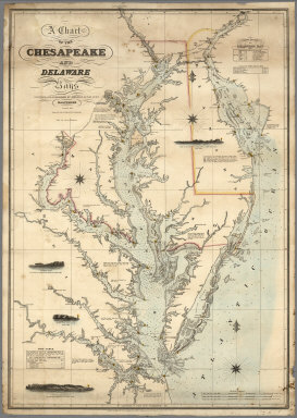
Lucas, Fielding Jr.
Full Title
A Chart of the Chesapeake And Delaware Bays Compiled And Published By Fielding Lucas Junr. Baltimore. Corrected_1862. Engraved by John and William W. Warr Philadelphia. Sold by Lucas Brothers. Drawn by F. Lucas Jr. Entered ... 1852 by Fielding Lucas Jr. ... Maryland.
Publisher
Fielding, Lucas Jr.
Author
Carey, Mathew
Full Title
The State of Maryland, from the best Authorities. by Samuel Lewis. W. Barker sculp. (with) Continuation of the Potowmac River, from Fort Cumberland. Engraved for Carey's American Edition of Guthrie's Geography improved.
Publisher
M. Carey
Author
[Carey, Henry Charles, Lea, Isaac]
Full Title
Virginia, Maryland and Delaware. J.G. Melish, del. Kneass, Sc. (to accompany) The Juvenile Atlas or a Series Of Maps, To Illustrate the Old and New Worlds ...1822.
Publisher
H.C. Carey & I. Lea
Author
Hillebrands, A.J.
Full Title
Atlas de Vereenigde Staten No. 4. Pennsylvania, New Jersey, Delaware, Maryland en Virginia.
Publisher
[J. Oomkens, J. Zoon]
Author
Bradstreet Company
Full Title
Delaware, Maryland. (to accompany) Bradstreet's Pocket Atlas Of The United States. Published Exclusively for Macullar, Parker & Company, Boston, Massachusetts ... New York: The Bradstreet Company, 1885. (on verso) Entered ... 1879, by The Bradstreet Company ... Washington.
Publisher
Bradstreet Co.
Author
Tanner, Henry S.
Full Title
Virginia, Maryland And Delaware. (to accompany) A New Pocket Atlas of the United States With The Roads and Distances, Designed For the Use of Travelers. By H.S. Tanner. Philadelphia: Published by the Author. 1828. (on verso) ...on the seventeenth day of November ... 1828, Henry S. Tanner ... hath deposited ... a book ... Pennsylvania.
Publisher
H.S.Tanner
Author
Cram, George Franklin
Full Title
New Rail Road and County Map of Deleware (Delaware), Maryland, Virginia & West Virginia.
Publisher
A.C. Shewey and Co.
Author
Tanner, Henry S.
Full Title
Virginia Maryland And Delaware By H.S. Tanner. American Atlas. Engraved & Published by H.S. Tanner, Philadelphia. Improved To 1825. Entered ... 20th day of Decr. 1820, by H.S. Tanner ... Pennsylvania.
Publisher
Henry Tanner
Author
Ensign, Bridgman & Fanning
Full Title
Our Nation's Camp Ground. Published By Ensign, Bridgman & Fanning, 156 William Street, N.Y. (with) Two inset maps of the Mid-Atlantic States and Washington. (with) 6 inset pictures.
Publisher
Ensign, Bridgman & Fanning
Author
[Grant, M. B., Howell, R. H.]
Full Title
Map of the seat of war. Published by T.A. Burke, Morning News Office. Compiled & drawn by M.B. Grant C.E. Lithographed by R.H. Howell, Savannah.
Publisher
T.A. Burke
|