Search Results:

1953 Conservation of Resources. World Atlas Conservation of Resources. |

1816 Comparative View Of The Heights Of The P … Wall Map Comparative View Of The Heights Of The P … |

1844 Welt-Karte, Mercators Proj. World Atlas Welt-Karte in Mercators Projektion. Nach … |

1860 Welt-Karte, Globular-Proj. World Atlas Erd-Karte in der Globular-Projektion. Zu … |

1849 Covers: School Atlas To Accompany Modern … School Atlas (Covers to) Modern Atlas, Physical, Poli … |

1849 Title Page: Modern Atlas, Physical, Poli … School Atlas (Title Page to) Modern Atlas, Physical, … |

1849 Statistical Tables: Geographical And Sta … School Atlas (Statistical Tables to) Geographical And … |

1849 Statistical Tables:The Extent And Popula … School Atlas (Statistical Tables to) Tables Of The Ex … |

1849 Statistical Tables: Population Of The Un … School Atlas (Statistical Tables to) Table Of The Pop … |

1849 Map Of The World. Adapted To Woodbridge' … School Atlas Map Of The World. Adapted To Woodbridge' … |

1849 Moral And Political Chart Of The Inhabit … School Atlas Moral And Political Chart Of The Inhabit … |

1849 Isothermal Chart Or View Of Climates School Atlas Isothermal Chart Or View Of Climates: Sh … |

1849 Chart of the Extent of Countries School Atlas Comparative Chart of the Extent of Count … |

1816 Covers: Maps Of The World And Quarters World Atlas (Covers to) A General Atlas, Being A Col … |
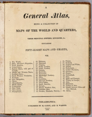
1816 Title Page: Maps Of The World And Quarte … World Atlas (Title Page to) A General Atlas, Being A … |

1816 The World World Atlas The World. From Arrowsmith's Map of the … |

1816 Chart Of The World On Mercators Projecti … World Atlas Chart Of The World On Mercators Projecti … |

1880 Text: The World. World Atlas (Text Page) The World. |

1880 Chart of the World on Mercator's Project … World Atlas Chart of the World on Mercator's Project … |

1880 Text: Europe. Physical. World Atlas (Text Page) Europe. Physical. |

1880 Text: Europe. Political. World Atlas (Text Page) Europe. Political. |

1890 Cover: Arbuckles' Illustrated Atlas of T … World Atlas (Cover to) Arbuckles' Illustrated Atlas … |

1890 (World Map labeled Arbuckles' Ariosa Cof … World Atlas (World Map labeled Arbuckles' Ariosa Cof … |

1856 Rivers and Lakes (key) World Atlas Principal rivers and lakes in the World. … |

1953 Covers: World Geo-graphic Atlas. World Atlas (Covers to) World Geo-graphic Atlas, A C … |

1953 Text Page: Addenda and Corrigenda. World Atlas (Text Page) Addenda and Corrigenda at ti … |

1953 Half Title: World Geo-graphic Atlas. World Atlas (Half Title Page) World Geo-graphic Atla … |

1953 Title Page: World Geo-graphic Atlas, A C … World Atlas (Title Page) World Geo-graphic Atlas, A … |

1953 Text Page: Preface. Foreward. World Atlas (Text Page) Preface. Foreward. |

1953 Table of Contents: World Geo-graphic Atl … World Atlas (Table of Contents to) World Geo-graphic … |

1953 Text Page: Astronomy. The Moon. Our Plan … World Atlas (Text Page) Astronomy. The Moon. Our Pla … |

1953 Text Page: Geology. World Atlas (Text Page) Geology. |

1953 World. Physical. World Atlas World. Physical. |

1953 World. Climatic Regions. World Atlas World. Climatic Regions. |

1953 World. Pressure and Predominant Winds. T … World Atlas World. Pressure and Predominant Winds. W … |

1953 World. Annual Rainfall and Ocean Current … World Atlas World. Annual Rainfall and Ocean Current … |

1953 World. Natural Vegetation. World Atlas World. Natural Vegetation. |

1953 World. Great Soil Groups. World Atlas World. Great Soil Groups. |

1798 A New Map of the World Separate Map A New Map of the World, with all the New … |

1847 World At One View, 1847 Broadside World At One View. Entered ... 1847, by … |

1864 Overland Telegraph via Behrings Strait a … Separate Map P. McD. Collins' Proposed Overland Teleg … |

1850 The World, on Mercator's Projection Separate Map The World, on Mercator's Projection: By … |

1850 Chart Prepared By James B. Moore Separate Map Chart Prepared By James B. Moore, To Acc … |

1909 (Map of the World) Complement of The Man … Ephemera (Map of the World) by The Manufacturers … |

1923 United States Shipping Board Services to … Separate Map United States Shipping Board Services to … |

1885 Domestic And Foreign Missions Of The Met … Separate Map Domestic And Foreign Missions Of The Met … |

1885 Text: Domestic And Foreign Missions Of T … Separate Map (Text to) One Million For Missions ... J … |

1959 Iraq, Suez Canal, Europe, Australia, Mal … Separate Map Map of Iraq; Map of the Suez Canal; Map … |

1959 Iraq, Suez Canal, Europe, Australia, Mal … Separate Map Map of the Western Mediterranean; Map of … |

1876 Map Of The World on Mercator's Projectio … State Atlas Map of the world on Mercator's projectio … |