Who What Where WhenREMOVE |
Author
Sinclair, Thomas
Full Title
(Covers to) Map of Mexico Showing the Seat of War. Lith. of T. Sinclair, 79 So. 3rd St. Philadelphia.
Publisher
Thomas Sinclair
Author
California State Board of Trade
Full Title
(Covers to:) California hand book with state and county maps by the California State Board of Trade in association supported by voluntary contributions. San Francisco. (1892?)
Publisher
California State Board of Trade
Author
California State Board of Trade
Full Title
(Covers to:) California resources and possibilities. Eighteenth annual report of the California State Board of Trade for the year 1907. Submitted March 10th, 1908.
Publisher
California State Board of Trade
Author
Whitney, J.D.
Full Title
(Covers to) The Yosemite Book; A Description of the Yosemite Valley and the Adjacent Region of the Sierra Nevada, and of the Big Trees of California, Illustrated by Maps and Photographs. Geological Survey of California. J.D. Whitney, State Geologist. Published by Authority of the Legislature. New York, Julius Bien. 1868.
Publisher
Julius Bien
Author
[Gibbes, C.D., Holt, Warren]
Full Title
(Covers to) Map of the States Of California And Nevada. Carefully Compiled from the Latest Authentic Sources. By Chas. Drayton Gibbes, C.E. Comprising Information obtained from the U.S. Coast And Land Surveys ... And Others. Published by Warren Holt. No. 607 Clay Street, San Francisco, Cal. 1873. Entered ... 1873 by Warren Holt ... Washington. S. Blinton Formerly of the U.S. Coast Survey Draughtsman & Lithographer. 148-1/2 S. Fourth Street, Philadelphia, Pa.
Publisher
Warren Holt
Author
Reynolds & Proctor
Full Title
(Covers to) Illustrated atlas of Sonoma County, California. Compiled and published from personal examinations, official records and actual surveys. Published by Reynolds & Proctor, Santa Rosa, Cal. Entered ... 1897, by Reynolds & Proctor, Santa Rosa, Cal. (1898)
Publisher
Reynolds & Proctor
Author
Hartmann, Carl
Full Title
(Covers to) Die wichtigsten Hafen und Rheden, sowie die Goldregion von Californien. (with 10 maps:) Bai und Hafen von San Francisco. Der Hafen San Pedro. Das Stromgebiet des San Sacramento nebst den Goldlager-statten. Der Haven von San Francisco. Bai und Hafen von MonteRey. Mundungen der Flusse Colorado und Gila. Bai und Hafen von San Diego. Bai und Hafen von Santa Barbara. Der Hafen von la Paz und Bai von Pichilingue. Die Bai la Trinidad. Alfr. Hartmann, Architect, entworf. Zu Hartmanns zweiten Bericht uber Californien. Weimar, 1849. Verlag und Lithographie von B.F. Voigt.
Publisher
Bernh. Fr. Voigt
Author
Britton & Rey
Full Title
(Covers to) Britton & Rey's Guide Map of the City of San Francisco. 1887. Copyright. (with) Geo. F. Schild's Map Attachment. Patented Dec. 8th 1885. (and with) Index of Britton & Rey's Street Guide Map of the City and County of San Francisco, with Geo. F. Schild's Patented Attachment for Finding Instantly Any Point or Distance on Map. (on verso) Map: Copyrighted by Britton & Rey, August, 1886. Attachment: Patented by Geo. F. Schild, December 8th, 1885.
Publisher
Britton & Rey
Author
Eddy, William M.
Full Title
(covers to) Approved and declared to be the official map of the State of California by an act of the Legislature passed March 25th 1853. Compiled by W.M. Eddy State Surveyor General. Published for R.A. Eddy, Marysville, California by J.H. Colton, No. 86 Cedar St. New York 1854. Authorities --- (with inset:) San Francisco and Adjoining Bays. Engraved on stone by Schedler & Liebler, 129 William St. New York. Printed by D. McLellan, 26 Spruce St. N.Y. Entered according to act of Congress in the year 1853 by Wm. M. Eddy in the Clerk's Office of the District Court of the United States for the Northern District of California.
Publisher
R.A. Eddy
Author
[Rhea, J. J., Sierra Art & Engraving Co.]
Full Title
(Covers to) Alameda County, California. Sierra Art & Eng. Designed by J.J. Rhea, Oakland, Cal. Printed by Kelley-Davis Co., Oakland, Cal. (1914)
Publisher
Kelley-Davis Co.
Author
[Gifford, C. B. (Charles B.), Nagel, L. (Louis)]
Full Title
(Covers to) San Francisco, 1862. From Russian Hill. C.B. Gifford, del. et lith. Printed by L. Nagel, S.F. Published by A. Rosenfield, S.F. Entered according to Act of Congress in the year 1862 by A. Rosenfield ... Northern District of California. (label) Panoramic view of San Francisco.
Publisher
A. Rosenfield.
Author
[Bancroft, H.H., (Knight, W.H.)]
Full Title
(Covers to) Bancroft's Map Of California And Nevada. Published By H.H. Bancroft & Co. Booksellers & Stationers San Francisco Cal. 1868. Entered ... 1868 by H.H. Bancroft & Company ... California.
Publisher
H.H. Bancroft & Co.
Author
Free House Renting Bureau (Sterling Furniture company, Bunster & Saxe).
Full Title
(Covers to) Free Map of San Francisco. Free House Renting Bureau ... Sterling Furniture Company Bunster & Saxe 1049 Market St., Opposite Granada Theater. (on verso: untitled view map of San Francisco).
Publisher
Free House Renting Bureau
Author
Faust, H.W.
Full Title
(Covers to) Faust's Map Of City And County Of San Francisco California. Published By H.W. Faust. Latest Edition 1903. Copyrighted by H.W. Faust, 1903. Galloway Litho. Co. S.F. (inset) General View Of San Francisco Bay.
Publisher
H.W. Faust
Author
Thomas Bros.
Full Title
(Covers to) Thomas Bros. New Map Of City And County Of San Francisco. Published By Thomas Bros. Map Publishers, 461 Market Street, San Francisco ... 361 7th Street, Oakland ... Copyrighted By Thomas Bros. (on verso) New Map Of Oakland, Berkeley, Alameda, San Leandro, Piedmont, Emeryville, Albany ...
Publisher
Thomas Bros.
Author
Colton, G.W. & C.B.
Full Title
(Covers to) Colton's California And Nevada Edition Prepared For Payot, Upham & Company, Wholesale And Importing Stationers, Booksellers, Printers And Blank Book Manufacturers, 204 Sansome Street, San Francisco, Cal. 1883. Entered ... 1873 by G.W. & C.B. Colton & Co. ... Washington.
Publisher
G.W. & C.B. Colton & Co.
Author
Colton, G.W. and C.B.
Full Title
(Covers to) Colton's California and Nevada. Published by G.W. and C.B. Colton & Co. No. 182 William St. New York. Entered ... 1873 by G.W. & C.B. Colton & Co. ... Washington.
Publisher
G.W. & C.B. Colton & Co.
Author
[H.M. Gousha Company, Tide Water Associated Oil Company]
Full Title
(Covers to) Street map of San Francisco. 1 inch = about six-tenths miles. Copyright by The H.M. Goushá Company Chicago, San Jose. Lithographed in U.S.A. ((inset) Downtown San Francisco. (onverso) San Francisco Bay Region and Adjacent Area. (prepared for) Flying A Ethyl Gasoline. Scale--one inch equals approx. 4 1/2 miles. Copyright by The H.M. Goushá Company Chicago, San Jose. Lithographed in U.S.A. by Schwabacher-Frey. (with panel title) Let's get associated, San Francisco and Bay Region. Flying "A" Service. Tide Water Associated oil Company.
Publisher
H.M. Goushá & Company
Author
Faust, H.W.
Full Title
(Covers to) Faust's Map Of City And County Of San Francisco California. Published By H.W. Faust. Copyrighted 1892. Galloway Litho. Co. S.F. (inset) General View Of San Francisco Bay.
Publisher
H.W. Faust
Author
Bancroft Company, The.
Full Title
(Covers to) Bancroft's Official Guide Map Of City And County Of San Francisco, Compiled From Official Maps In Surveyor's Office. Published by The Bancroft Company Booksellers, Stationers, Printers, Lithographers, etc. San Francisco, 1891. (inset) Skeleton Map Showing the relative position of San Francisco to the Surrounding Country.
Publisher
The Bancroft Co.
Author
Bancroft Company, The
Full Title
(Covers to) Bancroft's Official Guide Map Of City And County Of San Francisco, Compiled From Official Maps In Surveyor's Office. Published by The Bancroft Company Booksellers, Stationers, Printers, Lithographers, etc. San Francisco, 1887. (inset) Skeleton Map Showing the relative position of San Francisco to the Surrounding Country.
Publisher
The Bancroft Co.
Author
[Doolittle, A.J., Holt, A.J., Ransom, Leander]
Full Title
(Covers to) A New Map Of The States Of California And Nevada Exhibiting the Rivers, Lakes, Bays and Islands, with the principal Towns, Roads, Railroads and Transit Routes to the Silver Mining Districts of Nevada Territory ... Carefully compiled from United States and other Reliable Surveys by Leander Ransom. And A.J. Doolittle, 1868. W. Holt, 411 Kearney St. S.F. Entered ... 1863 by Warren Holt ... California.
Publisher
Warren Holt
Author
[Gibbes, C.D., Holt, Warren]
Full Title
(Covers to) Map of the States Of California And Nevada. Carefully Compiled from the Latest Authentic Sources. By Chas. Drayton Gibbes, C.E. Comprising Information obtained from the U.S. Coast And Land Surveys ... And Others. Published by Warren Holt. No. 624 Montgomery St., San Francisco, Cal. 1875. Entered ... 1875 by Warren Holt ... Washington. S. Blinton Formerly of the U.S. Coast Survey Draughtsman & Lithographer. 148-1/2 S. Fourth Street, Philadelphia, Pa.
Publisher
Warren Holt
Author
Jackson, William A.
Full Title
(Covers to) Map Of The Mining District of California by Wm. A. Jackson. Published by Lambert & Lane, 69 Wall St. New York. Entered ... 1851 by Lambert & Lane ... New York. (with 16 page appendix) Appendix To Jackson's Map Of The Mining Districts Of California. ... Second Edition, Revised And Enlarged. New-York: Lambert & Lane, 69 Wall-Street. 1851.
Publisher
Lambert & Lane
Author
Mitchell, Samuel Augustus
Full Title
(Covers to) A New Map of Texas Oregon and California With The Regions Adjoining. Compiled from the most recent authorities. Philadelphia Published by S. Augustus Mitchell N.E. Corner Of Market & Seventh Streets. 1846. Entered ... 1845 by H.N. Burroughs ... Pennsylvania.
Publisher
S.A. Mitchell
Author
Langley, Henry G.
Full Title
(Covers to) A Map And Street Directory Of San Francisco: To Which Are Added Many Items ... Useful For Strangers Visiting The Metropolis of the Pacific. Price Seventy-Five Cents. San Francisco: Henry G. Langley, 612 Clay St. 1870. (on verso) Entered ... 1870, By Henry G. Langley ... California. (with) Map Of San Francisco From the Latest Survey. Engraved Expressly For The San Francisco Directory. 1870. Lith. Britton & Rey S.F.
Publisher
Henry G. Langley
Author
Faust, H.W.
Full Title
(Covers to) Faust's Map & Guide Of San Francisco. Published by H.W. Faust. Entered by H.W. Faust ... Washington, D.C., June 1882. Galloway Litho. Co., 422 Commercial St., S.F. Compiled By P. Spitze. C.E. (inset) Map Of The City & County Of San Francisco. (inset) General View Of San Francisco Bay.
Publisher
H.W. Faust
Author
Colton, J.H.
Full Title
(Covers to) Colton's California 1861. Published By J.H. Colton, 172 William St. New York. York. Entered ... 1855 by J.H. Colton ... New York. (inset) City Of San Francisco.
Publisher
J.H. Colton
Author
[C.F. Weber & Co., Punnett Brothers]
Full Title
(Covers to) Weber's Map of Santa Cruz County, California ; showing towns, steam and electric railroads, wagon and automobile roads, township and section lines, rivers, creeks, reclamation and irrigation districts, etc. Compiled from the latest official and private sources. Published by C.F. Weber & Co., San Francisco, Los Angeles. Copyright 1914 by Punnett Brothers. (2 insets) City of Santa Cruz, and Watsonville.
Publisher
C.F. Weber & Co.
Author
[C.F. Weber & Co., Punnett Brothers]
Full Title
(Covers to) Weber's Map of Plumas County, California ; showing towns, steam and electric railroads, wagon and automobile roads, township and section lines, rivers, creeks, reclamation and irrigation districts, etc. Compiled from the latest official and private sources. Published by C.F. Weber & Co., San Francisco, Los Angeles. Copyright 1914 by Punnett Brothers.
Publisher
C.F. Weber & Co.
Author
Thompson, Thos. H.
Full Title
(Covers to) Official historical atlas map of Fresno County. Office of the Board of Supervisors of Fresno County, California ... Compiled, drawn and published from personal examinations and surveys by Thos. H. Thompson, Tulare, California, 1891.
Publisher
Thompson Thos. H.
Author
Thompson, Thos. H.
Full Title
(Covers to) Official historical atlas map of Tulare County ... compiled, drawn and published from personal examinations and surveys by Thos. H. Thompson, Tulare, California. 1892.
Publisher
T.H. Thompson
Author
[United States. Post Office Dept., Von Haake, A.]
Full Title
(Covers to) Post route map of the states of California and Nevada showing post offices with the intermediate distances and mail routes in operation on the 1st of June, 1896. Published by order of Postmaster General William L. Wilson under the direction of A. von Haake, Topographer, P.O. Dept. (Washington, D.C., 1896)
Publisher
U.S. Post Office
Author
United States. Post Office Dept.
Full Title
(Covers to) Post route map of the states of California and Nevada, showing post offices with the intermediate distances between them, and mail routes. (Northwest sheet. Washington, D.C., 1901)
Publisher
U.S. Post Office
Author
[Bennett, Edward H., Burnham, Daniel Hudson]
Full Title
(Covers to) Report on a plan for San Francisco by Daniel H. Burnham. Assisted by Edward H. Bennett. Presented to the Mayor and Board of Supervisors by the Association for the Improvement and Adornment of San Francisco. Edited by Edward F. O'Day. September, MCMV. Published by the City.
Publisher
City of San Francisco
Author
[Branner, John Casper, California. State Earthquake Investigation Commission, Gilbert, G. K., Lawson, Andrew C., Reid, Harry Fielding]
Full Title
(Covers to) Atlas of maps and seismograms accompanying the report of the State Earthquake Investigation Commission upon the California earthquake of April 18, 1906. Andrew C. Lawson, G.K. Gilbert, H.F. Reid, J.C. Branner, A.O. Leuschner, George Davidson, Charles Burckhalter, W.W. Campbell. Carnegie Institution of Washington. Washington, D.C. 1908. (seal) Carnegie Institution of Washington 1902.
Publisher
Carnegie Institution
Author
Chevalier, August
Full Title
(Covers to) The commercial, pictorial and tourist map of San Francisco. Copyrighted by Aug. Chevalier, Publisher, 331 Kearny Street. 1st edition 1904.
Publisher
Aug. Chevalier
Author
Pacific Coast Steamship Co.
Full Title
(Covers to) Pacific Coast Steamship Co. February to May 1896, Inc. ... Goodall Perkins & Co. General Agents, 10 Market Street, San Francisco, Cal. Ticket Office 4 New Montgomery St. Palace Hotel, San Francisco, Cal.
Publisher
Rand McNally
Author
Metsker, Charles Frederick, 1881-
Full Title
(Covers to) Metsker's map of Modoc County, state of California. Compiled by Chas. F. Metsker ... It pays to have a few good maps. Buy the best of "Metsker the Map Man" ... Copyrighted By Chas. F. Metsker ... Printing by "Metsker the Map Man". (1952?)
Publisher
Charles F. Metsker
Author
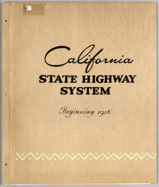
California Department of Transportation (CALTRANS)
Full Title
(Covers to) California State Highway System Beginning 1918 (-1990).
Publisher
California Department of Transportation (CALTRANS)
Author
William P. Humphreys & Co.
Full Title
(Covers to) Atlas of the city and county of San Francisco from actual surveys and official records. Compiled and published by Wm. P. Humphreys & Co., A.B. Holcombe, W.C. Kewen. Eng. by Worley & Bracher ... Phila, Pa. Printed by F. Bourquin ... Phila, Pa. 1876.
Publisher
W. Humphreys
Author
Smith, F. E. (Frank Enos)
Full Title
(Covers to) Official map of Madera County, California 1914. Compiled from official records and surveys. Published by F.E. Smith, Co. Surveyor. Drawn by Irving Bacon, Deputy. Approved and declared the Official map of Madera County by order of the Board of Supervisors ... Copyright by F.E. Smith, 1914. Britton & Rey Lithographers Inc., S.F.
Publisher
F.E. Smith, County Surveyor
Author
Green, Abbott M.
Full Title
(Covers to) Official map of Modoc County, California. Compiled & drawn by A.M. Green, Civil Engineer. 1911. Approved, July 6th 1911 ...
Publisher
Abbott M. Green
Author
[C.F. Weber & Co., Punnett Brothers]
Full Title
(Covers to) Weber's Map of Yolo County, California showing towns, steam and electric railroads, wagon and automobile roads, township and section lines, rivers, creeks, reclamation and irrigation districts, etc. Compiled from the latest official and private sources. Published by C.F. Weber & Co., San Francisco, Los Angeles. Copyright 1914 by Punnett Brothers.
Publisher
C.F. Weber
Author
[C.H. Street & Co., Immigration Association of California]
Full Title
(Covers to) Map of the state of California, compiled expressly for C.H. Street & Co., successors to the Immigration Association of California, 415 Montgomery St., San Francisco ... Lith. Britton & Rey, S.F. (1886?)
Publisher
Britton & Rey
Author
[Hill Publishing Company, Hill, E. F.]
Full Title
(Covers to) Map of Los Angeles, California. Copyright, by E.F. Hill.
Publisher
Hill Publishing Co.
Author
[Central Pacific Railroad Company, Union Pacific Railroad Company]
Full Title
(Covers to) The only great through all rail route is the Union and Central Pacific R.R. line via Omaha ... Rand, McNally & Co., Printers Engravers, etc., 108 West Randolph St., Chicago ... Through time table, in effect January 1, 1872.
Publisher
Rand McNally & Co.
Author
Ringgold, Cadwalader, 1802-1867
Full Title
(Covers to) A Series of charts, with sailing directions, embracing surveys of the Farallones, entrance to the Bay of San Francisco ... State of California... Third edition, with additions.
Publisher
Jno. T. Towers
|