|
Author
California Department of Transportation, Division of Highways
Full Title
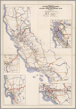
State Highway Map with Freeway and Expressway System Planning and Construction Progress, January 1973.
Publisher
California Department of Transportation, Division of Highways
Author
California Department of Transportation, Division of Highways
Full Title
State Highway Map with Freeway and Expressway System Planning and Construction Progress, January 1974.
Publisher
California Department of Transportation, Division of Highways
Author
California Department of Transportation, Division of Highways
Full Title
State Highway Map with Freeway and Expressway System Planning and Construction Progress, January 1975.
Publisher
California Department of Transportation, Division of Highways
Author
California Department of Transportation, Division of Highways
Full Title
State Highway Map with Freeway and Expressway System Planning and Construction Progress, January 1968.
Publisher
California Department of Transportation, Division of Highways
Author
California Department of Transportation, Division of Highways
Full Title
State Highway Map with Freeway and Expressway System Planning and Construction Progress, January 1967.
Publisher
California Department of Transportation, Division of Highways
Author
California Department of Transportation, Division of Highways
Full Title
California Freeway and Expressway System, Planning and Construction Progress, January 1969.
Publisher
California Department of Transportation, Division of Highways
Author
California Department of Transportation, Division of Highways
Full Title
California Freeway and Expressway System, Planning and Construction Progress, January 1971.
Publisher
California Department of Transportation, Division of Highways
Author
Irrigation Districts Association of California
Full Title
California Water Resources Development, including Development of the Bureau of Reclamation, U.S. Army Corps of Engineers, Major Features of the California Water Plan together with Various Projects of Districts and Municipalities. Issued by Irrigation Districts Association of California, Water News and Information Program.
Publisher
Irrigation Districts Association of California
Author
Irrigation Districts Association of California
Full Title
Existing and Proposed Water Developments in the State of California, 1951. Issued by Irrigation Districts Association of California, Water Economics Committee.
Publisher
Irrigation Districts Association of California
Author
[Irrigation Districts Association of California, Imagineers '68' Burton]
Full Title
California Water Resources Developments. Issued by Irrigation Districts Association of California, Water News and Information Program.
Publisher
Irrigation Districts Association of California
Author
California Department of Transportation, Division of Highways
Full Title
Progress Map, California Interstate Highways and Other Portions, California Freeway and Expressway System, May 1962.
Publisher
California Department of Transportation, Division of Highways
Author
Bancroft, A.L.
Full Title
Bancroft's Map Of California, Nevada, Utah And Arizona. Published By A.L. Bancroft & Compy. Booksellers & Stationers, San Francisco, Cal. 1871. Entered ... by A.L. Bancroft & Company ... Washington, D.C.
Publisher
A.L. Bancroft
Author
Cram, George
Full Title
Cram's Superior Map Of California Showing Distances between Railroad Stations, and Populations by Decimals of all Cities and Villages with 100 Inhabitants and over. A Concise and Ready Reference Index ... George F. Cram, Engraver and Publisher Established 1867. 130 Fulton Street, New York. 55 to 61 Market Street, Chicago. Price $3.00. Copyright, 1908, by George F. Cram, Chicago ... Geo. F. Cram, Engraver, Chicago. (inset) Vicinity Of San Francisco, Oakland, Sacramento, San Jose, Stockton. George F. Cram, Engr. & Pub. Chicago, Ill. (with 3 additional inset maps).
Publisher
George F. Cram
Author
Railroad Commission of the State of California
Full Title
1926 Edition Of The Official Railroad Map Of California. Issued by Railroad Commission Of The State Of California. State Building, San Francisco ... Compiled by the Railroad Commission of the State of California, Engineering Department, Lester S. Ready, Chief Engineer. J.W. Clement Co., Buffalo, N.Y. (with 4 inset maps).
Publisher
J.W. Clement
Author
U.S. General Land Office
Full Title
Department Of The Interior General Land Office J.A. Williamson, Commissioner. State Of California. 1876. Compiled from the official Records of the General Land Office and other sources by C. Roeser, Principal Draughtsman G.L.O. Photo lith & print by Julius Bien 16 & 18 Park Place N.Y.
Publisher
Julius Bien
Author
Britton & Rey
Full Title
Map showing the Golden Gate Park, The Avenue And Buena Vista Park. 1903. Lith. Britton & Rey, S.F.
Publisher
Britton & Rey
Author
[Langley, Henry G., Wackenreuder, V.]
Full Title
City And County Of San Francisco. Compiled From Official Surveys And Sectionalized In Accordance With U.S. Surveys. Drawn By V. Wackenreuder, C.E. 1861. Published By Henry G. Langley For the San Francisco Directory. Entered ... 1861 By Henry G. Langley ... California. Britton & Co. Print. (with 3 inset maps of the Farrallon Islands).
Publisher
Henry Langley
Author
[Thomas Bros., Freese, Harry]
Full Title
Commercial and school map of California ; Compiled, published and copyrighted by Harry Freese ; published and for sale by Thomas Bros. (insets) San Francisco, Oakland and vicinity. Scale 1:335,000 ; Los Angeles and vicinity. Scale 1:335,000 ; Map showing township range survey system in California.
Publisher
Thomas Bros.
Author
Edward Denny & Co.
Full Title
Denny's pocket map of San Benito County, California : compiled from latest official and private data. By Edward Denny & Co. Map publishers, 338 Bush Street, San Francisco. Copyright 1913 by Edward Denny & Co. Revised, January 1st., 1920.
Publisher
Edward Denny & Co.
Author
California Railway Commissioners
Full Title
Commissioners Official Railway Map of California Completed to November 15th 1891.
Publisher
H.S. Crocker Company.
Author
Congdon, Chas. H.
Full Title
Official Map of Kern County, California. Compiled from Official Records and Private Surveys... Approved and Declared to be the Official Map of Kern County, May 7, 1898.
Publisher
W.B. Walkup
Author
[C.F. Weber & Co., Punnett Brothers]
Full Title
(Weber's Map of Sierra County, California). Published by C.F. Weber & Co., San Francisco, Los Angeles. Copyright 1914 by Punnett Brothers.
Publisher
C.F. Weber & Co.
Author
[C.F. Weber & Co., Punnett Brothers]
Full Title
(Weber's Map of Stanislaus County, California). Published by C.F. Weber & Co., San Francisco, Los Angeles. Copyright 1914 by Punnett Brothers.
Publisher
C.F. Weber & Co.
Author
[C.F. Weber & Co., Punnett Brothers]
Full Title
(Weber's Map of Lake County, California). Published by C.F. Weber & Co., San Francisco, Los Angeles. Copyright 1914 by Punnett Brothers.
Publisher
C.F. Weber & Co.
Author
[C.F. Weber & Co., Punnett Brothers]
Full Title
(Weber's Map of Placer County, California). Published by C.F. Weber & Co., San Francisco, Los Angeles. Copyright 1914 by Punnett Brothers.
Publisher
C.F. Weber & Co.
Author
Punnett Brothers
Full Title
Map of Kings County, Cal. Copyright, 1912, by Punnett Brothers. Drawn & published by Punnett Brothers. 301 MacDonough Building, 333 Keary St. S.F.Cal.
Publisher
Punnett Brothers.
Author
U.S. Geological Survey
Full Title
San Francisco and vicinity, California. From Geological Survey atlas sheets surveyed in 1892-1913.
Publisher
U.S. Geological Survey
Author
Allardt, G. F.
Full Title
Map no. 3. Salt marsh and tide lands situate in the city and county of San Francisco. To be sold at public auction by order of the Board of Tide Land Commissioners by Talbert & Leet, auctioneers, at their sales rooms no. 526 California Street, San Francisco. Sale to commence Friday Nov. 26th, 1869. B.F. Washington, H.P. Coon, L.L Bullock, Wm. S. Byrne, Secretary, Tide Land Commissioners. G.F. Allardt, Surveyor & Chief Engineer. C.H. Baker Lith., S.F.
Publisher
G.H. Baker, Lith.
Author
Allardt, G. F.
Full Title
Sale map no. 12. Salt marsh and tide lands situate in the city and county of San Francisco, state of California. To be sold at public auction by order of the Board of Tide Land Commissioners ... at the sales rooms of Greenebaum & Co., auctioneers, nos. 115 & 117 Bush Street, San Francisco. Sale to commence Tuesday, March 4th, 1873. R.P. Johnson, Edgar Briggs, C.M. Stratton, Board of Tide Land Commissioners. J.M. Currier, Secretary. G.F. Allardt, Chief Engineer.
Publisher
No Publisher
Author
Allardt, G. F.
Full Title
Sale map no. 8 of salt marsh and tide lands situate in the county of Marin, state of California. To be sold at public auction by order of the Board of Tide Land Commissioners ... John Middleton, auctioneer. Sale to commence Tuesday, July 18th 1871 at Platt's Hall, San Francisco. B.F. Washington, Rodmond Gibbons, L.L. Bullock, Board of Tide Land Commissioners. Wm. S. Byrne, Secretary. G.F. Allardt, Chief Engineer. F.C. Hafenrichter, draughtsman. G.T. Brown & Co. Lith. 540 Clay St. S.F.
Publisher
G.T. Brown & Co. Lith.
Author
[Britton & Co., Hoadley, Milo]
Full Title
Map of the Beideman Tract lots & blocks according to official map of the Western Addition. Drawn from actual survey by M. Hoadley. ... Lith. Britton & Co. To be sold at public auction, on Saturday, Oct. 6th, 1860 at 12 o'clock M. at Platts Music Hall. By H.A. Cobb and R.H. Sinton, real estate auctrs. (with) Map of the city of San Francisco. Published by Britton & Co., Lithographers, Montgomery St. cor. of Comml. sts., San Francisco.
Publisher
Britton & Co.
Author
Post Publishing Company (San Francisco, Calif.)
Full Title
(Business map of San Francisco). Issued by Post Publishing Company, publishers of the Daily and Weekly Post, San Francisco, Cal. (1886?)
Publisher
Post Publishing Company
Author
Allardt, G. F.
Full Title
Sale map no. 11. Salt marsh and tide lands situate in the counties of Alameda & Contra Costa, state of California. To be sold at public auction by order of the Board of Tide Land Commissioners ... Greenbaum & Co. Auctioneers. Sale to commence Wednesday July 10th 1872, at 11 A.M. at the sales rooms of Greenbaum & Co. Nos. 115 & 117 Bush Street, San Francisco. R.P. Johnson, Edgar Briggs, C.M. Stratton, Board of Tide Land Commissioners. J.M. Currier, Secretary. G.F. Allardt, Chief Engineer. Lith. Britton & Rey S.F. (inset) Tide lands in Lake Merritt.
Publisher
Britton & Rey
Author
Langley, Henry G.
Full Title
Map of San Francisco from the latest surveys. Engraved expressly for the San Francisco Directory. 1873. Lith. Britton & Rey, S.F.
Publisher
H.G. Langley
Author
[Auradou, A. L. (A. Leon), O'Shaughnessy, M. M. (Michael Maurice), 1864-1934, San Francisco (Calif.). Board of Public Works]
Full Title
Map of the city and county of San Francisco prepared by the Board of Public Works, M.M. O'Shaughnessy, City Engineer. A.L. Auradou, cartographer. Map issued October 15, 1927. Revised to Sept. 1, 1929.
Publisher
Board of Public Works
Author
[McClure, W. F. (Wilbur F.), Patterson, Smith & Co.]
Full Title
Map of Berkeley, California. W.F. McClure, City Engineer. Patterson, Smith & Co., Inc., successors to R.R. Patterson, Real Estate and Insurance, 2107 University Avenue ... General agents for Claremont Heights Tract. (1910?)
Publisher
Patterson, Smith & Co.
Author
[McClure, W. F. (Wilbur F.), Patterson, Smith & Co.]
Full Title
Claremont Heights Subdivision No. 1. Choice Berkeley villa sites. W.F. McClure, City Engineer of Berkeley. Patterson, Smith & Co., Inc., 2107 University Avenue, Berkeley, Cal. (1910?)
Publisher
Patterson, Smith & Co.
Author
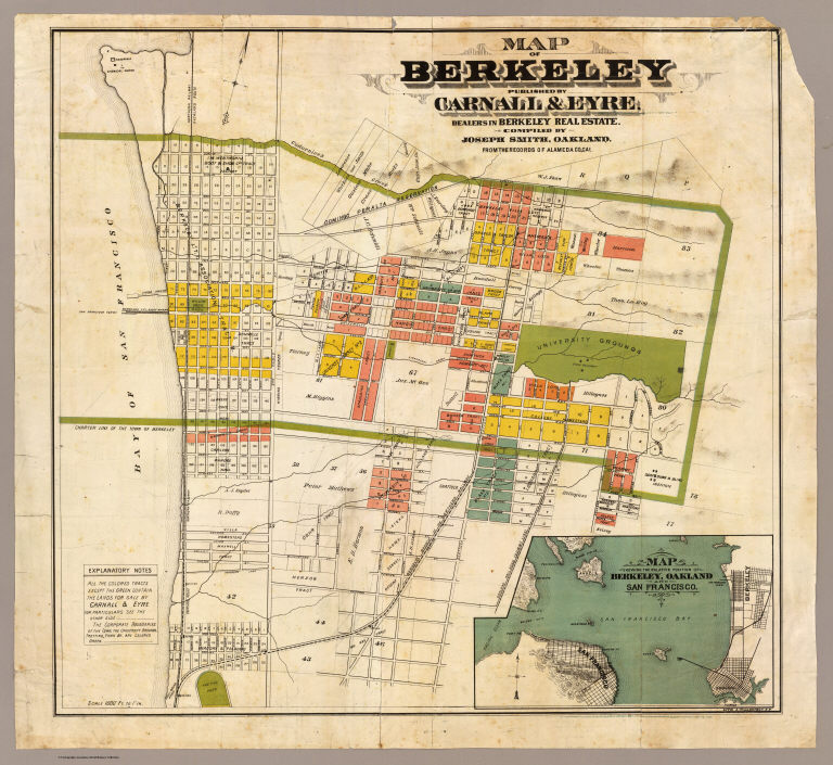
Smith, Joseph, draftsman
Full Title
Map of Berkeley. Published by Carnall & Eyre, dealers in Berkeley Real Estate. Compiled by Joseph Smith, Oakland. From the records of Alameda Co., Cal. Lith. A. Waldstein, S.F. (1880)
Publisher
Carnall & Eyre
Author
[King, M. G. (Malcolm G.), William J. Dingee]
Full Title
Map of Oakland, Berkeley and Alameda. William J. Dingee, agent. For the purchase, sale, appraisal and care of real estate. 460 & 462 Eighth Street near Broadway, Oakland. M.G. King, C.E., surveyor. Entered ... in the year 1878, by Woodward & Taggart in the office of the Librarian of Congress at Washington, D.C. Galloway Litho Co., 418-422 Commercial St., S.F. (1884?)
Publisher
William J. Dingee.
Author
Tassin, J. B.
Full Title
A newly constructed and improved map of the state of California. Shewing the extent and boundary of the different counties according to an Act passed by the Legislature April 25th, 1851. With a corrected and improved delineation of the gold region compiled from the best and most recent surveys by J.B. Tassin. Lith. by Pollard & Peregoy -- Published by Cooke and Lecount, San Francisco. Entered according to Act of Congress in the year 1851 by J.B. Tassin ... Northern District of the state of California.
Publisher
Cooke and Lecount.
Author
[San Diego Land and Town Company, W.W. Elliott & Co.]
Full Title
Birds-eye view of National City, San Diego County, California. W.W. Elliott Lith., S.F. Published by Frank P. Burgess and Co., proprietors of National City Record. (1887?)
Publisher
Frank P. Burgess and Co.
Author
[C.H. Street & Co., Immigration Association of California]
Full Title
Map of the state of California, compiled expressly for C.H. Street & Co., successors to the Immigration Association of California, 415 Montgomery St., San Francisco ... Lith. Britton & Rey, S.F. (1886?)
Publisher
Britton & Rey
Author
Goos, Pieter
Full Title
Paskaerte van Nova Granada, en t'Eylandt California. t'Amersterdam by Pieter Goos op't Waater inde Vergulde Zeepiegel, Ao 1666.
Publisher
Pieter Goos
Author
Santa Fe Railroad
Full Title
Map of Part of California Compiled from Various Sources.
Publisher
Santa Fe Railroad
Author
[California Geological Survey, Hoffmann, Charles F., Whitney, J.D.]
Full Title
Topographical Map of Central California Together With a Part of Nevada. (Sheet III). State Geological Survey Of California. J.D. Whitney, State Geologist. C.F. Hoffmann, Principal Topographer, V. Wackenreuder, J.T. Gardner, A. Craven, A.D. Wilson, Field Assistants. 1873 ... Julius Bien, Engr.
Publisher
Julius Bien
Author
[California Geological Survey, Hoffmann, Charles F., Whitney, J.D.]
Full Title
Topographical Map of Central California Together With a Part of Nevada. (Sheet IV). State Geological Survey Of California. J.D. Whitney, State Geologist. C.F. Hoffmann, Principal Topographer, V. Wackenreuder, J.T. Gardner, A. Craven, A.D. Wilson, Field Assistants. 1873 ... Julius Bien, Engr.
Publisher
Julius Bien
Author
[California Geological Survey, Hoffmann, Charles F., Whitney, J.D.]
Full Title
Topographical Map of Central California Together With a Part of Nevada. (Sheet I). State Geological Survey Of California. J.D. Whitney, State Geologist. C.F. Hoffmann, Principal Topographer, V. Wackenreuder, J.T. Gardner, A. Craven, A.D. Wilson, Field Assistants. 1873 ... Julius Bien, Engr.
Publisher
Julius Bien
Author
[California Geological Survey, Hoffmann, Charles F., Whitney, J.D.]
Full Title
Topographical Map of Central California Together With a Part of Nevada. (Sheet II). State Geological Survey Of California. J.D. Whitney, State Geologist. C.F. Hoffmann, Principal Topographer, V. Wackenreuder, J.T. Gardner, A. Craven, A.D. Wilson, Field Assistants. 1873 ... Julius Bien, Engr.
Publisher
Julius Bien
Author
Goddard, George H. (George Henry), 1817-1906
Full Title
Birds eye view of the city of San Francisco and surrounding country. Drawn by George H. Goddard. Lith. Britton & Rey, S.F. Entered according to act of Congress in the year 1868 by Snow & May in the ... U.S. District Court for the Northern District of California.
Publisher
Snow & May
|