Browse All

1807 Map Of The Frontier Of British North Ame … Separate Map A Map Of The Frontier Of British North A … |

1867 Karte Von Californien Separate Map Karte Von Californien und Theilen der be … |

1919 Map of Pacific Grove Properties Separate Map Map of Pacific Grove Properties Showing … |

1879 State of Louisiana. Separate Map Department Of The Interior General Land … |

1839 Geological Map of New Jersey Separate Map A Geological Map of New Jersey, by Henry … |

1866 Map Of The Seat Of War To Accompany The … Separate Map Map Of The Seat Of War To Accompany The … |

1848 Gold And Quicksilver District Of Califor … Separate Map Topographical Sketch of the Gold & Quick … |

1848 Upper and Lower Gold Mines on the South … Separate Map Positions of the Upper and Lower Gold Mi … |

1848 Upper Mines, Lower Mines or Mormon Diggi … Separate Map Upper Mines. Nos. 1&8. Lower Mines or Mo … |

1881 Railroad Map Of Iowa Separate Map Railroad Map Of Iowa Prepared For The Bo … |

1883 Montana Territory. Separate Map Department Of The Interior General Land … |

1903 Map Of The Warm Springs Valley Separate Map Virginia Hot Springs Company Map Of The … |

1889 Sectional Map Of Colfax And Mora Countie … Separate Map Sectional Map Of Colfax And Mora Countie … |

1884 Index Map of the City of San Francisco A … Separate Map (Index Map of the City of San Francisco … |

1883 Washington Territory. 1883 Separate Map Department Of The Interior General Land … |

1894 State of Nevada, 1894 Separate Map Department Of The Interior General Land … |

1912 State Of Wyoming, 1912 Separate Map Department Of The Interior General Land … |

1907 State of Wyoming, 1907 Separate Map Department Of The Interior General Land … |

1859 Maine, New Hampshire, Vermont Separate Map Maine, New Hampshire, Vermont 1859. Publ … |

1859 Maine Separate Map Maine 1859. Published By A.J. Coolidge, … |

1859 Vermont Separate Map Vermont 1859. Published By A.J. Coolidge … |

1859 New Hampshire Separate Map New Hampshire 1859. Published By A.J. Co … |

1890 Map Of Indian Territory And Oklahoma Separate Map Map Of Indian Territory And Oklahoma. 18 … |

1932 San Francisco Bay Metropolitan Area Separate Map San Francisco Bay Metropolitan Area (Com … |

1906 Alaska. Separate Map Department Of The Interior General Land … |

1832 Map Of The Town Of Ipswich, County Of Es … Separate Map Map Of The Town Of Ipswich, County Of Es … |

1830 Map Of North-Brookfield Separate Map Map Of North-Brookfield. From Actual Sur … |

1901 Map Of North Dakota Separate Map Map of North Dakota. Great Opportunities … |

1899 System Of Sewerage For The City And Coun … Separate Map System Of Sewerage For The City And Coun … |

1890 Map Of Astoria And Environs, Oregon Separate Map Whitney's Map Of Astoria And Environs, O … |

1882 Pantagraph Map Of Illinois Separate Map The Pantagraph Map Of Illinois. 1882. Pr … |

1839 The Coasts of Guatimala And Mexico, from … Separate Map The Coasts of Guatimala And Mexico, from … |

1869 Map Of The Route Of The Southern Contine … Separate Map Map Of The Route Of The Southern Contine … |

1865 Map Of Nevada Showing New Discoveries Of … Separate Map Map Of Nevada Showing the location Of Th … |

1915 Wayne Co. Indiana Separate Map Wayne Co. Indiana. Copyrighted 1915 by T … |

1887 Territory Of Arizona, 1887 Separate Map Department Of The Interior General Land … |

1896 Map of the Peninsula of Florida and Adja … Separate Map Map of the Peninsula of Florida and Adja … |

1906 Map Of The County Of Stanislaus, Califor … Separate Map Official Map Of The County Of Stanislaus … |

1841 Map Of The Oregon Territory Separate Map Map Of The Oregon Territory By The U.S. … |

1897 Guide Map Of The City of San Francisco Separate Map Guide Map Of The City of San Francisco. … |

1856 Central Bluffs, Burt County, Nebraska Separate Map Central Bluffs, Burt County, Nebraska. A … |

1944 State Of California (north sheet), 1944 Separate Map United States Department Of The Interior … |

1944 State Of California (south sheet), 1944 Separate Map United States Department Of The Interior … |

1944 Composite: State Of California, 1944 Separate Map (Composite of) United States Department … |

1872 Map of the proposed line of Montgomery A … Separate Map Map of the proposed line of Montgomery A … |
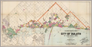
1891 Map Of The City Of Duluth, St. Louis Cou … Separate Map Albertson's Map Of The City Of Duluth, S … |

1932 The Pacific Coast where the nation will … Separate Map The Pacific Coast where the nation will … |

1913 Northwestern Pacific Separate Map Northwestern Pacific. Northwestern Pacif … |

1866 Railroad Map Of The City Of San Francisc … Separate Map Railroad Map Of The City Of San Francisc … |

1869 Map Of The Route Of The Southern Contine … Separate Map Map Of The Route Of The Southern Contine … |