Who What Where WhenREMOVEWHEREShow MoreWHO
WHEN
|
Author
British North America-U.S. Boundary
Full Title
A Map Of The Frontier Of British North America, And The United States, Describing The Boundary Line as fixed by the Treaty of 1783, which has never been respected by the American Government. Likewise the New Line of Demarcation as now proposed to be established between those States, and the British Provinces intended to secure the Independence of the Indians.
Publisher
N.P.
Author
[Colton, G.W. & C.B., Ruhl, Karl]
Full Title
Karte Von Californien und Theilen der benachbarten Staaten und Territorien. E. Steiger, New York, 1867. Drawn, Engraved & Printed by G.W. & C.B. Colton & Co., New York.
Publisher
E. Steiger
Author
Del Monte Properties Company
Full Title
Map of Pacific Grove Properties Showing Lots which will be sold at Absolute Auction Sale. Commencing on Thursday, November 6th ... (on verso) Advertisements and views around Pacific Grove.
Publisher
No publisher
Author
U.S. General Land Office
Full Title
Department Of The Interior General Land Office J.A. Williamson, Commissioner. State of Louisiana. 1879. Compiled from the official Records of the General Land Office and other sources by C. Roeser, Principal Draughtsman G.L.O. Photo lith & print by Julius Bien 16 & 18 Park Place N.Y.
Publisher
Julius Bien
Author
Rogers, Henry Darwin
Full Title
A Geological Map of New Jersey, by Henry D. Rogers, Prof. of Geology in Univ. of Penna. (To accompany the Report on the Geology of N. Jersey,) Jan. 1839. P.S. Duval, Lith. Philada. On Stone by J. Probst.
Publisher
P.S. Duval litho.
Author
Case, O.D. & Co.
Full Title
Map Of The Seat Of War To Accompany The American Conflict. Hartford: Published By O.D. Case & Co. Engraved by Oliver J. Stuart, New York and Brooklyn. Entered ... 1866 by O.D. Case & Company ... Connecticut. (inset) Map Of The Lower Portion Of Florida. (inset) Map Of The Lower Portion Of Texas.
Publisher
O.D. Case & Co.
Author
Ord, Edward Otho Cresap (E.O.C.O.)
Full Title
Topographical Sketch of the Gold & Quicksilver District Of California, July 25th 1848. E. O. C. O. Lt. U.S.A. P.S. Duval's Lith. steam Press Phila.
Publisher
U.S.
Author
Mason, Richard B.
Full Title
Positions of the Upper and Lower Gold Mines on the South Fork of the American River, California. July 20th, 1848. (with, on one sheet) Upper Mines. Nos. 1&8. Lower Mines or Mormon Diggings. No. 3.
Publisher
U.S.
Author
Mason, Richard B.
Full Title
Upper Mines. Nos. 1&8. Lower Mines or Mormon Diggings. No. 3. (with, on one sheet) Positions of the Upper and Lower Gold Mines on the South Fork of the American River, California. July 20th, 1848.
Publisher
U.S.
Author
Cram, George
Full Title
Railroad Map Of Iowa Prepared For The Board Of Railroad Commissioners. By George F. Cram, Map Publisher, 66 Lake Street, Chicago, Ill. Entered ... 1872, by Geo. F. Cram ... Washington.
Publisher
George F. Cram
Author
U.S. General Land Office
Full Title
Department Of The Interior General Land Office N.C. McFarland, Commissioner. Montana Territory. 1883. Compiled from the official Records of the General Land Office and other sources. G.P. Strum, Principal Draughtsman G.L.O. Photo lith & print by Julius Bien & Co. 139 Duane Str. N.Y.
Publisher
Julius Bien
Author
Hotchkiss, Jedidiah
Full Title
Virginia Hot Springs Company Map Of The Warm Springs Valley Showing Railways, Roads, And Paths Leading To The Healing, Hot And Warm Springs Compiled from U.S. Geol. Survey and other Maps. Eng. Office of Jed. Hotchkiss, Staunton, Va. 1895. With Revisions, 1903. The Norris Peters Co. Photo-Litho., Washington, D.C. (inset map) Virginia Hot Springs and Vicinity. (inset geological section) Section on Line A-B of Map.
Publisher
The Norris Peters Co. Photo Litho.
Author
[Rollandet, Edward, (Maxwell Land Grant Company)]
Full Title
Sectional Map Of Colfax And Mora Counties. New Mexico. Compiled from the Original Plats in the Surveyor General's Office at Santa Fe, New Mexico, and from Private Surveys by the Maxwell Land Grant Company. Edward Rollandet, Draughtsman, Denver Colo.
Publisher
Edward Rollandet
Author
[San Francisco Assessor, Holtz, L.P.]
Full Title
(Index Map of the City of San Francisco Assessor's Office, 1884. Compiled by L.P. Holtz, City and County Assessor).
Publisher
Assessor's Office
Author
U.S. General Land Office
Full Title
Department Of The Interior General Land Office N.C. McFarland Commissioner. Washington Territory. 1883. Compiled from the official Records of the General Land Office and other sources. G.P. Strum, Principal Draughtsman G.L.O. Photo lith & print by Julius Bien & Co. 139 Duane Str. N.Y.
Publisher
Julius Bien & Co.
Author
U.S. General Land Office
Full Title
Department Of The Interior General Land Office Hon. S.W. Lamoreux, Commissioner. State Of Nevada. Compiled from the official Records of the General Land Office and other sources, under supervision of Harry King, C.E., Chief Draftsman, G.L.O. 1894. Photo lith & print by Forbes Co. Boston & N.Y. Drawn by M. Hendges.
Publisher
Forbes Co.
Author
U.S. General Land Office
Full Title
Department Of The Interior General Land Office Fred Dennett, Commissioner. State Of Wyoming. Compiled from the official Records of the General Land Office and other sources, under the direction of I.P. Berthrong, Chief of Drafting Division G.L.O. 1912. Compiled and drawn by I.P. Berthrong. Traced and Lettered by I.P. Berthrong. (with 4 inset maps).
Publisher
General Land Office
Author
U.S. General Land Office
Full Title
Department Of The Interior General Land Office Richard A. Ballinger, Commissioner. State Of Wyoming. Compiled from the official Records of the General Land Office and other sources, under the direction of I.P. Berthrong, Chief of Drafting Division G.L.O. 1907. Compiled and drawn by I.P. Berthrong. Traced and Lettered by I.P. Berthrong. Andrew B. Graham Co., Photo Lithographers. Washington, D.C. (with 4 inset maps).
Publisher
Andrew B. Graham Co.
Author
Coolidge, A.J.
Full Title
Maine, New Hampshire, Vermont 1859. Published By A.J. Coolidge, No. 39 Court St. Boston. Plotted on the polyconic projection by Shedd & Edson, Civil Engineers & Surveyors, No. 42 Court St. Boston. Meisel Brothers Lith, Boston. Entered ... 1859 by A.J. Coolidge ... Massachusetts. (with) New Hampshire. Published By A.J. Coolidge ... 1859 ... Engraved by G.W. Boynton. (with) Vermont. Published By A.J. Coolidge ... 1859 ...
Publisher
A.J. Coolidge
Author
Coolidge, A.J.
Full Title
Maine 1859. Published By A.J. Coolidge, No. 39 Court St. Boston. Plotted on the polyconic projection by Shedd & Edson, Civil Engineers & Surveyors, No. 42 Court St. Boston. Meisel Brothers Lith, Boston. Entered ... 1859 by A.J. Coolidge ... Massachusetts. (with) New Hampshire. Published By A.J. Coolidge ... 1859 ... Engraved by G.W. Boynton. (with) Vermont. Published By A.J. Coolidge ... 1859 ...
Publisher
A.J. Coolidge
Author
Coolidge, A.J.
Full Title
Vermont 1859. Published By A.J. Coolidge, No. 39 Court St. Boston. Plotted on the polyconic projection by Shedd & Edson, Civil Engineers & Surveyors, No. 42 Court St. Boston. Meisel Brothers Lith, Boston. Entered ... 1859 by A.J. Coolidge ... Massachusetts. (with) New Hampshire. Published By A.J. Coolidge ... 1859 ... Engraved by G.W. Boynton. (with) Vermont. Published By A.J. Coolidge ... 1859 ...
Publisher
A.J. Coolidge
Author
Coolidge, A.J.
Full Title
New Hampshire 1859. Published By A.J. Coolidge, No. 39 Court St. Boston. Plotted on the polyconic projection by Shedd & Edson, Civil Engineers & Surveyors, No. 42 Court St. Boston. Meisel Brothers Lith, Boston. Entered ... 1859 by A.J. Coolidge ... Massachusetts. (with) New Hampshire. Published By A.J. Coolidge ... 1859 ... Engraved by G.W. Boynton. (with) Vermont. Published By A.J. Coolidge ... 1859 ...
Publisher
A.J. Coolidge
Author
U.S. Census Office
Full Title
Map Of Indian Territory And Oklahoma. 1890. Julius Bien & Co. Lith. N.Y. Eleventh Census Of The United States.
Publisher
Julius Bien & Co.
Author
Pacific Gas and Electric Company
Full Title
San Francisco Bay Metropolitan Area (Comprising the Nine Counties Bordering on the Bay). Copyrighted By Pacific Gas And Electric Company December 1932 And Presented To San Francisco Bay Industrial Committee. Compliments of Pacific Gas and Electric Company, San Francisco. (with 2 inset maps of California).
Publisher
Pacific Gas and Electric Company
Author
U.S. General Land Office
Full Title
Department Of The Interior General Land Office William A. Richards, Commissioner. Alaska. Compiled from the official Records of the General Land Office U.S. Coast and Geodetic Survey; Geological Survey; Canadian and other sources under the direction of Frank Bond, Chief of Drafting Division G.L.O. 1906. (with 4 inset maps).
Publisher
Andrew B. Graham Co., Lithographers
Author
[Anderson, Philander, Annin & Smith]
Full Title
Map Of The Town Of Ipswich, County Of Essex, State Of Massachts. Surveyed and Drawn by Philander Anderson 1832. Annin, Smith & Co.'s Lithy. (inset) Plan Of Ipswich Village.
Publisher
Annin & Smith & Co.'s Lith.
Author
[Nye, Bonum, Pendleton's Lithography]
Full Title
Map Of North-Brookfield. From Actual Survey Made By Bonum Nye In 1830. Pendleton's Lithography, Boston. North-Brookfield, (formerly the North Parish in Brookfield) was incorporated as a Town in 1812. - Population at the census in 1830 was 1241.
Publisher
Pendleton's Lithography
Author
[Brown, Wm. H. & Co., Poole Brothers]
Full Title
Map of North Dakota. Great Opportunities for Men in Farming, Stock Raising, Manufacturing and all Commercial Pursuits. 100,000 Acres in the most prosperous counties of North Dakota are offered by us on terms so easy ... Wm. H. Brown & Co.'s Lands Shown In Red. Copyrighted, 1901, by Poole Bros., Chicago.
Publisher
Poole Bros.
Author
Grunskey, C.E.
Full Title
System Of Sewerage For The City And County Of San Francisco. Sewerage Districts Sewered On The Separate System Location Of Sewers And Of Pumping Stations. C.E. Grunsky, Civil Engineer in Charge, Marsden Manson, C.S. Tilton, Associate Engineers. October 29, 1899. Photo Lith. Britton & Rey, S.F.
Publisher
Britton & Rey
Author
[Whitney, W.H., Jackson, Henry & Co.]
Full Title
Whitney's Map Of Astoria And Environs, Oregon. Compiled from Official Data, By Henry Jackson & Co., Civil Engineers. March 1st, 1890. Compliments Of Wingate & Stone ... Astoria, Oregon. Union Pacific. The Overland Route. L.H. Everts, Lith. Phila. Pa. Entered ... 1890, by W.H. Whitney ... Washington. (untitled inset map of mouth of the Columbia River).
Publisher
L.H. Everts, Lith.
Author
[Rand McNally and Company, The Weekly Pantagraph]
Full Title
The Pantagraph Map Of Illinois. 1882. Presented to the subscribers of The Weekly Pantagraph, Established In 1846. The best and most widely circulated family newspaper in Central Illinois ... Copyright, 1882, by Rand McNally & Co., Map Publishers Chicago. (inset map) Chicago And Vicinity. (inset map) Vicinity Of Davenport & Rock Island.
Publisher
Rand McNally and Company
Author
[Arrowsmith, John, Forbes, Alexander]
Full Title
The Coasts of Guatimala And Mexico, from Panama To Cape Mendocino: with the Principal Harbours in California. 1839. London, Smith Elder & Co. 1839. John Arrowsmith. (with 6 inset maps).
Publisher
Smith Elder & Co.
Author
Palmer, William. J.
Full Title
Map Of The Route Of The Southern Continental R.R. With Connections From Kansas City Mo. Ft. Smith Ark. And Shreveport La. Giving a general View of the Recent Surveys of the Kansas Pacific Railway Co, across the Continent Made in 1867 & 1868 under the direction of Gen. Wm. J. Palmer. On the routes of the 32nd and 35th Parallels. J.F Gedney Lith, Washington, D.C.
Publisher
J.F. Gedney Lith.
Author
New York and Silver Peak Mining Company
Full Title
Map Of Nevada Showing the location Of The New Discoveries Of Silver Peak. 1865. R.C. Root, Anthony & Co. 21 Nassau St. N.Y. (inset) Diagram Of Silver Peak.
Publisher
R.C. Root, Anthony & Co.
Author
Geographical Publishing Company
Full Title
Wayne Co. Indiana. Copyrighted 1915 by The Geographical Publ. Co. Chicago.
Publisher
The Geographical Publishing Company
Author
U.S. General Land Office
Full Title
Department Of The Interior General Land Office Hon. Wm. A.J. Sparks, Commissioner. Territory Of Arizona. 1887. Compiled from the official Records of the General Land Office and other sources, under supervision of Geo. U. Mayo, Civil Engineer - Chief or Drafting Division, G.L.O. 1894. Photo lith & print by Julius Bien & Co. 139 Duane St. N.Y. Compiled And drawn by A.F. Dinsmore.
Publisher
Julius Bien & Co.
Author
Florida East Coast Railway
Full Title
Map of the Peninsula of Florida and Adjacent Islands. Published by the Land Department, Florida East Coast Railway. This map is absolutely correct in all the Geographical details, and every Railroad is shown in its proper location. The Matthews Northrup Co., Complete Engraving And Printing Works, Buffalo, N.Y. (inset) West Indies, Central America And South America. (inset) Bahama Islands
Publisher
Matthews-Northrup Co.
Author
Carlton, D.C.
Full Title
Official Map Of The County Of Stanislaus, California 1906 Compiled From Official Records And Surveys And Published By Stanislaus Land & Abstract. Co. Modesto, Cal. Drawn By D.C. Carlton. (with 5 inset maps).
Publisher
Stanislaus Land & Abstract Co.
Author
Wilkes, Charles
Full Title
Map Of The Oregon Territory By The U.S. Ex. Ex. Charles Wilkes Esqr. Commander. 1841. Note. The Northern part of this Map contains the latest information of the Hudson Bay Company, and the Eastern part, that of Lieut. Fremont's U.S.T.E. Exploration on the Eastern side of the Rocky Mountains. (inset map) Columbia River Reduced From A Survey Made By The U.S. Ex. Ex. 1841.
Publisher
No publisher
Author
Southern Pacific Company
Full Title
Guide Map Of The City of San Francisco. Published By The Southern Pacific Company For The Information Of Delegates To The Sixteenth International Christian Endeavor Convention. 1897. Copyrighted By H.S. Crocker Co.
Publisher
H.S. Crocker Co.
Author
Central Bluffs, Nebraska
Full Title
Central Bluffs, Burt County, Nebraska. All lots in this City are 50x150 feet, the alleys are 15 feet wide, Spring Av. is 100 feet wide, Michigan & Ohio Avenues are 80 feet & all other Streets 66 feet. Leopold Gast & Brother Lith. St. Louis, Mo. Second Carondelet Avenue betw. Lafayette & Geier Avs. S.W. from City Hospital. (Inset Map) Topographical Sketch of a Portion of Nebraska Territory.
Publisher
Leopold Gast & Brother Lith.
Author
U.S. General Land Office
Full Title
United States Department Of The Interior, Harold L. Ickes, Secretary, General Land Office, Fred W. Johnson, Commissioner. State Of California. Compiled From The Official Records Of The General Land Office And Other Sources. 1944. Compiled and drawn by T.W. Gales.
Publisher
U.S. Government
Author
U.S. General Land Office
Full Title
(Composite of) United States Department Of The Interior, Harold L. Ickes, Secretary, General Land Office, Fred W. Johnson, Commissioner. State Of California. Compiled From The Official Records Of The General Land Office And Other Sources. 1944. Compiled and drawn by T.W. Gales.
Publisher
U.S. Government
Author
[Britton & Rey, San Francisco City]
Full Title
Map of the proposed line of Montgomery Avenue from the corner Washington and Montgomery Street to the corner of Union and Stockton Street. Length 2354 feet, Width 80 feet. Britton & Rey.
Publisher
Britton & Rey
Author
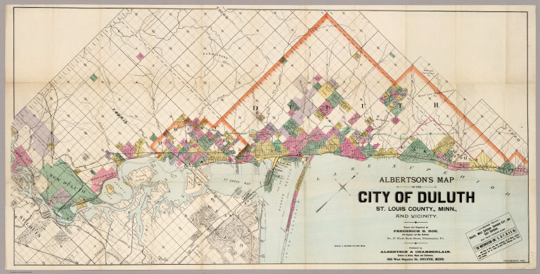
Roe, Frederick B.
Full Title
Albertson's Map Of The City Of Duluth, St. Louis County, Minn., And Vicinity. Drawn and Engraved by Frederick B. Roe, Civil Engineer and Map Publisher, No. 17 North Sixth Street, Philadelphia, Pa. Published by Albertson & Chamberlain ... 323 West Superior St., Duluth, Minn. Copyright, 1891.
Publisher
Albertson & Chamberlain
Author
Foster and Kleiser
Full Title
The Pacific Coast where the nation will converge in 1932 - An Outdoor Advertising Opportunity. Foster and Kleiser Company.
Publisher
Foster and Kleiser
Author
Northwestern Pacific Railroad
Full Title
Northwestern Pacific. Northwestern Pacific Railroad. (Untitled map of Northern California).
Publisher
No publisher
Author
Gensoul, A.
Full Title
Railroad Map Of The City Of San Francisco California. Published By A. Gensoul Pacific Map Depot 511 Montgomery St. S. Franco. 1866. Lith. Britton & Co. S.F.
Publisher
A. Gensoul
Author
Palmer, William. J.
Full Title
Map Of The Route Of The Southern Continental R.R. With Connections From Kansas City Mo. Ft. Smith Ark. And Shreveport La. Giving a general View of the Recent Surveys of the Kansas Pacific Railway Co, across the Continent Made in 1867 & 1968 under the direction of Gen. Wm. J. Palmer. On the routes of the 32nd and 35th Parallels together with compilations from Keeler's Official Map showing the Central and Northern Routes to the Pacific, and the intermediate topography. J.F Gedney Lith, Washington, D.C.
Publisher
J.F. Gedney Lith.
|