Who What Where WhenREMOVE |
Author
[Reid, John, Winterbotham, W.]
Full Title
(Title Page to) The American Atlas; Containing The Following Maps ... New-York: Published By John Reid, Bookseller And Stationer, No. 106, Water-Street. 1796.
Publisher
John Reid
Author
Jefferys, Thomas
Full Title
(Title Page to) The American Atlas: Or, A Geographical Description Of The Whole Continent Of America ... Engraved On Forty-Eight Copper Plates, By The Late Mr. Thomas Jefferys, Geographer to the King, and Others. London, Printed and Sold by R. Sayer and J. Bennett, Map and Print Sellers, No. 53, Fleet-Street. MDCCLXXVI.
Publisher
Sayer and Bennett
Author
Henshaw, Frances A.
Full Title
(Title Page to) Frances A. Henshaw's Book of Penmanship Executed at the Middlebury Female Academy April 29, 1823.
Publisher
Manuscript
Author
[Mitchell, Samuel Augustus, Drake, Ira S.]
Full Title
(Title Page to) Mitchell's New Traveller's Guide Through The United States, Containing The Principal Cities, Towns &c. ... Illustrated By An Accurate Map Of The United States. Philadelphia: Thomas, Cowperthwait & Co. 1853. (on verso) Entered ... 1848, by Thomas, Cowperthwait & Co. ... Pennsylvania. Stereotyped by J. Fagan. Printed by Smith & Peters. (with map) Mitchell's New Traveller's Guide Through The United States, Showing the Rail Roads, Canals, Stage Roads &c. ... Drawn and Engraved by Ira S. Drake. Philadelphia 1854. Published by Thomas, Cowperthwait & Co. Entered ... 1848, by Thomas, Cowperthwait, & Co. ... Pennsylvania. (with 5 inset maps).
Publisher
Thomas, Cowperthwait & Co.
Author
[Mitchell, Samuel Augustus, Young, James H.]
Full Title
(Title Page to) Mitchell's Traveller's Guide Through The United States, Containing The Principal Cities, Towns, &c. ... Illustrated By An Accurate Map Of The United States. Philadelphia: Hinman & Dutton, No. 6 North Fifth Street. 1838. (on verso) Entered ... 1836, by Mitchell & Hinman ... Pennsylvania. Stereotyped by John Fagan ... Philadelphia. (with map) Mitchell's Travellers Guide Through The United States. A Map Of The Roads, Distances, Steam Boat & Canal Routes &c. By J.H. Young. Philadelphia. Published by S. Augustus Mitchell. 1838. Engraved On Steel By J.H. Young And D. Haines. Entered ... 1834 by S. Augustus Mitchell ... Pennsylvania. (with 9 inset maps).
Publisher
Mitchell & Hinman
Author
Mitchell, Samuel Augustus
Full Title
(Title Page to) A Route-Book, Adapted To Mitchell's National Map Of The American Republic; Comprising Tables Of The Principal Rail-Road, Steam-Boat And Stage Routes, Throughout The United States. Philadelphia: S. Augustus Mitchell, N.E. Cor. Market And Seventh Sts. 1847. (on verso) Entered ... 1846, by S. Augustus Mitchell ... Pennsylvania. Stereotyped by J. Fagan. Printed by Kay & Brother. (with) Mitchell's National Map of the American Republic Or United States Of North America ... 1846. Drawn by J.H. Young. Engraved by J.H. Brightly. Entered ... 1846, by S. Augustus Mitchell ... Pennsylvania. (with 4 inset maps).
Publisher
S. Augustus Mitchell
Author
Mitchell, Samuel Augustus
Full Title
(Title Page to) Mitchell's Compendium Of The Internal Improvements Of The United States; Comprising General Notices Of All The Most Important Canals and Rail-Roads... Philadelphia: Published By Mitchell & Hinman, No. 6, North-Fifth Street. 1838. (on verso) Entered ... 1835, by Mitchell & Hinman ... Pennsylvania. Stereotyped by John Fagan ... Philadelphia. (with) Mitchell's Map Of The United States Showing the Principal Travelling, Turnpike and Common Roads ... Philadelphia: Published By S. Augustus Mitchell. 1838. Sold by Mitchell & Hinman. No. 6 North Fifth Street. Entered ... 1835, by S. Augustus Mitchell... Pennsylvania. (with 8 inset maps).
Publisher
Mitchell and Hinman
Author
[Mitchell, Samuel Augustus, Young, James H.]
Full Title
(Title Page to) Mitchell's Traveller's Guide Through The United States, Containing The Principal Cities, Towns, &c. ... Illustrated By An Accurate Map Of The United States. Philadelphia: Thomas, Cowperthwait, & Co. 253 Market Street. (on verso) Entered ... 1836, by Mitchell & Hinman ... Pennsylvania. Stereotyped by John Fagan ... Philadelphia. (with map) Mitchell's Travellers Guide Through The United States. A Map Of The Roads, Distances, Steam Boat & Canal Routes &c. By J.H. Young. Philadelphia. Published by S. Augustus Mitchell. 1845. Engraved On Steel By J.H. Young And D. Haines. Entered ... 1834 by S. Augustus Mitchell ... Pennsylvania. (with 8 inset maps).
Publisher
Thomas, Cowperthwait & Co.
Author
[Mitchell, Samuel Augustus, Drake, Ira S.]
Full Title
(Title Page to) Mitchell's New Traveller's Guide Through The United States, Containing The Principal Cities, Towns &c. ... Illustrated By An Accurate Map Of The United States. Philadelphia: Thomas, Cowperthwait & Co. 1849. (on verso) Entered ... 1848, by Thomas, Cowperthwait & Co. ... Pennsylvania. Stereotyped by J. Fagan. Printed by Smith & Peters. (with map) Mitchell's New Traveller's Guide Through The United States, Showing the Rail Roads, Canals, Stage Roads &c. ... Drawn and Engraved by Ira S. Drake. Philadelphia 1849 Published by Thomas, Cowperthwait & Co. Entered ... 1848, by Thomas, Cowperthwait, & Co. ... Pennsylvania. (with 5 inset maps).
Publisher
Thomas, Cowperthwait & Co.
Author
[Mitchell, Samuel Augustus, Young, James H., Drake, Ira S., Hazzard, John L.]
Full Title
(Title page to) Mitchell's New Traveller's Guide Through The United States and the Canadas, Containing The Principal Cities And Towns. Alphabetically Arranged, Together with Rail Road, Steamboat, Stage, and Canal Routes, With table of Places, and Distances from Place to Place. Illustrated By An Accurate Map Of The United States, Showing the Lines of Finished Rail Roads, And their More Important Connections. Philadelphia: Charles Desilver, 253 Market Street. 1856. (on verso) Entered ... 1855, by Charles Desilver ... Pennsylvania.
Publisher
Charles Desilver
Author
[Mitchell, Samuel Augustus, Young, James H.]
Full Title
(Title page to) Mitchell's Traveller's Guide Through The United States, Containing The Principal Cities, Towns, &c. Alphabetically Arranged; Together with the Stage, Steam-Boat, Canal and Rail-Road Routes, with the Distances, in Miles from Place to Place. Illustrated By An Accurate Map Of The United States. Philadelphia: Thomas, Cowperthwait, & Co. 253 Market Street. 78P. (on verso) Entered ... 1836, by Mitchell & Hinman ... Pennsylvania. Stereotyped by John Fagan ... Philadelphia. (with map) Mitchell's Travellers Guide Through The United States. A Map Of The Roads, Distances, Steam Boat & Canal Routes &c. By J.H. Young. Philadelphia. Published by S. Augustus Mitchell. 1843. Engraved On Steel By J.H. Young And D. Haines. Entered ... 1834 by S. Augustus Mitchell ... Pennsylvania. (with 8 inset maps).
Publisher
Thomas, Cowperthwait & Co.
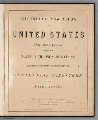
Author
Mitchell, Samuel Augustus Jr.
Full Title
(Title Page) Mitchell's New Atlas Of The United States And Territories, Together With Plans Of The Principal Cities. Designed To Accompany And Illustrate The Centennial Gazetteer Of The United States. Published By Ziegler & McCurdy, Philadelphia, Pa., Cincinnati, O., Chicago, Ill., St. Louis, Mo., And Springfield, Mass. Entered ... 1874, by S. Augustus Mitchell ... Washington.
Publisher
Ziegler & McCurdy
Author
[Heermans, Anna A., Cogswell, Charlotte B.]
Full Title
(Title Page to) A Hieroglyphic Geography Of The United States. Part 1 Containing The States Of Maine, New Hampshire, Vermont, Massachusetts, Rhode Island, Connecticut And New York. Designed And Drawn By Anna A. Heermans. Engraved By Charlotte B. Cogswell, Cooper Union Engraving School, New York. New York, E.P. Dutton And Company, 713 Broadway, 1875. (on verso) Entered ... 1874, by Charlotte B. Cogswell ... Washington. Riverside, Cambridge: Electrotyped And Printed By H.O. Houghton And Company.
Publisher
E.P. Dutton & Co.
Author
[Lloyd, H.H., Warner & Beers]
Full Title
(Title Page to) Atlas of Whiteside Co. and the State of Illinois To Which Is Added An Atlas Of The United States, Maps of The Hemispheres &c. &c. &c. Warner & Beers. Publishers 62 & 64 West Lake Street, Chicago. 1872. Union Lith. & Printg. Co. Chicago. Assistants: Jos. H. Cox, W.H. Bishop, G.R. Hoffman, L.W. Wight, A.D. Miner, E.C. Moore ... H.R. Belden, John I. Moore, Chas. H. Sharp, R.T. Higgins, Wm. H. Beers, Frank W. Rorh. Entered ... 1872 by Warner & Beers ... Washington D.C.
Publisher
Warner & Beers
Author
U.S. General Land Office
Full Title
(Title Page to) Report of the Commissioner of General Land Office, for the Year 1867. Abridged and published by order of the Senate of the United States. Washington: Government Printing Office. 1867.
Publisher
Government Printing Office
Author
[Cowles, Calvin D., Davis, George B., Kirkley, JAW., Perry, Leslie J., United States. War Department]
Full Title
(Title Page to) Atlas to accompany the official records of the Union and Confederate armies. Published under the direction of the Hons. Redfield Proctor, Stephen B. Elkins and Daniel S. Lamont, secretaries of war, by Maj. George B. Davis, U.S. Army, Mr. Leslie J. Perry, civilian expert, Mr. Joseph W. Kirkley, civilian expert, Board of Publication. Compiled by Capt. Calvin D. Cowles, 23d U.S. Infantry. Washington: Government Printing Office, 1891-1895.
Publisher
U.S. Government Printing Office
Author
[Cowles, Calvin D., Davis, George B., Kirkley, JAW., Perry, Leslie J., United States. War Department]
Full Title
(Text Page to) Atlas to accompany the official records of the Union and Confederate armies. Published under the direction of the Hons. Redfield Proctor, Stephen B. Elkins and Daniel S. Lamont, secretaries of war, by Maj. George B. Davis, U.S. Army, Mr. Leslie J. Perry, civilian expert, Mr. Joseph W. Kirkley, civilian expert, Board of Publication. Compiled by Capt. Calvin D. Cowles, 23d U.S. Infantry. Washington: Government Printing Office, 1891-1895.
Publisher
U.S. Government Printing Office
Author
[Gannett, Henry, 1846-1914, Hewes, Fletcher W.]
Full Title
(Title Page to) Scribner's statistical atlas of the United States showing by graphic methods their present condition and their political, social and industrial development. By Fletcher W. Hewes and Henry Gannett, Chief Geographer of the United States Geological Survey. Formerly Geographer of the tenth census of the United States. New York, Charles Scribner's Sons, 743 and 745 Broadway. (verso) Copyright 1883 by Charles Scribner's Sons. Struthers, Servoss & Co., Engravers, Nos. 32 and 34 Frankfort Street, New York. J.J. Little & Co., Printers, Nos. 10 to 20 Astor Place, New York. Haddon & Co., Binders, Nos. 139 to 143 Centre Street, New York.
Publisher
Charles Scribner's Sons
Author
[Gannett, Henry, 1846-1914, Hewes, Fletcher W.]
Full Title
(Title Page Verso to) Scribner's statistical atlas of the United States showing by graphic methods their present condition and their political, social and industrial development. By Fletcher W. Hewes and Henry Gannett, Chief Geographer of the United States Geological Survey. Formerly Geographer of the tenth census of the United States. New York, Charles Scribner's Sons, 743 and 745 Broadway. (verso) Copyright 1883 by Charles Scribner's Sons. Struthers, Servoss & Co., Engravers, Nos. 32 and 34 Frankfort Street, New York. J.J. Little & Co., Printers, Nos. 10 to 20 Astor Place, New York. Haddon & Co., Binders, Nos. 139 to 143 Centre Street, New York.
Publisher
Charles Scribner's Sons
Author
Bache, A. D.
Full Title
(Title Page to) Maps and charts of the United States Coast Survey. A.D. Bache, Superintendent. To July, 1854.
Publisher
U.S.
Author
Cram, George Franklin
Full Title
(Title Page to) New Commercial Atlas Of The United States and Territories: (Scale, 21 Miles To The Inch.) Showing All Railroads, Stations, Cities, Towns, Villages, Congressional Townships, Etc., Etc. A Complete Shippers' Guide. Drawn And Engraved From The Very Latest Government Surveys. Published By The Cram Atlas Company, New York And Chicago: Western Office, No. 66 Lake Street, Chicago. Entered ... 1875, by The Cram Atlas Company ... Washington, District of Columbia. Printed At The Lakeside Press, Clark And Adams Sts., Chicago.
Publisher
Cram Atlas Company
Author
Rand McNally and Company
Full Title
(Title Page to) Rand McNally auto road atlas of the United States and Ontario, Quebec, and the Maritime Provinces of Canada, with a brief description of the national parks and monuments. Copyright, 1927, by Rand McNally & Company.
Publisher
Rand McNally
Author
Klinckowstrom, Axel Leonhard
Full Title
Title Page to: Atlas til Friherre Klinckowstroms Bref om de Forente Staterne. (Stockholm) Stente af C. Muller, (1824)
Publisher
C. Muller
Author
Marshall, John
Full Title
(Title Page to) Vie De George Washington. Collection de Planches. Paris, Dentu, Imprimeur-Libraire, Rue Du Pont-De-Lodi, No. 3. M.D.CCC.VII. (1807)
Publisher
Dentu, Imprimeur-Libraire.
Author
Marshall, John
Full Title
(Title Page to) The Life of George Washington. Maps and Subscribers' Names. Philadelphia: Published By C.P. Wayne. 1807. (Atlas volume only).
Publisher
C.P. Wayne
Author
Becker, George F.
Full Title
(Title Page to) Department Of The Interior, United States Geological Survey, J.W. Powell Director. Atlas to Accompany a Monograph on The Geology of the Quicksilver Deposits of the Pacific Slope By George F. Becker. Washington 1887. Giles Litho. & Liberty Printing Co. N.Y.
Publisher
United States Geological Survey
Author
Hague, Arnold
Full Title
(Title Page to) Department Of The Interior, United States Geological Survey, Charles D. Walcott, Director. Atlas To Accompany Monograph XXXII On The Geology Of The Yellowstone National Park, By Arnold Hague. Washington, 1904. Julius Bien & Co. Lith. N.Y.
Publisher
United States Geological Survey
Author
Colton, G.W.
Full Title
(Title Page to) Colton's Atlas Of America. Illustrating The Physical And Political Geography Of North And South America And The West India Islands, By George W. Colton. Accompanied By Descriptions Geographical, Statistical, And Historical, By Richard Swainson Fisher, M.D. New York: J.H. Colton And Company, No. 172 William, Corner Beekman Street. 1857. Entered ... One Thousand Eight Hundred and Fifty-five, by J.H. Colton And Company ... New York.
Publisher
J.H. Colton
Author
Scott, Joseph
Full Title
(Title Page to) The United States Gazetteer: Containing an Authentic Description of the Several States. Illustrated with Nineteen Maps. By Joseph Scott. Philadelphia: Printed By F. & R. Bailey, at Yorick's Head, No. 116, High Street. 1795. (Published according to Act of Congress.)
Publisher
F. & R. Bailey
Author
[Pacific Railroad Survey, Warren, Gouverneur Kemble, 1830-1882]
Full Title
(Title Page to) Memoir to accompany the Map of the territory of the United States from the Mississippi River to the Pacific Ocean, giving a brief account of each of the exploring expeditions since A.D. 1800, with a detailed description of the method adopted in compiling the general map. By Lieut. Gouverneur K. Warren, Corps of Topographical Engineers, U.S.A. 1859.
Publisher
[A.O.P. Nicholson I-XI, T. Ford XII.]
Author
Phelps & Ensign
Full Title
(Title Page to) Phelps & Ensign's Traveller's Guide Through the United States ... Illustrated By A New And Accurate Map Of The United States. New York: Phelps & Ensign, No. 7 Bowery. 1845. Entered .. 1838, by Phelps & Ensign .. New York. (with) Phelps & Ensign's Travellers' Guide, and Map of the United States ... New York, Published by T & E.H. Ensign, 1845. Engraved on Steel by J.Wells, Brooklyn L.I. Entered ... 1837 by Phelps & Squire ... New York. (with 16 inset maps).
Publisher
Phelps & Ensign
Author
Phelps & Ensign
Full Title
(Title Page to) Phelps & Ensign's Traveller's Guide Through the United States ... Illustrated By A New And Accurate Map Of The United States. New York: Phelps & Ensign, No. 7 Bowery. 1843. Entered .. 1838, by Phelps & Ensign .. New York. (with) Phelps & Ensign's Travellers' Guide, and Map of the United States ... New York, Published by T & E.H. Ensign, 1843. Engraved on Steel by J.Wells, Brooklyn L.I. Entered ... 1837 by Phelps & Squire ... New York. (with 16 inset maps).
Publisher
Phelps & Ensign
Author
[Ensigns & Thayer, Phelps, Humphrey]
Full Title
(Title Page to) Phelps's Travellers' Guide Through The United States ... Accompanied With A New Map Of The United States. New-York: Published By Ensigns & Thayer, 50 Ann-Street. 1849. (with) Phelps's National Map Of The United States, A Travellers Guide ... New York, Published By Ensign & Thayer ... 1849. Drawn & Engraved by J.M. Atwood, N.Y. Entered ... 1849, by Ensign & Thayer ... New York. (with 3 inset maps).
Publisher
Ensigns & Thayer
Author
[Pownall, Thomas, 1722-1805, Evans, Lewis, 1700?-1756, Almon, John, 1737-1805, Turner, James, d. 1759, Gist, Christopher, d. 1750]
Full Title
(Title page to) A Topographical Description of Such Parts of North America as are Contained in the (Annexed) Map of the Middle British Colonies, in North America.
Publisher
John Almon
Author
[Mitchell, Samuel Augustus, Young, J.H.]
Full Title
(Title Page to) Mitchell's Traveller's Guide Through The United States, Containing The Principal Cities, Towns, &c.... Illustrated By An Accurate Map Of The United States. Philadelphia: Thomas, Cowperthwait, & Co. 253 Market Street. 1839. (on verso) Entered ... 1836, by Mitchell & Hinman ... Pennsylvania. Stereotyped by John Fagan ... Philadelphia. (with map) Mitchell's Travellers Guide Through The United States. A Map Of The Roads, Distances, Steam Boat & Canal Routes &c. By J.H. Young. Philadelphia. Published by S. Augustus Mitchell. 1839. Engraved On Steel By J.H. Young And D. Haines. Entered ... 1834 by S. Augustus Mitchell ... Pennsylvania. (with 9 inset maps).
Publisher
Samuel Augustus Mitchell
Author
Finley, Anthony
Full Title
(Title Page to) A New American Atlas, Designed Principally To Illustrate The Geography Of The United States Of North America; In Which Every Country In Each State And Territory Of The Union Is Accurately Delineated, As Far As At Present Known: The Whole Compiled From The Latest And Most Authentic Information. Philadelphia: Published By Anthony Finley, At The North-East Corner Of Chestnut And Fourth Streets. 1826.
Publisher
Anthony Finley
Author
[Mitchell, Samuel Augustus, Young, James H., Drake, Ira S., Hazzard, J.L.]
Full Title
(Title Page to) Mitchell's New Traveller's Guide Through The United States and the Canadas, Containing The Principal Cities And Towns ... Illustrated By An Accurate Map Of The United States ... Philadelphia: Charles Desilver, No. 714 Chestnut Street, Opposite The Masonic Hall. 1860. (on verso) Entered ... 1859, by Charles Desilver ... Pennsylvania. (with) A New Map Of The United States of America. By J.H. Young. Philadelphia. Published By Charles Desilver ... Entered ... 1859, by Charles Desilver ... Pennsylvania (with 2 inset maps). (with map) Mitchell's New Traveller's Guide Through The United States ... Drawn and Engraved by J.L. Hazzard & I.S. Drake. Philadelphia. Published by Charles Desilver ... 1860. Entered ... 1848 by Charles Desilver ... Pennsylvania (with 5 inset maps).
Publisher
Charles Desilver
Author
Tanner, Henry S.
Full Title
(Title Page to) The American Traveller, or Tourists' and Emigrants' Guide Through the United States. Containing Brief Notices of the Several States, Cities, Principal Towns ... Tenth Edition. With Several Additional Routes, and a Map, in which the various routes described in the work, are represented by appropriate lines. By H.S. Tanner. New York: Published at the Map Establishment, No. 237 Broadway. 1846. (on verso) Entered ... 1846, By H.S. Tanner ... New York.
Publisher
The Map Establishment
Author
[U.S. Northern Boundary Commission, Campbell, A.]
Full Title
(Title Page) Joint Maps Of The Northern Boundary Of The United States, From The Lake Of The Woods To The Summit Of The Rocky Mountains. United States Northern Boundary Commission, Archibald Campbell Esq. Commissioner. W.J. Twining, Capt. of Engrs, U.S.A. Chief Astronomer. Her Majesty's North American Boundary Commission, D.R. Cameron, Maj. Royal Art. Commissioner. S. Anderson, Capt. Royal Engrs. Chief Astronomer.
Publisher
U.S.
Author
Phelps & Ensign
Full Title
(Title Page to) Phelps & Ensign's Traveller's Guide Through the United States ... Illustrated By A New And Accurate Map Of The United States. New York: Phelps & Ensign, No. 7 Bowery. 1839. Entered .. 1838, by Phelps & Ensign .. New York. (with) Phelps & Ensign's Travellers' Guide, and Map of the United States ... New York, Published by Phelps & Ensign, 1839. Engraved on Steel by J.Wells, Brooklyn L.I. Entered ... 1837 by Phelps & Squire ... New York. (with 16 inset maps).
Publisher
Phelps & Ensign
Author
Tanner, Henry S.
Full Title
(Title Page to) The American Traveller; Or Guide Through the United States. Containing Brief Notices of the Several States, Cities, Principal Towns ... Alphabetically arranged, Eighth Edition. By H.S. Tanner. Philadelphia: Published by H. Tanner, Jr. New York: T.R. Tanner. 1842. (on verso) Entered ... 1839, by H.S. Tanner ... Pennsylvania. With direct References to the accompanying Map "The Travellers Guide or Map of the Roads, Canals, and Railways of the United States. With the distances from place to place by H.S. Tanner.
Publisher
H. Tanner Jr.
Author
Williams, Wellington
Full Title
(Title Page to) The Traveller's and Tourist's Guide Through the United States of America, Canada, etc. Containing the Routes of Travel by Railroad, Steamboat, Stage and Canal...Accompanied by an Entirely New and Authentic Map of the United States, Including California, Oregon, etc., and a Map of the Island of Cuba. By W. Williams. Philadelphia: Lippincott, Grambo & Co. MDCCCLII. (on verso) Entered ... 1851, by W. Williams ... Pennsylvania.
Publisher
Lippincott, Grambo & Co.
Author
Smith, J. Calvin
Full Title
(Title Page to) The Illustrated Hand-Book, A New Guide for Travelers Through The United States of America... Embellished with 125 highly finished Engravings. Accompanied By A Large and Accurate Map. By J. Calvin Smith. New York: Published By Sherman & Smith, 122 Broadway, N.W. Cor. Cedar-St. 1847. Entered ...1846, by Sherman & Smith ... (with) A New Map For Travellers Through the United States of America Showing the Railroads, Canals & Stage Roads, With The Distances, by J. Calvin Smith. Published by Sherman & Smith, New-York. 1846. Entered ... 1846, by J. Calvin Smith ... (inset) Map Of Oregon Northern California Santa Fe &c. (4 additional inset maps).
Publisher
Sherman & Smith
Author
[Mitchell, Samuel Augustus, Drake, Ira S.]
Full Title
(Title Page to) Mitchell's New Traveller's Guide Through The United States and the Canadas, Containing The Principal Cities And Towns... Illustrated By An Accurate Map Of The United States ... Philadelphia: Charles Desilver, 253 Market Street. 1855. (on verso) Entered ... 1855, by Charles Desilver ... Pennsylvania. Stereotyped By J. Fagan. Printed By Smith & Peters. (with map) Mitchell's New Traveller's Guide Through The United States, Showing the Rail Roads, Canals, Stage Roads &c ... by Ira S. Drake. Philadelphia 1855. Published by Charles Desilver ... Entered ... 1848, by Thomas, Cowperthwait, & Co. ... Pennsylvania. (with 5 inset maps).
Publisher
Charles Desilver
Author
Tanner, Henry S.
Full Title
(Title Page to) The American Traveller; Or Guide Through the United States. Containing Brief Notices of the Several States, Cities, Principal Towns ... Sixth Edition. By H.S. Tanner. Philadelphia: Published by the Author, No. 309 Market Street. 1840. (on verso) Entered ... 1839, by H.S. Tanner ... Pennsylvania.
Publisher
Henry S. Tanner
Author
Leahy, J.F.
Full Title
(Title Page to) Leahy's Hotel Guide and Railway Distance Maps of America. The Green book, It Shows the Way. Published by American Hotel Register Company. Leahy Building 228-234 W. Ontario street, Chicago, Ill. Established Nearly Half Century. Revised Edition No. 59, Copyrighted Jan. 1934. Price of this book, complete $5.00. Subscription, Five Years .... $20.00, Combined Guide and Map of any Individual State 25 cents.
Publisher
American Hotel register Co.
Author
Hewett, Daniel
Full Title
(Title Page to) The Traveller's Guide Through The United States, And Brief Geographical View Of The World ... Being the Outlines of a Course of Lectures on Geography. By D. Hewett, A.M. New York Published for the Author, at No. 73 Vesey Street, March, 1822. (with map) United States. J.D. Stout. (with folded sheet) General View Of The World. Arranged according to the course of Geographical Lectures by D. Hewett.
Publisher
D. Hewett
Author
Phelps & Ensign
Full Title
(Title Page to) Phelps & Ensign's Traveller's Guide Through the United States ... Illustrated By A New And Accurate Map Of The United States. New York: Phelps & Ensign, No. 7 Bowery. 1838. Entered .. 1838, by Phelps & Ensign .. New York. (with) Phelps & Ensign's Travellers' Guide, and Map of the United States ... New York, Published by Phelps & Ensign, 1838. Engraved on Steel by J.Wells, Brooklyn L.I. Entered ... 1837 by Phelps & Squire ... New York. (with 16 inset maps).
Publisher
Phelps & Ensign
Author
[Pacific Railroad Survey, Warren, Gouverneur Kemble, 1830-1882]
Full Title
(Title Page to) Reports of Explorations and Surveys, to Ascertain the Most Practicable and Economical Route for a Railroad From the Mississippi River to the Pacific Ocean. Made Under the Direction of the Secretary of War, In 1853-56, According to Acts of Congress of March 3, 1853, May 31, 1854, and August 5, 1854. Volume XI. Washington: George W. Bowman, Printer. 1861. 36th Congress, 2d Session, Senate, Ex. Doc.
Publisher
[A.O.P. Nicholson I-XI, T. Ford XII.]
Author
[Pacific Railroad Survey, Warren, Gouverneur Kemble, 1830-1882]
Full Title
(Title Page to) Topographical maps, profiles, and sketches to illustrate the various Reports of Surveys for railroad routes from the Mississippi River to the Pacific Ocean. Washington, D.C., 1861.
Publisher
[A.O.P. Nicholson I-XI, T. Ford XII.]
|