Who What Where WhenREMOVE |
Author
Clason Map Company
Full Title
Approved Mineral Surveys Of The Principal Mining Districts In Boulder County Colorado. 1916. Published By The Clason Map Co. 1515 Tremont Place, Denver, Colo. Copyrighted 1916 by The Clason Map Co. Denver, Colo.
Publisher
Clason Map Company
Author
Thayer, H.L.
Full Title
(Covers to) Thayer's Map Of The Leadville Mines California Mining District Lake County Colorado. ... Compiled From The United States Surveys And County Records. Published by H.L. Thayer, Leadville, Colorado. Julius Bien, Photo-Lith. N.Y.
Publisher
H.L. Thayer
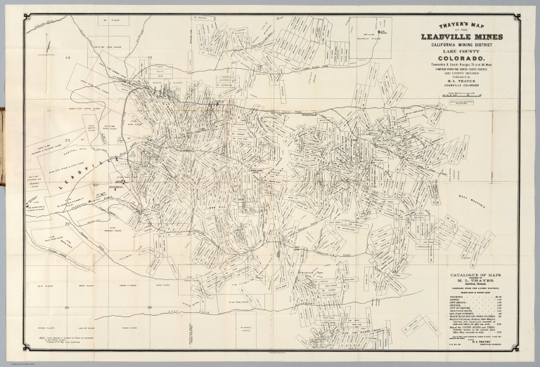
Author
Thayer, H.L.
Full Title
Thayer's Map Of The Leadville Mines California Mining District Lake County Colorado. ... Compiled From The United States Surveys And County Records. Published by H.L. Thayer, Leadville, Colorado. Julius Bien, Photo-Lith. N.Y.
Publisher
H.L. Thayer
Author
[Page, H.R. & Co., Blake, J.A]
Full Title
Blake's New Map Of Colorado. 1881. J.A. Blake, Publisher, 294 Fifteenth Street, Denver. Copyrighted 1880 by H.R. Page. A. Loehnes.
Publisher
J.A. Blake
Author
Leahy, J.F.
Full Title
(Index Page to) Leahy's Hotel Guide and Railway Distance Maps. Colorado.
Publisher
American Hotel register Co.
Author
Leahy, J.F.
Full Title
Leahy's Hotel Guide and Railway Distance Map of the State of Colorado. Published by American Hotel Register Company. Leahy Build., 228-234 W. Ontario St., Chicago, Ill. Copyrighted by J.F. Leahy, Jan., 1934.
Publisher
American Hotel register Co.
Author
Nell, Louis
Full Title
(Covers to) Nell's Topographical Map Of The State Of Colorado. The Kendrick Book & Stationery Co. Denver, 1905. C.A. Kendrick, Pres. H.E. Bellamy, Vice Pres. Copyright by Louis Nell, Denver, Colo. 1903. The Friedenwald Co. Photo-Lith. Balto.
Publisher
Kendrick Book & Stationery Co.
Author
Nell, Louis
Full Title
(Index to) Nell's Topographical Map Of The State Of Colorado. The Kendrick Book & Stationery Co. Denver, 1905. C.A. Kendrick, Pres. H.E. Bellamy, Vice Pres. Copyright by Louis Nell, Denver, Colo. 1903. The Friedenwald Co. Photo-Lith. Balto.
Publisher
Kendrick Book & Stationery Co.
Author
Nell, Louis
Full Title
Nell's Topographical Map Of The State Of Colorado. The Kendrick Book & Stationery Co. Denver, 1905. C.A. Kendrick, Pres. H.E. Bellamy, Vice Pres. Copyright by Louis Nell, Denver, Colo. 1903. The Friedenwald Co. Photo-Lith. Balto.
Publisher
Kendrick Book & Stationery Co.
Author
Thayer, H.L.
Full Title
(Covers to) Thayer's Map of Colorado. Published by H.L. Thayer & Co. Denver, Colorado. 1875. Sixth Edition. Entered ... 1875 by H.L. Thayer & Co. ... Washington. Rufus Blanchard Engraver. H.L. Thayer Draftsman.
Publisher
H.L. Thayer
Author
Thayer, H.L.
Full Title
Thayer's Map of Colorado. Published by H.L. Thayer & Co. Denver, Colorado. 1875. Sixth Edition. Entered ... 1875 by H.L. Thayer & Co. ... Washington. Rufus Blanchard Engraver. H.L. Thayer Draftsman.
Publisher
H.L. Thayer
Author
W. & A.K. Johnston Limited
Full Title
Montana, Wyoming (North). Utah, Colorado, Wyoming (South).
Publisher
W. & A.K. Johnston Limited
Author
[Bishop, F. M., De Motte, B. C., Geological and Geographical Survey of the Territories (U.S.), Powell, John Wesley, 1834-1902, Thompson, A. H. (Almon Harris), 1839-1906]
Full Title
Green River from the Union Pacific Rail Road to the mouth of White River, 1873 (land cover). Department of the Interior. U.S. Geological and Geographical Survey of the Territories. Second Division. J.W. Powell, geologist in charge, A.H. Thompson, geographer, B.C. De Motte & F.M. Bishop, topographers. W.H. Graves del. Outlines engraved by S.J. Kubel. U.S. G. and G. Survey, 2d. Div. ... Geology of the Unita Mountains. (Julius Bien Lith.)
Publisher
Julius Bien
Author
[Bishop, F. M., De Motte, B. C., Geological and Geographical Survey of the Territories (U.S.), Powell, John Wesley, 1834-1902, Thompson, A. H. (Almon Harris), 1839-1906]
Full Title
Green River from the Union Pacific Rail Road to the mouth of White River, 1873 (geology). Department of the Interior. U.S. Geological and Geographical Survey of the Territories. Second Division. J.W. Powell, geologist in charge, A.H. Thompson, geographer, B.C. De Motte & F.M. Bishop, topographers. W.H. Graves del. Outlines engraved by S.J. Kubel. U.S. G. and G. Survey, 2d. Div. ... Geology of the Unita Mountains. (Julius Bien Lith.)
Publisher
Julius Bien
Author
[Geological and Geographical Survey of the Territories (U.S.), Powell, John Wesley, 1834-1902]
Full Title
Structure sections through the Uinta Mountains. U.S. G. and G. Survey, 2d. Div., J.W. Powell, geologist in charge. Geology of the Unita Mountains. (Julius Bien Lith.)
Publisher
Julius Bien
Author
[Geological and Geographical Survey of the Territories (U.S.), Powell, John Wesley, 1834-1902]
Full Title
Displacement diagrams derived from the Structure sections through the Uinta Mountains, pl. I. U.S. G. and G. Survey, 2d. Div., J.W. Powell, geologist in charge. Geology of the Unita Mountains. (Julius Bien Lith.)
Publisher
Julius Bien
Author
[Geological and Geographical Survey of the Territories (U.S.), Powell, John Wesley, 1834-1902]
Full Title
Stereogram of the displacements of the eastern portion of the Uinta Mountains. U.S. G. and G. Survey, 2d. Div., J.W. Powell, geologist in charge. Geology of the Unita Mountains. (Julius Bien Lith.)
Publisher
Julius Bien
Author
[Geological and Geographical Survey of the Territories (U.S.), Gilbert, Grove Karl, 1843-1918, Powell, John Wesley, 1834-1902]
Full Title
Bird's-eye view of a part of the Uinta Uplift. Designed by G.K. Gilbert. U.S. G. and G. Survey, 2d. Div., J.W. Powell, geologist in charge. Geology of the Unita Mountains. (Julius Bien Lith.)
Publisher
Julius Bien
Author
[Geological and Geographical Survey of the Territories (U.S.), Powell, John Wesley, 1834-1902]
Full Title
Stereogram of the displacements of the Yampa Plateau. U.S. G. and G. Survey, 2d. Div., J.W. Powell, geologist in charge. Geology of the Unita Mountains. (Julius Bien Lith.)
Publisher
Julius Bien
Author
[Geological and Geographical Survey of the Territories (U.S.), Marvine, Archibald Robertson, 1848-1876, Powell, John Wesley, 1834-1902]
Full Title
No. 1. Structure section through the Aspen Mountain Uplift. No. 2. Displacement diagram derived from the above section. (with) Generalized structure section through the Park Mountains. By Archibald R. Marvine. U.S. G. and G. Survey, 2d. Div., J.W. Powell, geologist in charge. Geology of the Unita Mountains. (Julius Bien Lith.)
Publisher
Julius Bien
Author
[Geological and Geographical Survey of the Territories (U.S.), Powell, John Wesley, 1834-1902]
Full Title
(Covers to) Atlas accompanying the report on the geology of a portion of the Uinta Mountains and a region of country adjacent thereto by J.W. Powell, Geologist in charge 1876. Julius Bien Lith. Department of the Interior, U.S. Geographical and Geological Survey of the Territories, Second Division.
Publisher
Julius Bien
Author
[Geological and Geographical Survey of the Territories (U.S.), Powell, John Wesley, 1834-1902]
Full Title
(Title Page to) Atlas accompanying the report on the geology of a portion of the Uinta Mountains and a region of country adjacent thereto by J.W. Powell, Geologist in charge 1876. Julius Bien Lith. Department of the Interior, U.S. Geographical and Geological Survey of the Territories, Second Division.
Publisher
Julius Bien
Author
Clason Map Company
Full Title
(Covers to) Clason's Denver Green Guide. The Clason Map Co. Chicago - Denver. New Census Edition 35 (cents). (with) Clason's Guide Map Of Denver Colorado. Published By The Clason Map Co. Chicago, Ill. Denver, Colo. Copyrighted By the Clason Map Co. Denver, Colo. (inset map) Denver Business District.
Publisher
Clason Map Company
Author
Clason Map Company
Full Title
(View to) Clason's Denver Green Guide. The Clason Map Co. Chicago - Denver. New Census Edition 35 (cents). (with) Clason's Guide Map Of Denver Colorado. Published By The Clason Map Co. Chicago, Ill. Denver, Colo. Copyrighted By the Clason Map Co. Denver, Colo. (inset map) Denver Business District.
Publisher
Clason Map Co.
Author
Clason Map Company
Full Title
(Title Page to) Clason's Denver Green Guide. The Clason Map Co. Chicago - Denver. New Census Edition 35 (cents). (with) Clason's Guide Map Of Denver Colorado. Published By The Clason Map Co. Chicago, Ill. Denver, Colo. Copyrighted By the Clason Map Co. Denver, Colo. (inset map) Denver Business District.
Publisher
Clason Map Co.
Author
Clason Map Company
Full Title
Clason's Guide Map Of Denver Colorado. Published By The Clason Map Co. Chicago, Ill. Denver, Colo. Copyrighted By the Clason Map Co. Denver, Colo. (inset map) Denver Business District. (with guide book) Clason's Denver Green Guide. The Clason Map Co. Chicago - Denver. New Census Edition 35 (cents).
Publisher
Clason Map Co.
Author
Page, H.R. & Co.
Full Title
Page's Map of Colorado. Copyrighted 1880 by H.R. Page.
Publisher
H.R. Page & Co.
Author
U.S. General Land Office
Full Title
(Map 11 - Wyoming, Nebraska, Colorado, Kansas, South Dakota).
Publisher
Julius Bien
Author
Bolitho, Edwin
Full Title
Colorado. Russell & Struthers, Engr's N. Y. (to accompany) Pocket Mining Atlas. Compiled From The Latest Official Surveys, And The Most Authentic Sources. Edwin Bolitho, Engineering and Mining Journal, New York, 1880. Price, $1.00 per copy. (on following page) Entered ... 1880 ... Washington, D.C., by Trask & Francis, Bankers ... 70 Broadway, New York ...
Publisher
Edwin Bolitho, Engineering and Mining Journal
Author
Bolitho, Edwin
Full Title
Map of San Juan, Colorado. (to accompany) Pocket Mining Atlas. Compiled From The Latest Official Surveys, And The Most Authentic Sources. Edwin Bolitho, Engineering and Mining Journal, New York, 1880. Price, $1.00 per copy. (on following page) Entered ... 1880 ... Washington, D.C., by Trask & Francis, Bankers ... 70 Broadway, New York ...
Publisher
Edwin Bolitho, Engineering and Mining Journal
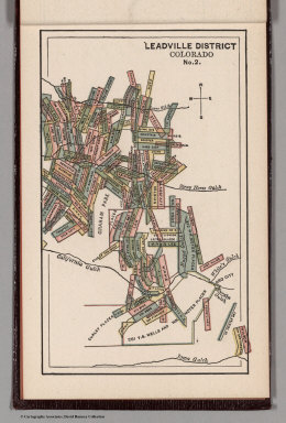
Author
Bolitho, Edwin
Full Title
Leadville District, Colorado. No. 1. (to accompany) Pocket Mining Atlas. Compiled From The Latest Official Surveys, And The Most Authentic Sources. Edwin Bolitho, Engineering and Mining Journal, New York, 1880. Price, $1.00 per copy. (on following page) Entered ... 1880 ... Washington, D.C., by Trask & Francis, Bankers ... 70 Broadway, New York ...
Publisher
Edwin Bolitho, Engineering and Mining Journal
Author
Bolitho, Edwin
Full Title
Leadville District, Colorado. No. 2. (to accompany) Pocket Mining Atlas. Compiled From The Latest Official Surveys, And The Most Authentic Sources. Edwin Bolitho, Engineering and Mining Journal, New York, 1880. Price, $1.00 per copy. (on following page) Entered ... 1880 ... Washington, D.C., by Trask & Francis, Bankers ... 70 Broadway, New York ...
Publisher
Edwin Bolitho, Engineering and Mining Journal
Author
Bolitho, Edwin
Full Title
Central City District, Col. (to accompany) Pocket Mining Atlas. Compiled From The Latest Official Surveys, And The Most Authentic Sources. Edwin Bolitho, Engineering and Mining Journal, New York, 1880. Price, $1.00 per copy. (on following page) Entered ... 1880 ... Washington, D.C., by Trask & Francis, Bankers ... 70 Broadway, New York ...
Publisher
Edwin Bolitho, Engineering and Mining Journal
Author
Bolitho, Edwin
Full Title
Silver Cliff District, Colorado. (to accompany) Pocket Mining Atlas. Compiled From The Latest Official Surveys, And The Most Authentic Sources. Edwin Bolitho, Engineering and Mining Journal, New York, 1880. Price, $1.00 per copy. (on following page) Entered ... 1880 ... Washington, D.C., by Trask & Francis, Bankers ... 70 Broadway, New York ...
Publisher
Edwin Bolitho, Engineering and Mining Journal
Author
Bolitho, Edwin
Full Title
Map of Caribou Hill, Grand Island Mining District, Boulder County, Colorado. (to accompany) Pocket Mining Atlas. Compiled From The Latest Official Surveys, And The Most Authentic Sources. Edwin Bolitho, Engineering and Mining Journal, New York, 1880. Price, $1.00 per copy. (on following page) Entered ... 1880 ... Washington, D.C., by Trask & Francis, Bankers ... 70 Broadway, New York ...
Publisher
Edwin Bolitho, Engineering and Mining Journal
Author
Mitchell, Samuel Augustus Jr.
Full Title
Map of Kansas, Nebraska and Colorado. Showing also the southern portion of Dacotah. Drawn & Engraved by W.H. Gamble Philada. Entered ... 1861 by S. Augustus Mitchell, Jr. ... Pennsylvania.
Publisher
S.A. Mitchell Jr.
Author
Colton. G.W. & C.B.
Full Title
(Covers to) Colton's Sectional & Topographical Map of Colorado. Published by G.W. & C.B. Colton & Co. 172 William St. New York. 1871. Entered ... 1871 by G.W. & C.B. Colton & Co. ... Washington.
Publisher
G.W. & C.B. Colton
Author
Colton. G.W. & C.B.
Full Title
Colton's Sectional & Topographical Map of Colorado. Published by G.W. & C.B. Colton & Co. 172 William St. New York. 1871. Entered ... 1871 by G.W. & C.B. Colton & Co. ... Washington.
Publisher
G.W. & C.B. Colton
Author
Mitchell, Samuel Augustus Jr.
Full Title
County map of Colorado, Wyoming, Dakota, Montana. Entered ... 1874, by S. Augustus Mitchell ... Washington.
Publisher
S.A. Mitchell Jr.
Author
Mitchell, Samuel Augustus Jr.
Full Title
County map of Colorado, Wyoming, Dakota, Montana. Entered ... 1877 by S. Augustus Mitchell, . ... Washington.
Publisher
S.A. Mitchell Jr.
Author
Mitchell, Samuel Augustus Jr.
Full Title
Map of Kansas, Nebraska and Colorado. Showing the Southern Portion of Dacotah. Drawn and Engraved by W.H. Gamble Philada. Entered ... 1867 by S. Augustus Mitchell, Jr. ... Pennsylvania.
Publisher
S.A. Mitchell Jr.
Author
National Map Company
Full Title
Colorado. (Copyrighted by) National Map Company, Indianapolis. (to accompany) Official Paved Road and Commercial Survey of the United States.
Publisher
National Map Company
Author
Everts & Kirk
Full Title
Denver Junction, Weld Co., Colorado. (with) Saltillo ... (with) Firth ... (with) Roca ... (with) Malcolm ... (all) Lancaster Co. (Nebraska. Philadelphia, Everts & Kirk, 1885)
Publisher
Everts & Kirk
Author
Touring club italiano
Full Title
Stati Uniti, United States of America, Colorado, Kansas. (with San Francisco, Oakland, Berkeley region). Propr. Artistico-letteraria del T.C.I. Ufficio cartografico del T.C.I. (1929)
Publisher
Touring club italiano
Author
Touring club italiano
Full Title
(Legend to) Stati Uniti, United States of America, Colorado, Kansas ... New Mexico, Oklahoma, Texas. Propr. Artistico-letteraria del T.C.I. Ufficio cartografico del T.C.I. (1929)
Publisher
Touring club italiano
Full Title
Alpine Lake, summit of Cerro Blanco near Fort Garland, Colo. 1874. U.S. Geographical Surveys West of the 100th Meridian. (1889)
Publisher
U.S.
Full Title
Beaver Park Valley of Conejos River, Colorado. U.S. Geographical Surveys West of the 100th Meridian. (1889)
Publisher
U.S.
Full Title
Lost Lakes, head of Conejos River, Colorado, Glacier Peak in the distance. U.S. Geographical Surveys West of the 100th Meridian. (1889)
Publisher
U.S.
Author
[United States. Army. Corps of Engineers, Wheeler, G.M.]
Full Title
Sketch of Pioche, Nevada showing position of astronomical monument and meridian marks. Sketch of Virginia City, Nevada showing position of astronomical monument. Sketch of Hughes, Colorado showing position of astronomical monument and meridian mark. Sketch of Colorado Springs, Colorado showing position of astronomical monument. Sketch of Labran, Colorado showing position of astronomical monument and meridian mark. Sketch of Trinidad, Colorado showing position of astronomical monument. Expeditions of 1872, 1873, 1874, 1875 & 1876, under the command of 1st Lieut. Geo. M. Wheeler, Corps of Engineers, U.S. Army. U.S. Geographical Surveys West of the 100th Meridian. George D. Clarke, del. The Graphic Co., N.Y. By order of the honorable the Secretary of War, under the direction of Brig. Gen. A.A. Humphreys, Chief of Engineers, U.S. Army. (1877)
Publisher
U.S.
Author
[United States. Army. Corps of Engineers, Wheeler, G.M.]
Full Title
Sketch of Beaver, Utah showing position of astronomical monument. Sketch of Cheyenne, Wyoming showing position of astronomical monument. Sketch of Fort Union, New Mexico showing position of astronomical monument. Sketch of Georgetown, Colorado showing position of astronomical monument and meridian mark. Sketch of St. George, Utah showing position of astronomical monument. Military reservation, Santa Fe, New Mexico showing position of astronomical monument. Expeditions of 1872, 1873, 1874, 1875 & 1876, under the command of 1st Lieut. Geo. M. Wheeler, Corps of Engineers, U.S. Army. U.S. Geographical Surveys West of the 100th Meridian. George D. Clarke, del. The Graphic Co., N.Y. By order of the honorable the Secretary of War, under the direction of Brig. Gen. A.A. Humphreys, Chief of Engineers, U.S. Army. (1877)
Publisher
U.S.
|