Who What Where WhenREMOVE |
Author
[Brockhaus, F.A., Leeder, Ehrenfried, Leutemann, Heinrich]
Full Title
Grossbritannien und Ireland.
Publisher
F.A. Brockhaus
Author
Wyld, James, 1812-1887
Full Title
Map of Ireland Divided into Provinces and Counties. J.W. del. (engraved by) Stockley, Sc. London, James Wyld, Charing Cross East. (to accompany) An Atlas of the World, Comprehending Separate Maps of its various Countries, Constructed & drawn from the latest Astronomical & Geographical Observations. By James Wyld, Geographer to Her Majesty and H. Late R.H. Prince Albert. London. Published by James Wyld (Successor to Mr. Faden) Charing Cross East. 1864.
Publisher
James Wyld
Author
Bellin, Jacques Nicolas, 1703-1772
Full Title
Carte de L'Irlande.
Publisher
J.N. Bellin
Author
Bellin, Jacques Nicolas, 1703-1772
Full Title
plan de la Ville de Dublin.
Publisher
J.N. Bellin
Author
Bellin, Jacques Nicolas, 1703-1772
Full Title
Port et Ville de Kingsaill en Irlande.
Publisher
J.N. Bellin
Author
Bellin, Jacques Nicolas, 1703-1772
Full Title
Plan de Galloway et ses Environs.
Publisher
J.N. Bellin
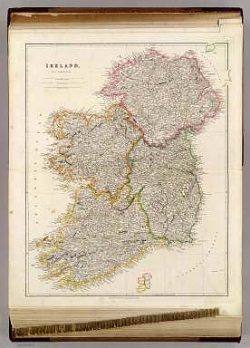
Author
Arrowsmith, Aaron Jr.
Full Title
Ireland. London, Published Jany. 4.1825 by A. & S. Arrowsmith, No.10 Soho Square.
Publisher
A. & S. Arrowsmith
Author
W. & A.K. Johnston Limited
Full Title
Edinburgh. Scottish Lake District. (Index Map to) Ireland.
Publisher
W. & A.K. Johnston Limited
Author
W. & A.K. Johnston Limited
Full Title
Ireland (Section 1)
Publisher
W. & A.K. Johnston Limited
Author
W. & A.K. Johnston Limited
Full Title
Ireland (Section 2).
Publisher
W. & A.K. Johnston Limited
Author
W. & A.K. Johnston Limited
Full Title
Ireland (Section 3). Ireland (Section 4).
Publisher
W. & A.K. Johnston Limited
Author
W. & A.K. Johnston Limited
Full Title
Ireland (Section 5). Ireland (Section 6).
Publisher
W. & A.K. Johnston Limited
Author
W. & A.K. Johnston Limited
Full Title
(Composite of) Ireland (Section 1-6).
Publisher
W. & A.K. Johnston Limited
Author
Mitchell, Samuel Augustus
Full Title
Ireland.
Publisher
S.A. Mitchell
Author
Mitchell, Samuel Augustus Jr.
Full Title
County map of Scotland. (with two inset maps) 72. Shetland Islands. 73. Ireland in Provinces and Counties. Entered ... 1860 by S. Augustus Mitchell, Jr. ... Pennsylvania.
Publisher
S.A. Mitchell Jr.
Author
[Gross, Alexander, Geographia Map Company]
Full Title
Great Britain & Ireland. Copyright "Geographia" Map Co. (Produced by) Alexander Gross, F.R.G.S. (inset map) Sheland Islands and Orkney Islands. (to accompany) "Geographia", Atlas of the World : Comprising 33 pages of colored maps, 10 pages of black and white maps, and 8 pages of useful information. Produced under the direction of Alexander Gross. F.R.G.S. Fellow of the Royal Geographical, Royal Economical, Royal Statistical, royal Meteorological and royal Aeronautical Societies. Copyright 1935 by "Geographia" Map Co., 11 John St., New York.
Publisher
Geographia Map Co.
Author
Arrowsmith, Aaron Jr.
Full Title
Ireland. Re- Published, Jany st. 1845, by G.F. Cruchley, Mapseller, 81 Fleet Street, London. (to accompany) Outlines Of The World. By A. Arrowsmith, Hydrographer to His Majesty. 1850.
Publisher
G.F. Cruchley
Author
[Andree, Richard, Times (London, England)]
Full Title
British Isles. (with 2 insets) The Shetland Islands and Orkney Islands. Environs of London. (Published at the office of "The Times," London, 1900).
Publisher
The Office of The Times
Author
[Andree, Richard, Times (London, England)]
Full Title
Scotland Geological map. (with inset) Shetland Islands. Ireland Geological map. ( (Published at the office of "The Times," London, 1900).
Publisher
The Office of The Times
Author
[Andree, Richard, Times (London, England)]
Full Title
Ireland. ( (Published at the office of "The Times," London, 1900).
Publisher
The Office of The Times
Author
Mitchell, Samuel Augustus Jr.
Full Title
Ireland in provinces and counties. County map of Scotland. (with inset) Shetland Islands.Entered ... 1874, by S. Augustus Mitchell ... Washington.
Publisher
S.A. Mitchell Jr.
Author
Vandermaelen, Philippe, 1795-1869
Full Title
Partie de l'Angleterre. Europe no. 7. (Dresse par Ph. Vandermaelen, lithographie par H. Ode. Premier partie. - Europe. Bruxelles. 1827)
Publisher
Ph. Vandermaelen
Author
Delamarche, Felix
Full Title
Iles Britanniques ... 1824.
Publisher
F. Delamarche
Author
Delamarche, Felix
Full Title
Norwege, Suede et Danemark ... 1823.
Publisher
F. Delamarche
Author
Vandermaelen, Philippe, 1795-1869
Full Title
Partie de l'Angleterre. Europe no. 12. (Dresse par Ph. Vandermaelen, lithographie par H. Ode. Premier partie. - Europe. Bruxelles. 1827)
Publisher
Ph. Vandermaelen
Author
Lothian, John
Full Title
Great Britain and Ireland.
Publisher
James MacLeod and Francis Orr & Sons
Author
Lothian, John
Full Title
Ireland.
Publisher
James MacLeod and Francis Orr & Sons
Author
Mitchell, Samuel Augustus
Full Title
Ireland.
Publisher
Thomas, Cowperthwait & Co.
Author
Society for the Diffusion of Useful Knowledge (Great Britain)
Full Title
Ireland, North Sheet.
Publisher
Edward Stanford
Author
Society for the Diffusion of Useful Knowledge (Great Britain)
Full Title
Ireland, (South) Sheet.
Publisher
Edward Stanford
Author
Mitchell, Samuel Augustus
Full Title
Ireland. Entered ... 1856 by Charles Desilver ... Pennsylvania.
Publisher
Charles DeSilver
Author
[Raynal, G.T., Bonne, R.]
Full Title
Carte des Isles Britanniques : contenant les Royaumes d'Angleterre, d'Ecosse et d'Irlande. Par M. Bonne, Ingenieur, Hdrographe de la Marine. (on upper margin) Liv. III IV X XIV XVI et XVII : No. 17 bis. &18. (to accompany) Histoire Philosophique et Politique Des Establissements et Du Commerce Des Europeens Dans Les Deux Indes.
Publisher
Jean-Leonard Pellet
Author
Johnson, A.J.
Full Title
Johnson's Ireland by Johnson & Browning. (with) Johnson's Scotland (with) two inset maps: Orkney Isles and Shetland Isles. No. 62-63.
Publisher
Johnson and Browning
Author
[Tardieu, Ambroise, Vuillemin, A., Duvotenay, Erhard, Testarode, E.]
Full Title
Iles Britanniques.
Publisher
Furne Et Cie
Author
Mitchell, Samuel Augustus Jr.
Full Title
County Map Of Scotland. (with inset map) Shetland Islands. (and) Ireland In Provinces And Counties. Entered ... 1876 by S. Augustus Mitchell, . ... Washington.
Publisher
S.A. Mitchell Jr.
Author
Bowen, Emanuel
Full Title
A new and accurate map of Great Britain & Ireland, together with their respective islands &c. Drawn from surveys and the most approved maps and charts. The whole being regulated by astronomical observations, by Emanl. Bowen. (London: Printed for William Innys, Richard Ware, Aaron Ward, J. and P. Knapton, John Clarke, T. Longman and T. Shewell, Thomas Osborne, Henry Whitridge ... M.DCC.XLVII)
Publisher
William Innys [et al.]
Author
Bowen, Emanuel
Full Title
A new and accurate map of Ireland. Laid down from the best authorities extant, and regulated by astronoml. observatns. By Emanl. Bowen. (London: Printed for William Innys, Richard Ware, Aaron Ward, J. and P. Knapton, John Clarke, T. Longman and T. Shewell, Thomas Osborne, Henry Whitridge ... M.DCC.XLVII)
Publisher
William Innys [et al.]
Author
[Marks, A. F. (Firm), Petri, Eduard Iulevic, 1854-1899, Shokalskago,Iu. M.]
Full Title
No.39. Velikobritaniia i Irlandiia. Izdanie i sobstven, tva. A.F. Marks V. Peterburgi. Pechat. v kartogr. art. zav. A. F. Marksa. (to accompany) Bolshoi vsemirnyi nastolny atlas Marksa. Depechatka 1916 goda. (with 3 insets).
Publisher
Izd. A.F. Marksa
Author
Mitchell, Samuel Augustus Jr.
Full Title
County map of Scotland. (inset map) 72. Shetland Islands. 73. Ireland in Provinces and Counties. Entered ... 1867 by S. Augustus Mitchell, Jr. ... Pennsylvania.
Publisher
S.A. Mitchell Jr.
Author
Delamarche, Felix.
Full Title
Carte des Iles Britanniques ... 1838.
Publisher
F. Delamarche
Author
Arrowsmith, Aaron Jr.
Full Title
Great Britain and Ireland. Insulae Britannicae. London, Published Jany. 2, 1828 by A. Arrowsmith Hydrographer to His Majesty, No. 10, Soho Square.
Publisher
A. Arrowsmith
Author
[Dower, John, Higgins, W.M.]
Full Title
British Isles.
Publisher
[W.S. Orr, Chambers, W. & R.]
Author
[Dower, John, Higgins, W.M.]
Full Title
Ireland.
Publisher
[W.S. Orr, Chambers, W. & R.]
Author
Stein, C.G.D.
Full Title
(Text Page to) Tableau de l'Angleterre : Historique, statistique, politique et militaire. Tabelle von England. Historisch, statistische, politische und militarische. (to accompany) Neuer Atlas Der Ganzen Welt.
Publisher
J.C. Hinrichs
Author
Stein, C.G.D.
Full Title
Neue karte von Gross-Britannien von Irland : mit einer histor, statist, politischen und militairischen Tabelle, nebst Erlauterungen, Herausgegeben und verlegt von J.C. Hinrichs in Leipzig 1826. Sitt v. Bruchner. Schrift gest. v. Leuteman. (to accompany) Neuer Atlas Der Ganzen Welt.
Publisher
J.C. Hinrichs
Author
Arrowsmith, John
Full Title
Ireland, By J. Arrowsmith. (Map) 7. London, Pubd. 15 Feby. 1842, by J. Arrowsmith, 10 Soho Square.
Publisher
John Arrowsmith
Full Title
British Isles. (with) Shetland Isles. Withington sculp. (Published by Lincoln & Edmands, 1819)
Publisher
Lincoln & Edmands
Full Title
British Isles. Asia. H. Morse Sc. Published by Lincoln & Edmands, Boston. (1832)
Publisher
Lincoln & Edmands
Full Title
Ireland. Philad., Published by M. Carey & Son, 1820. (1825)
Publisher
Carey & Lea
Author
Cornell, S. S. (Sarah S.)
Full Title
British Isles. Designed to accompany Cornell's High school geography. Entered ... 1855, by S.S. Cornell ... Southern District of New York. New York: D. Appleton & Co., 443 & 445 Broadway. (1864)
Publisher
Appleton & Co.
|