Who What Where WhenREMOVE |
Author
Arrowsmith, Aaron
Full Title
North America. Drawn by A. Arrowsmith. Engraved by Thomson & Hall. Published, 1817, by A. Constable & Co. Edinburgh.
Publisher
[A. Constable & Co., Longman & Compy]
Author
[Disturnell, John, Colton, J.H.]
Full Title
Map Of North America From The Latest Authorities Showing the Proposed Railroad Routes from the Atlantic to the Pacific Oceans. J.H. Colton & Co. New York, 1854, for J. Disturnell. Entered ... 1849, by J.H. Colton ... New York.
Publisher
J.H. Colton & Co. for J. Disturnell
Author
Wilkinson, Robert
Full Title
North America, Published the 12th of August 1824. By R. Wilkinson, No.125, Fenchurch Street, London. Republished, by William Darton; 58, Holborn Hill, 3. Jany. 1826. E. Bourne, Sculp.
Publisher
William Darton
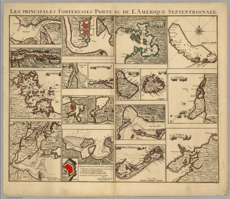
Author
[Covens, Jean, Mortier, Corneille, (Popple, Henry)]
Full Title
Les Principales Forteresses Ports &c. De L'Amerique Septentrionale. I.K.S.
Publisher
Covens & Mortier
Author
Mitchell, John
Full Title
A Map of the British and French Dominions in North America with the Roads, Distances, Limits and Extent of the Settlements.
Publisher
John Mitchell
Author
Prichard, James Cowles
Full Title
Ethnographical Map of North America, in the Earliest Times, Illustrative of Dr. Pritchard's Natural History of Man and His Researches into the Physical History of Mankind. Second Edition - 1861.
Publisher
H. Billere
Author
[Jones, C.H., Hamilton, T.H., Williams, J.David]
Full Title
North America. By T. Ettling.
Publisher
J. David Williams
Author
[Bayer, Herbert, Container Corporation of America]
Full Title
North America. Physical.
Publisher
Container Corporation of America
Author
Hall, S. (Sidney)
Full Title
North America. By Sidney Hall. London, published by Longman, Rees, Orme, Brown & Green, Paternoster Row, Augt. 1, 1829.
Publisher
Longman, Rees, Orme, Brown and Green
Author
Woodbridge, William C.
Full Title
Physical Map Of North America. Adapted To Woodbridge's Geography. Entered .. . 1843, by W.C. Woodbridge ... Massachusetts. Hartford. Published By Wm. Jas. Hamersley.
Publisher
Wm. Jas. Hamersley
Author
Woodbridge, William C.
Full Title
Political Map Of North America. Adapted To Woodbridge's Geography. Includes: References and Expalnations. Entered .. . 1843, by W.C. Woodbridge ... Massachusetts. Hartford. Published By Wm. Jas. Hamersley.
Publisher
Wm. Jas. Hamersley
Author
[Carey, Mathew, Warner, Benjamin]
Full Title
North America. From Arrowsmiths Large Map &cc. Philadelphia: Published By M. Carey, And B. Warner. 1816.
Publisher
M. Carey and B. Warner
Author
[Breese, Samuel, 1802-1873, Morse, Sidney E. (Sidney Edwards), 1794-1871]
Full Title
(Covers to) Morse's North American atlas. Containing the following beautifully colored maps ... New York: Published by Harper & Brothers, 82 Cliff Street. Entered ... 1842, by Sidney E. Morse and Samuel Breese ... New York.
Publisher
Harper & Brothers
Author
[Breese, Samuel, 1802-1873, Morse, Sidney E. (Sidney Edwards), 1794-1871]
Full Title
(Title Page, Contents to) Morse's North American atlas. Containing the following beautifully colored maps ... New York: Published by Harper & Brothers, 82 Cliff Street. Entered ... 1842, by Sidney E. Morse and Samuel Breese ... New York.
Publisher
Harper & Brothers
Author
[Breese, Samuel, 1802-1873, Morse, Sidney E. (Sidney Edwards), 1794-1871]
Full Title
North America. (By Sidney E. Morse and Samuel Breese. New York: Published by Harper & Brothers, 1845)
Publisher
Harper & Brothers
Author
Bradley, Abraham Junior
Full Title
Map of the United States, Exhibiting the Post-Roads, the situations, connexions and distances of the Post-Offices, Stage Roads, Counties & Principal Rivers By Abraham Bradley Junr. Entered ... 2nd day of June1804, by Abraham Bradley Junr. of the District of Columbia. (inset) Map Of North America. (1805)
Publisher
Abraham Bradley
Author
Bradley, Abraham Junior
Full Title
(Covers to) Map of the United States, Exhibiting the Post-Roads, the situations, connexions and distances of the Post-Offices, Stage Roads, Counties & Principal Rivers By Abraham Bradley Junr. Entered ... 2nd day of June1804, by Abraham Bradley Junr. of the District of Columbia. (inset) Map Of North America. (1805)
Publisher
Abraham Bradley
Author
[Liechtenstern, Joseph Marx von, Hartl, Martin]
Full Title
Nord America mit Benuzung der neuesten und zuverlaessigsten Quellen und Hulfsmittel nach dem Entwurfe des Herrn Ios. Marx Freiherrn von Liechtenstern gezeichnet von Martin Hartl. Wien, Im. Verlage des Kunst und Industrie Comptoirs. 1805.
Publisher
Kunst und Industrie Comptoirs
Author
Andriveau-Goujon, Eugène
Full Title
Amerique Du Nord. Paris 1877. E. Andriveau-Goujon, Editeur, Ru du Bac, 4. Imp. Lemercier; Paris. Grave chez L. Wuhrer, R. Gay-Lussac, 52; Paris. (with untitled inset map of Aleutian Islands).
Publisher
Lemercier
Author
Andreas, A. T. (Alfred Theodore), 1839-1900
Full Title
New railroad map of the United States, the Dominion of Canada, Mexico and the West Indies. (Published by the Andreas Atlas Co., Lakeside Building, Chicago, Ills. Engraved & printed by Chas. Shober & Co., Props. of Chicago Lithographing Co.)
Publisher
Andreas Atlas Co.
Author
Sargent, C.S.
Full Title
Map Showing the Position of the Forest, Prairie & Treeless Regions of North America exclusive of Mexico. Prepared under the direction of C.S. Sargent, Special Agent. (inset) Aleutian Islands. Julius Bien & Co. lith. N.Y. Compiled under the Direction of Henry Gannett, E.M. Harry King, Draughtsman.
Publisher
Julius Bien
Author
Sargent, C.S.
Full Title
Map Showing the Natural Divisions of the North American Forests exclusive of Mexico. Prepared under the direction of C.S. Sargent, Special Agent. (inset) Aleutian Islands. Julius Bien & Co. lith. N.Y. Compiled under the Direction of Henry Gannett, E.M. Harry King, Draughtsman.
Publisher
Julius Bien
Author
Sargent, C.S.
Full Title
Map Showing the Distribution of Genus Fraxinus [The Ashes] in North America exclusive of Mexico. Prepared under the direction of C.S. Sargent, Special Agent. (inset) Aleutian Islands. Julius Bien & Co. lith. N.Y. Compiled under the Direction of Henry Gannett, E.M. Harry King, Draughtsman.
Publisher
Julius Bien
Author
Sargent, C.S.
Full Title
Map Showing the Distribution of the Genus Quercus [The Oaks.] in North America exclusive of Mexico. Prepared under the direction of C.S. Sargent, Special Agent. (inset) Aleutian Islands. Julius Bien & Co. lith. N.Y. Compiled under the Direction of Henry Gannett, E.M. Harry King, Draughtsman.
Publisher
Julius Bien
Author
Sargent, C.S.
Full Title
Map Showing the Distribution of the Genus Pinus [The Pines.] in North America exclusive of Mexico. Prepared under the direction of C.S. Sargent, Special Agent. (inset) Aleutian Islands. Julius Bien & Co. lith. N.Y. Compiled under the Direction of Henry Gannett, E.M. Harry King, Draughtsman.
Publisher
Julius Bien
Author
Sargent, C.S.
Full Title
Map Showing the Distribution of the Genus Abies & Picea [The Firs & Spruces] in North America exclusive of Mexico. Prepared under the direction of C.S. Sargent, Special Agent. (inset) Aleutian Islands. Julius Bien & Co. lith. N.Y. Compiled under the Direction of Henry Gannett, E.M. Harry King, Draughtsman.
Publisher
Julius Bien
Author
Sargent, C.S.
Full Title
Map Showing the Distribution of Fraxinus Americana & Pinus Ponderosa in North America exclusive of Mexico. Prepared under the direction of C.S. Sargent, Special Agent. (inset) Aleutian Islands. Julius Bien & Co. lith. N.Y. Compiled under the Direction of Henry Gannett, E.M. Harry King, Draughtsman.
Publisher
Julius Bien
Author
Sargent, C.S.
Full Title
Map Showing the Distribution of the Genera Chamaecyparis & Cupressus in North America exclusive of Mexico. Prepared under the direction of C.S. Sargent, Special Agent. (inset) Aleutian Islands. Julius Bien & Co. lith. N.Y. Compiled under the Direction of Henry Gannett, E.M. Harry King, Draughtsman.
Publisher
Julius Bien
Author
Sargent, C.S.
Full Title
Map Showing the Distribution of the Genera Thuya, Taxodium and Sequoia in North America exclusive of Mexico. Prepared under the direction of C.S. Sargent, Special Agent. (inset) Aleutian Islands. Julius Bien & Co. lith. N.Y. Compiled under the Direction of Henry Gannett, E.M. Harry King, Draughtsman.
Publisher
Julius Bien
Author
Sargent, C.S.
Full Title
Map Showing the Distribution of Pinus Strobus, P. (Pinus) Palustris, and Pseudotsuga Douglasii in North America exclusive of Mexico. Prepared under the direction of C.S. Sargent, Special Agent. (inset) Aleutian Islands. Julius Bien & Co. lith. N.Y. Compiled under the Direction of Henry Gannett, E.M. Harry King, Draughtsman.
Publisher
Julius Bien
Author
Marzolla, Benedetto
Full Title
Carta generale dell'America Settentrionale. Napoli, 1842. Real Litografia Militare, Benedetto Marzolla esegui col pennello sulla pietra.
Publisher
B. Marzolla
Author
[Marzolla, Benedetto, Society for the Diffusion of Useful Knowledge (Great Britain)]
Full Title
America Settentrionale Inglese e Russa, Groenlandia, Islanda, Terre Artiche col passaggio Nord-Ovest, soverto dalla nave l'Investigatore sotto il comando del Capitano Mac-Clure nel 1853. La presente Carta e stata eseguita su quella, pubblicata in Londra nel 1834, dalla Societa per la diffuzione delle utili conoscenze ... Essa fa parte dell'Atlante Geografico che si pubblica da B. Marzolla. Napoli 1854.
Publisher
B. Marzolla
Author
Williamson, Jessie E.
Full Title
Map of North America. Jessie E. Williamson. 1850.
Publisher
Manuscript
Author
[Mexico Republica, (Espinosa y Tello, J.)]
Full Title
Carta General Para Las Navegaciones a la India Oriental Por El Mar Del Sur Y el grande Oceano que Separa el Continente Americano del Asiatico, Construida Segun las derrotas, Observaciones y trabajos de los mas Celebres Naveganles Espanoles Y Publicada por Orden del Exmo Sr. D. Guadalupe Victoria Primer Presidente de la Republica Mexico Ano de 1825. Los numberos de la Sonda son braxas de 6 pics de Burgos. (inset map on sheet 2) Plano Geometrico del Embocadero De S. Bernadino ano 1792. (inset map) Parte De La Isla De Samar.
Publisher
Republica Mexico
Author
[Mexico Republica, (Espinosa y Tello, J.)]
Full Title
(Composite of) Carta General Para Las Navegaciones a la India Oriental Por El Mar Del Sur Y el grande Oceano que Separa el Continente Americano del Asiatico, Construida Segun las derrotas, Observaciones y trabajos de los mas Celebres Naveganles Espanoles Y Publicada por Orden del Exmo Sr. D. Guadalupe Victoria Primer Presidente de la Republica Mexico Ano de 1825. Los numberos de la Sonda son braxas de 6 pics de Burgos. (inset map on sheet 2) Plano Geometrico del Embocadero De S. Bernadino ano 1792. (inset map) Parte De La Isla De Samar.
Publisher
Republica Mexico
Author
San Francisco Examiner
Full Title
Second Third of the Map Story of the War. (with) Allied Occupation Zones. July 3, 1945. Third Section of the Map Story of the War. (with) Okinawa. July 4, 1945. First Third of a 45-Inch Map Story of the War. (with) inset map of Luzon, Philippines. July 2, 1945. (accompanied by) History of the War. July 4, 1945. San Francisco Examiner.
Publisher
San Francisco Examiner
Author
[Sonnenschein, W. Swan, Allen, Bevan, G.P.]
Full Title
(Text Page) North America.
Publisher
Sonnenschein & Allen
Author
[Sonnenschein, W. Swan, Allen, Bevan, G.P.]
Full Title
North America. W. Swan Sonnenschein & Allen's Plastic School Atlas. (inset) British Isles on the same scale.
Publisher
Sonnenschein & Allen
Author
[Sonnenschein, W. Swan, Allen, Bevan, G.P.]
Full Title
North America. W. Swan Sonnenschein & Allen's Plastic School Atlas. (inset) British Isles on the same scale.
Publisher
Sonnenschein & Allen
Author
Woodbridge, William C.
Full Title
North America. Entered ... 1821, by William C. Woodbridge ... Cunnecticut. ( to accompany) Woodbridge's Larger Atlas. Atlas On A New Plan, Exhibiting The Prevailing Religions, Forms Of Government, Degrees Of Civilization, And The Comparative Size Of Towns, Rivers And Mountains. By William C. Woodbridge, A.M. ... Hartford: Published by Samuel G. Goodrich ...
Publisher
Samuel G. Goodrich
Author
Woodbridge, William C.
Full Title
Political Map Of North America. Adapted To Woodbridge's Geography. Entered ... 1843, by W.C. Woodbridge ... Massachusetts. Hartford. Published By Wm. Jas. Hamersley. (to accompany) Modern Atlas, Physical, Political And Statistical; Exhibiting On Separate Maps ...
Publisher
Belknap and Hamersley
Author
Woodbridge, William C.
Full Title
Physical Map Of North America. Adapted To Woodbridge's Geography. Entered ... 1843, by W.C. Woodbridge ... Massachusetts. Hartford. Published By Wm. Jas. Hamersley. (to accompany) Modern Atlas, Physical, Political And Statistical; Exhibiting On Separate Maps ...
Publisher
Belknap and Hamersley
Author
Johnson, A.J.
Full Title
Johnson's North America. (inset) Hawaiian Group or Sandwich Islands. Entered ... 1867.
Publisher
A.J. Johnson
Author
Radefeld, Carl Christian Franz, 1788-1874
Full Title
Stromgebiet von Nordamerica. Nach den besten Quellen entworfen und gezeichnt. vom Hauptm. Radefeld. 1847. Stich, Druk und Verlag des Bibliographischen Instituts zu Hildburghausen, (1860)
Publisher
Bibliographischen Instituts
Author
Radefeld, Carl Christian Franz, 1788-1874
Full Title
Bergsystem von Nord-America, 1848. Nach den neuesten Forshungen entw. u. gez. v. Hauptm. C. Radefeld. H. Schleifmann sc. Stich, Druck und Verlag des Bibliographischen Instituts in Hildburghausen, (1860)
Publisher
Bibliographischen Instituts
Author
Meyer, Joseph, 1796-1856
Full Title
Nord America, 1853. (Stich, Druck und Verlag des Bibliographischen Instituts in Hildburghausen, 1860)
Publisher
Bibliographischen Instituts
Author
Radefeld, Carl Christian Franz, 1788-1874
Full Title
Ueberfahrts-Karte. 1850. Entw. u. gez. von Major Radefeld. Stich, Druck u. Verlag des Bibliographischen Instituts in Hildburghausen, (1860)
Publisher
Bibliographischen Instituts
Author
Ruhle von Lilienstern, August
Full Title
Nordliches America. Berlin 1824 von R.v.L.
Publisher
C.G. Luderitz
|


![Distribution of Genus Fraxinus [The Ashes] in North America.](https://www.davidrumsey.com/rumsey/Size2/D5005/2332004.jpg)
![Distribution of the Genus Quercus [The Oaks.] in North America.](https://www.davidrumsey.com/rumsey/Size2/D5005/2332007.jpg)
![Distribution of the Genus Pinus [The Pines.] in North America.](https://www.davidrumsey.com/rumsey/Size2/D5005/2332009.jpg)
![Distribution of the Genus Abies & Picea [The Firs & Spruces] in North America.](https://www.davidrumsey.com/rumsey/Size2/D5005/2332010.jpg)


