Who What Where WhenREMOVEWHATShow More |
Author
Tanner, Henry S.
Full Title
(Geographical Memoir, pg. 18 in) A New American Atlas Containing Maps Of The Several States of the North American Union, Projected and drawn on a Uniform Scale from Documents found in the public Offices of the United States and State Governments, and other Original and Authentic Information, By Henry S. Tanner ... Philadelphia: Published By H.S. Tanner. 1823. (title page only) Writing Drawn and Engraved by Joseph Perkins. Barralet del. Humphrys sc.
Publisher
Henry Tanner
Author
Tanner, Henry S.
Full Title
(Text page in) A New American Atlas Containing Maps Of The Several States of the North American Union, Projected and drawn on a Uniform Scale from Documents found in the public Offices of the United States and State Governments, and other Original and Authentic Information, By Henry S. Tanner ... Philadelphia: Published By H.S. Tanner. 1823. (title page only) Writing Drawn and Engraved by Joseph Perkins. Barralet del. Humphrys sc.
Publisher
Henry Tanner
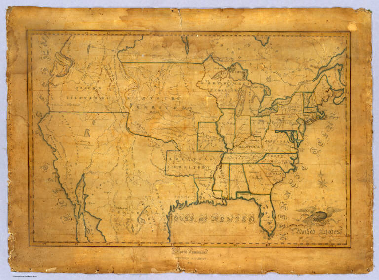
Author
Symonds, Maria
Full Title
United States. Maria Symonds. Topsfield Academy. 1830.
Publisher
Manuscript
Author
Scott, Bradford
Full Title
United States of America by Bradford Scott 1816.
Publisher
Manuscript
Author
Mitchell, Samuel Augustus
Full Title
(Title Page to) A New American Atlas, Designed Principally To Illustrate The Geography Of The United States Of North America; In Which Every Country In Each State And Territory Of The Union Is Accurately Delineated, As Far As At Present Known: The Whole Compiled From The Latest And Most Authentic Information. Philadelphia: Published By Samuel Augustus Mitchell. 1831.
Publisher
S.A. Mitchell
Author
Magnus, Charles
Full Title
Union Military Chart. Complete Map Of The Rail Roads And Water Courses In The United States & Canada. Charles Magnus & Co. ... Liverpool, New York Office No. 12 Frankfort St. ... Entered ... 1859 by Charles Magnus & Co. ... New York. (with) Military Map Of Maryland & Virginia. (with) Map Of Northern Military Movements: Between New York & St. Louis. Published by Chs. Magnus ... Entered ... 1861 by Charles Magnus ... New York. (with two small untitled maps: Pensacola Bay and United States).
Publisher
Charles Magnus
Author
Mitchell, Samuel Augustus
Full Title
(Index Page to) A New American Atlas, Designed Principally To Illustrate The Geography Of The United States Of North America; In Which Every Country In Each State And Territory Of The Union Is Accurately Delineated, As Far As At Present Known: The Whole Compiled From The Latest And Most Authentic Information. Philadelphia: Published By Samuel Augustus Mitchell. 1831.
Publisher
S.A. Mitchell
Author
American Telephone and Telegraph Company
Full Title
(Covers to) Lines And Metallic Circuit Connections. American Telephone and Telegraph Company. 15 Dey St., New York September 1898. (inset) Maine.
Publisher
No Publisher
Author
American Telephone and Telegraph Company
Full Title
Lines And Metallic Circuit Connections. American Telephone and Telegraph Company. 15 Dey St., New York September 1898. (inset) Maine.
Publisher
No Publisher
Author
Andriveau-Goujon, E.
Full Title
(Covers to) Carte Generale Des Etats - Unis Et Du Mexique Comprenant L'Amerique Centrale Et Les Antilles. E. Andriveau-Goujon, Editeur. Paris, Rue Du Bac, 21. 1865 ... (with four inset maps).
Publisher
Andriveau-Goujon
Author
Andriveau-Goujon, E.
Full Title
Carte Generale Des Etats - Unis Et Du Mexique Comprenant L'Amerique Centrale Et Les Antilles. E. Andriveau-Goujon, Editeur. Paris, Rue Du Bac, 21. 1865 ... (with four inset maps).
Publisher
Andriveau-Goujon
Author
Arbuckle Bros.
Full Title
(Front cover to) Arbuckles' lllustrated Atlas of the United States of America. Copyright 1889, Arbuckle Bros. N.Y.
Publisher
Arbuckle Bros.
Author
Mitchell, Samuel Augustus
Full Title
Map Of The United States Constructed From the latest Authorities. Published by S. Augustus Mitchell Philadelphia. 1831. J.H. Young Sc.
Publisher
S.A. Mitchell
Author
Arbuckle Bros.
Full Title
(Back cover to) Arbuckles' lllustrated Atlas of the United States of America. Copyright 1889, Arbuckle Bros. N.Y.
Publisher
Arbuckle Bros.
Author
Tanner, Henry S.
Full Title
(Title Page to) A Connected View of The Whole Internal Navigation of the United States; ... Corrected and Improved From the Edition of 1826, And Much Enlarged, ... With A Sheet Map, ... The Map Has Been Engraved For the Purpose ... On A Reduced Scale, From Tanner's Excellent Four Sheet Map of the United States, Recently Published. ... By a Citizen of the United States. Philadelphia: Published by the Author ... Printed by Lydia R. Bailey. 1830. (on verso) ...on the seventeenth day of April ... 1830, George Armroyd ... hath deposited ... a Book ... Pennsylvania.
Publisher
George Armroyd
Author
Tanner, Henry S.
Full Title
A Connected View of The Whole Internal Navigation of the United States; ... Corrected and Improved From the Edition of 1826, And Much Enlarged, ... With A Sheet Map, ... The Map Has Been Engraved For the Purpose ... On A Reduced Scale, From Tanner's Excellent Four Sheet Map of the United States, Recently Published. ... By a Citizen of the United States. Philadelphia: Published by the Author ... Printed by Lydia R. Bailey. 1830. (on verso) ...on the seventeenth day of April ... 1830, George Armroyd ... hath deposited ... a Book ... Pennsylvania.
Publisher
George Armroyd
Author
Atwood, J.M.
Full Title
(Covers to) Map Of The United States, Canada, Mexico, Central America, and the West India Islands With a Portion of Venezuela & New Granada; Showing the routes overland and by the Isthmus to California and Oregon, Also the new Boundaries of California, Utah, & New Mexico, Compiled from the latest Authorities. Engraved & Published By J.M. Atwood, No. 19 Beekman Street, New York. 1851. D. McLellan, Printr. Spruce St ... Entered ... 1851, by J.M. Atwood ... New York.
Publisher
J.M. Atwood
Author
Atwood, J.M.
Full Title
Map Of The United States, Canada, Mexico, Central America, and the West India Islands With a Portion of Venezuela & New Granada; Showing the routes overland and by the Isthmus to California and Oregon, Also the new Boundaries of California, Utah, & New Mexico, Compiled from the latest Authorities. Engraved & Published By J.M. Atwood, No. 19 Beekman Street, New York. 1851. D. McLellan, Printr. Spruce St ... Entered ... 1851, by J.M. Atwood ... New York.
Publisher
J.M. Atwood
Author
[Barber, B.B., Willard, A.]
Full Title
Map Of The United States Of America With Its Territories & Districts. Including also a part of Upper & Lower Canada And Mexico. Published By B.B. Barber & A. Willard, Hartford, 1835.
Publisher
Barber and Willard
Author
Barber, John Warner
Full Title
(Covers to) Map Of The United States exhibiting the principal Rail Road & Steam boat Routes.
Publisher
J.W. Barber
Author
Barber, John Warner
Full Title
Map Of The United States exhibiting the principal Rail Road & Steam boat Routes.
Publisher
J.W. Barber
Author
[Dagelet, Joseph Lepaute, La Perouse, Jean-Francois de Galaup, comte de, 1741-1788]
Full Title
Carte generale d'une partie de la cote du nord-ouest de l'Amerique reconnue par les Fregates Francaises la Boussole et l'Astrolabe. Assujettie au point journalier de la Fregate la Boussole determine astronomiquement par M. Dagelet. Bouclet sculp. Herault scrip. Atlas du Voyage de la Perouse no. 16. (Paris: L'Imprimerie de la Republique, An V, 1797)
Publisher
L'Imprimerie de la Republique
Author
Mitchell, Samuel Augustus
Full Title
Map Of The United States, And Territories. Together With Canada &c. 9. Constructed & Engraved by W. Williams Philadelphia. (with) inset map Island Of Newfoundland. 10. Entered ... 1860, by S. Augustus Mitchell, Jr. ... Pennsylvania.
Publisher
S.A. Mitchell, Jr.
Author
Alaskan Boundary Tribunal
Full Title
(Covers to) Alaskan Boundary Tribunal. (Volume 1) British Atlas. Maps And Charts Accompanying The Case Of Great Britain. Washington, Government Printing Office, 1904.
Publisher
(U.S.) Government Printing Office
Author
Alaskan Boundary Tribunal
Full Title
(Title Page to) Alaskan Boundary Tribunal. (Volume 1) British Atlas. Maps And Charts Accompanying The Case Of Great Britain. Washington, Government Printing Office, 1904. (Pasted in: Senate Document No. 162, 58th Congress, 2d Session).
Publisher
(U.S.) Government Printing Office
Author
Alaskan Boundary Tribunal
Full Title
(Table of Contents to) Alaskan Boundary Tribunal. (Volume 1) British Atlas. Maps And Charts Accompanying The Case Of Great Britain. Washington, Government Printing Office, 1904.
Publisher
(U.S.) Government Printing Office
Author
[Alaskan Boundary Tribunal, Vancouver, George]
Full Title
(Facsimile) A Chart Shewing Part of the Coast of N.W. America with Tracks of his Majesty's Sloop Discovery and Armed Tender Chatham .... Published May 1st, 1798 by J. Edwards, Pall Mall & G. Robinson, Paternoster Row.
Publisher
(U.S.) Government Printing Office
Author
[Alaskan Boundary Tribunal, Vancouver, George]
Full Title
(Facsimile) From Vancouvers Atlas - Part of Chart No. XII; Part of Chart No. VII. Photo. Lith. by A. Hoen & Co., Baltimore, MD.
Publisher
(U.S.) Government Printing Office
Author
Alaskan Boundary Tribunal
Full Title
(Facsimile) Russian Map (Enclosure in C. Bagot's Dispatch). Translation of Title: Map of Marine Discoveries by Russian Navigators in the Pacific and Frozen Oceans, made in various years.
Publisher
(U.S.) Government Printing Office
Author
Alaskan Boundary Tribunal
Full Title
(Facsimile) (Russian Map) Part of Map Numbered 5.
Publisher
(U.S.) Government Printing Office
Author
[Alaskan Boundary Tribunal, Von Langsdorff, G.H.]
Full Title
(Facsimile) Map of the World Illustrating the Voyages and Travels of G.H. Von Langsdorff. Photo. Lith. by A. Hoen & Co. Baltimore MD. London, Published Feby. 1st. 1814 by Henry Colburn, Conduit Street. Thompson & Hall sculpt. 14 Bury Strt., Bloomsby.
Publisher
(U.S.) Government Printing Office
Author
[Arrowsmith, Aaron, Alaskan Boundary Tribunal]
Full Title
(Facsimile) Map of America (northwest portion) by A. Arrowsmith, Hydrographer to His Majesty, 1822. Additions to 1824.
Publisher
(U.S.) Government Printing Office
Author
[Alaskan Boundary Tribunal, Arrowsmith]
Full Title
(Facsimile) (Arrowsmith's America - northwestern portion). Photo. Lith. by A. Hoen & Co. Baltimore, MD.
Publisher
(U.S.) Government Printing Office
Author
[Faden, William, 1750?-1836, Alaskan Boundary Tribunal]
Full Title
(Facsimile) Map of North America (portion) from 20 to 80 Degrees North Latitude Exhibiting the recent Discoveries, Geographical and Nautical; Drawn chiefly from the Authorities M. de Humbolt (Humboldt), Lieut; Pike. Mess. Lewis and Clarke. Sir Alexr. Mackenzie. Mr. Hearne, Col. Bouchette, Capt. Vancouver, Ross, Parry & Franklin also Describing the Boundary Lines between the Territories of Great Britain & Spain with the United States. London. Published by Ja. Wyld (successor to W. Faden) N.5. Charing Cross, Geographer to His Majesty and to H.R.H. the Duke of York, June 1, 1823. Photo. Lith. by A. Hoen & Co. Baltimore, MD. (by Faden).
Publisher
(U.S.) Government Printing Office
Author
[Faden, William, 1750?-1836, Alaskan Boundary Tribunal]
Full Title
(Facsimile) Map of North America (portion) from 20 to 80 Degrees North Latitude Exhibiting the recent Discoveries, Geographical and Nautical; Drawn chiefly from the Authorities M. de Humbolt (Humboldt), Lieut; Pike. Mess. Lewis and Clarke. Sir Alexr. Mackenzie. Mr. Hearne, Col. Bouchette, Capt. Vancouver, Ross, Parry & Franklin also Describing the Boundary Lines between the Territories of Great Britain & Spain with the United States. London. Published by Ja. Wyld (successor to W. Faden) N.5. Charing Cross, Geographer to His Majesty and to H.R.H. the Duke of York, June 1, 1824. Photo. Lith. by A. Hoen & Co. Baltimore, MD. (by Faden).
Publisher
(U.S.) Government Printing Office
Author
[Alaskan Boundary Tribunal, Arrowsmith]
Full Title
(Facsimile) Arrowsmith's North America (northwestern portion).
Publisher
(U.S.) Government Printing Office
Author
[Alaskan Boundary Tribunal, Herbert, L., Senior]
Full Title
(Facsimile) Part of Colonial Office Manuscript Map by L. Herbert Senior. 1831. Map No. VI. Dangerfield Lith. 22 Bedford St. Covent Garden. 12638.
Publisher
(U.S.) Government Printing Office
Author
[Alaskan Boundary Tribunal, Bouchette]
Full Title
(Facsimile) The British Dominions in North America (portion). Bouchette's Map.
Publisher
(U.S.) Government Printing Office
Author
Alaskan Boundary Tribunal
Full Title
(Facsimile) Translation of Title: Part of Map of the Frozen Ocean and the Eastern Ocean. Compiled from the latest documents in the Hydrographic Department of the Ministry of Marine. 1844. Photo. Lith. by A. Hoen & Co. Baltimore, MD. 1345.
Publisher
(U.S.) Government Printing Office
Author
[Alaskan Boundary Tribunal, Greenhow, Robert]
Full Title
(Facsimile) Map of the Western & Middle Portions of North America, to Illustrate the History of California, Oregon, and the other Countries on the North-west Coast of America, Robert Greenhow, Compiled from the Best Authorities by Robert Greenhow. Drawn by George H. Ringgold, Engraved by E.F. Woodward, Philada. Copy-right secured according to Law. Photo. Lith. by A. Hoen & Co. Baltimore, MD.
Publisher
(U.S.) Government Printing Office
Author
[Alaskan Boundary Tribunal, Simpson, George]
Full Title
(Facsimile) Map shewing the Author's Route. Sir George Simpson's Map.
Publisher
(U.S.) Government Printing Office
Author
Alaskan Boundary Tribunal
Full Title
(Facsimile) Translation of Title: Part of Map of the Straits of the North-West Coast of America, from Lat. 54° to 56°. From the list (or inventory) of Vancouver, corrected by Colonial Navigators. New Archangel IX. 1849. Photo. Lith. by A. Hoen & Co. Baltimore, MD.
Publisher
(U.S.) Government Printing Office
Author
[Alaskan Boundary Tribunal, Hudson's Bay Company]
Full Title
(Facsimile) Papers _ Hudsons Bay Company. Map of North America. Photo. Lith. by A. Hoen & Co. Baltimore, MD. No. 542. Ordered by the House of Commons to be Printed 12th. July 1850. Henry Hansard, Printer.
Publisher
(U.S.) Government Printing Office
Author
[Alaskan Boundary Tribunal, Hydrographic Department, Ministry of Marine]
Full Title
(Facsimile) Translation of Title. (Part of) Mercator map of the Southern Half of the Koloshenski Archipelago. Compiled from various journals and maps, and engraved in the Hydrographic Department of the Ministry of Marine. 1853. Photo. Lith. by A. Hoen & Co. Baltimore, MD.
Publisher
(U.S.) Government Printing Office
Author
[Arrowsmith, John, Alaskan Boundary Tribunal]
Full Title
(Facsimile) Map of North America Drawn by J. Arrowsmith. Select Committee _ on the Hudson's Bay Company. Nos. 224. 260. (Sess.2.) London Pub. 1857 by John Arrowsmith, 10 Soho Square. Photo. Lith. by A. Hoen & Co. Baltimore, MD. Ordered, by the House of Commons to be Printed 31st. July 11th. August, 1857. Henry Howard Pranter.
Publisher
(U.S.) Government Printing Office
Author
[Arrowsmith, John, Alaskan Boundary Tribunal]
Full Title
(Facsimile) Part of Map of British North America. Drawn by J. Arrowsmith. 1863. Photo. Lith. by A. Hoen & Co. Baltimore, MD.
Publisher
(U.S.) Government Printing Office
Author
[Alaskan Boundary Tribunal, British Admiralty]
Full Title
(Facsimile) No. X. N.W. America. British Columbia. Portland Canal from the Admiralty Survey of 1868. (reduced from original scale). Photo. Lith. by A. Hoen & Co. Baltimore, MD.
Publisher
(U.S.) Government Printing Office
Author
[Alaskan Boundary Tribunal, British Admiralty]
Full Title
(Facsimile) No. XI. N.W. America. British Columbia. Observatory Inlet, from the Admiralty Survey, of 1868. (Reduced from the original scale). Photo. Lith. by A. Hoen & Co. Baltimore, MD.
Publisher
(U.S.) Government Printing Office
Author
[Alaskan Boundary Tribunal, British Admiralty]
Full Title
(Facsimile) No. VIII. N.W. America. British Columbia. Port Simpson to Nass Village. From the Admiralty Survey, of 1868. Photo. Lith. by A. Hoen & Co. Baltimore, MD. (Reduced from original scale).
Publisher
(U.S.) Government Printing Office
Author
[Alaskan Boundary Tribunal, Hunter, Jos.]
Full Title
(Facsimile) Plan of the Stachine or Stickeen River. This is the plan referred to in my report dated 30th June, 1877, Signed Jos. Hunter. Photo. Lith. by A. Hoen & Co. Baltimore, MD. (Reduced from original scale).
Publisher
(U.S.) Government Printing Office
|