|
Author
Duflot de Mofras, Eugene
Full Title
Le R.P. Narcisco Duran, prefet apostolique des Franciscains Espagnole missionnaires dans la Nouvelle Californie
Publisher
Arthus Bertrand
Author
Duflot de Mofras, Eugene
Full Title
Ranchero Californien Jetant le Lazo.
Publisher
Arthus Bertrand
Author
Duflot de Mofras, Eugene
Full Title
Isba. Maison des Colonies de L'Amerique Russe.
Publisher
Arthus Bertrand
Author
Duflot de Mofras, Eugene
Full Title
(Covers to Vol 2) Exploration Du Territoire De L'Oregon, Des Californies Et De La Mer Vermeille, Executee Pendant Les Annees 1840, 1841 Et 1842, Par M. Duflot De Mofras, Attache A La Legation De France A Mexico. Ouvrage Publie Par Ordre Du Roi, Sous Les Auspices De M. Le Marechal Soult, Duc De Dalmatie, President du Conseil, Et De M. Le Ministre Des Affaires Etrangeres. Tome Premier. Paris, Arthus Bertrand, Editeur, Libraire De La Societe De Geographie, Rue Hautefeuille, No. 23. 1844. Paris. - Typographie de Firmin Didot Freres, rue Jacob, 56 ... Tome Second ... Atlas (with map) Carte De La Cote De L'Amerique Sur L'Ocean Pacifique Septentrional comprenant Le Territoire De L'Oregon, Les Californies, La Mer Vermeille ...
Publisher
Arthus Bertrand
Author
Duflot de Mofras, Eugene
Full Title
(Title Page to Vol 2) Exploration Du Territoire De L'Oregon, Des Californies Et De La Mer Vermeille, Executee Pendant Les Annees 1840, 1841 Et 1842, Par M. Duflot De Mofras, Attache A La Legation De France A Mexico. Ouvrage Publie Par Ordre Du Roi, Sous Les Auspices De M. Le Marechal Soult, Duc De Dalmatie, President du Conseil, Et De M. Le Ministre Des Affaires Etrangeres. Tome Premier. Paris, Arthus Bertrand, Editeur, Libraire De La Societe De Geographie, Rue Hautefeuille, No. 23. 1844. Paris. - Typographie de Firmin Didot Freres, rue Jacob, 56 ... Tome Second ... Atlas (with map) Carte De La Cote De L'Amerique Sur L'Ocean Pacifique Septentrional comprenant Le Territoire De L'Oregon, Les Californies, La Mer Vermeille ...
Publisher
Arthus Bertrand
Author
Duflot de Mofras, Eugene
Full Title
Indiens Kodiaks Chassant La Baleine.
Publisher
Arthus Bertrand
Author
Duflot de Mofras, Eugene
Full Title
Vue de la Nouvelle Archangel.
Publisher
Arthus Bertrand
Author
Duflot de Mofras, Eugene
Full Title
Temascal, Bain des Indiens.
Publisher
Arthus Bertrand
Author
Duflot de Mofras, Eugene
Full Title
Sculptures Indiennes, Cote Nord Ouest de L'Amerique.
Publisher
Arthus Bertrand
Author
Cram, George Franklin
Full Title
Mexico, Cuba & Central America.
Publisher
A.C. Shewey and Co.
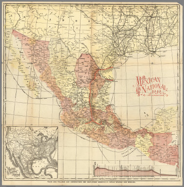
Author
Mexico National R.R.
Full Title
Mexico National R.R. and Connections.
Publisher
Mexico National R.R.
Author
[Arrowsmith, Aaron, Humboldt, Alexander von, 1769-1859]
Full Title
A new map of Mexico and adjacent provinces compiled from original documents by A. Arrowsmith, 1810. (Sheet 1). (with) Valley of Mexico, from Mr. Humboldt's map. London, Published 5th October 1810 by A. Arrowsmith, 10 Soho Squ(ar)e, Hydrographer to H.R.H. the Prince of Wales. Engraved by E. Jones.
Publisher
A. Arrowsmith
Author
[Arrowsmith, Aaron, Humboldt, Alexander von, 1769-1859]
Full Title
(A new map of Mexico and adjacent provinces compiled from original documents by A. Arrowsmith, 1810. Sheet 2). (with) Veracruz. (with) Acapulco. London, Published 5th October 1810 by A. Arrowsmith, 10 Soho Square. (Engraved by E. Jones)
Publisher
A. Arrowsmith
Author
[Arrowsmith, Aaron, Humboldt, Alexander von, 1769-1859]
Full Title
(A new map of Mexico and adjacent provinces compiled from original documents by A. Arrowsmith, 1810. Sheet 3). London, Published 5th October 1810 by A. Arrowsmith, 10 Soho Square. (Engraved by E. Jones)
Publisher
A. Arrowsmith
Author
[Arrowsmith, Aaron, Humboldt, Alexander von, 1769-1859]
Full Title
(A new map of Mexico and adjacent provinces compiled from original documents by A. Arrowsmith, 1810. Sheet 4). London, Published 5th October 1810 by A. Arrowsmith, 10 Soho Square. (Engraved by E. Jones)
Publisher
A. Arrowsmith
Author
Bowen, Emanuel
Full Title
A new & accurate map of Mexico or New Spain together with California, New Mexico &c. Drawn from the best modern maps & charts & regulated by astronl. observns. By Eman: Bowen. (London: Printed for William Innys, Richard Ware, Aaron Ward, J. and P. Knapton, John Clarke, T. Longman and T. Shewell, Thomas Osborne, Henry Whitridge ... M.DCC.XLVII)
Publisher
William Innys [et al.]
Author
[Arrowsmith, Aaron, Humboldt, Alexander von, 1769-1859]
Full Title
(Composite of) A new map of Mexico and adjacent provinces compiled from original documents by A. Arrowsmith, 1810. (with) Valley of Mexico, from Mr. Humboldt's map. (with) Veracruz. (with) Acapulco. London, Published 5th October 1810 by A. Arrowsmith, 10 Soho Square, Hydrographer to H.R.H. the Prince of Wales. Engraved by E. Jones.
Publisher
A. Arrowsmith
Author
Bradford, Thomas G.
Full Title
Mexico, Guatemala and the West Indies. (to accompany) A Comprehensive Atlas, Geographical, Historical & Commercial. By T.G. Bradford. William D. Ticknor, Boston. Wiley & Long, New-York. Entered ... 1835, by Thos. G. Bradford ... Massachusetts.
Publisher
[William D. Ticknor, Wiley & Long]
Author
[Morse, Sidney E., Breese, S.]
Full Title
Mexico (to accompany) Supplement To The New-York Observer. The Cerographic Atlas Of The United States. No.3. 1845. (inset) Central America and Yucatan.
Publisher
Sidney E. Morse & Co.
Author
[Morse, Sidney E., Breese, Samuel]
Full Title
Mexico. (By Sidney E. Morse and Samuel Breese. New York: Published by Harper & Brothers, 1845). (inset) Central America and Yucatan. (to accompany) Morse's Cerographic Maps. No. V.
Publisher
Harper and Brothers
Author
Gray, O.W.
Full Title
Gray's Atlas Map of Mexico. (inset) Territory and Isthmus of Tehuantepec.
Publisher
Stedman, Brown & Lyon
Author
Gray, O.W.
Full Title
Mexico. (insets) Mexico to Vera Cruz. The Isthmus of Tehuantepec.
Publisher
Stedman & Brown
Author
[Drioux, Claude-Joseph, Leroy, Charles]
Full Title
Carte physique et politique : Amerique du Nord. Par M.Mrs. Drioux et Ch. Leroy. Dessine par A. Vilpou. Grave par L. Sonnet. Librairie Classique Eugene Belin Paris. (to accompany) Atlas Universel Et Classique De Geographie ...1886. (insets) Voyages de Christophe Colomb ; Mexique.
Publisher
Eugene Belin
Author
[Drioux, Claude-Joseph, Leroy, Charles]
Full Title
Carte physique et politique des Etats - Unis : Canada et partie du Mexice. Par M.Mrs. Drioux et Ch. Leroy. Dessine par A. Vilpou. Grave par L. Sonnet. Librairie Classique Eugene Belin Paris. (to accompany) Atlas Universel Et Classique De Geographie ...1886. (insets) Etats - Unis (Etats di Nord-Est) ; Territoire d'Alaska.
Publisher
Eugene Belin
Author
[Kartographia Winterthur, Conférence Suisse des Directeurs Cantonaux de l'instruction Publique]
Full Title
Etats - Unis et Mexique. Kartographia Winterthur S.A. Conference des Chefs des Depart. Cant. de l'Instruction Publique. Atlas Scolaire 2e. Edition. (with inset map) Le Suisse.
Publisher
Librairie Payot
Author
Appleton, D. & Co.
Full Title
Mexico. Copyright 1891 by Appleton & Co. (inset) Mexico City. (to accompany) The Library Atlas Of Modern Geography ... New York, D. Appleton And Company 1892. (on upper margin) Mexico. 41.
Publisher
D. Appleton & Co.
Author
[Rand McNally and Company, State Farm Insurance Companies Travel Bureau]
Full Title
Rand McNally Road map: Mexico. Copyright by Rand McNally & Company, Chicago, Ill. Lithorgaphed in the U.S.A. U.3504. (to accompany) State Farm road atlas : United States, Canada, Mexico. (inset) Mexico D.F.
Publisher
State Farm Insurance Companies Travel Bureau
Author
[Rand McNally and Company, State Farm Insurance Companies Travel Bureau]
Full Title
(Text Page to) Mexico and Canada tourist information. Canadian Customs regulations. (to accompany) State Farm road atlas : United States, Canada, Mexico.
Publisher
State Farm Insurance Companies Travel Bureau
Author
[Rand McNally and Company, State Farm Insurance Companies Travel Bureau]
Full Title
(Text Page to) Motor, fish and game law information. Road broadcasting stations. Offiliated with the Columbia, mutual and national broadcasting companies ... (to accompany) State Farm road atlas : United States, Canada, Mexico.
Publisher
State Farm Insurance Companies Travel Bureau
Author
Wyld, James, 1812-1887
Full Title
(Covers to) Mexico The British Possessions In North America And The United States. London. Published By Jas. Wyld, Geographer To The Queen, Charing Cross East. 1846. James Wyld, Geographer to the Queen and to H.R.H. Prince Albert, Charing Cross, East, four doors from Trafalgar Square, London ... (inset) North America. (inset) Islands in the Pacific Ocean.
Publisher
James Wyld
Author
Wyld, James, 1812-1887
Full Title
(North Sheet) Mexico The British Possessions In North America And The United States. London. Published By Jas. Wyld, Geographer To The Queen, Charing Cross East. 1846. James Wyld, Geographer to the Queen and to H.R.H. Prince Albert, Charing Cross, East, four doors from Trafalgar Square, London ... (inset) North America. (inset) Islands in the Pacific Ocean.
Publisher
James Wyld
Author
Wyld, James, 1812-1887
Full Title
(South Sheet) Mexico The British Possessions In North America And The United States. London. Published By Jas. Wyld, Geographer To The Queen, Charing Cross East. 1846. James Wyld, Geographer to the Queen and to H.R.H. Prince Albert, Charing Cross, East, four doors from Trafalgar Square, London ... (inset) North America. (inset) Islands in the Pacific Ocean.
Publisher
James Wyld
Author
Wyld, James, 1812-1887
Full Title
(Composite to) Mexico The British Possessions In North America And The United States. London. Published By Jas. Wyld, Geographer To The Queen, Charing Cross East. 1846. James Wyld, Geographer to the Queen and to H.R.H. Prince Albert, Charing Cross, East, four doors from Trafalgar Square, London ... (inset) North America. (inset) Islands in the Pacific Ocean.
Publisher
James Wyld
Author
Mitchell, Samuel Augustus
Full Title
Map Of Mexico, Including Yucatan & Upper California, exhibiting The Chief Cities and Towns, The Principal Travelling Routes &c. Philadelphia: Published by S. Augustus Mitchell N.E. Corner Of Market And Seventh Sts. 1847. Entered ... 1846 by S. Augustus Mitchell ... Pennsylvania. (inset) The Late Battlefield.
Publisher
S.A. Mitchell
Author
[Mitchell, Samuel Augustus, Stealey, Geo.]
Full Title
(Covers to) Map Of Mexico, Including Yucatan & Upper California, exhibiting The Chief Cities and Towns, The Principal Travelling Routes &c. Philadelphia: Published by S. Augustus Mitchell N.E. Corner Of Market And Seventh Sts. 1847. Entered ... 1847 by S. Augustus Mitchell ... Pennsylvania. (inset) The Late Battlefield. (with) Map of the Principal Roads from Vera Cruz and Alvarado to the City of Mexico ... Compiled from the latest and best Authorities. By Geo. Stealey, Civil Engineer.
Publisher
S.A. Mitchell
Author
[Mitchell, Samuel Augustus, Stealey, Geo.]
Full Title
Map Of Mexico, Including Yucatan & Upper California, exhibiting The Chief Cities and Towns, The Principal Travelling Routes &c. Philadelphia: Published by S. Augustus Mitchell N.E. Corner Of Market And Seventh Sts. 1847. Entered ... 1847 by S. Augustus Mitchell ... Pennsylvania. (inset) The Late Battlefield. (with) Map of the Principal Roads from Vera Cruz and Alvarado to the City of Mexico ... Compiled from the latest and best Authorities. By Geo. Stealey, Civil Engineer.
Publisher
S.A. Mitchell
Author
[Johnson, A.J., Johnson, D. Griffing]
Full Title
A New Map Of The Union, With The Adjacent Islands & Countries, From Authentic Sources. Published by D.G. & A.J. Johnson, Trinity Buildings, 111 Broadway, New-York. 1857 ... Entered ... 1856 by D.G. Johnson ... New York. (inset of northwest Missouri and adjacent parts of Kansas and Nebraska).
Publisher
D.G. & A.J. Johnson
Author
Williams, G. Washington.
Full Title
Williams' Copper - Plate Map Of The United States, Canada, Mexico, Central America, West Indies, &c. Published by John M. Atwood, 402 Locust Street, Philadelphia. Printed by F. Bourquin, 31 So. 6th Street, Phila. Copyright 1876 by G. Washington Williams.
Publisher
John M. Atwood
Author
[Smith, J. Calvin, Smith, Robert P.]
Full Title
The New Naval And Military Map Of The United States. By J. Calvin Smith, Author Of Harper's Gazetteer, Colton's County Map Of The U.S. Travellers' Guide &c. 1862. J. Baker & Co. Publishers. J.M. Atwood, Map Engraver 517 Minor St. Philadelphia, Pa. Entered ... 1862 by Robert P. Smith ... Pennsylvania. (with 5 inset maps and 3 profiles).
Publisher
J. Baker
Author
Mitchell, Samuel Augustus
Full Title
Mexico & Guatemala: By H.S. Tanner. (with) two inset maps: Guatemala and Valley of Mexico. Entered ... 1846 by H.N. Burroughs ... Pennsylvania.
Publisher
S.A. Mitchell
Author
Monk, Jacob
Full Title
Monk's Standard American Map Exhibiting the larger portion of North America; Embracing The United States And Territories, Mexico, And Central America, Including The West India Islands, The Canadas, New Brunswick And Nova Scotia. Compiled from recent Government surveys and other authentic sources. Baltimore. Drawn, Engraved & Printed by A. Hoen & Co. Second street. Published by Jacob Monk. 1859. (inset) New Map Of The World on Mercators Projection ...
Publisher
Jacob Monk
Author
[Gaston, Samuel N., Morse, Charles W.]
Full Title
A New Map Of Our Country Present And Prospective. Compiled from Government Surveys and other Reliable Sources. Published by J.G. Wells, New York. Mack R. Barnitz, Cincinnati, Ohio. 1859. Entered ... 1856 by Morse & Gaston ... New York. (inset) Map Of The World On Mercators Projection By Milo Doty. 1858.
Publisher
J.G. Wells
Author
Rand McNally and Company
Full Title
(South West section, Rand, McNally & Co.'s New Shippers' Railroad Map of the United States. Scale: 18 miles to one inch).
Publisher
Rand McNally & Co.
Author
Rand McNally and Company
Full Title
(Covers to) (Rand, McNally & Co.'s New Shippers' Railroad Map of the United States. Scale: 18 miles to one inch).
Publisher
Rand McNally & Co.
Author
Rand McNally and Company
Full Title
(Composite Map of) (Western section of Rand, McNally & Co.'s New Shippers' Railroad Map of the United States. Scale: 18 miles to one inch).
Publisher
Rand McNally & Co.
Author
[Cruchley, G., Laurie, Richard Holmes]
Full Title
Fredonia Or The United States of North America; Including Also Cabotia, Or The Canadian Provinces; The Western Territory California, Oregon and the Northern Part of the Mexican States. 1849.
Publisher
R. L. Laurie
Author
[Arrowsmith, Aaron, Humboldt, Alexander von, 1769-1859]
Full Title
A New Map Of Mexico And Adjacent Provinces Compiled From Original Documents By A. Arrowsmith. 1810. London, Published 5th October 1810, by A. Arrowsmith 10 Soho Sque. Hydrographer to His Majesty. Engraved by E. Jones ... (inset) Valley Of Mexico From Mr. Humboldt's Map. (inset) Veracruz. (inset) Acapulco.
Publisher
A. Arrowsmith
Author
Wyld, James, 1812-1887
Full Title
Mexico and Guatemala, Shewing the position of the Mines.
Publisher
James Wyld
Author
Garcia Cubas, Antonio, 1832-1912
Full Title
(Covers to) Atlas geografico, estadistico e historico de la Republica Mexicana, formado por Antonio Garcia y Cubas. Mexico. Imprenta de Jose Mariano Fernandez de Lara, calle de la Palma numero 4. 1858.
Publisher
Imprenta de Jose Mariano Fernandez de Lara.
Author
Garcia Cubas, Antonio, 1832-1912
Full Title
(Title Page to) Atlas geografico, estadistico e historico de la Republica Mexicana, formado por Antonio Garcia y Cubas. Mexico. Imprenta de Jose Mariano Fernandez de Lara, calle de la Palma numero 4. 1858.
Publisher
Imprenta de Jose Mariano Fernandez de Lara.
|