|
Author
[Mathewson, A. J., Messinger, John, Peck, J. M.]
Full Title
New Sectional Map Of the State of Illinois. Compiled From The United States Surveys. Also exhibiting the Internal Improvements, distances between Towns, Villages & Post Offices, the outlines of Prairies, Woodlands, Marshes & the lands donated to the State by the Gen. Govt. for the purpose of Internal Improvements. By J.M. Peck, John Messinger, And A.J. Mathewson. Published by J.H. Colton & Co. New-York. 1854. Engraved by S. Stiles & Co., N. York. Entered ... 1853 by J.H. Colton & Co. ... New York. (inset) Vicinity of Alton & St. Louis. (inset) Vicinity Of Galena, The Lead Region And Part Of Wisconsin And Iowa.
Publisher
J.H. Colton & Co.
Author
[Messinger, John, Peck, J. M., Colton, J.H., Mathewson, A.J.]
Full Title
Colton's New Sectional Map Of the State of Illinois. Compiled From The United States Surveys. Also exhibiting the Internal Improvements, distances between Towns, Villages & Post Offices, the outlines of Prairies, Woodlands, Marshes & the lands donated to the State by the Gen. Govt. for the purpose of Internal Improvements. By J.M. Peck, John Messinger, And A.J. Mathewson. Published by J.H. Colton, No. 172 William Street, New York. 1860. Entered ... 1836 by J.H. Colton & Co. ... New York. (inset) The City Of Chicago Illinois. (inset) The City Of St. Louis Missouri.
Publisher
J.H. Colton & Co.
Author
[Colton, G. W. & C. B., Messinger, John, Peck, J. M., Mathewson, A.J.]
Full Title
Colton's Sectional Map Of the State of Illinois. Compiled From The United States Surveys. Also exhibiting the Internal Improvements, distances between Towns, Villages & Post Offices, the outlines of Prairies, Woodlands, Marshes & the lands donated to the State by the Gen. Govt. for the purpose of Internal Improvements. By J.M. Peck, John Messinger, And A.J. Mathewson. Published by G.W. And C.B. Colton, & Co., No. 172 William St., New York. 1867. Entered ... 1836 by J.H. Colton & Co ... New York. (inset) The City Of Chicago Illinois. (inset) The City Of St. Louis Missouri.
Publisher
G.W. & C.B. Colton & Co.
Author
[Mitchell, Samuel Augustus, Young, James H.]
Full Title
The Tourist's Pocket Map Of The State Of Tennessee Exhibiting Its Internal Improvements Roads Distances &c. by J.H. Young. Philadelphia: Published By S. Augustus Mitchell. 1839. Sold by Thomas, Cowperthwait & Co. No. 253 Market Street. Entered ... 1834 by S. Augustus Mitchell ... Pennsylvania. Engraved by J.H. Young. (inset) Vicinity Of Nashville. (inset) Vicinity Of Knoxville.
Publisher
S. Augustus Mitchell
Author
Wells, John G.
Full Title
Wells' New Sectional Map Of Nebraska From the last Government Survey. J.G. Wells 11 Beekman St. New York. J.B. Snow, Land Agent, Otoe Nebraska. Lith. V. Keil 181 William St. N.Y. Entered ... 1857, J.G. Wells ... New York.
Publisher
J.G. Wells
Author
Mitchell, Samuel Augustus
Full Title
Mitchell's National Map of the American Republic Or United States Of North America ... 1846. Drawn by J.H. Young. Engraved by J.H. Brightly. Entered ... 1846, by S. Augustus Mitchell ... Pennsylvania. (with 4 inset maps). (with) A Route-Book, Adapted To Mitchell's National Map Of The American Republic; Comprising Tables Of The Principal Rail-Road, Steam-Boat And Stage Routes, Throughout The United States. Philadelphia: S. Augustus Mitchell, N.E. Cor. Market And Seventh Sts. 1847. (on verso) Entered ... 1846, by S. Augustus Mitchell ... Pennsylvania. Stereotyped by J. Fagan. Printed by Kay & Brother.
Publisher
S. Augustus Mitchell
Author
Rand McNally and Company
Full Title
Rand, McNally & Co.'s Cycling & Wagon Road Map Of South Eastern Wisconsin. Copyrighted By Rand, McNally & Co. (ink stamped) Copyrighted 1895, Rand, McNally & Co.
Publisher
Rand McNally & Co.
Author
Punnett Brothers
Full Title
Map Of The State Of California. Compiled And Published By Punnett Bros. 625 Mission St., S.F., Cal. 1897. Copyrighted. B.H.C. Sandy, Sole Agent. 316 Battery St. S.F. (inset) San Joaquin Valley. (inset) Yosemite Valley And Vicinity.
Publisher
Punnett Brothers, and B.H.C. Sandy
Author
Finley, Anthony
Full Title
Pennsylvania. Philada. Published by A. Finley, 1832. J.H. Young Sc.
Publisher
Anthony Finley
Author
Finley, Anthony
Full Title
New Jersey. Philadelphia Published by A. Finley 1834 Engraved by J.H. Young.
Publisher
Anthony finley
Author
Mitchell, Samuel Augustus
Full Title
Map Of Pennsylvania New Jersey And Delaware Compiled From the Latest Authorities. Philadelphia Published by S. Augustus Mitchell. 1832. (inset) Vicinity Of Pittsburgh. (inset) Lehigh And Schuylkill. Coal Regions. (inset) Vicinity Of Philadelphia. (inset) Vicinity Of Lancaster.
Publisher
S. Augustus Mitchell
Author
Blanchard, Rufus
Full Title
Blanchard's Map Of The North Western States. Showing the Counties, Towns, Railroads, Stations, Steam Boat Landing etc. Compiled From The Most Authentic Sources. Published by Rufus Blanchard, 148 Lake Street, Chicago, Ill. 1866. Lith. Chas. Shober, Chicago. Entered ... 1865, by R. Blanchard ... Illinois.
Publisher
Rufus Blanchard
Author
Blanchard, Rufus
Full Title
(Composite of) Blanchard's Map Of The North Western States. Showing the Counties, Towns, Railroads, Stations, Steam Boat Landing etc. Compiled From The Most Authentic Sources. Published by Rufus Blanchard, 148 Lake Street, Chicago, Ill. 1866. Lith. Chas. Shober, Chicago. Entered ... 1865, by R. Blanchard ... Illinois.
Publisher
Rufus Blanchard
Author
Ensign, Bridgman & Fanning
Full Title
Map of Missouri. Published By Ensign, Bridgman & Fanning, 156 William St. New York 1857. Entered ... 1856, by Ensign, Bridgman & Fanning ... New York.
Publisher
Ensign, Bridgman & Fanning
Author
[Perris, Fred T., Levet, Benj. F.]
Full Title
Perris' Miners Map Of The Desert Region Of Southern California Embracing The Counties Of San Bernardino, Riverside and Orange, and Portions Of The Adjacent Counties, Showing Mining Districts, Forest Reserves, Indian Reservations, and County Boundaries. Compiled And Drawn In The Office Of The Chief Engineer Of The Southern California Railway, By Benj. F. Levet, From Data Acquired By Fred T. Perris, Chief Engineer, From All Authentic Sources, 1896. Approved By Boards of Supervisors of Los Angeles, San Bernardino, and Riverside Counties. Copyright, 1896, By Fred T. Perris. Assigned To Rand, McNally & Co. Map Publishers, Chicago.
Publisher
Rand, McNally & Co.
Author
The Holden Drug Co.
Full Title
Map Of The City of Stockton, California Copyrighted March 18, 1897. Published By The Holden Drug Co. Corner Main and El Dorado Streets Stockton, California.
Publisher
The Holden Drug Co.
Author
[Bancroft, A.L., Knight, W.H.]
Full Title
Bancroft's Map Of California, Nevada, Utah And Arizona. Published By A.L. Bancroft, & Compy. Booksellers & Stationers San Francisco Cal. 1876. Entered ... by A.L. Bancroft & Company ... Washington, D.C.
Publisher
A.L. Bancroft & Co.
Author
[Burr, David H., 1803-1875, Colton, J. H.]
Full Title
New-York. By David H. Burr. Published by J.H. Colton & Co. 9 Wall Street New-York. 1833. Entered ... 1833 by J.H. Colton & Co. ... New York. Engraved & Printed by S. Stiles & Co. No. 9 Wall St. N. York. (with 5 inset maps)
Publisher
J.H. Colton & Co.
Author
Colton, G.W. & C.B.
Full Title
Colton's Map Of The States And Territories West Of The Mississippi River To The Pacific Ocean Showing The Overland Routes, Projected Rail Road Lines &c. Published by G.W. And C.B. Colton, & Co. 172 William St. New York. 1868. Entered ... 1867 by G.W. & C.B. Colton & Co ... New York.
Publisher
G.W. & C.B. Colton.
Author
Colton, G.W. & C.B.
Full Title
Colton's New Railroad Map Of The United States & Canada, Published by G.W. And C.B. Colton, & Co. 172 William St. New York. 1869. Entered ... 1861, by J.H. Goldthwait ... New York. (inset) Map Of The Great Railroad Routes from the Middle Atlantic Ports To The Mississippi River. (inset) Map Of The Railroads Of New England And Eastern N. York. (inset) The Northern Hemisphere On A Polar Projection, Showing the time on each meridian as compared with Washington noon, and the longest day for different latitudes.
Publisher
G.W. & C.B. Colton.
Author
Colton, G.W. & C.B.
Full Title
(Covers to) Colton's New Rail Road & County Map Of The United States, The Canadas &c. 1871. Published By G.W. And C.B. Colton, 172 William St. New York. Entered ... 1869 by G.W. & C.B. Colton & Co ... New York. (inset) Colton's Map Of The United States showing the Proposed Railroad Routes To The Pacific Ocean. (inset) Southern Part Of Florida.
Publisher
G.W. & C.B. Colton & Co.
Author
Colton, J.H.
Full Title
Colton's Map Of The United States, The Canadas &c. Showing The Rail Roads, Canals & Stage Roads: With Distances from Place to Place. Published by J.H. Colton No. 86 Cedar St., New York, 1852. (inset) Map Of New England And Eastern New York. (inset) Map Of The United States, Central America &c. (inset) The Isthmus Of Panama Showing the Routes Of Travel Between Chagres & Panama.
Publisher
J.H. Colton.
Author
Colton, J. H.
Full Title
Colton's New Map Of Indiana. Reduced from his Large Map Exhibiting the Boundaries of Counties, Township Surveys, Location of Cities, Towns, Villages, Post Offices, Canals, Rail Roads & other Internal Improvements. New-York, Published by J.H. Colton. 1853.
Publisher
J. H. Colton.
Author
Colton, J. H.
Full Title
Illinois. Published By J.H. Colton No. 86 Cedar St. New York. 1854. Entered ... 1853, by J.H. Colton ... New York. (inset) Vicinity of Chicago.
Publisher
J. H. Colton.
Author
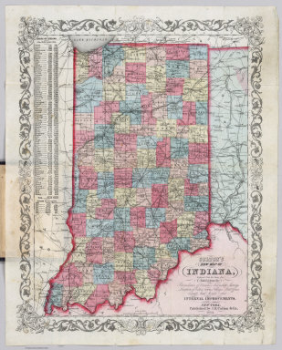
Colton, J. H.
Full Title
Colton's New Map Of Indiana. Reduced from his Large Map Exhibiting the Boundaries of Counties, Township Surveys, Location of Cities, Towns, Villages, Post Offices, Canals, Rail Roads & other Internal Improvements. New-York, Published by J.H. Colton & Co. 1854. Entered ... 1854, by J.H. Colton ... New York.
Publisher
J.H. Colton & Co.
Author
[Colton, J. H., Colton, G. Woolworth]
Full Title
Colton's Township Map Of The State Of Iowa Compiled from the United States Surveys, & other Authentic Sources. Published By J.H. Colton And Co. No. 172 William St. New York. 1855. Entered ... 1851, by J.H. Colton ... New York. Drawn by Geo W. Colton. Engraved by J.M. Atwood.
Publisher
J.H. Colton & Co.
Author
Cram, George Franklin
Full Title
New Sectional Map Of The State Of Missouri. Engraved from Official Draughts of each County. Published by George F. Cram & Co. Proprietor Of The Western Map Depot. 148. Lake Street, Chicago, Ill. 1871. Entered ... 1869, by George F. Cram ... Illinois.
Publisher
George F. Cram
Author
Edwards, R.M.
Full Title
Railroad Map Of The City Of San Francisco, California. Published by R.M. Edwards, Late D.E. Appleton & Co., Publisher & Bookseller, 508 & 510 Montgomery Street, San Francisco.
Publisher
R.M. Edwards
Author
Finley, Anthony
Full Title
Map of Kentucky And Tennessee Compiled from the Latest Authorities. Philadelphia Published by A. Finley. D.H. Vance Del. J.H. Young Sculp.
Publisher
Anthony Finley
Author
Finley, Anthony
Full Title
Virginia. Published by A. Finley Philada. Young & Delleker Sc.
Publisher
Anthony Finley
Author
Finley, Anthony
Full Title
Map Of The United States Constructed From the Latest Authorities. The Publisher is indebted to the politeness of Major S.H. Long for the use of his documents in the construction of that portion of this Map west of the Mississippi river. (inset) Statistical Table. Total Pop. of U. State.
Publisher
Anthony Finley
Author
Rand McNally and Company
Full Title
Rand McNally Junior Road Map California and Nevada. Copyright By Rand McNally & Co. Chicago Ill. Made In U.S.A. .. (1926)
Publisher
Rand McNally
Author
Matthews-Northrup
Full Title
The Matthews-Northrup Up-To-Date Map of St. Louis Mo. Copyright, 1895, by The Matthews-Northrup Co., Complete Engraving and Printing Works, Buffalo and New York.
Publisher
Matthews-Northrup
Author
McDonald & Williams
Full Title
Miniature Map Of San Francisco. Published By McDonald & Williams 14 Montgomery Street, San Francisco. McDonald & Williams' Clothing House Is at the Point of the Arrow. Copyrighted by McDonald & Williams, 1879. Designed, Engraved and Printed by the Pacific Press Publishing House, 12th and Castro Sts., Oakland; Office 22 Montgomery St., S.F.
Publisher
Pacific Press
Author
Mitchell, Samuel Augustus
Full Title
Map Of The United States Constructed From the Latest Authorities. Published by S. Augustus Mitchell Philadelphia. 1831. The Publisher is indebted to the politeness of Major S.H. Long for the use of his documents in the construction of that portion of this Map west of the Mississippi river. (inset) Statistical Table. Total Pop. of the U. States.
Publisher
S. Augustus Mitchell
Author
Mitchell, Samuel Augustus
Full Title
Map of the States Of Ohio, Indiana And Illinois with the settled part of Michigan. Published by S. Augustus Mitchell Philadelphia: 1834. Sold by Mitchell & Hinman No. 6 North 5th St. Entered ... 1834 by S. Augustus Mitchell ... Pennsylvania. Engraved by J.H. Young. (inset) Lead Region East of the Mississippi River. (inset) Falls Of Ohio. (inset) Vicinity Of Cincinnati. (inset) Vicinity Of Detroit.
Publisher
S. Augustus Mitchell
Author
[Mitchell, Samuel Augustus, Young, James H.]
Full Title
The Tourist's Pocket Map Of The State Of Indiana Exhibiting Its Internal Improvements Roads Distances &c. By J.H. Young. Philadelphia: Published by S. Augustus Mitchell. 1834. Entered ... 1834 ... Pennsylvania. Engraved by J.H. Young & F. Dankworth. (inset) Population of the State of Indiana...1930.
Publisher
S. Augustus Mitchell
Author
Mitchell, Samuel Augustus
Full Title
Map Of The States Of North Carolina South Carolina and Georgia. Philadelphia: Published by S. Augustus Mitchell. 1836. Sold By Mitchell & Hinman No. 6 North Fifth Street. Entered ... 1835, by S. Augustus Mitchell ... Pennsylvania. Engraved by J.H. Young. (inset) Vicinity Of Charleston.
Publisher
S. Augustus Mitchell
Author
[Mitchell, Samuel Augustus, Young, James H.]
Full Title
The Tourist's Pocket Map Of The State Of Ohio Exhibiting Its Internal Improvements Roads Distances &c. By J.H. Young. Philadelphia: Published By Thomas, Cowperthwait & Co. 1851. Sold by Thomas, Cowperthwait & Co. No. 253 Market Street. Entered ... April 15th 1831 by S. Augustus Mitchell ... Pennsylvania. (inset) Profile of the Ohio and Erie Canal. (inset) Profile of the Miami Canal.
Publisher
Thomas, Cowperthwait & Co.
Author
Colton, G.W. & C.B.
Full Title
Map showing the Line of The New Haven, Middletown And Boston Railroad and its connections. Published by G.W. And C.B. Colton, & Co. 172 William St. New York. 1867. Entered ... 1867 by G.W. & C.B. Colton & Co ... New York.
Publisher
G.W. & C.B. Colton.
Author
[Colton, J. H., Colton, G. Woolworth]
Full Title
Colton's Township Map Of The State Of Iowa Compiled from the United States Surveys, & other Authentic Sources. Published By J.H. Colton. No. 172 William St. New York. 1854. Entered ... 1851, by J.H. Colton ... New York. Drawn by Geo W. Colton. Engraved by J.M. Atwood.
Publisher
J.H. Colton.
Author
Henn, Williams & Co.
Full Title
A Township Map Of The State Of Iowa. Compiled from the United States Surveys, official information and personal reconnaissance, showing the Streams, Roads, Towns, County Seats, Works of Internal Improvement, &c. &c. Published by Henn, Williams & Co. Fairfield, Iowa. and by R.L. Barnes, Philadelphia. No. 6 South 7th. Street 1855. Friend & Aub Lith. Phila. Entered ... 1854, by R.L Barnes ... Penna.
Publisher
Henn, Williams & Co.
Author
[Galvani, W.H., Gill, J.K.]
Full Title
J.K. Gill & Cos. Map of Oregon. Portland Ogn. 1889. New Sectional Township & County Map Of Oregon. Published by J.K. Gill & Co. Booksellers and Stationers Portland, Oregon. Compiled and drawn from all United States and Railroad Surveys made previous to March 1st 1884 by W.H. Galvani, Civil Engineer, Portland Or. ... Entered ... 1889 by J.K. Gill & Co. ... Washington. Lith. by L.M. Snyder & Co. 79 Dearborn St. Chicago, Ill.
Publisher
J.K. Gill
Author
Henn, Williams & Co.
Full Title
A Township Map Of The State Of Iowa. Compiled from the United States Surveys, official information and personal reconnaissance, showing the Streams, Roads, Towns, Post Offices, County Seats, Works of Internal Improvement, &c. &c. By Henn, Williams & Co. Fairfield, Iowa. Published by Keen and Lee, Chicago & Charles DeSilver, Philadelphia. 1856. Entered ... by Keen and Lee in the year 1856 ... Illinois.
Publisher
Keen & Lee
Author
Chapman, Silas
Full Title
Chapman's New Township Map Of The North West. Published By Silas Chapman, Milwaukee, Wis. Entered ... 1862 by S. Chapman ... Wisconsin. Engraved & Printed by L. Lipman, Practical Lithographer, Milwaukee, Wis.
Publisher
Silas Chapman
Author
Colton, J. H.
Full Title
Pennsylvania. Published By J.H. Colton, No. 86 Cedar St. New York. 1854. Entered ... 1853, by J.H. Colton ... New York.
Publisher
J. H. Colton.
Author
Jackson, William A.
Full Title
Map of the Mining District of California by Wm. A. Jackson. Copyright secured. Entered ... 1850 by Theodore A. Mudge ... New York. Lambert & Lane's Litho. No. 69 Wall St. N.Y. (Reprint by Thomas W. Norris, Livermore, Calif. December 25, 1936).
Publisher
T.W. Norris
Author
Colton, J.H.
Full Title
Territories Of New Mexico And Utah. Published By J.H. Colton & Co. No 172 St. New York. 1856. Entered ... 1855 by J.H. Colton & Co. ... New York.
Publisher
J.H. Colton.
Author
Colton, G.W. & C.B.
Full Title
Colton's Popular Series of Sectional Maps. Illinois. Published By G.W. & C.B. Colton & Co. 172 William St. New York. Rufus Blanchard Chicago Ill. 1872. For fuller details of the geography of this state refer to Coltons larger and more complete Sectional Map. Entered ... 1870 by G.W. & C.B. Colton & Co ... Washington.
Publisher
[G.W. & C.B. Colton., Rufus Blanchard]
Author
[Finley, Anthony, Vance, David H.]
Full Title
Map of the State of Missouri And Territory Of Arkansas Compiled From the Latest Authorities. Published by A. Finley Philadelphia. 1826. Drawn by D.H. Vance. Engraved by J.H. Young. (inset) Statistical Table. The State of Missouri Population...1920.
Publisher
Anthony Finley
|