Who What Where WhenREMOVE |
Author
Leahy, J.F.
Full Title
(Title Page to) Leahy's Hotel Guide and Railway Distance Maps of America. The Green book, It Shows the Way. Published by American Hotel Register Company. Leahy Building 228-234 W. Ontario street, Chicago, Ill. Established Nearly Half Century. Revised Edition No. 59, Copyrighted Jan. 1934. Price of this book, complete $5.00. Subscription, Five Years .... $20.00, Combined Guide and Map of any Individual State 25 cents.
Publisher
American Hotel register Co.
Author
Bellin, Jacques Nicolas, 1703-1772
Full Title
(Title Pasge to) Le Petit Atlas Maritime Tome IV. Contenat L'Europe, et les Divers Etats qu'elle Renferme Except la France.
Publisher
J.N. Bellin
Author
[Gray, Ormando Willis, Lloyd, H.H., Walling, H. F.]
Full Title
(Title Page to) New topographical atlas of the State of Ohio. With descriptions historical, scientific, and statistical, together with maps of the Untied States and territories. By H.F. Walling, and O.W. Gray, civil and topographical engineers. Published by Stedman, Brown & Lyon, Cincinnati. 1872. Entered ... 1872, by H.F. Walling, and O.W. Gray, and H.H. Lloyd & Co. ... Washington.
Publisher
Stedman, Brown & Lyon
Author
[Gray, Ormando Willis, Lloyd, H.H., Walling, H. F.]
Full Title
(Title Page Verso to) New topographical atlas of the State of Ohio. With descriptions historical, scientific, and statistical, together with maps of the Untied States and territories. By H.F. Walling, and O.W. Gray, civil and topographical engineers. Published by Stedman, Brown & Lyon, Cincinnati. 1872. Entered ... 1872, by H.F. Walling, and O.W. Gray, and H.H. Lloyd & Co. ... Washington.
Publisher
Stedman, Brown & Lyon
Author
Bellin, Jacques Nicolas, 1703-1772
Full Title
(Title Page to) Le Petit Atlas Maritime Tome V. Contenat Les Costes De France et Les Places Maritimes sur l'Ocean et sur la Mediterranee.
Publisher
J.N. Bellin
Author
Arrowsmith, Aaron Jr.
Full Title
(Title Page to) Outlines Of The World. By A. Arrowsmith, Hydrographer to His Majesty. 1825. London; Published Jany 4th 1825, by A. & S. Arrowsmith, No. 10, Soho Square. (title page portrait) Aaron Arrowsmith ... Obiit. 1823. H.W. Pickersgill A.R.A. Pinxt. T.A. Dean Sculpt.
Publisher
A. & S. Arrowsmith
Author
Bellin, Jacques Nicolas, 1703-1772
Full Title
(Title Page to) Le Petit Atlas Maritime Recueil De Cartes et Plans Des Quatre Parties Du Monde, en Cinq Volumes.
Publisher
J.N. Bellin
Author
Bellin, Jacques Nicolas, 1703-1772
Full Title
(Title Page 2 to) Le Petit Atlas Maritime Recueil De Cartes et Plans Des Quatre Parties Du Monde Premier Volume Contenant L'Amerique Septentrionale et Isles Antilles.
Publisher
J.N. Bellin
Author
Bellin, Jacques Nicolas, 1703-1772
Full Title
(Title Page to) Le Petit Atlas Maritime Recueil De Cartes et Plans Des Quatre Parties Du Monde. Second Volume. Contentant, L'Amerique Meridionale. et ses Details.
Publisher
J.N. Bellin
Author
[Price, T. T., Rose, Theodore F., Woolman, H. C.]
Full Title
(Title Page to) Historical and biographical atlas of the New Jersey coast. Proposed, arranged and illustrated by T.F. Rose. Surveys by H.C. Woolman. History and statistics by T.T. Price, M.D. Philadelphia, Woolman & Rose, 1878.
Publisher
Woolman & Rose
Author
Bellin, Jacques Nicolas, 1703-1772
Full Title
(Title Page to) Le Petit Atlas Maritime Recueil De Cartes et Plans Des Quatre Parties Du Monde. Tome III. Contenant, I, L' Asie, II, L' Afrique. Avec les details interessans de ces Deux Parties. M, DCC, LXIV.
Publisher
J.N. Bellin
Author
Bellin, Jacques Nicolas, 1703-1772
Full Title
(Title page to) Seconde Partie du Tome III, Conmtenant L'Afrique. Avec des Details tant sur La Mer Mediterranee que sur l'Ocean, et Les Isles Qui en Dependent. M.DCC.LXIV. (engraved by) Arrivet.
Publisher
J.N. Bellin
Author
Smith, J. Calvin
Full Title
(Title Page to) The Illustrated Hand-Book, A New Guide for Travelers Through The United States of America ... Embellished with 125 highly finished Engravings. Accompanied By A Large and Accurate Map. By J. Calvin Smith. New York: Published By Sherman & Smith, 135 Broadway, N.W. Cor. Cedar-St. 1849. Entered ...1846, by Sherman & Smith ... (with) A New Map For Travellers Through the United States of America Showing the Railroads, Canals & Stage Roads, With The Distances, by J. Calvin Smith. Published by Sherman & Smith, New-York. 1850. Entered ... 1846, by J. Calvin Smith ... (inset) Map Of Oregon Northern California Santa Fe &c. (4 additional inset maps).
Publisher
Sherman & Smith
Author
Mitchell, Samuel Augustus
Full Title
(Title Page to) Mitchell's Compendium Of The Internal Improvements Of The United States; Comprising General Notices Of All The Most Important Canals and Rail-Roads... Philadelphia: Published By Mitchell & Hinman, No. 6 North-Fifth Street. 1835. (on verso) Entered ... 1835, by Mitchell & Hinman ... Pennsylvania. Stereotyped by John Fagan ... Philadelphia. (with) Mitchell's Map Of The United States Showing the Principal Travelling, Turnpike and Common Roads ... Philadelphia: Published By S. Augustus Mitchell. 1835. Sold by Mitchell & Hinman No. 6 North Fifth Street. Entered ... 1835, by S. Augustus Mitchell... Pennsylvania. (with 8 inset maps).
Publisher
S.A. Mitchell
Author
Tanner, Henry S.
Full Title
(Title Page to) The American Traveller; Or Guide Through the United States. Containing Brief Notices Of The Several States, Cities, Principal Towns, Canals And Rail Roads, &c. With Tables of Distances ... The whole Alphabetically arranged, with direct Reference to the accompanying Map of the Roads, Canals, and Railways of the United States. Fourth Edition. By H.S. Tanner. Philadelphia: Published By The Author, No. 309 Market Street. 1839. (on verso) Entered ... 1836, by H.S. Tanner ... Pennsylvania. (with) The Travellers Guide Or Map Of The Roads, Canals & Rail Roads of the United States, With the distances from place to place By H.S. Tanner. Entered ... 1834, by H.S. Tanner ... Pennsylvania. (with 4 city maps). (on recto of title page: view of) " Falls Of Niagara. From the American ladder. Drawn by T. Birch. Engraved by J.W. Steel.
Publisher
H.S. Tanner
Author
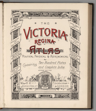
W. & A.K. Johnston Limited
Full Title
(Title Page) The Victoria Regina Atlas, Political, Physical & Astronomical. Containing Two Hundred Plates and Complete Index. Second Edition. W. & A.K. Johnston, Ltd. Established 1825. Edinburgh & London. 1906.
Publisher
W. & A.K. Johnston Limited
Author
[Everts & Co., Haskell & Wood, L.H. Everts & Co.]
Full Title
(Title Page to) The official state atlas of Kansas compiled from government surveys, county records and personal investigations. Philadelphia. L.H. Everts & Co. 1887. (on verso:) Copyright, 1887, L.H. Everts & Co. (with view:) State Capitol, Topeka, Kan. Haskell & Wood, Arch's. F.F. Goist Sc.
Publisher
L.H. Everts & Co.
Author
Tanner, Henry S.
Full Title
(Title Page to) The American Traveller; Or Guide Through the United States. Containing Brief Notices of the Several States, Cities, Principal Towns ... Third Edition. By H.S. Tanner. Philadelphia: Published by the Author, No. 51 South Third Street. 1837. (on verso) Entered ... 1836, by H.S. Tanner ... Pennsylvania. (on recto of title page: view of) " Falls Of Niagara. From the American ladder. Drawn by T. Birch. Engraved by J.W. Steel.
Publisher
H.S. Tanner
Author
Rand McNally and Company
Full Title
(Title Page to) Rand McNally auto road map Minnesota ... Copyright 1932 by Rand McNally & Co. Chicago, Ill. Made In U.S.A.
Publisher
Rand McNally
Author
Tanner, Henry S.
Full Title
(Title Page to) The Traveller's Hand Book for the State of New York, The Province of Canada, and Parts of the Adjoining States ... By Which Every Interesting Object on the Leading Routes is Brought into View. With Maps, Etc. Third Edition. By H.S. Tanner. New York: Published at the Geographical Establishment ... 1845. (on verso) Entered ... 1843, by H.S. Tanner ... New York.
Publisher
H.S. Tanner
Author
Langley, Henry G.
Full Title
(Title Page to) A Map And Street Directory Of San Francisco: To Which Are Added Many Items ... Useful For Strangers Visiting The Metropolis of the Pacific. Price Seventy-Five Cents. San Francisco: Henry G. Langley, 612 Clay St. 1870. (on verso) Entered ... 1870, By Henry G. Langley ... California. (with) Map Of San Francisco From the Latest Survey. Engraved Expressly For The San Francisco Directory. 1870. Lith. Britton & Rey S.F.
Publisher
Henry G. Langley
Author
Tanner, Henry S.
Full Title
(Title Page to) The American Traveller; Or Guide Through the United States. Containing Brief Notices of the Several States, Cities, Principal Towns ... With tables of Distances, ... Second Edition. By H.S. Tanner. Philadelphia: Published by the Author, Shakespeare Buildings. 1836. (on verso) Entered ... 1836, By H.S. Tanner ... Pennsylvania. (on recto of title page: view of) " Falls Of Niagara. From the American ladder. Drawn by T. Birch. Engraved by J.W. Steel.
Publisher
H.S. Tanner
Author
[Geological and Geographical Survey of the Territories (U.S.), Powell, John Wesley, 1834-1902]
Full Title
(Title Page to) Atlas accompanying the report on the geology of a portion of the Uinta Mountains and a region of country adjacent thereto by J.W. Powell, Geologist in charge 1876. Julius Bien Lith. Department of the Interior, U.S. Geographical and Geological Survey of the Territories, Second Division.
Publisher
Julius Bien
Author
Clason Map Company
Full Title
(Title Page to) Clason's Denver Green Guide. The Clason Map Co. Chicago - Denver. New Census Edition 35 (cents). (with) Clason's Guide Map Of Denver Colorado. Published By The Clason Map Co. Chicago, Ill. Denver, Colo. Copyrighted By the Clason Map Co. Denver, Colo. (inset map) Denver Business District.
Publisher
Clason Map Co.
Author
[Geographical and Geological Survey of the Rocky Mountain Region (U.S.), Jenney, Walter Proctor, 1849-1921, Newton, Henry, 1845-1877]
Full Title
(Title Page to) Topographical and Geological Atlas of the Black Hills of Dakota to accompany the report of Henry Newton, E.M., assistant geologist. Department of the Interior, United States Geographical and Geological Survey of the Rocky Mountain Region, J.W. Powell, in charge. Julius Bien, Lith. New York, 1879.
Publisher
Julius Bien
Author
Disturnell, John
Full Title
(Title Page to) The Traveller's Guide Through The State Of New York, Canada, &c. Embracing a General Description Of The City Of New York; The Hudson River Guide ... Accompanied By Correct Maps. New-York: Published By J. Disturnell, No. 156 Broadway. MDCCCXXXVI. Entered ... 1836, By John Disturnell ... New-York. J.W. Bell, Printer, 17 Ann-street. (with map) Miniature Plan of the City of New-York. Engraved by J.F. Morin. 1836. Published by Disturnell ... (with map) Hudson River & Vicinity. Drawn By David H. Burr. Published By J. Disturnell ... 1836. Entered ... 1834 by J. Disturnell ... New York. S. Stiles & Co. N.Y. (with map) Map Of The State of New York With the Latest Improvements ... Published by J. Disturnell. New York, 1836. Entered ... 1836 by John Disturnell ... New York.
Publisher
J. Disturnell
Author
Tanner, Henry S.
Full Title
(Title Page to) The American Traveller; Or Guide Through the United States. Containing Brief Notices of the Several States, Cities, Principal Towns ... By H.S. Tanner. Philadelphia: Published by the Author, Shakespeare Buildings. 1834. (on verso) Entered ... 1834, by H.S. Tanner ... Pennsylvania.
Publisher
H.S. Tanner
Author
[Lotter, Tobias Conrad, Lobeck, Tobias]
Full Title
(Title Page to) Atlas Geographicus Portatilis, XXIX, Mappis Orbis Habitabilis Regna Exhibens. Caelo Accurate Expressit Tobias Conradus Lotterus, Delineavit et Excudit Tobias Lobeck, Chalcograph: Augustan... (Augsburg, 17620) (engraved by)Tobias Lobeck. Sculpsit et execudit, Aug. A.Y. (after) G. Eichler.
Publisher
Tobias Lobeck
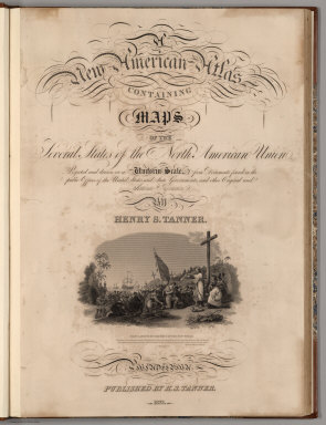
Author
Tanner, Henry S.
Full Title
(Title Page to) A New American Atlas Containing Maps Of The Several States of the North American Union, Projected and drawn on a Uniform Scale from Documents found in the public Offices of the United States and State Governments, and other Original and Authentic Information, By Henry S. Tanner ... Philadelphia: Published By H.S. Tanner. 1823. (title page only) Writing Drawn and Engraved by Joseph Perkins. Barralet del. Humphrys sc.
Publisher
Henry Tanner
Author
Mills, Robert
Full Title
(Title Page to) Atlas Of The State Of South Carolina, Made Under The Authority Of The Legislature; Prefaced With A Geographical, Statistical And Historical Map Of The State. By Robert Mills, Of South Carolina, P.A. ... Published by F. Lucas Jr. Baltimore for Mills' Atlas. (with) Sth. Carolina. B.T. Welch & Co. Sc. Published by F. Lucas Jr. Baltimore for Mills' Atlas.
Publisher
Tanner/Lucas
Author
Hewett, Daniel
Full Title
(Title Page to) The Traveller's Guide Through The United States, And Brief Geographical View Of The World ... Being the Outlines of a Course of Lectures on Geography. By D. Hewett, A.M. New York Published for the Author, at No. 73 Vesey Street, March, 1822. (with map) United States. J.D. Stout. (with folded sheet) General View Of The World. Arranged according to the course of Geographical Lectures by D. Hewett.
Publisher
D. Hewett
Author
Phelps & Ensign
Full Title
(Title Page to) Phelps & Ensign's Traveller's Guide Through the United States ... Illustrated By A New And Accurate Map Of The United States. New York: Phelps & Ensign, No. 7 Bowery. 1838. Entered .. 1838, by Phelps & Ensign .. New York. (with) Phelps & Ensign's Travellers' Guide, and Map of the United States ... New York, Published by Phelps & Ensign, 1838. Engraved on Steel by J.Wells, Brooklyn L.I. Entered ... 1837 by Phelps & Squire ... New York. (with 16 inset maps).
Publisher
Phelps & Ensign
Author
Warren, Gouverneur Kemble, 1830-1882
Full Title
(Title Page to) Explorations in the Dacota Country, in the Year 1855. By Lieut. G.K. Warren, Topographical Engineer of the "Sioux Expedition." Senate. 34th Congress, 1st Session. Ex. Doc. No. 76. Washington: A.O.P. Nicholson, Senate Printer. 1856. (with map) Reconnoissances in the Dacota Country By G.K. Warren, Lieut: Topl. Engrs. U.S.A. ... P.S. Duval & Co. Lith. Philada. (profile) Profile Of Route From Fort Pierre To Fort Kearney ... 1855.
Publisher
A.O.P. Nicholson, Senate Printer
Author
[Atwood, J.M., Ensign, Bridgman & Fanning]
Full Title
(Title Page to) Ensign, Bridgman & Fanning's Traveller's Guide Through The States Of Ohio, Michigan, Indiana, Illinois, Missouri, Iowa, And Wisconsin ... Accompanied With A New Map Of The Above States. New York: Ensign, Bridgman & Fanning, 156 William Street, Corner Of Ann, 1856. (on verso) Entered ... 1855, by Ensign, Bridgman & Fanning ... New York. (with) Map Of The Western States By J.M. Atwood. Published By Ensign, Bridgman & Fanning ... 1855. Entered ... 1848 by Ensign's & Thayer ... New York.
Publisher
Ensign, Bridgman & Fanning
Author
Blanchard, Rufus
Full Title
(Title Page) Hand-Book Of Minnesota: Describing Its Agricultural, Commercial and Manufacturing Resources, And Other Capabilities Of Producing Wealth, Also Its Physical And Social Conditions and its Future. By Rufus Blanchard. Chicago: Blanchard & Cram, 1867.
Publisher
Blanchard & Cram.
Author
Page, H.R. & Co.
Full Title
(Title Page) Illustrated Atlas Of Winnebago And Boone Counties, Illinois ... Also Maps of Michigan, Indiana, Ohio, Illinois, Wisconsin, Minnesota, Iowa, Missouri, Dakota, Nebraska, Kansas, Montana, Colorado, New Mexico, Arizona, Texas, and Washington Territory. Compiled from Late and Authentic Sources, Together with Other Valuable Information. Published By H.R. Page & Co. Chicago. Copyrighted 1886.
Publisher
H.R. Page & Co.
Author
Mitchell, Samuel Augustus
Full Title
(Title Page to) A New Universal Atlas Containing Maps of the various Empires, Kingdoms, States and Republics Of The World. With a special map of each of the United States, Plans of Cities &c. Comprehended in seventy sheets and forming a series of One Hundred And Seventeen Maps, Plans And Sections ... Philadelphia, Published By S. Augustus Mitchell, N.E. corner of Market & 7th Streets. 1849. Entered ... 1846, by H.N. Burroughs. ... Pennsylvania. (title page by) J. Knight Sc.
Publisher
S.A. Mitchell
Author
[Pacific Railroad Survey, Warren, Gouverneur Kemble, 1830-1882]
Full Title
(Title Page to) Reports of Explorations and Surveys, to Ascertain the Most Practicable and Economical Route for a Railroad From the Mississippi River to the Pacific Ocean. Made Under the Direction of the Secretary of War, In 1853-56, According to Acts of Congress of March 3, 1853, May 31, 1854, and August 5, 1854. Volume XI. Washington: George W. Bowman, Printer. 1861. 36th Congress, 2d Session, Senate, Ex. Doc.
Publisher
[A.O.P. Nicholson I-XI, T. Ford XII.]
Author
[Pacific Railroad Survey, Warren, Gouverneur Kemble, 1830-1882]
Full Title
(Title Page to) Topographical maps, profiles, and sketches to illustrate the various Reports of Surveys for railroad routes from the Mississippi River to the Pacific Ocean. Washington, D.C., 1861.
Publisher
[A.O.P. Nicholson I-XI, T. Ford XII.]
Author
Hammond & Tillman Publishing Co.
Full Title
(Title Page) An Illustrated Standard Atlas Of Gibson County, Indiana. Hammond & Tillman Publishing Company, Boonville, Indiana. Printed By Crescent Engraving-Printing Co., Evansville, Ind. Engraved By S. Wangersheim, Chicago.
Publisher
Hammond & Tillman Pub. Co.
Author
Everts, L.H.
Full Title
(Title Page to) Combination Atlas Map Of Portage County Ohio. Compiled, Drawn and Published From Personal Examinations and Surveys By L.H. Everts, Chicago, Ill. 1874. Duval & Hunter Pr. Phila. N. Friend, Engr. Philad. C.L. Smith, Del.
Publisher
L.H. Everts
Author
[Sanford, E.F., Everts, W.P.]
Full Title
(Title Page) Atlas Of Strafford County New Hampshire. From actual Surveys, drawn and Published By Sanford & Everts, 320 Chestnut Street, Philadelphia. 1871. E.F. Sanford, W.P Everts. Assistants: F.B. Roe, F.W. Tucker, C.T. Liggett, C.H. Edwards. Entered ... 1871 by Sanford & Everts ... Washington. Engd. by Worley & Bracher, 320 Chestnut St. Phila. Printed by Fred. Bourquin, 320 Chestnut St. Philada.
Publisher
Sanford & Everts
Author
Bolitho, Edwin
Full Title
(Title Pages to) Pocket Mining Atlas. Compiled From The Latest Official Surveys, And The Most Authentic Sources. Edwin Bolitho, Engineering and Mining Journal, New York, 1880. Price, $1.00 per copy. (on following page) Entered ... 1880 ... Washington, D.C., by Trask & Francis, Bankers ... 70 Broadway, New York ...
Publisher
Edwin Bolitho, Engineering and Mining Journal
Author
King, Clarence
Full Title
(Title Page) United States Geological Exploration of the Fourtieth Parallel. Clarence King. Geologist in Charge. Atlas Accompanying Volume III on Mining Industry. (Table of Contents - list of plates).
Publisher
Julius Bien
Author
Boardman, Harvey
Full Title
(Title Page to) A Complete And Accurate Guide To And Around The White Mountains. Illustrated with Maps. By Harvey Boardman. Boston: Crosby, Nichols, & Co. MDCCCLIX. (with) Map Of The White Mountains New Hampshire From Original Surveys by Harvey Boardman, Griswold, Conn. 1858. Engraved by Smith, Knight & Tappan, Boston. Entered ... 1858, by Harvey Boardman ... Massachusetts. (with) Railway Map Of Routes To The White Mountains By Harvey Boardman, Griswold, Ct. Entered ... 1859, by Harvey Boardman ... Massachusetts. J.H. Bufford's Lith. 313 Washn. St. Boston.
Publisher
Crosby, Nichols, & Co.
Author
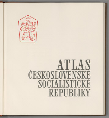
[Götz, Antonín, Československá akademie věd., Czechoslovakia. Ústřední správa geodézie a kartografie.]
Full Title
(Title Page) Atlas Ceskoslovenske Socialisticke Republiky. (Atlas of the Czechoslovakian Socialist Republic).
Publisher
Czechoslovakia. Ústřední správa geodézie a kartografie.
Author
World Meteorological Organization (WMO)
Full Title
(Title Page) Climatic Atlas of North and Central America. Atlas climatico de America del Norte y America Central. Altas climatique de l'Amerique de Nord et de l'Amerique Centrale. I. Maps of mean temperatures and precipitation ... Technical Supervisor --- Professor F. Steinhauser. OMM - WMO, UNESCO Cartographia.
Publisher
WMO, Unesco, Cartographia
Author
Bradford, Thomas G.
Full Title
(Title Page One to) An Illustrated Atlas, Geographical, Statistical, And Historical, Of The United States And The Adjacent Countries. By T.G. Bradford. Boston: Weeks, Jordan, And Company. New York: Wiley And Putnam. (on verso) Entered ... 1838, by Thomas G. Bradford ... Massachusetts. Cambridge: Stereotyped And Printed By Folsom, Wells, And Thurston, Printers To The University.
Publisher
[Weeks, Jordan & Co., Wiley and Putnam.]
Author
[U.S. Northern Boundary Commission, Campbell, Archibald, Twining, W.J.]
Full Title
(Title Page) Reports upon the Survey of the Boundary Between the Territory of the United States and the Possessions of Great Britain from the Lake of the Woods to the Summit of the Rocky Mountains, authorized by an Act of Congress Approved March 19, 1872. Archibald Campbell, Esq., (and) Captain W.J. Twining ... Published in accordance with an Act of Congress Approved March 3, 1877. Washington: Government Printing Office. 1878.
Publisher
Government Printing Office
Author
Mitchell, Samuel Augustus Jr.
Full Title
(Title Page to) Mitchell's New General Atlas, Containing Maps Of The Various Countries Of The World, Plans Of Cities, Etc., Embraced In Fifty-Five Quarto Maps, Forming A Series Of Eighty-Seven Maps And Plans, Together With Valuable Statistical Tables. Philadelphia: Published By S. Augustus Mitchell, Jr. No. 31 South Sixth Street. 1865. Entered ... 1860, by S. Augustus Mitchell, Jr. ... Pennsylvania.
Publisher
S.A. Mitchell Jr.
|