Who What Where WhenREMOVE |
Author
Bradstreet Company
Full Title
(Title Page to) Bradstreet's Pocket Atlas Of The United States. Published Exclusively for Macullar, Parker & Company, Boston, Massachusetts ... New York: The Bradstreet Company, 1885. (on verso) Entered ... 1879, by The Bradstreet Company ... Washington.
Publisher
Bradstreet Co.
Author
Tanner, Henry S.
Full Title
(Title Page to) A New American Atlas Containing Maps Of The Several States of the North American Union, Projected and drawn on a Uniform Scale from Documents found in the public Offices of the United States and State Governments, and other Original and Authentic Information, By Henry S. Tanner ... Philadelphia: Published By H.S. Tanner. 1823. (title page only) Writing Drawn and Engraved by Joseph Perkins. Barralet del. Humphrys sc.
Publisher
Henry Tanner
Author
Tanner, Henry S.
Full Title
(Title Page to) A New American Atlas Containing Maps Of The Several States of the North American Union, Projected and drawn on a Uniform Scale from Documents found in the public Offices of the United States and State Governments, and other Original and Authentic Information, By Henry S. Tanner ... Philadelphia: Published By H.S. Tanner. 1825. (title page only). Barralet del. Humphrys sc. Joseph Perkins, Philadelphia.
Publisher
Henry Tanner
Author
Melish, John
Full Title
(Title Page to) A Military and Topographical Atlas of the United States; including The British Possessions & Florida ... To Which Is Added, A List Of The Military Districts, A Register Of The Army, And A List Of The Navy Of The United States. By John Melish. Philadelphia, Printed By G. Palmer. November, 1813.
Publisher
John Melish
Author
Carey, Mathew
Full Title
(Title Page to) The General Atlas For Carey's Edition Of Guthrie's Geography improved ... Philadelphia: Published By Mathew Carey. May 1, 1795.
Publisher
Mathew Carey
Author
[Bowen, Emanuel, Gibson, John]
Full Title
(Title Page to) Atlas Minimus or a New Set of Pocket Maps of the Several Empires, Kingdoms and States of the Known World, with Historical Extracts relative to each. Drawn and Engraved by J. Gibson from the Best Authorities, Revis'd, Corrected and Improv'd by Eman: Bowen Geographer to His Majesty.
Publisher
J. Newberry
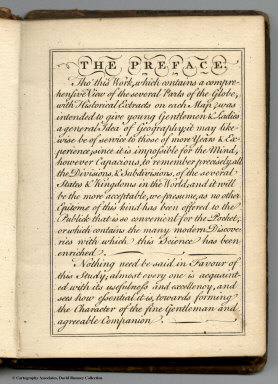
Author
[Bowen, Emanuel, Gibson, John]
Full Title
(Preface to) Atlas Minimus or a New Set of Pocket Maps of the Several Empires, Kingdoms and States of the Known World, with Historical Extracts relative to each. Drawn and Engraved by J. Gibson from the Best Authorities, Revis'd, Corrected and Improv'd by Eman: Bowen Geographer to His Majesty.
Publisher
J. Newberry
Author
[Andree, Richard, Scobel, Albert]
Full Title
(Title Page to) Andrees Allgemeiner Handatlas in 139 Haupt- und 161 Nebenkarten nebst vollstandigem alphabetischem Namenverzeichnis. Funfte, vollig neubearbeitete und vermehrte Auflage. Jubilaumsausgabe. Herausgegeben von A. Scobel. Bielefeld Und Leipzig, Verlag Von Velhagen & Klasing, 1906.
Publisher
Velhagen & Klasing
Author
Carey, Mathew
Full Title
(Title Page to) Carey's General Atlas ... Philadelphia: Published By Mathew Carey. May 1, 1796.
Publisher
Mathew Carey
Author
Mendenhall, C. S.
Full Title
(Title Page to) Mendenhall's guide and road map of Connecticut showing main touring routes, good roads, common roads, railroads, etc. Published by C.S. Mendenhall, Map Publisher, Cincinnati, O. Copyright 1909 by C.S. Mendenhall.
Publisher
C.S. Mendenhall
Author
[Woerl, Joseph Edmund, Herder, Bartholomew]
Full Title
(Title Page to) Karte der Schweiz, von Dr. I. Woerl. Lithographie von B. Herder in Freiburg im Breisgau. Mitglied der königl. Academie der Kriegswissenschaften in Schweden, der königl. geographischen Societaeten zu London und Paris, der historischen Gesellschaft zu Freiburg i. B. etc.
Publisher
B. Herder
Author
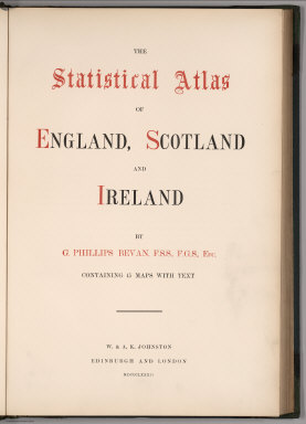
Bevan, G. Phillips
Full Title
(Title Page) The Statistical Atlas of England, Scotland and Ireland. By G. Phillips Bevan, F.S.S., F.G.S., Etc. Containing 45 Maps with Text. W. & A.K. Johnston, Edinburgh and London, MDCCCLXXXII.
Publisher
W. &. A.K. Johnston
Author
Baist, G.W.
Full Title
(Title Page to) Baist's Real Estate Atlas of Surveys of Los Angeles, Cal. Complete in One Volume. Compiled and Published from Official Records, Private Plans, Actual Surveys. By G. W. Baist, Surveyor. Wm. E. & H.V. Baist, Asst. Surveyors. 306 Walnut St., Philadelphia. Copyrighted 1921, by G.Wm. Baist.
Publisher
G. W. Baist
Author
Akademiia nauk SSSR
Full Title
(Title Page to:) Plan stolichnago goroda Sanktpeterburga s izobraheniem znatiieshikh onago prospektov, izdannyi trudami Imperatorskoi Akademii nauk i khudozhestv. Plan de la ville de St. Petersbourg avec ses principales vues dessine & grave sous la direction de l'Academie imperiale des sciences et des arts.
Publisher
Imperatorskoi Akademii nauk i khudozhestv
Author
[Codazzi, Agustín, 1793-1859, Paz, Manuel María, 1820-1902]
Full Title
(Title Page to) Atlas geografico e historico de la Republica de Colombia (Antigua Nueva Granada) : el cual comprende las repuublicas de Venezuela y Ecuador con arreglo a los trabajos geograficos del general de ingenieros Agustin Codazzio ejecutados en Venezuela y Nueva Granada. Construida la parte cartografica por Manuel M. Paz, Miembro de la Sociedad de Geografia de Paris. y redactado el texto explicativo por el doctor Felipe Perez. Todo de orden del Gobierno Nacional de Colombia. Paris - 1889, Imprenta A. Lahure, Calle de Fleures, 9.
Publisher
A. Lahure
Author
[Scovel, James L., O'Brien, Emmett J]
Full Title
(Title Page to) Atlas of Landforms. James L Scovel; Emmett J O'Brien; J C McCormack, (Major); R.B. Chapman; Department of Earth, Space and Grafic Sciences; United States Military Academy, West Point, New York. John Wiley and Sons Inc., New York. London. Sydney.
Publisher
John Wiley & Sons Inc.
Author
Rizzi Zannoni, Giovanni Antonio (1736-1814)
Full Title
(Title Page to) No. 2. (Fiume Tronto). Atlante geografico del regno di Napoli : compito e rettificato sotto I felici auspicj di Giuseppe Napoleone I, re di Napoli, e di Sicilia, Principe francese e grand' elettore dell' impero da Gio. Antonio Rizzi-Zannoni. Direttore del Gabinetto Topografico della M.S. Nel 1808. Gius. Guerra Inc. Nap. 1806.
Publisher
Giuseppe Guerra
Author
Mitchell, Samuel Augustus
Full Title
(Title Page to) A New Universal Atlas Containing Maps of the various Empires, Kingdoms, States and Republics Of The World. With a special map of each of the United States, Plans of Cities &c. Comprehended in eighty four sheets and forming a series of One Hundred And Forty Five Maps, Plans And Sections ... Philadelphia, Charles Desilver, 1229 Chesnut Street,1864. Entered ... 1859, by Charles Desilver ... Pennsylvania. (title page by) Barralet del. Humphreys, sc. J. Knight Sc.
Publisher
Charles Desilver.
Author
U.S. Office of War Information
Full Title
(Title Page to) A War Atlas for Americans. Prepared with the Assistance of the Office of War Information. Published for Council on Books in Wartime by Simon and Schuster. New York. 1944.
Publisher
Simon and Schuster
Author
Debenham, Frank
Full Title
(Title Page to) The global atlas; a new view of the world from space. By Frank Debenham, Professor Emeritus of Geography, University of Cambridge. Introduction by Bertrand Russell. Produced by Geographical Project Ltd., London. (Published by): Simon and Schuster, New York. (verso of title page) Copyright 1958, Adprint Ltd., London. Printed in the U.S.A. by Western Printing and Lithographing Company. Published by Simon and Schuster, Inc., Rockefeller Center, New York 20, N.Y.
Publisher
Simon and Schuster
Author
[Johnston, Alexander Keith, 1804-1871, Rogers, Henry Darwin]
Full Title
(Title Page to) Atlas Of The United States Of North America, Canada, New Brunswick, Nova Scotia, Newfoundland, Mexico, Central America, Cuba, And Jamaica. On A Uniform Scale. From The Most Recent State Documents, Marine Surveys, And Unpublished Materials. With Plans Of The Principal Cities And Sea-Ports, And An Introductory Essay On The Physical Geography, Products, And Resources Of North America. By Professor Henry Darwin Rogers, Of Boston, U.S., And A. Keith Johnston, F.R.S.E., F.R.G.S., F.G.S., Geographer To The Queen. London: Edward Stanford, 6, Charing Cross, S.W. [The Authors Reserve The Right Of Translation.] (on verso) Entered at Stationers' Hall, London ... 1857 by H.D. Rogers ... Massachusetts.
Publisher
Edward Stanford
Author
[Beers, F.W. (Frederick W.), Cramer, Louis H.]
Full Title
(Title Page) Combination Atlas Of Saratoga And Ballston From Recent And Actual Surveys And Records Under the Superintendence of F.W. Beers And Louis H. Cramer, Published By J.B. Beers & Co. 36 Vesey Street, New York. 1876. Entered ... 1876 by J.W. Beers & Co. ... Washington. Printed by Charles Hart, 36 Vesey St. N.Y. Engraved by L.E. Neuman 36 Vesey St. N.Y.
Publisher
J.B. Beers & Co.
Author
Egloffstein, Baron F.W. von
Full Title
(Title Page to) Contributions to the Geology and the Physical Geography of Mexico, including a Geological and Topographical Map, with profiles, Of some of the principal Mining Districts; together with a graphic description of an ascent of The Volcano Popocatepetl. Edited by Baron F.W. von Egloffstein. New York: D. Appleton & Company, 443 & 445 Broadway. 1864. (on verso) Entered ... 1864, by F.W. von Egloffstein ... New York.
Publisher
D. Appleton & Company.
Author
[Matthews-Northrup Division, J.W. Clement Co.]
Full Title
(Title Page to)The New Matthews-Northrup Global atlas of the World at War. Cartography and manufacturing by J. W. Clement Co., Matthews-Northrup Works, Buffalo, N.Y. Copyright, 1943, by the World Publishing Company. (on verso) Published in the United States of America.
Publisher
World Publishing Company
Author
California Division of Highways
Full Title
(Covers to) California Highway Transportation Survey, 1934.
Publisher
California Division of Highways
Author
California Division of Highways
Full Title
(Title to) California Highway Transportation Survey, 1934.
Publisher
California Division of Highways
Author
Johnston, Alexander Keith, 1804-1871
Full Title
(Title Page to) The physical atlas of natural phenomena by Alexander Keith Johnston, F.R.S.E., F.R.G.S., F.G.S. ... A new and enlarged edition. William Blackwood and Sons, Edinburgh and London, MDCCCLVI. [The Author reserves the right of translation]
Publisher
William Blackwood & Sons
Author
California Division of Highways
Full Title
(Title Page) Appendix A. California Highway Transportation Survey, 1934. (Table of Contents) Index of Maps.
Publisher
California Division of Highways
Author
[Gunnison, J.W., Preuss, C., Stansbury, Howard]
Full Title
(Title Page to) Exploration and Survey of the Valley of the Great Salt Lake of Utah, including a Reconnoissance of a new Route through the Rocky Mountains. By Howard Stansbury ... (with view) Fort Utah on the Timpanogas - Valley of the Great Salt Lake. Philadelphia: Lippincott, Grambo & Co. 1852.
Publisher
Lippincott, Grambo & Co.
Author
California Division of Highways
Full Title
(Title Page) California Highway Transportation Survey, 1934. Appendix B. Tabulation of Field Count by Cities and Counties.
Publisher
California Division of Highways
Author
[Carey, Mathew, Guthrie, W.]
Full Title
(Title Page to) A New System of Modern Geography: or, A Geographical, Historical, and Commercial Grammar; and Present State of the Several Nations of the World. ... By William Guthrie, Esq. ... In two volumes. Volume I. The First American Edition, Corrected, Improved, and Greatly Enlarged. Philadelphia: Printed by Mathew Carey. April 27. M.DCC.XCV.
Publisher
M. Carey
Author
[Carey, Mathew, Guthrie, W.]
Full Title
(Title Page to) A New System of Modern Geography: or, A Geographical, Historical, and Commercial Grammar; and Present State of the Several Nations of the World. ... By William Guthrie, Esq. ... In two volumes. Volume II. The First American Edition, Corrected, Improved, and Greatly Enlarged. Philadelphia: Printed by Mathew Carey. April 27. M.DCC.XCV.
Publisher
M. Carey
Author
[Rand McNally and Company, State Farm Insurance Companies Travel Bureau]
Full Title
(Title Page to) State Farm Road Atlas: United States, Canada, Mexico,Central and South America. Copyright 1940 by Rand McNally & Company, Chicago, Ill. (opposite title page) The State Farm Insurance Companies Home Office: Bloomington, Illinois ; Pacific Coast Office: Berkeley, California. Cost to Cost Service ...
Publisher
State Farm Insurance Companies Travel Bureau
Author
Schubert, Friedrich Theodor
Full Title
(Title Page to) Kriegsstrassen Karte eines Theiles von Russland und der angraenzenden laender; nach der unter der Leitung des Russ. kaiserlichen Generalstabes vom General Major Schubert im Masstabe von 1:1680000 im Jahre 1829 herausgegebenen Karte auf das Mass von 1:1400000 vergrossert, von dem k.k. osterr. Generalquartiermeisterstabe herausgegeben im Jahre 1837. "Berichtigungen im Jahr 1854 u. 1856 ... ). (on upper left margin) III.
Publisher
Generalquartiermeisterstab
Author
Schubert, Friedrich Theodor
Full Title
(Title Page to) Kriegsstrassen Karte eines Theiles von Russland und der angraenzenden laender; nach der unter der Leitung des Russ. kaiserlichen Generalstabes vom General Major Schubert im Masstabe von 1/1680000 im Jahre 1829 herausgegebenen Karte auf das Mass von 1/1400000 vergrossert, von dem k.k. osterr. Generalquartiermeisterstabe herausgegeben im Jahre 1837.
Publisher
Generalquartiermeisterstab
Author
[Poirson, J.B., Herbin de Halle, Etienne de.]
Full Title
(Title Page to) Statistique Generale et Particuliere De La France et De Ses Colonies, avec une Nouvelle Description ... Sept Volumes ... 9 Grandes Cartes ... par J.B. Poirson ... Collection de Table et Cartes. A Paris, Chez F. Buisson ... 1804. (Atlas only).
Publisher
F. Buisson
Author
Geographisches Institut (Weimar, Germany)
Full Title
(Title Page to) Allgemeiner Hand-Atlas der Erde und des Himmels nach den besten astronomischen Bestimmungen, neuesten Entdeckungen und kritischen Untersuchungen entworfen. Geographisches Institut in Weimar. (1856?)
Publisher
Weimar Geo Inst.
Author
[Paullin, Charles O., Wright, John K.]
Full Title
(Title Page) Atlas of the Historical Geography of the United States. By Charles O. Paullin, Carnegie Institution of Washington. Edited by John K. Wright, Librarian, American Geographical Society of New York. Published Jointly by Carnegie Institution of Washington and the American Geographical Society of New York, 1932.
Publisher
[Carnegie Institution of Washington, American Geographical Society of New York]
Author
Smith, J. Calvin
Full Title
(Title Page to) Smith's Hand-Book For Travelers Through The United States Of America... Embellished with 130 Highly-finished Engravings, And Accompanied By A Large And Accurate Map. By J. Calvin Smith. New York: Published By J. Calvin Smith & Son, (Late Of Sherman & Smith,) 71 Nassau-Street, Corner Of John-St. 1856. Entered ... 1856, By J. Calvin Smith ... (with) A New Map For Travellers Through the United States Of America Showing the Railroads, Canals & Stage Roads. With The Distances, by J. Calvin Smith. Published by J. Calvin Smith, New-York. MDCCCLVI. Entered ... 1856, by J. Calvin Smith ... (inset) Map Of Oregon Northern California Santa Fe &c. (& 4 additional inset maps).
Publisher
J. Calvin Smith & Son
Author
Thomas, Cowperthwait & Co.
Full Title
(Title Page to) Description Of The Republic Of Mexico, ... Illustrated By A Map, In Which Is Included Smaller Maps Of The Valley Of Mexico, And The Fields Of Palo Alto, And Resaca De La Palma. Philadelphia: Thomas, Cowperthwait & Co. 1846. (on verso) Entered ... 1846, by Thomas, Cowperthwait & Co. ... Pennsylvania. (with) Map Of Mexico Including Yucatan. Entered... 1846, by Thomas, Cowperthwait & Co. ... Pennsylvania. (with two insets).
Publisher
Thomas, Cowperthwait & Co.
Author
Stieler, Adolf
Full Title
(Title Page to) Hand-Atlas uber alle Theile der Erde, nach dem neuesten Zustande und uber das Weltgebaude ; Herausgegeben, und mit Herrn Hofrath C.G. Reichard gemeinschaftlich ausgearbeitet, von Adolf Stieler Hzgl. Sachs. Legationsrath. Grundriss von Gotha, 1823). Gotha bei Justus Perthes. Gest v. Edler in Gotha. (with inset map) Gotha und Umgebung 1823 ; gest. v. Edler. Gez. v. Bar.
Publisher
Justus Perthes
Author
Servoss, R. D.
Full Title
(Title Page to) Sectional road map of Westchester County, New York and part of Fairfield County, Conn. Indexed. Showing the good roads. Published by R.D. Servoss, 21 & 23 Centre St., New York. Copyright 1895, by R.D. Servoss.
Publisher
R.D. Servoss.
Author
Associated Railway Land Dept of Florida
Full Title
(Title Page to) Township map of Peninsular Florida issued by the Associated Railway Land Department of Florida. 1890 ... Copyright, 1890, for the Associated Railway Land Department of Florida, By D.H. Elliott, General Land Agent. Matthews, Northrup & Co. Buffalo, New York.
Publisher
D.H. Elliott, General Land Agent, Associated Railway Land Department of Florida.
Author
Stieler, Adolf
Full Title
(Title Page) Adolf Stieler's Hand Atlas Uber Alle Theile Der Erde Und Uber Das Weltgebaude. 95 Karten. Gotha Justus Perthes. (title page only) Entw. v. H. Berghaus 1881. Gest. v. H. Eberhardt u. E. Kuhn.
Publisher
Justus Perthus
Author
Deutsche Seewarte
Full Title
(Title Page to) Deutsche Seewarte. Atlantischer Ozean. Ein atlas von 39 karten, die physikalischen verhaltnisse und die verkehrs-strassen darstellend, mit einer erlauternden einleitung und als beilage zum segelhandbuch fur den Atlantischen Ozean. Zweite Auflage. Herausgegeben von der Direktion. Hamburg: L. Friederichsen & Co. (Inhaber: Dr. L. Friederichsen.) 1902.
Publisher
L. Friederichsen & Co.
Author
[Compton, Richard J., Dry, Camille N.]
Full Title
(Title Page to) Pictorial St. Louis, the great metropolis of the Mississippi Valley; a topographical survey drawn in perspective A.D. 1875, by Camille N. Dry, designed & edited by Rich. J. Compton. St. Louis. Compton & Company, 1876. Western Engraving Co. St. Louis.
Publisher
Compton & Company
Author
[United States Exploring Expedition (1838-1842), Wilkes, Charles, 1798-1877]
Full Title
(Title page to) Atlas. Narrative of the United States Exploring Expedition During the Years 1838, 1839, 1840, 1841, 1842. By Charles Wilkes, U.S.N. Commander Of The Expedition, Member Of The American Philosophical Society, Etc. In Five Volumes, And An Atlas. Philadelphia: Lea & Blanchard. 1845. (on verso) Entered ... 1844, By Charles Wilkes ... District of Columbia.
Publisher
Lea & Blanchard
Author
McGraw-Hill Book Company
Full Title
(Title Page) Man's Domain: A Thematic Atlas of the World.
Publisher
General Drafting Co., Inc.
Author
Ringgold, Cadwalader, 1802-1867
Full Title
(Title Page to) A Series of charts, with sailing directions, embracing surveys of the Farallones, entrance to the Bay of San Francisco ... State of California... Third edition, with additions.
Publisher
Jno. T. Towers
Author
[Woerl, Joseph Edmund, Herder, Benjamin]
Full Title
(Title Page to) Das Koenigreich Wuerttemberg Das Grossherzogthum Baden und die Fuurstenthuumer Hohenzollern : entworfen und bearbeitet im Maasstabe 1:200 000 in 12 Blaettern von I.E. Woerl ; in Stein gestochen unter seiner Leitung. Eine Abteilung der von Obrist Weiss entworfenen Karte von Suddeutschland. In tiefster ehrfurcht aller untertanigst gewidmet von H. Heder. [Gewidmet] Grosherzog Leopold von Baden. Woerl dir: 1831. Im Herder'schen Kunst-Institut in Freburgn im Breisgan. (at head of title) 1830.
Publisher
Herder'sche Kunst- u. Buchhandlung
|