Who What Where WhenREMOVE |
Author
Stieler, Adolf
Full Title
(Title Page) Hand - Atlas Uber Alle Theile Der Erde nach dem neuesten Zustande Und Uber Das Weltgebaude. Herausgegebenn von Adolf Stieler, berbeitet von Demselben, so wie von F.v. Stulpnagel, H. Berghaus u. I.C. Bar. Gotha bei Justus Perthes. (title page only) gez. v. Bar. gest. v. Edler in Gotha.
Publisher
Justus Perthes
Author
[Thomas Bros., Thomas Brothers]
Full Title
(Covers to) Thomas Bros. Recreational and Statistical Atlas, California.
Publisher
Thomas Bros.
Author
Stieler, Adolf
Full Title
(Title Page to) Hand Atlas Uber Alle Theile Der Erde Und Uber Das Weltgebaude. Herausgegeben Von Adolf Stieler. Gotha Justus Perthes.
Publisher
Justus Perthes
Author
[Carey, Henry Charles, Lea, Isaac]
Full Title
(Title Page to) The Juvenile Atlas or a Series Of Maps, To Illustrate the Old and New Worlds. Philadelphia. Published By H.C. Carey & I. Lea 1822.
Publisher
H.C. Carey & I. Lea
Author
Bromme, Traugott
Full Title
(Title Page to) Atlas zu Alex. V. Humboldt's Kosmos in zweiundvierzig Tafeln mit erlauterndem Texte. Herausgegeben von Traugott Bromme. Stuttgart. Verlag von Krais & Hoffman. (with second title page) Atlas zur Physik der Welt in ... Bromme.
Publisher
Krais & Hoffman
Author
Bartholomew, J. G.
Full Title
(Title Page) Atlas of the World's Commerce, A New Series of Maps with Descriptive Text and Diagrams showing Products, Imports, Exports, Commercial Conditions and Economic Statistics of the Countries of the World, Compiled from the Latest OfficialReturns at the Edinburgh Geographical Institute and Edited by J.G. Bartholomew, F.R.S.E., F.R.G.S., Etc. Victoria Gold Medalist of the Royal Geographical Society. London, George Newnes, Limited, Southampton Street, Strand, W.C.
Publisher
George Newnes, Limited
Author
[Great Britain. War Office, Stevens, Benjamin Franklin]
Full Title
(Map Title Page to) B.F. Steven's Facsimile of the Unpublished British Head Quarters Coloured Manuscript map of New York & Environs, 1782, Reproduced from the original drawing in the War Office, London. Issued only to subscribers at 4, Trafalgar Square, W.C., London. 1900. Malby and Sons. Engravers.
Publisher
Malby and Sons, engravers
Author
Arrowsmith, Aaron
Full Title
(Covers and Title Label to) Complete Neptune, to Illustrate, by Arrowsmith, The Progress of Maritime Discovery. Part I. (Containing five Charts).
Publisher
Cadell & Davies
Author
Johnston, A. Keith
Full Title
(Title Page to) Atlas Of Physical Geography, Illustrating, In A Series Of Original Designs, The Elementary Facts Of Geology, Hydrology, Meteorology, And Natural History. By Alex. Keith Johnston, F.R.S.E. F.R.G.S. F.G.S ... Second Edition. William Blackwood And Sons, Edinburgh And London. MDCCCLII.
Publisher
William Blackwood & Sons
Author
Smith, Charles
Full Title
(Title Page) Smith's New General Atlas Containing Distinct Maps Of all the Principal Empires, Kingdoms, & States Throughout the World Carefully delineated from the best Authorities extant. London, Printed for C. Smith, Mapseller extraordinary, To his Royal Highness the Prince of Wales, No. 172, Strand. 1808. (title page only) Halliwell fect.
Publisher
C. Smith
Author
Kirkwood, Robert
Full Title
(Title Page) Kirkwood's General Atlas ... Constructed from the best Authorities extant. Published as the Act directs by Robt. Kirkwood, Engraver, Edinburgh, John Smith & Son, Booksellers, Glasgow, & Wm. Faden, London. 1817. R. Kirkwood Script. & Sculpt. (Table of Contents).
Publisher
[Robert Kirkwood, John Smith & Son]
Author
Wilkinson, Robert
Full Title
(Title Page) A General Atlas, being A Collection of Maps of the World And Quarters, the Principal Empires, Kingdoms &c. with their several Provinces & other Subdivisions, Correctly Delineated. London: Published Feby. 1st 1800, by Robert Wilkinson, No. 58, Cornhill. (on table of contents page) ... London: Printed For Robert Wilkinson, No. 58, Cornhill. 1808.
Publisher
Robert Wilkinson
Author
Wilkinson, Robert
Full Title
(Title Page) Wilkinson's General Atlas of the World, Quarters, Empires, Kingdoms, States &c. with Appropriate Tables. Second Edition. London. Published March 1, 1809, by Rob't Wilkinson, No. 125 Fenchurch St.
Publisher
R. Wilkerson
Author
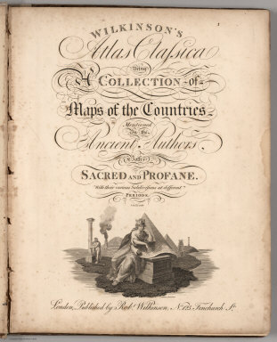
Wilkinson, Robert
Full Title
(Title Page) Wilkinson's Atlas Classica Being A Collection of Maps of the Countries Mentioned By the Ancient Authors, Both Sacred And Profane. With their various Subdivisions at different Periods. T. Bourne Sculp. London, Published by Robt. Wilkinson, No. 125, Fenchurch St. Published 4th Jany. 1822. (on table of contents page) ... London: Printed For Robert Wilkinson, No. 125, Fenchurch Street ... 1823.
Publisher
Robert Wilkinson
Author
Stieler, Adolf
Full Title
(Title Page) Hand Atlas Uber Alle Theile Der Erde nach dem neuesten Zustande Und Uber Das Weltgebaude. Herausgegebenn von Adolf Stieler, berbeitet von Demselben, so wie von C.G. Reichard, H. Hubbe, F.v. Stulpnagel, H. Berghaus u. I.C. Bar. Gotha bei Justus Perthes. (title page only) gez. v. Bar. gest. v. Edler in Gotha.
Publisher
Justus Perthus
Author
Stieler, Adolf
Full Title
(Title Page) Hand Atlas Uber Alle Theile Der Erde Und Uber Das Weltgebaude. Erste Auscabe 1817 Jubel Auscabe 1867. Herausgegeben Von Adolf Stieler. Gotha Justus Perthes.
Publisher
Justus Perthes
Author
[Cook, James, 1728-1779, King, James]
Full Title
(Title Page to) Voyage to the Pacific Ocean, undertaken by the Command of His Majesty, for making discoveries in the Northern Hemisphere. Performed under the direction of Captains Cook, Clerke and Gore, in His Majesty's ships the Resolution and Discovery , in the years 1776, 1777, 1778, 1779 and 1780. In three volumes. Vol. I. and II. written by Captain James Cook, F.R.S. Vol. III. by Captain James King, LL.D. and F.R.S. ... The second edition. London: Printed by H. Hughs, For G. Nicol, Bookseller to his Majesty, in the Strand; and T. Cadell, in the Strand. M.DCC.LXXXV.
Publisher
G. Nicol and T. Cadell
Author
Hopkins, G.M.
Full Title
(Title Page) City Atlas Of Newport Rhode Island From official Records Private Plans and Actual Surveys, Based upon Plans deposited in the Department of Surveys. Surveyed & Published under the Direction Of G.M. Hopkins, C.E. 320 Walnut Street, Philadelphia. 1876. Engraved by Edward Busch, 320 Walnut Street. Printed by F. Bourquin, 31 So. 6th Street Phila. Entered ... 1876 by G.M. Hopkins ... Washington D.C.
Publisher
G.M. Hopkins
Author
[U.S. Geological Survey, Alpha, Tau Rho, Detterman, Janis S., Morley, James M.]
Full Title
(Title Page) Atlas of Oblique Maps, A Collection of Landform Portrayals of Selected Areas of the World. By Tau Rho Alpha, Janis S. Detterman, and James M. Morley. This folio comprises scale-accurate, obliquely viewed maps compiled from 1961-1986 that portray the physiography of selected areas of the ocean floor and continents. U.S. Geological Survey Miscellaneous Investigations Series I-1799.
Publisher
U.S. Geological Survey
Author
[U.S. Geological Survey, Alpha, Tau Rho, Detterman, Janis S., Morley, James M.]
Full Title
(Title Page Verso) Department of Interior ... Preface.
Publisher
U.S. Geological Survey
Author
Black, Adam & Charles
Full Title
(Title Page to) Atlas of Australia with all the Gold Regions: a series of maps from the latest and best authorities. Edinburgh, Adam and Charles Black, North Bridge, booksellers and publishers to the Queen.
Publisher
Adam & Charles Black
Author
Atchison, Topeka, and Santa Fe Railroad Company
Full Title
(Title Page) The California Limited. Pictures by C.D. Williams. 1903-1904 Santa Fe. Copyright, 1903, by Geo. T. Nicholson.
Publisher
Rand McNally
Author
[USGS (U.S. Geological Survey), Walcott, Charles D.]
Full Title
(Title Page) Twenty-first Annual Report of the United States Geological Survey to the Secretary of the Interior. 1899-1900. Charles D. Walcott, Director. In Seven Parts. Henry Gannett, Chief of Division. Washington. Government Printing Office. Part V - Forest Reserves.
Publisher
Government Printing Office
Author
Tanner, Henry S.
Full Title
(Title Page to) A New Pocket Atlas of the United States With The Roads and Distances, Designed For the Use of Travelers. By H.S. Tanner. Philadelphia: Published by the Author. 1828. (on verso) ...on the seventeenth day of November ... 1828, Henry S. Tanner ... hath deposited ... a book ... Pennsylvania.
Publisher
H.S.Tanner
Author
Clason Map Company
Full Title
(Title page to) Clason's Map Of California Published By The Clason Map Co., Denver, Colo. Copyrighted 1910 By The Clason Map Co., Denver, Col. (inset) Enlarged Section Of San Francisco And Vicinity. (inset) Enlarged Section Of Los Angeles And Vicinity.
Publisher
Clason Map Company
Author
Southern Pacific Company
Full Title
The Great Sunset Route. Shortest Line between the Atlantic and the Pacific Oceans... Boston Agency: 192 Washington Street 192. General Eastern Agency: New York city, 339 Broadway. (with) Map of summer & winter resorts and other places upon and near the Central & Southern Pacific railroads in California. D. Van Vleck S.F. Eng. F.T. Newbery Del. (with catalog) A List of Government And Railroad Lands in California, Open to Preemption or Homestead or to Purchase. Southern Pacific Company, New Orleans to San Francisco Via the Sunset Route. With Complements of the New York General Agency. 339 Broadway. L.H. Nutting, Eastern passenger Agent. E. Hawley, Genl. Eastern Agent.
Publisher
Southern Pacific Company
Author
[Oddy, S.A., Wallis, James]
Full Title
(Title Page) Oddy's New General Atlas Of The World Containing Maps of Empires, Kingdoms, States Principalities &c. Engraved and Carefully Selected from the latest and most Approved Authors by James Wallis. London. Published by S.A. Oddy, No. 20 Warwick Lane & Sold by Davies & Eldridge, Exeter, Thompson & Wrightson, Birmingham & T. Sutherland, Edinburgh. (title page engraving) Drawn by C. Mufs. Engraved by J. Wallis.
Publisher
S.A. Oddy
Author
[Banks, Joseph, Sir, 1743-1820, Byron, John, 1723-1786, Cook, James, 1728-1779, Hawkesworth, John, 1715?-1773]
Full Title
(Title Page to) An account of the voyages undertaken by the order of His present Majesty for making discoveries in the Southern Hemisphere, and successively performed by Commodore Byron, Captain Wallis, Captain Carteret, and Captain Cook, in the Dolphin, the Swallow, and the Endeavor. Drawn up from the journals which were kept by the several commanders, and from the papers of Joseph Banks, Esq; by John Hawkesworth, LL.D. In three volumes. Illustrated with cuts, and a great variety of charts and maps relative to countries now first discovered, or hitherto but imperfectly known. London: printed for W. Strahan; and T. Cadell in the Strand, MDCCLXXIII.
Publisher
W. Strahan and T. Cadell
Author
[Cook, James, 1728-1779, Furneaux, Tobias, 1735-1781, Hodges, William, 1744-1797]
Full Title
(Title Page to) A voyage towards the South Pole, and round the World. Performed in His Majesty's ships the Resolution and Adventure, in the years 1772, 1773, 1774, and 1775. Written by James Cook, Commander of the Resolution ... In two volumes illustrated with maps and charts ... The second edition. (with portrait) Captain James Cook, F.R.S. Painted by Wm. Hodges. Engraved by J. Basire, 1777. London: Printed for W. Strahan; and T. Cadell in the Strand. MDCCLXXVII.
Publisher
W. Strahan and T. Cadell
Author
Duflot de Mofras, Eugene
Full Title
(Title Page to Vol 1) Exploration Du Territoire De L'Oregon, Des Californies Et De La Mer Vermeille, Executee Pendant Les Annees 1840, 1841 Et 1842, Par M. Duflot De Mofras, Attache A La Legation De France A Mexico. Ouvrage Publie Par Ordre Du Roi, Sous Les Auspices De M. Le Marechal Soult, Duc De Dalmatie, President du Conseil, Et De M. Le Ministre Des Affaires Etrangeres. Tome Premier. Paris, Arthus Bertrand, Editeur, Libraire De La Societe De Geographie, Rue Hautefeuille, No. 23. 1844. Paris. - Typographie de Firmin Didot Freres, rue Jacob, 56 ... Tome Second ... Atlas (with map) Carte De La Cote De L'Amerique Sur L'Ocean Pacifique Septentrional comprenant Le Territoire De L'Oregon, Les Californies, La Mer Vermeille ...
Publisher
Arthus Bertrand
Author
Duflot de Mofras, Eugene
Full Title
(Title Page to Vol 2) Exploration Du Territoire De L'Oregon, Des Californies Et De La Mer Vermeille, Executee Pendant Les Annees 1840, 1841 Et 1842, Par M. Duflot De Mofras, Attache A La Legation De France A Mexico. Ouvrage Publie Par Ordre Du Roi, Sous Les Auspices De M. Le Marechal Soult, Duc De Dalmatie, President du Conseil, Et De M. Le Ministre Des Affaires Etrangeres. Tome Premier. Paris, Arthus Bertrand, Editeur, Libraire De La Societe De Geographie, Rue Hautefeuille, No. 23. 1844. Paris. - Typographie de Firmin Didot Freres, rue Jacob, 56 ... Tome Second ... Atlas (with map) Carte De La Cote De L'Amerique Sur L'Ocean Pacifique Septentrional comprenant Le Territoire De L'Oregon, Les Californies, La Mer Vermeille ...
Publisher
Arthus Bertrand
Author
Ringgold, Cadwalader.
Full Title
(Title Page) A Series of Charts, With Sailing Directions, Embracing Surveys of the Farallones, Entrance to the Bay of San Francisco ... State of California. By Cadwalader Ringgold, Commander, U.S. Navy. Washington: Printed by Jno. T. Towers, 1851. (on verso) Entered ... 1851, by Cadwalader Ringgold ... District of Columbia.
Publisher
Jno. T. Towers
Author
Disturnell, John
Full Title
(Title Page to) Influence of Climate in North and South America: Showing the Varied Climatic Influences Operating in the Equatorial, Tropical, Sub-tropical, Temperate, Cold and Frigid Regions, Extending from the Arctic to the Antarctic Circle. Accompanied by an Agricultural, and Isothermal Map of North America, Compiled by J. Disturnell, Author of "Influence of Climate, Relating to the World," Etc. New York: Published by D. Van Nostrand, No. 192 Broadway. And for Sale by Booksellers Generally. 1867.
Publisher
D. Van Nostrand
Author
Gilpin, William
Full Title
(Title Page to) Mission of the North American People, Geographical, Social, and Political. Illustrated by Six Charts Delineating the Physical Architecture and Thermal Laws of all the Continents. By William Gilpin, Late Governor of Colorado. Philadelphia: J.B. Lippincott & Co. 1873. (on verso) Entered ... 1873, by William Gilpin ... Washington.
Publisher
J.B. Lippincott & Co.
Author
Servoss, R. D.
Full Title
(Title Page to) Servoss' sectional road map of Westchester County, New York with part of Fairfield County, Conn. Showing the good roads. Indexed. Published by Isaac H. Blanchard Co. 268-270 Canal St. New York. Copyright, 1902, by Isaac H. Blanchard Co.
Publisher
Isaac H. Blanchard Co.
Author
[Conder, C.R. (Claude Reignier), Kitchener, H.R. (Horatio Herbert)]
Full Title
(Title Page) Map of Western Palestine in 26 Sheets from surveys conducted for the Committee of the Palestine Exploration Fund by Lieutenants C.R. Conder and H.H. Kitchener, R.E. During the Years 1872 - 1877. [Bound with] Map of West Palestine... Special Edition Illustrating The Old Testament, the Apocropha and Josephus... by Trelawney Saunders. [Bound with] Map of West Palestine... Special Edition Illustrating the New Testament also the Talmud and Josephus(after the Birth of Jesus)... [Bound with] Map of West Palestine... Reduced from the One Inch Map. [Bound with] Map of West Palestine... Special Edition Illustrating the Divisions of the Natural Drainage and the Mountain Ranges... by Trelawney Saunders. (Five works bound in in one; (main map) London: Committee of the Palestine Exploration Fund, 1880; (the other maps) London Edward Stanford, 1881-2.)
Publisher
Committee of the Palestine Exploration Fund
Author
Ogle, George A. & Co.
Full Title
(Title Page to) Standard Atlas Of Dawson County Nebraska. Including A Plat Book Of The Villages, Cities And Townships Of The County ... Compiled and Published By Geo. A. Ogle & Co. Publishers & Engravers. 134 Van Buren St. Chicago. 1904.
Publisher
Geo. A. Ogle & Co.
Author
General de Correos Seccion de Transportes.
Full Title
(Title Page) Cartas Postales de la Republica Mexicana. Direccion General de Correos, Seccion de Transportes. 1904. Araluce - Editor, Mexico - Barcelona.
Publisher
General de Correos Seccion de Transportes
Author
Cram, George Franklin
Full Title
(Title Page) Cram's Unrivaled Family Atlas of the World. Copyright 1883 by Geo. F. Cram. Chi. Ill. A.C. Shewey & Co., 264 Wabash Avenue, Chicago, Rushville, Ind.
Publisher
A.C. Shewey and Co.
Author
Tanner, Henry S.
Full Title
(Title Page to) A New American Atlas Containing Maps Of The Several States of the North American Union, Projected and drawn on a Uniform Scale from Documents found in the public Offices of the United States and State Governments, and other Original and Authentic Information, By Henry S. Tanner ... Philadelphia: Published By H.S. Tanner. 1825. (title page only) Writing Drawn and Engraved by Joseph Perkins. Barralet del. Humphrys sc.
Publisher
Henry Tanner
Author
[Bentley, Phyllis, Blackburn, Harold]
Full Title
(Title Page) Colne Valley Cloth from the Earliest Times to the Present Day from the Earliest Times to the Present Day by Phyllis Bentley wil Illustrations by harold Blackburn. Issued by The Huddersfield and District Woollen Export Group. (verso) Copyyright First Published 1947. Printed in England at the Curwen Press, Plaistow, London, E. 13.
Publisher
The Huddersfield and District Woollen Export Group, Chamber of Commerce Huddersfield
Author
[Montenegro, Roberto, Ludkins, Fred, Terry, T. Philip, Martinez, Judith]
Full Title
(Title Page) A Map of Mexico. (View) Nayarit.
Publisher
Southern Pacific Company
Author
[Alcedo, Antonio de, 1735-1812, Arrowsmith, Aaron, Thompson, George Alexander]
Full Title
(Title Page to) Atlas to Thompson's Alcedo; or dictionary of America & West Indies; collated with all the most recent authorities, and composed chiefly from scarce and original documents, for that work, by A. Arrowsmith, Hydrographer to His Royal Highness the Prince Regent. London: Printed by George Smeeton, Great Saint Martin's Lane, Charing Cross. 1819.
Publisher
George Smeeton
Author
De Pue & Company
Full Title
(Title Page to) The illustrated atlas and history of Yolo County, Cal. Containing a history of California from 1513 to 1850, a history of Yolo County from 1825 to 1880, with statistics of agriculture, education, churches, elections, lithographic views of farms, residences, mills &c., portraits of well-known citizens, and the official county map. De Pue & Company. 1879. Jos. Winterburn & Co., Printers, 417 Clay Street, San Francisco.
Publisher
De Pue & Company
Author
Bradford, Thomas G.
Full Title
(Title Page to) A Comprehensive Atlas, Geographical, Historical & Commercial. By T.G. Bradford. William D. Ticknor, Boston. Wiley & Long, New-York. Entered ... 1835, by Thos. G. Bradford ... Massachusetts. (title page) Drawn by E. Tisdale, Landscapes by W. Croome. Eng. by J. Andrews.
Publisher
[William D. Ticknor, Wiley & Long]
Author
[Gray, Ormando Willis, Walling, H. F.]
Full Title
(Title Page to) Official topographical atlas of Massachusetts, from astronomical, trigonometrical and various local surveys; compiled and corrected by H.F. Walling & O.W. Gray, 102 Chauncy St., Boston. Published by Stedman, Brown & Lyon, 1871.
Publisher
Stedman, Brown & Lyon
Author
[Gray, Ormando Willis, Walling, H. F.]
Full Title
(Title Page to) New topographical atlas of the state of Pennsylvania with descriptions historical, scientific and statistical. Together with a map of the United States and territories. By Professor Henry F. Walling, Lafayette College, Easton, Pa. and O.W. Gray, Civil & Top'l. Engineer, 10 North Fifth Street, Philadelphia. Published by Stedman, Brown & Lyon, Philadelphia, 1872.
Publisher
Stedman, Brown & Lyon
Author
Barbie du Bocage, Jean Denis
Full Title
(Title Page to) Maps, Plans, Views and Coins, Illustrative of the Travels of Anacharsis the Younger in Greece, during the middle of the fourth century before the Christian Era. Second Edition. London: Printed for G.G. and J. Robinson, Paternoster-Row; and for L. White, Dublin. M.DCC.XCIII. (1793).
Publisher
G.G. & J. Robinson
Author
Woerl, Joseph Edmund
Full Title
(Covers and Title to) Atlas ueber alle Theile der Erde in 28 Blaettern von Professor Dr. J.E. Wood fuenfte Auflage. Carlsruhe & Freiburg, Herder's che Verlagshandlung. 1843. (Atlas over all parts of the earth in 28 leaves of Professor Dr. J.E. Wood, fifth edition. Carlsruhe & Freiburg, Herder's Publishing House. In 1843.)
Publisher
B. Herder
Author
[Delkeskamp, Friedrich Wilhelm (1794-1872), Hegi, Franz, Sperli, J.J.]
Full Title
(Title Page) Relief pittoresque du sol classique de la Suisse, dessine d'apres nature et grave a l'eau forte par Frederic Guillaume Delkeskamp. Termine a l'aqua tinte par M.M. Fracois Hegi et J.J. Sperli a Zuric. - Malerisches Relief des klassischen Bodens der Schweiz. Nach der Natur gezeichnet und radirt von Friederich Wilhelm Delkeskamp. In Aqua tinta vollendet von Franz Hegi und J. J. Sperli in Zürich. - ... Frankfurt a.M. zu finden bei dem Verleger F. W. Delkeskamp....
Publisher
F. W. Delkeskamp
|