Who What Where WhenREMOVE |
Author
Bartholomew, J. G.
Full Title
Precious Stones, Pearls &c.
Publisher
George Newnes, Limited
Author
Bartholomew, J. G.
Full Title
Petroleum & Asphalt.
Publisher
George Newnes, Limited
Author
Bartholomew, J. G.
Full Title
India Rubber.
Publisher
George Newnes, Limited
Author
Bartholomew, J. G.
Full Title
Timber - Growing Countries
Publisher
George Newnes, Limited
Author
Bartholomew, J. G.
Full Title
Tobacco - Growing Countries.
Publisher
George Newnes, Limited
Author
Bartholomew, J. G.
Full Title
Ivory, Gums, Resin, Wax, &c.
Publisher
George Newnes, Limited
Author
Bartholomew, J. G.
Full Title
Vegetable Oils, &c.
Publisher
George Newnes, Limited
Author
Bartholomew, J. G.
Full Title
Opium, Drugs, &c. Chinchona. Camphor.
Publisher
George Newnes, Limited
Author
Bartholomew, J. G.
Full Title
Fish Oils, Hides & Skins.
Publisher
George Newnes, Limited
Author
Bartholomew, J. G.
Full Title
Dyeing and Tanning Materials.
Publisher
George Newnes, Limited
Author
Johnson, A.J.
Full Title
Map of The World Showing the Geographical Distribution & Range of The Principal Members of The Animal Kingdom (with) Bird Map (with) Map of The World Illustrating the Productive Industry Of Various Countries, & exhibiting the principal features of Commerce And Navigation. By Johnson & Browning. Nos. 8-9.
Publisher
Johnson and Browning
Author
Johnson, A.J.
Full Title
Map of The World Illustrating the principal features of The Land And The Co-Tidal Lines. (with) Map of The World Showing the principal Ocean Currents & Boundaries of River Systems. By Johnson & Browning. Nos. 4-5.
Publisher
Johnson and Browning
Author
Johnson, A.J.
Full Title
Map of The World Illustrating The Principal Features Of Meteorology. (with) Rain Map (with) Map of The World Showing the Distribution And Limits of Cultivation of The Principal Plants Useful To Mankind. Published By Johnson & Browning, 172 William St. New York. Nos. 8-9.
Publisher
Johnson and Browning
Author
Stein, C.G.D.
Full Title
(Index Page to) Ubersicht aller Staaten und Lander der ganzen erde, zur Erlauterung der Weltcharte. (to accompany) Neuer Atlas Der Ganzen Welt.
Publisher
J.C. Hinrichs
Author
Stein, C.G.D.
Full Title
Planiglobien. Von J. Boreux Jug. Leipzig, J.C. Hinrichsshce Buchhandlung. (to accompany) Neuer Atlas Der Ganzen Welt.
Publisher
J.C. Hinrichs
Author
Mitchell, Samuel Augustus Jr.
Full Title
Map Of The World On The Mercator Projection Exhibiting the American Continent As It's Centre. Entered ... 1867 by S. Augustus Mitchell, Jr. ... Pennsylvania.
Publisher
S.A. Mitchell Jr.
Author
[Bradford, Thomas G., Goodrich, S.G.]
Full Title
(Covers to) A General Atlas Of The World, With A Separate Map Of Each Of The United States Of America. Edited By S.G. Goodrich. Boston, C.D. Strong. Entered ... 1841 by C.D. Strong ... Massachusetts. B.W. Thayer & Co.'s Lithogy., Boston.
Publisher
C.D. Strong
Author
[Bradford, Thomas G., Goodrich, S.G.]
Full Title
(Title Page to) A General Atlas Of The World, With A Separate Map Of Each Of The United States Of America. Edited By S.G. Goodrich. Boston, C.D. Strong. Entered ... 1841 by C.D. Strong ... Massachusetts. B.W. Thayer & Co.'s Lithogy., Boston.
Publisher
C.D. Strong
Author
[Bradford, Thomas G., Goodrich, S.G.]
Full Title
(Index Page to) A General Atlas Of The World, With A Separate Map Of Each Of The United States Of America. Edited By S.G. Goodrich. Boston, C.D. Strong. Entered ... 1841 by C.D. Strong ... Massachusetts. B.W. Thayer & Co.'s Lithogy., Boston.
Publisher
C.D. Strong
Author
Arrowsmith, John
Full Title
Orbis Veteribus Notus, Auctore J. Arrowsmith. (Map) 1. London, Pubd. 15 Feby. 1842, by J. Arrowsmith, 10 Soho Square.
Publisher
John Arrowsmith
Author
Arrowsmith, John
Full Title
The World, on Mercators Projection, by J. Arrowsmith. (Map) 2. London, Pubd. 15 Feby. 1844, by J. Arrowsmith, 10 Soho Square.
Publisher
John Arrowsmith
Author
Arrowsmith, John
Full Title
(Covers to) The London Atlas of Universal Geography, Exhibiting the Physical & Political Divisions of the Various Countries of the World, Constructed from Original Materials. Is most respectfully dedicated to his venerable Friend John Middleton Esqr. As a testimony of Gratitude and Esteem, By his much Obliged & Humble Servant, John Arrowsmith, F.R.G.S & R.A.S. 40 Soho Square, London. London, Pubd. by J. Arrowsmith, 10 Soho Square 1842.
Publisher
John Arrowsmith
Author
Arrowsmith, John
Full Title
(Title Page to) The London Atlas of Universal Geography, Exhibiting the Physical & Political Divisions of the Various Countries of the World, Constructed from Original Materials. Is most respectfully dedicated to his venerable Friend John Middleton Esqr. As a testimony of Gratitude and Esteem, By his much Obliged & Humble Servant, John Arrowsmith, F.R.G.S & R.A.S. 40 Soho Square, London. London, Pubd. by J. Arrowsmith, 10 Soho Square 1842.
Publisher
John Arrowsmith
Author
Arrowsmith, John
Full Title
(Contents Page to) The London Atlas of Universal Geography, Exhibiting the Physical & Political Divisions of the Various Countries of the World, Constructed from Original Materials. Is most respectfully dedicated to his venerable Friend John Middleton Esqr. As a testimony of Gratitude and Esteem, By his much Obliged & Humble Servant, John Arrowsmith, F.R.G.S & R.A.S. 40 Soho Square, London. London, Pubd. by J. Arrowsmith, 10 Soho Square 1842.
Publisher
John Arrowsmith
Author
Phelps, Humphrey
Full Title
Pictorial View of the World. Entered...1846, by Humphrey Phelps...New-York.
Publisher
H. Phelps
Author
Ensign, Bridgman & Fanning
Full Title
The World At One View. Entered...1847, by H. Phelps...New York. Published by Ensign, Bridgman, & Fanning, 156 William Street, Corner of Ann, N.Y.
Publisher
Ensign, Bridgman & Fanning
Author
Adams, Daniel
Full Title
(Covers to) School atlas to Adams' Geography. Containing the following maps: ... Boston: Published by Lincoln & Edmands, No. 53 Cornhill. Sold by them and by the principal booksellers in the United States, 1819.
Publisher
Lincoln & Edmands
Full Title
The World. Published by Lincoln & Edmands, (1819)
Publisher
Lincoln & Edmands
Author
Adams, Daniel
Full Title
(Covers to) Atlas to Adams' geography. Containing the following maps ... Boston: Published by Lincoln & Edmands, No. 59 Washington Street. Cushing & Sons, and Joseph Jewett, Baltimore. Hubbard & Edmands, Cincinnati. Sold by them and by the principal booksellers in the United States. 1832.
Publisher
Lincoln & Edmands
Full Title
The World. G. Boynton Sc. Published by Lincoln & Edmands. (1832)
Publisher
Lincoln & Edmands
Author
[Carey, H. C., Lea, I.]
Full Title
(Covers to) Carey's School atlas; containing the following maps: ... Philadelphia: H.C. Carey & I. Lea -- Chestnut Street. 1825. Price one dollar plain, and 125 cents coloured.
Publisher
Carey & Lea
Full Title
The World. Philadelphia: Published by M. Carey and Son. 1820. (1825)
Publisher
Carey & Lea
Author
Cornell, S. S. (Sarah S.)
Full Title
(Covers to) Cornell's companion atlas to Cornell's high school geography: comprising a complete set of maps, designed for the student to memorize, together with numerous maps for reference, etc. By S.S. Cornell, corresponding member of the American Geographical and Statistical Society. New York: Published by D. Appleton and Company, 443 & 445 Broadway. 1864. Entered ... 1856, by S.S. Cornell ... Southern District of New York.
Publisher
Appleton & Co.
Author
Cornell, S. S. (Sarah S.)
Full Title
(Title Page to) Cornell's companion atlas to Cornell's high school geography: comprising a complete set of maps, designed for the student to memorize, together with numerous maps for reference, etc. By S.S. Cornell, corresponding member of the American Geographical and Statistical Society. New York: Published by D. Appleton and Company, 443 & 445 Broadway. 1864. Entered ... 1856, by S.S. Cornell ... Southern District of New York.
Publisher
Appleton & Co.
Author
Cornell, S. S. (Sarah S.)
Full Title
(Preface to) Cornell's companion atlas to Cornell's high school geography: comprising a complete set of maps, designed for the student to memorize, together with numerous maps for reference, etc. By S.S. Cornell, corresponding member of the American Geographical and Statistical Society. New York: Published by D. Appleton and Company, 443 & 445 Broadway. 1864. Entered ... 1856, by S.S. Cornell ... Southern District of New York.
Publisher
Appleton & Co.
Author
Cornell, S. S. (Sarah S.)
Full Title
The World, showing its great river systems. Designed to accompany Cornell's High school geography. (with Lengths of rivers, heights of mountains). Engraved by Geo. Rae Smith, N.Y.. Entered ... 1856, by S.S. Cornell ... Southern District of New York. New York: D. Appleton & Co., 443 & 445 Broadway. (1864)
Publisher
Appleton & Co.
Author
Cornell, S. S. (Sarah S.)
Full Title
The World showing the diversities of the land surface. (with) Comparative view of the principal lakes & islands in the World. Entered ... 1855, by S.S. Cornell ... Southern District of New York. New York: D. Appleton & Co., 443 & 445 Broadway, (1864)
Publisher
Appleton & Co.
Author
Fitch, George W.
Full Title
(Covers to) Fitch's mapping plates, designed for learners in geography, being a collection of plates prepared for delineating maps of the World, and countries forming its principal subdivisions ... By George W. Fitch. New York: Sheldon, Blakeman and Company, 115 Nassau Street. Entered ... 1850, by Huntington and Savage ... New York.
Publisher
Blakeman, Sheldon & Co.
Author
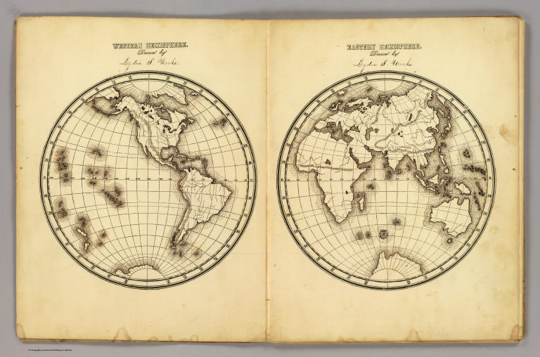
[Fitch, George W., Weeks, Lydia S.]
Full Title
Western Hemisphere ... Eastern Hemisphere drawn by (to be filled in. By George W. Fitch. New York: Sheldon, Blakeman and Company, 115 Nassau Street. Entered ... 1850, by Huntington and Savage ... New York)
Publisher
Blakeman, Sheldon & Co.
Author
[Aspin, Jehoshaphat, 18th/19th cent., Gaultier, abbe (Aloisius Edouard Camille), 1746?-1818]
Full Title
(Covers to) A complete course of geography, by means of instructive games, invented by the Abbe Gaultier. Collated with the author's last Paris edition, and digested for Europe conformably to the territorial arrangements of the Pacification of 1815, by Jehoshaphat Aspin. In three parts. The first part, containing the game of simple geography, for teaching the names and situations of the different countries and places of the Earth. The second part, containing a concise treatise on the artificial sphere. The third part, containing a geographical game, illustrative of ancient and modern history ... London: printed for John Harris and Son, corner of St. Paul's Church-yard. 1821.
Publisher
Harris and Son
Author
[Aspin, Jehoshaphat, 18th/19th cent., Gaultier, abbe (Aloisius Edouard Camille), 1746?-1818]
Full Title
(Title Page to) A complete course of geography, by means of instructive games, invented by the Abbe Gaultier. Collated with the author's last Paris edition, and digested for Europe conformably to the territorial arrangements of the Pacification of 1815, by Jehoshaphat Aspin. In three parts. The first part, containing the game of simple geography, for teaching the names and situations of the different countries and places of the Earth. The second part, containing a concise treatise on the artificial sphere. The third part, containing a geographical game, illustrative of ancient and modern history ... London: printed for John Harris and Son, corner of St. Paul's Church-yard. 1821. (on verso) London: printed by S. and R. Bentley, Dorset-Street, Fleet-Street.
Publisher
Harris and Son
Author
[Aspin, Jehoshaphat, 18th/19th cent., Gaultier, abbe (Aloisius Edouard Camille), 1746?-1818]
Full Title
(Dedication Page) A complete course of geography, by means of instructive games, invented by the Abbe Gaultier. Collated with the author's last Paris edition, and digested for Europe conformably to the territorial arrangements of the Pacification of 1815, by Jehoshaphat Aspin. In three parts. The first part, containing the game of simple geography, for teaching the names and situations of the different countries and places of the Earth. The second part, containing a concise treatise on the artificial sphere. The third part, containing a geographical game, illustrative of ancient and modern history ... London: printed for John Harris and Son, corner of St. Paul's Church-yard. 1821. (with verso of title page) London: printed by S. and R. Bentley, Dorset-Street, Fleet-Street.
Publisher
Harris and Son
Full Title
Appendix. General questions on geography; or a game ... A table of general questions after a method suggested by Lady Ch******e L*****r. Printed by S. & R. Bentley, Dorset Street, Fleet Street, London. (1821)
Publisher
Harris and Son
Author
[Gaultier, abbe (Aloisius Edouard Camille), 1746?-1818, Wauthier, J. M.]
Full Title
A plain map for the geographical game of Asia, Africa, America, and newly discovered islands, according to the method of the Abbe Gaultier. MDCCXCII.
Publisher
Harris and Son
Author
[Gaultier, abbe (Aloisius Edouard Camille), 1746?-1818, Wauthier, J. M.]
Full Title
A new map of the World, according to the method of the Abbe Gaultier. By Mr. Wauthier, his pupil. 1799.
Publisher
Harris and Son
Author
Grigg, John
Full Title
(Covers to) Grigg's American school atlas, exhibiting the different grand divisions of the globe, together with a set of maps particularly adapted to illustrate the geography of North and South America, according to the political divisions of the present time. Drawn and engraved from the latest and best authorities. Philadelphia: John Grigg, No. 9 North Fourth Street. 1830.
Publisher
John Grigg
Author
Grigg, John
Full Title
(Title Page to) Grigg's American school atlas, exhibiting the different grand divisions of the globe, together with a set of maps particularly adapted to illustrate the geography of North and South America, according to the political divisions of the present time. Drawn and engraved from the latest and best authorities. Philadelphia: John Grigg, No. 9 North Fourth Street. 1830.
Publisher
John Grigg
Author
Ensign, Bridgman & Fanning
Full Title
World At One View. Ensign, Bridgman & Fanning, Publishers, 156 William St., New York. Entered...1854, By Ensign, Bridgman & Fanning...New York.
Publisher
Ensign, Bridgman & Fanning
Author
Grigg, John
Full Title
(Contents to) Grigg's American school atlas, exhibiting the different grand divisions of the globe, together with a set of maps particularly adapted to illustrate the geography of North and South America, according to the political divisions of the present time. Drawn and engraved from the latest and best authorities. Philadelphia: John Grigg, No. 9 North Fourth Street. 1830.
Publisher
John Grigg
|