Who What Where WhenREMOVEWHEREShow More |
Author
U.S. General Land Office
Full Title
Department Of The Interior General Land Office Hon. Binger Hermann, Commissioner. Map Of The State Of Wyoming. Compiled from the official Records of the General Land Office and other sources under the direction of Harry King, C.E., Chief of Drafting Division G.L.O. 1900. Compiled, Drawn and Lettered by I.P. Berthrong. A.B. Graham Photo. Lith. Washington, D.C.
Publisher
A.B. Graham Photo Lith.
Author
California Railway Commissioners
Full Title
Commissioners Official Railway Map of California Completed to November 15th 1891.
Publisher
H.S. Crocker Company.
Author
Wyld, James, 1812-1887
Full Title
A New Map Of The Province Of Lower Canada, Describing all the Seigneuries, Townships, Grants of Land, &c. Compiled from Plans deposited in the Patent Office Quebec; By Samuel Holland, Esq. Surveyor General ... London. James Wyld Geographer to Her Majesty. 5 Charing Cross, Jany. 1, 1838 (Second Edition).
Publisher
James Wyld
Author
Congdon, Chas. H.
Full Title
Official Map of Kern County, California. Compiled from Official Records and Private Surveys... Approved and Declared to be the Official Map of Kern County, May 7, 1898.
Publisher
W.B. Walkup
Author
[National Geographic Society, Bumstead, Albert H. (Albert Hoit), 1875-1940]
Full Title
Map of the Western Theatre of War : Prepared in the Map Department of the National Geographic Society for the National Geographic Magazine ; Gilbert Grosvenor, Editor ; A. H. Bumstead, cartographer. Copyright, National Geographic Society, Washington, D.C. 1918. (with 2 insets).
Publisher
National Geographic Society
Author
[C.F. Weber & Co., Punnett Brothers]
Full Title
(Weber's Map of Sierra County, California). Published by C.F. Weber & Co., San Francisco, Los Angeles. Copyright 1914 by Punnett Brothers.
Publisher
C.F. Weber & Co.
Author
[C.F. Weber & Co., Punnett Brothers]
Full Title
(Weber's Map of Stanislaus County, California). Published by C.F. Weber & Co., San Francisco, Los Angeles. Copyright 1914 by Punnett Brothers.
Publisher
C.F. Weber & Co.
Author
[C.F. Weber & Co., Punnett Brothers]
Full Title
(Weber's Map of Lake County, California). Published by C.F. Weber & Co., San Francisco, Los Angeles. Copyright 1914 by Punnett Brothers.
Publisher
C.F. Weber & Co.
Author
[C.F. Weber & Co., Punnett Brothers]
Full Title
(Weber's Map of Placer County, California). Published by C.F. Weber & Co., San Francisco, Los Angeles. Copyright 1914 by Punnett Brothers.
Publisher
C.F. Weber & Co.
Author
Punnett Brothers
Full Title
Map of Kings County, Cal. Copyright, 1912, by Punnett Brothers. Drawn & published by Punnett Brothers. 301 MacDonough Building, 333 Keary St. S.F.Cal.
Publisher
Punnett Brothers.
Author
U.S. General Land Office
Full Title
Department Of The Interior General Land Office Hon. Binger Hermann, Commissioner. Map Of The State Of Wyoming. Compiled from the official Records of the General Land Office and other sources under the direction of Harry King, C.E., Chief of Drafting Division G.L.O. 1900. Compiled, Drawn and Lettered by I.P. Berthrong.
Publisher
No publisher.
Author
U.S. General Land Office
Full Title
Department Of The Interior General Land Office. William A. Richards, Commissioner. Map Of The State Of North Dakota. Compiled from the official Records of the General Land Office and other sources under the direction of Frank Bond, Chief of Drafting Division G.L.O. 1903. Compiled and Drawn by M. Hendges. Lettering by Wm. Bauman Jr. The Friedenwald Co. Photo-Lith. Balto.
Publisher
The Friedenwald Co.
Author
U.S. General Land Office
Full Title
Department Of The Interior General Land Office. Hon. Binger Hermann, Commissioner. Map Of The State Of South Dakota. Compiled from the official Records of the General Land Office and other sources under the direction of Harry King, C.E., Chief of Drafting Division G.L.O. 1901. Compiled, Drawn and Lettered by M. Hendges. A.B. Graham Photo. Lith. Washington, D.C.
Publisher
A.B. Graham Photo Lith.
Author
U.S. General Land Office
Full Title
Department Of The Interior General Land Office. Hon. Binger Hermann, Commissioner. Map Of Oklahoma Territory. Compiled from the official Records of the General Land Office and other sources under the direction of Harry King, C.E., Chief of Drafting Division G.L.O. 1898. Revised and Drawn by M. Hendges.
Publisher
No publisher.
Author
U.S. General Land Office
Full Title
Department Of The Interior General Land Office. Hon. Binger Hermann, Commissioner. State Of Idaho. Compiled from the official Records of the General Land Office and other sources under the direction of Harry King, C.E. Chief of Drafting Division G.L.O. 1899. Compiled by R.H. Morton. A.B. Graham, Photo. Lith. Washington, D.C. Traced and Lettered by I.P. Berthrong.
Publisher
No publisher.
Author
U.S. General Land Office
Full Title
Department Of The Interior General Land Office. William A. Richards, Commissioner. Territory Of Arizona. Compiled from the official Records of the General Land Office and other sources under the direction of Frank Bond, Chief of Drafting Division G.L.O. 1903. Compiled and Drawn by Daniel O'Hare. Andrew B. Graham, Photo-Lith. Washington, D.C.
Publisher
A.B. Graham Photo Lith.
Author
Loader, T. B.
Full Title
Under the patronage of His Majesty, T.B. Loader's scientific and commercial map of England and Wales in which are delineated the canals, rail-roads, & navigable rivers : the extent of the navigation of each river, with the elevations of the canals, together with the geology, and principal situations of the mineral productions. 1834. Published by T.B. Loader, 31 Bedford, St. Covent Garden. Mounted & colored by G. Cross, 98 Dean St. Soho.
Publisher
T.B. Loader
Author
Manning, S.
Full Title
Map of Portage and adjoining counties. Engraved by S. Manning, Akron O(hio). "Figures denote distances from Cuyahoga Falls".
Publisher
No publisher
Author
Amerine, C.H.
Full Title
C.H. Amerine's : Sectional map of Washington, Oregon, Idaho, and western Montana. Compiled from latest official data exploration and other sources. Compiled and published by C.H. Amerine, 1891. Copyrighted by C.H. Amerine, Tacoma, Wash. Photo - Litho by Schmidt Lable & Lith Co. S.F.
Publisher
[C.H.Amerine, Schmidt Lable & Lith Co.]
Author
Breese, Sidney
Full Title
Skeleton Map Showing the Railroads completed and in Progress in the United States, and those projected through the Public Lands and their connection with the principal Harbours on the Lakes and on the Seaboard. Printed by order of the Senate of the United States the 9th Sess: 31st Congress 1848-9. Accompanied with a report from Hon. Sidney Breese, for granting land to the State if Illinois to aid in the completion of her rail roads. C.B. Graham's Lithy. Washington City, D.C. (to accompany) Report: In Senate of the United States. December 19, 1848.
Publisher
C.B. Graham's Lithy.
Author
[Aaron Blake Publishers, Zeleznik, John, Lewis, Susan]
Full Title
The Ian Fleming Thriller Map.
Publisher
Aaron Blake Publishers
Author
Journal L'Auto Quotidien Sportif
Full Title
Tour de France Cycliste, 12e Annee 1914.
Publisher
Journal L'Auto Quotidien Sportif
Author
Richard, Albert
Full Title
Albert Richard Football map. Copyright 1938, Albert Richard Co. Milwaukee, Wis. F.R. Cheeseman.
Publisher
Albert Richard Company
Author
U.S. Geological Survey
Full Title
San Francisco and vicinity, California. From Geological Survey atlas sheets surveyed in 1892-1913.
Publisher
U.S. Geological Survey
Author
Allardt, G. F.
Full Title
Map no. 3. Salt marsh and tide lands situate in the city and county of San Francisco. To be sold at public auction by order of the Board of Tide Land Commissioners by Talbert & Leet, auctioneers, at their sales rooms no. 526 California Street, San Francisco. Sale to commence Friday Nov. 26th, 1869. B.F. Washington, H.P. Coon, L.L Bullock, Wm. S. Byrne, Secretary, Tide Land Commissioners. G.F. Allardt, Surveyor & Chief Engineer. C.H. Baker Lith., S.F.
Publisher
G.H. Baker, Lith.
Author
Allardt, G. F.
Full Title
Sale map no. 12. Salt marsh and tide lands situate in the city and county of San Francisco, state of California. To be sold at public auction by order of the Board of Tide Land Commissioners ... at the sales rooms of Greenebaum & Co., auctioneers, nos. 115 & 117 Bush Street, San Francisco. Sale to commence Tuesday, March 4th, 1873. R.P. Johnson, Edgar Briggs, C.M. Stratton, Board of Tide Land Commissioners. J.M. Currier, Secretary. G.F. Allardt, Chief Engineer.
Publisher
No Publisher
Author
Allardt, G. F.
Full Title
Sale map no. 8 of salt marsh and tide lands situate in the county of Marin, state of California. To be sold at public auction by order of the Board of Tide Land Commissioners ... John Middleton, auctioneer. Sale to commence Tuesday, July 18th 1871 at Platt's Hall, San Francisco. B.F. Washington, Rodmond Gibbons, L.L. Bullock, Board of Tide Land Commissioners. Wm. S. Byrne, Secretary. G.F. Allardt, Chief Engineer. F.C. Hafenrichter, draughtsman. G.T. Brown & Co. Lith. 540 Clay St. S.F.
Publisher
G.T. Brown & Co. Lith.
Author
[Britton & Co., Hoadley, Milo]
Full Title
Map of the Beideman Tract lots & blocks according to official map of the Western Addition. Drawn from actual survey by M. Hoadley. ... Lith. Britton & Co. To be sold at public auction, on Saturday, Oct. 6th, 1860 at 12 o'clock M. at Platts Music Hall. By H.A. Cobb and R.H. Sinton, real estate auctrs. (with) Map of the city of San Francisco. Published by Britton & Co., Lithographers, Montgomery St. cor. of Comml. sts., San Francisco.
Publisher
Britton & Co.
Author
DeSilver, Robert
Full Title
Pennsylvania. Philadelphia: Published by Robert DeSilver, 1827.
Publisher
Robert DeSilver
Author
Doolittle, Amos
Full Title
A Correct Map of Connecticut from actual Survey. Engraved by A. Doolittle Newhaven 1797. Published for Dr. Trumbull's History of Connecticut.
Publisher
A. Doolittle
Author
[Savory, William, Sumner, William, Taylor, Allen]
Full Title
Map Of The Western Reserve Including the Fire Lands In Ohio. Published By Allen Taylor, Nelson-Portage County, Ohio. Revised & Corrected March 1, 1833. Copyright Secured ... Engraved by Savory, Pitt.
Publisher
Allen Taylor
Author
Post Publishing Company (San Francisco, Calif.)
Full Title
(Business map of San Francisco). Issued by Post Publishing Company, publishers of the Daily and Weekly Post, San Francisco, Cal. (1886?)
Publisher
Post Publishing Company
Author
Doolittle, Amos
Full Title
Connecticut from the best authorities. Delineated & engraved by A. Doolittle, N. Haven. (Philadelphia: Robert DeSilver, 1827)
Publisher
Robert DeSilver
Full Title
The state of Georgia. Gridley sc. (Philadelphia: Robert DeSilver, 1827)
Publisher
Robert DeSilver
Author
DeSilver, Robert
Full Title
A correct map of Virginia. Philadelphia: Published by Robert De Silver, 1827.
Publisher
Robert DeSilver
Full Title
Maryland. (inset) Western part of Maryland. (Philadelphia: Robert DeSilver, 1827)
Publisher
Robert DeSilver
Full Title
The state of Ohio with part of Upper Canada, &c. (Philadelphia: Robert DeSilver, 1827)
Publisher
Robert DeSilver
Author
Allardt, G. F.
Full Title
Sale map no. 11. Salt marsh and tide lands situate in the counties of Alameda & Contra Costa, state of California. To be sold at public auction by order of the Board of Tide Land Commissioners ... Greenbaum & Co. Auctioneers. Sale to commence Wednesday July 10th 1872, at 11 A.M. at the sales rooms of Greenbaum & Co. Nos. 115 & 117 Bush Street, San Francisco. R.P. Johnson, Edgar Briggs, C.M. Stratton, Board of Tide Land Commissioners. J.M. Currier, Secretary. G.F. Allardt, Chief Engineer. Lith. Britton & Rey S.F. (inset) Tide lands in Lake Merritt.
Publisher
Britton & Rey
Author
Langley, Henry G.
Full Title
Map of San Francisco from the latest surveys. Engraved expressly for the San Francisco Directory. 1873. Lith. Britton & Rey, S.F.
Publisher
H.G. Langley
Author
[Los Angeles & Santa Monica Land & Water Co., Theo. G. Kocher & Co.]
Full Title
Map of the subdivision of Rancho San Jose de Buenos Ayres and the town of Sunset owned by Los Angeles & Santa Monica Land & Water Co., situated in Los Angeles Co., Cal. Surveyed by Theo. G. Kocher & Co. 1887. Los Angeles Litho. Co., 48 to 52 Banning St.
Publisher
Los Angeles & Santa Monica Land & Water Co
Author
[Auradou, A. L. (A. Leon), O'Shaughnessy, M. M. (Michael Maurice), 1864-1934, San Francisco (Calif.). Board of Public Works]
Full Title
Map of the city and county of San Francisco prepared by the Board of Public Works, M.M. O'Shaughnessy, City Engineer. A.L. Auradou, cartographer. Map issued October 15, 1927. Revised to Sept. 1, 1929.
Publisher
Board of Public Works
Author
[McClure, W. F. (Wilbur F.), Patterson, Smith & Co.]
Full Title
Map of Berkeley, California. W.F. McClure, City Engineer. Patterson, Smith & Co., Inc., successors to R.R. Patterson, Real Estate and Insurance, 2107 University Avenue ... General agents for Claremont Heights Tract. (1910?)
Publisher
Patterson, Smith & Co.
Author
[McClure, W. F. (Wilbur F.), Patterson, Smith & Co.]
Full Title
Claremont Heights Subdivision No. 1. Choice Berkeley villa sites. W.F. McClure, City Engineer of Berkeley. Patterson, Smith & Co., Inc., 2107 University Avenue, Berkeley, Cal. (1910?)
Publisher
Patterson, Smith & Co.
Author
King, G. B.
Full Title
Chart of the Polar Seas. Engraved for Harpers Family Library, by (G.B.?) King. (185-?)
Publisher
Harper & Brothers?
Author
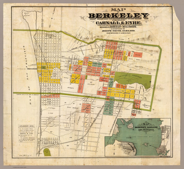
Smith, Joseph, draftsman
Full Title
Map of Berkeley. Published by Carnall & Eyre, dealers in Berkeley Real Estate. Compiled by Joseph Smith, Oakland. From the records of Alameda Co., Cal. Lith. A. Waldstein, S.F. (1880)
Publisher
Carnall & Eyre
Author
[King, M. G. (Malcolm G.), William J. Dingee]
Full Title
Map of Oakland, Berkeley and Alameda. William J. Dingee, agent. For the purchase, sale, appraisal and care of real estate. 460 & 462 Eighth Street near Broadway, Oakland. M.G. King, C.E., surveyor. Entered ... in the year 1878, by Woodward & Taggart in the office of the Librarian of Congress at Washington, D.C. Galloway Litho Co., 418-422 Commercial St., S.F. (1884?)
Publisher
William J. Dingee.
Author
Tassin, J. B.
Full Title
A newly constructed and improved map of the state of California. Shewing the extent and boundary of the different counties according to an Act passed by the Legislature April 25th, 1851. With a corrected and improved delineation of the gold region compiled from the best and most recent surveys by J.B. Tassin. Lith. by Pollard & Peregoy -- Published by Cooke and Lecount, San Francisco. Entered according to Act of Congress in the year 1851 by J.B. Tassin ... Northern District of the state of California.
Publisher
Cooke and Lecount.
Author
Michigan Central Railroad Company
Full Title
Special announcement : through cars to Detroit, Toledo, Chicago, St. Louis and the West via Michigan Central. Over the river in front of the falls on the great double track cantilever bridge ... Rand McNally Co. A "Falls Route" at last ... (1884?).
Publisher
Rand McNally
Author
Pan American World Airways, Inc.
Full Title
Pan American World Airways System : world's most experienced airline ; copyright 1956 by Pan American World Airways, Inc. Cartography by John Philip. Art by Paul John Brown. "All rights reserved by Pan American World Airways, Inc."
Publisher
Pan American World Airways, Inc.
|